Skip to content
Julian Cope
presents
The Modern
Antiquarian
Latest
Posts
Sites
Map
Blog
Forum
search
Search
⚠️
Sign in
more_horiz
United Kingdom
England
Southern England
Cornwall
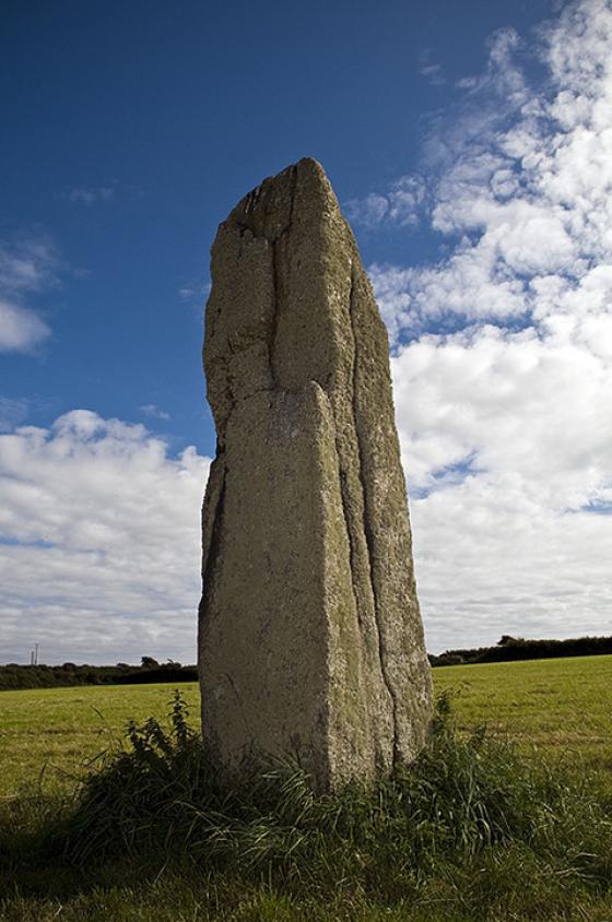
The Selus Stone
Standing Stone / Menhir
SW371314
Disputed
expand_more
Nearest town:
Newlyn (10km E)
OS reference:
SW371314
OS sheet:
203
Latitude:
50° 7' 25.27 N
Longitude:
5° 40' 42.97 W
Added to TMA by
Meic
Images (5)
Fieldnotes (1)
Add
content
Images
September 2014
Image credit: Michael Mitchell
Meic
Jan 7, 2015
Image credit: A. Brookes (17.6.2014)
thesweetcheat
Jul 22, 2014
Image credit: A. Brookes (17.6.2014)
thesweetcheat
Jul 22, 2014
The Selus Stone
Image credit: A. Brookes (10.2001)
thesweetcheat
Jan 21, 2009
Selus Stone
Image credit: Michael Mitchell
Meic
May 6, 2007
Articles
The Selus Stone
Standing Stone / Menhir
Meic
May 6, 2007
Situated in the church at St Just.
Sites within 20km of
The Selus Stone
Tom Thumb Rock
Natural Rock Feature
•
0.83km SSW
photo
3
description
2
link
1
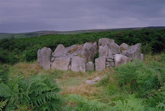
Tregeseal Entrance Grave
Entrance Grave
•
1.14km NE
photo
10
description
1
Bosworlas Lehau
Natural Rock Feature
•
1.14km ESE
description
2
Hailglower Farm
Round Cairn
•
1.56km ENE
photo
1
description
1
Carn Gluze
Chambered Cairn
•
1.6km WSW
photo
70
forum
2
description
9
Higher Botallack
Round Barrow(s)
•
1.62km NE
photo
3
description
2
Botallack
Stone Circle
•
1.76km NW
photo
1
forum
1
description
1
Tregeseal
Stone Circle
•
1.8km NE
photo
106
forum
3
description
19
link
2
Letcha
Kerbed Cairn
•
1.81km SW
photo
9
Numphra
Kerbed Cairn
•
1.95km SE
Kenidjack Cairn Circle
Cairn circle
•
1.97km W
photo
11
description
1
Kenidjack Castle
Cliff Fort
•
1.99km WNW
photo
29
description
4
Truthwall Common
Barrow / Cairn Cemetery
•
2.02km NE
photo
44
description
2
Tregeseal Holed Stones
Holed Stone
•
2.1km NE
photo
57
description
2
Cape Cornwall
Cliff Fort
•
2.15km W
photo
14
description
2
Carn Bean barrow
Round Barrow(s)
•
2.16km NNE
photo
4
description
2
Boscregan
Cairn(s)
•
2.2km SW
photo
26
description
2
Carn Kenidjack
Natural Rock Feature
•
2.26km NE
photo
14
description
4
link
2
Boslow Stone
Standing Stone / Menhir
•
2.55km NE
photo
18
description
2
Nanjulian
Ancient Village / Settlement / Misc. Earthwork
•
2.65km SSW
Portheras Common Barrow
Round Cairn
•
2.75km NE
photo
28
description
3
Wheal Buller Menhir
Standing Stone / Menhir
•
3.11km ENE
photo
10
description
3
Bartinne Castle Enclosure
Enclosure
•
3.12km ESE
photo
11
description
4
Botrea Barrows
Barrow / Cairn Cemetery
•
3.19km E
photo
18
description
1
Boswens Croft
Standing Stone / Menhir
•
3.21km ENE
photo
35
description
2
Little Brea
Round Barrow(s)
•
3.24km SE
photo
2
Lower Boscaswell Fogou
Fogou
•
3.45km N
photo
15
description
4
Chapel Carn Brea North
Cairn(s)
•
3.55km SE
photo
14
Tredinney Barrow
Cairn(s)
•
3.61km ESE
photo
19
description
1
Chapel Carn Brea
Entrance Grave
•
3.65km SE
photo
57
ondemand_video
1
description
9
Higher Downs
Round Barrow(s)
•
3.7km NE
photo
2
Tregiffian Vean
Chambered Tomb
•
3.7km SSE
photo
14
forum
1
description
3
Chapel Carn Brea long cairn
Long Cairn
•
3.71km SE
photo
13
description
2
St Euny’s Well
Sacred Well
•
3.74km ESE
photo
22
description
5
Trevedra Common
Round Barrow(s)
•
3.86km SSE
photo
1
Carn Euny Fogou & Village
Fogou
•
4.03km ESE
photo
113
ondemand_video
1
forum
2
description
21
link
4
Chûn Quoit
Dolmen / Quoit / Cromlech
•
4.03km NE
photo
85
forum
2
description
16
link
1
Escalls Cliff
Kerbed Cairn
•
4.25km S
photo
11
description
2
Chûn Castle
Hillfort
•
4.27km NE
photo
52
description
4
Bosvenning Common
Round Barrow(s)
•
4.28km ENE
photo
10
description
1
Pendeen Vau
Fogou
•
4.31km N
photo
26
forum
1
description
9
Caer Bran
Hillfort
•
4.31km E
photo
24
forum
1
description
3
Chûn
Round Barrow(s)
•
4.35km NE
photo
2
Higher Bodinnar Fogou
Fogou
•
4.42km ENE
description
3
Chy-Gwidden Round
Ancient Village / Settlement / Misc. Earthwork
•
4.44km E
Brane
Entrance Grave
•
4.44km ESE
photo
30
description
9
Brane Long Barrow
Long Barrow
•
4.59km ESE
photo
7
description
3
Crofto
Ancient Village / Settlement / Misc. Earthwork
•
4.66km NE
Bosullow Trehyllys Courtyard House Settlement
Ancient Village / Settlement / Misc. Earthwork
•
4.71km NE
photo
16
description
4
Sancreed Beacon
Cairn(s)
•
4.77km E
photo
24
description
2
Chypraze
Round Barrow(s)
•
5km NNE
photo
14
forum
1
description
1
Goldherring
Ancient Village / Settlement / Misc. Earthwork
•
5.11km ESE
photo
9
description
1
Kerrow Bosullow
Standing Stone / Menhir
•
5.12km NE
photo
1
description
1
Sancreed Holy Well
Sacred Well
•
5.13km E
photo
18
description
13
Boswarthen Holed Stone
Holed Stone
•
5.27km E
photo
3
description
1
Trevowhan
Standing Stone / Menhir
•
5.29km NE
description
1
The Giant’s Grave (Morvah)
Natural Rock Feature
•
5.35km NE
photo
1
description
1
Creeg Tol
Natural Rock Feature
•
5.36km ESE
photo
7
description
5
Trevear
Standing Stone / Menhir
•
5.4km S
description
1
Mayon Standing Stone
Standing Stone / Menhir
•
5.6km S
photo
3
description
1
Table Mên
Natural Rock Feature
•
5.62km S
photo
2
description
2
West Lanyon Quoit
Dolmen / Quoit / Cromlech
•
5.71km ENE
photo
4
description
5
Boscawen-Un (footpath)
Standing Stones
•
5.71km ESE
photo
3
description
2
Boscawen-Ûn
Stone Circle
•
5.71km ESE
photo
113
ondemand_video
2
forum
6
description
33
link
4
Trevean Round
Ancient Village / Settlement / Misc. Earthwork
•
5.72km NE
photo
7
description
1
Boscawen Menhir
Standing Stone / Menhir
•
5.72km ESE
photo
11
description
2
Mayon Cliff
Cairn(s)
•
5.82km SSW
photo
28
description
4
Tremayne
Standing Stone / Menhir
•
5.88km ENE
photo
4
description
3
Boscawen-Un hedge
Standing Stone / Menhir
•
5.88km ESE
photo
10
description
6
Trevean North
Ancient Village / Settlement / Misc. Earthwork
•
6.01km NE
photo
5
Sennen
Standing Stone / Menhir
•
6.03km S
photo
2
description
3
Trewern
Standing Stone / Menhir
•
6.1km ENE
photo
4
description
2
Maen Castle
Cliff Fort
•
6.14km SSW
photo
42
ondemand_video
1
description
3
Trevorgans Menhir
Standing Stone / Menhir
•
6.2km ESE
photo
17
forum
1
description
3
Trewern Round
Enclosure
•
6.2km ENE
photo
7
description
2
link
2
Changwens Menhir
Standing Stone / Menhir
•
6.21km ESE
photo
3
description
1
Lanyon Quoit
Dolmen / Quoit / Cromlech
•
6.25km ENE
photo
111
forum
1
description
18
link
1
The Blind Fiddler
Standing Stone / Menhir
•
6.31km E
photo
51
description
9
Burnt Downs Holed Stone
Holed Stone
•
6.4km NE
photo
2
description
1
Lanyon
Ancient Village / Settlement / Misc. Earthwork
•
6.45km ENE
photo
6
description
1
Men-An-Tol
Holed Stone
•
6.55km NE
photo
99
forum
3
description
43
link
3
Watch Croft
Cairn(s)
•
6.58km NE
photo
35
forum
1
description
5
Watch Croft
Standing Stone / Menhir
•
6.58km NE
photo
28
description
2
Bosiliack Barrow
Entrance Grave
•
6.6km ENE
photo
46
description
5
Pridden
Standing Stone / Menhir
•
6.63km ESE
photo
2
description
2
Alsia Holy Well
Sacred Well
•
6.66km SE
photo
7
description
5
Trelew Menhir
Standing Stone / Menhir
•
6.78km ESE
photo
12
description
3
Men Scryfa
Standing Stone / Menhir
•
6.8km NE
photo
48
description
13
link
1
Venton Bebibell
Sacred Well
•
6.91km NE
photo
4
description
1
The Four Parish Stone
Natural Rock Feature
•
7.09km NE
photo
7
description
3
Bosigran Cliff
Cliff Fort
•
7.13km NE
photo
30
description
2
Ding Dong Lane
Standing Stone / Menhir
•
7.15km ENE
photo
11
description
1
Drift Stones
Standing Stones
•
7.26km E
photo
44
description
10
link
1
Boskednan Cairn
Kerbed Cairn
•
7.28km NE
photo
33
description
4
Toldavas
Standing Stone / Menhir
•
7.29km ESE
photo
6
description
2
link
1
Boskednan Southern Cairn
Kerbed Cairn
•
7.3km ENE
photo
15
description
2
Carfury
Standing Stone / Menhir
•
7.35km ENE
photo
25
description
5
Carn Galva
Tor enclosure
•
7.35km NE
photo
23
description
6
Nine Maidens of Boskednan
Stone Circle
•
7.37km NE
photo
115
forum
4
description
19
Little Galva
Ring Cairn
•
7.55km NE
photo
4
description
1
Madron Holy Well
Sacred Well
•
7.6km ENE
photo
18
description
13
Pordenack Point
Round Barrow(s)
•
7.61km SSW
photo
18
description
2
Bosigran Settlement
Ancient Village / Settlement / Misc. Earthwork
•
7.7km NE
Hannibal’s Carn
Natural Rock Feature
•
7.73km NE
photo
3
description
1
Tresvennack Pillar
Standing Stone / Menhir
•
7.89km E
photo
18
description
1
Trengwainton Gardens
Holed Stone
•
7.91km ENE
photo
2
description
1
Bosporthennis 'Beehive Hut'
Ancient Village / Settlement / Misc. Earthwork
•
8.02km NE
photo
42
forum
2
description
8
link
1
Ennis Farm
Standing Stone / Menhir
•
8.12km E
Bosporthennis Quoit
Dolmen / Quoit / Cromlech
•
8.24km NE
photo
21
forum
2
description
3
link
1
Treverven
Standing Stone / Menhir
•
8.26km SE
photo
24
description
3
Kerris
Standing Stone / Menhir
•
8.29km E
photo
13
description
3
Lesingey Round
Hillfort
•
8.33km E
photo
17
description
1
Carn Les Boel
Cliff Fort
•
8.34km S
photo
25
ondemand_video
1
description
3
Bodrifty Iron Age Settlement
Ancient Village / Settlement / Misc. Earthwork
•
8.38km ENE
photo
22
description
2
link
1
Porthmeor
Standing Stone / Menhir
•
8.39km NE
photo
20
description
6
Bodrifty Reconstruction
8.47km ENE
photo
2
forum
1
description
1
link
1
Porthmeor Fogou
Fogou
•
8.47km NE
Porthmeor Roundhouses
Ancient Village / Settlement / Misc. Earthwork
•
8.61km NE
Bodrifty Barrows
Round Barrow(s)
•
8.62km ENE
photo
9
description
2
Faugan Round
Hillfort
•
8.68km E
photo
8
forum
1
description
1
link
1
Treen Entrance Graves
Entrance Grave
•
8.77km NE
photo
26
forum
1
description
6
Chyenhal
Standing Stone / Menhir
•
8.87km E
photo
5
description
2
Mulfra courtyard houses
Ancient Village / Settlement / Misc. Earthwork
•
8.89km ENE
photo
13
description
1
link
1
Mulfra Hill round barrows
Round Barrow(s)
•
8.92km ENE
photo
19
description
2
The Beacon (Zennor)
Round Barrow(s)
•
8.92km NE
photo
4
description
1
Porthmeor (Treen Common)
Stone Circle
•
8.94km NE
photo
17
description
2
Mulfra Hill
Standing Stone / Menhir
•
8.95km ENE
photo
3
description
1
Gûn Rith Menhir
Standing Stone / Menhir
•
8.99km ESE
photo
43
forum
2
description
10
Mulfra Quoit
Dolmen / Quoit / Cromlech
•
9km ENE
photo
78
forum
1
description
16
Choone
Holed Stone
•
9.02km ESE
photo
8
description
4
Redhouse
Standing Stones
•
9.04km E
photo
5
description
2
Tregiffian
Entrance Grave
•
9.05km ESE
photo
66
description
14
Trevelloe Carn
Natural Rock Feature
•
9.07km ESE
photo
1
description
2
link
1
Boleigh Fogou
Fogou
•
9.1km ESE
photo
45
forum
4
description
16
link
2
The Merry Maidens
Stone Circle
•
9.11km ESE
photo
110
ondemand_video
1
forum
2
description
30
Roskestal West Cliff
Round Cairn
•
9.13km S
description
1
The Pipers (Boleigh)
Standing Stones
•
9.17km ESE
photo
87
description
9
St. Levan’s Stone
Standing Stone / Menhir
•
9.23km SSE
photo
8
description
5
Boscawen-Ros
Standing Stones
•
9.4km ESE
photo
31
ondemand_video
1
description
4
Gurnard’s Head
Cliff Fort
•
9.4km NE
photo
40
description
6
Crankan courtyard settlement
Ancient Village / Settlement / Misc. Earthwork
•
9.46km ENE
Sheffield Menhir
Standing Stone / Menhir
•
9.5km E
photo
3
description
1
St. Levan’s Well
Sacred Well
•
9.52km SSE
photo
7
description
1
Try
Standing Stone / Menhir
•
9.52km ENE
photo
3
description
3
link
1
Treryn Dinas
Cliff Fort
•
9.54km SE
photo
49
ondemand_video
1
forum
1
description
15
Castallack Round
Ancient Village / Settlement / Misc. Earthwork
•
9.65km ESE
photo
5
description
3
Castallack Carn
Standing Stone / Menhir
•
9.65km ESE
photo
3
description
2
Pennance
Entrance Grave
•
9.86km NE
photo
13
description
3
Kerrow
Standing Stone / Menhir
•
9.99km NE
photo
2
description
1
Castallack
Cup Marked Stone
•
10.15km E
photo
7
description
2
Kerrowe Menhir
Standing Stone / Menhir
•
10.18km NE
photo
4
description
2
Paul Celtic Cross
Christianised Site
•
10.21km E
photo
2
description
1
Trye
Ancient Village / Settlement / Misc. Earthwork
•
10.21km ENE
photo
1
description
1
Castallack 2
Standing Stone / Menhir
•
10.23km E
photo
6
description
2
Lescudjack Castle
Hillfort
•
10.37km ENE
photo
10
forum
1
description
4
Rosemorran
Standing Stone / Menhir
•
10.42km ENE
photo
3
description
1
Rosemorran Fogou
Fogou
•
10.52km ENE
description
1
Swingate
Standing Stone / Menhir
•
10.57km ESE
photo
2
description
3
Chysauster Village
Ancient Village / Settlement / Misc. Earthwork
•
10.68km ENE
photo
78
description
6
link
1
Conquer Downs
Cairn(s)
•
10.83km ENE
photo
10
description
2
Kemyel
Standing Stone / Menhir
•
10.87km ESE
photo
3
description
3
Kemyel 2
Standing Stone / Menhir
•
11.02km ESE
photo
3
description
1
Giant’s Rock
Rocking Stone
•
11.16km NE
photo
7
description
3
Merlin’s Rock and the Mousehole
Natural Rock Feature
•
11.29km E
description
1
Tonkins Downs
Kerbed Cairn
•
11.6km ENE
photo
9
Foage
Round Barrow(s)
•
11.66km NE
photo
5
Zennor Quoit
Dolmen / Quoit / Cromlech
•
11.75km NE
photo
74
forum
3
description
14
Castle-an-Dinas (Nancledra)
Hillfort
•
11.91km ENE
photo
26
description
4
Noon Digery banjo enclosure
Enclosure
•
12.07km ENE
Sperris Quoit
Burial Chamber
•
12.11km NE
photo
24
description
3
Sperris Croft
Ancient Village / Settlement / Misc. Earthwork
•
12.33km NE
photo
12
description
3
Wicca Round
Ancient Village / Settlement / Misc. Earthwork
•
12.45km NE
photo
1
description
1
Trendrine Hill
Round Barrow(s)
•
13km NE
photo
18
description
3
Towednack Double Armed Cross
13.4km NE
photo
2
description
2
St. Michael’s Mount
Natural Rock Feature
•
14.32km E
photo
18
forum
1
description
10
Trink Hill
Round Barrow(s)
•
14.51km ENE
photo
5
description
4
Rosewall Hill
Cairn(s)
•
14.82km NE
photo
6
description
3
Trencrom Hill Well
Sacred Well
•
15.28km ENE
photo
3
description
1
Trencrom Hill
Hillfort
•
15.41km ENE
photo
42
ondemand_video
1
description
13
Giant’s Well
Sacred Well
•
15.63km ENE
photo
1
description
1
The Bowl Rock
Natural Rock Feature
•
16.04km ENE
photo
4
description
4
Beersheba
Standing Stone / Menhir
•
16.36km ENE
photo
9
description
5
Carbis Bay Longstone
Standing Stone / Menhir
•
17.23km ENE
photo
5
description
4
Treveneague Fogou
Fogou
•
17.63km ENE
forum
1
description
2
The Fairy Well
Sacred Well
•
17.94km ENE
photo
6
description
3
Cudden Point
Rocky Outcrop
•
18.05km E
photo
1
description
1
St Erth Round
Ancient Village / Settlement / Misc. Earthwork
•
18.9km ENE
Carnsew
Hillfort
•
19.33km ENE
photo
9
search
I’m looking for…
location_on
photo
ondemand_video
forum
description
link