Image credit: Robert Gladstone

Natural defences par excellence...

Towards Carn Boel. The Longships can be seen top left of image.

Looking very approx south across the Pendower Coves to Carn Barra.

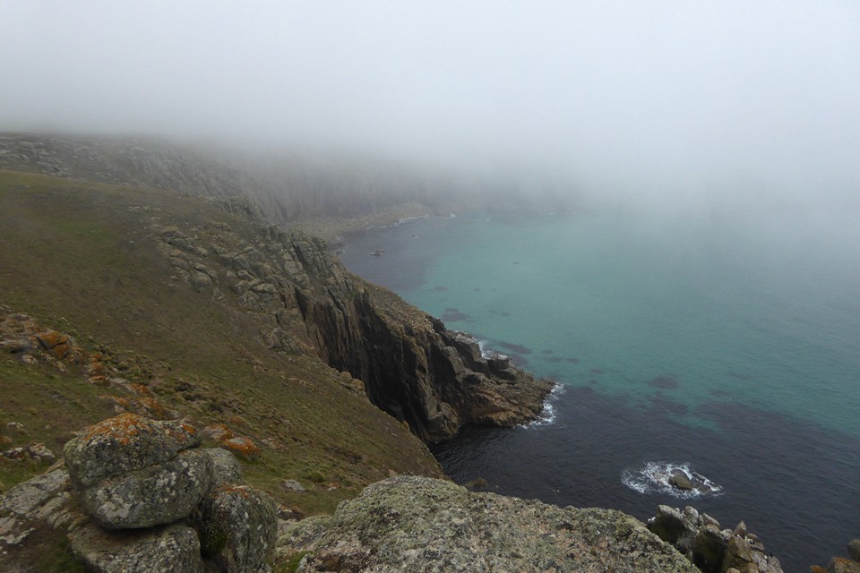
Towards Nanjizal / Mill Bay... wonder what the locals call it?

The defences are actually pretty powerful

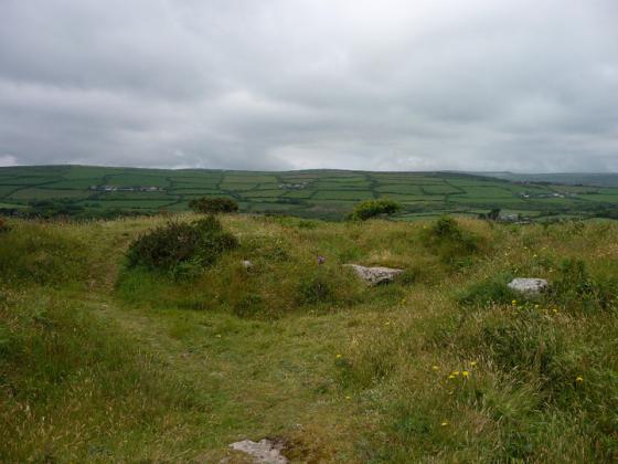
When one first arrives there doesn’t appear much here... from a specific antiquarian point of view... however tune in the radar and it is clear that cross bank does exactly what it needs to.


Looking southeast.

Stones flanking the entrance.

What appears to be a shallower bank and ditch to the northeast of the fort.

From Trevilley Cliff to the northwest, across Nanjizal.

Open Source Environment agency LIDAR

Land- and seascape context from the SE, seen from Ardensawah Cliff.

The blink-and-you’ll-miss-it Higher Bosistow round barrow. Almost gone, but a lovely setting.


Looking out of the entrance. The low mound of Higher Bosistow round barrow is indicated.

One of the two stones flanking the entrance. The other has fallen. The boulder shown in Hamish’s picture can be seen behind.

On the rampart, looking across Nanjizal to Carn Boel (confusingly similar names). The white buildings of the Land’s End theme park can be seen in the distance.

Approaching the fort. The single rampart can be clearly seen, sloping steeply from the large stone at the entrance.

Carn les Boel seen across Nanjizal. The fort occupies the rocky end of the headland, Higher Bosistow round barrow is on the high ground to the left.

Carn Les Boel cairn, with carn Brea in background.

The approach to the cliffs.

Greece is not the word…
24 June 2014.
We carry on round the coast path from Pordenack Point and its trashed barrows. The sea is that beautiful turquoise blue that you get in far west Cornwall when the weather is at its best, and it’s sure at its best today.
The little cove at the base of Lower Bosistow Cliff is quite lovely, revealing a narrow arch cutting deep into – and through – the rock below the headland. From there it’s a reasonably steep climb up onto the headland itself, where a sign warns of the dangers of coastal erosion and advises that we stick to the path. Which we do, at least until we reach the fort that occupies the rocky tip of the promontory.
For some reason when we first walked along this stretch of the path we didn’t visit Carn les Boel fort. I’m not sure why, perhaps just laziness or a desire to Get Along. No pressures today though, so we can have a leisurely explore and some lunch, away from the Land’s End crowds.
Although the rampart isn’t as big and impressive as some of the others on this Cornish coast, it’s still immediately apparent. It slopes steeply from the central neck of the promontory, ending at sheer cliffs. It’s not clear if it always ended so sharply or whether erosion has taken its toll. The ditch is mostly silted up, but from the rampart there is a great view across Nanjizal to the next headland, confusingly named Carn Boel.
The entrance to the fort interior is flanked by large granite blocks, one of which has fallen. The other one is an impressive size, weighing a good few tons. Slightly down the slope is the precariously balanced boulder shown in Hamish’s picture.
The interior is quite rocky, dropping to rugged cliffs at its tip. Not the most hospitable place you could decide to set up home, but then there’s no evidence that anyone ever did. No hut circles or anything structural can be seen.
We sit and enjoy the view and the sunshine for a while, before deciding to head onwards. We’re aiming for Treen and particularly Treryn Dinas today, so we’ve a little way to go. Before we leave, I take a minor detour to look for the Higher Bosistow round barrow. It occupies the highest part of the headland and has terrific views of the coast. Unfortunately the barrow itself is almost missing in action, barely more than a slight rise in the ground with a scooped centre. Great spot though. Inevitably.
The OS map claims there to be a fort here, all that I could see was a low ridge and shallow ditch. Kathy, my partner thought the stone looked like a camels head.
On the low hill behind is a cairn which has been hollowed out.
This is an interesting place, there are stones like erratics but the Glaciers didn’t reach here. This particular stone is on a platform it is aligned to the Beltane sun and sits, if you get on your hands and knees to have a look, on smaller stones. Have a look if you are there.