Looking towards Carn Galva.
Image credit: A. Brookes (26.6.2019)
Looking towards Carn Galva.

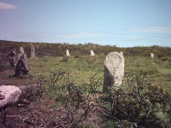
Looking towards Men Scrya, visible on the skyline.

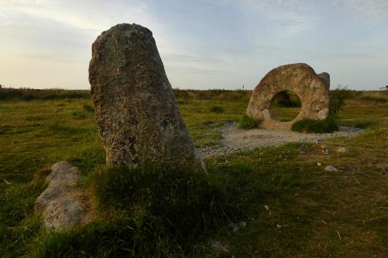
Looking towards Ding Dong mine, with one of the Nine Maidens barrows visible on the left skyline.

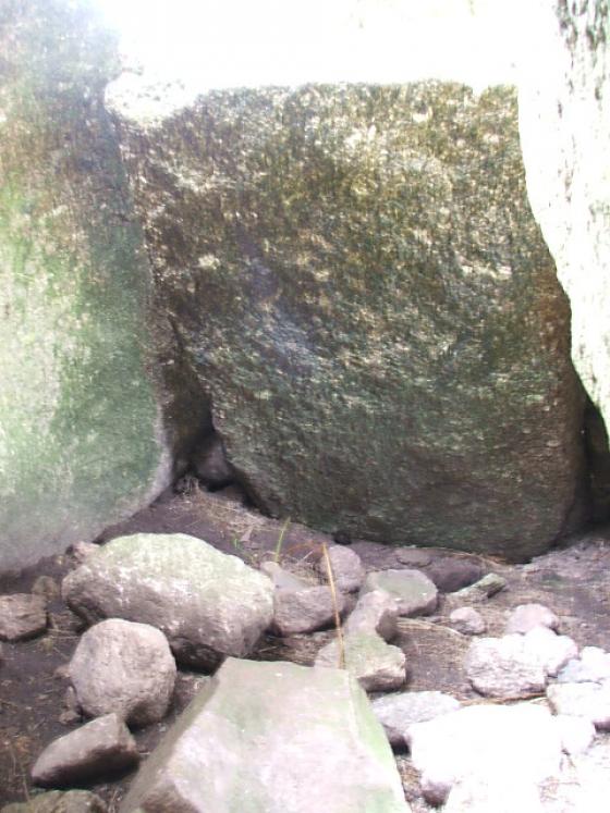
The cross carved into the stone.

Misty day at The Four Parish Stone. The path that can be seen in the top right leads to Men-an-Tol.

Looking up towards Ding Dong mine.

The Four Parish Stone. The cross is at the far end.
First though, a quick stop at a minor landmark that many visitors to the area pass without a glance. At the meeting of several paths, a large recumbent boulder marks the boundaries of four parishes, hence its name. A crude cross has been carved into the surface of the boulder, but I strongly suspect that it has been used a meeting point – either of people or of territory – for a Very Long Time. Both Men Scryfa and some of the barrows up towards Nine Maidens are visible from here.
At a point where the four parishes of Zennor, Morvah, Gulval, and Madron meet, is a flat stone with a cross cut on it. The Saxon kings are also said to have dined on this*.
*As well as at the Table-mên stone. See Popular Romances of the West of England, by Robert Hunt (3rd ed. 1908).
A naturally recumbent boulder, almost 3m long and incised with a (post-)medieval cross. Marks the boundaries of Zennor, Morvah, Madron and Gulval.
Added in view of proximity to many megalithic sites (and obviously “already there” judging by its attribution as a natural boulder). The fact that four parishes chose it as the point where their boundaries meet is certainly suggestive of longer-standing recognition of the stone in the locality.
Something to look out for on the way up to Nine Maidens anyway.