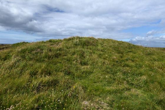
Some of the houses are now getting very overgrown.
Images
One of the smaller round houses.
Getting a little more overgrown than on our last visit.
The cobbled entrances survive in some of the houses.
Roundhouse with massive stones at the base of the structure.
In the rain at Bodrifty, looking NW towards Hannibal's Carn.
Another view of this well-preserved roundhouse.
Another roundhouse, Mulfra Hill on the right horizon.
Another of the roundhouses, looking north(ish).
Roundhouse, looking north-west(ish) to the sea. Note use of very large boulders in the construction.
Roundhouse, another behind, with the ridge of Mulfra Hill on the horizon.
One of the roundhouses.
Bodrifty hut circle. Pictures taken 17-10-03
Bodrfity hut circle
Hut circle at Bodrifty
Site of roundhouse.
General view of settlement.
Articles
Came across this wandering across the moors, wet and windy I had an idea it was in the vicinity. An iron Age settlement thats been left to the cows (mind the shit its everywhere), the remains of the roundhouse's walls are easily spotted, as is the 'pound wall' that surrounds the settlement. Very interesting place which stirrs one to ponder on the life of the ancient celts. Follow the yellow marked posts to find the 'Roundhouse', several fields away built on the site of a former iron age roundhouse is a complete full size one!, thatched roof and all the 'mod cons' inside!!, open fire and wooden beds!!..luxury accomodation eh!. An amazing reconstruction if ever!, used regulary by individuals/groups it seems id say, they ask for donations instead of an entrance charge.
I took a walk back to the ruinous remains of the old village, found a wind-free spot and closed my eyes...the village came to me in its former glory, beautiful.
Worthy of another visit definitely!!
In this area are the ruins of 8 roundhouses dating from 600BC -43AD.
As the name suggests, this is the official (contemporary) Bodrifty Iron Age Settlement home page. It includes photos of the reconstructed round house and a plan of the site and links to more info (such as the invaluable Building a Roundhouse page).
Sites within 20km of Bodrifty Iron Age Settlement
-
Bodrifty Reconstruction
photo 2 forum 1 description 1 link 1 -
Bodrifty Barrows
photo 9 description 2 -
Mulfra Hill round barrows
photo 19 description 2 -
Mulfra Hill
photo 3 description 1 -
Mulfra Quoit
photo 78 forum 1 description 16 -
Mulfra courtyard houses
photo 13 description 1 link 1 -
Bosporthennis 'Beehive Hut'
photo 42 forum 2 description 9 link 1 -
Nine Maidens of Boskednan
photo 119 forum 4 description 19 -
The Beacon (Zennor)
photo 4 description 1 -
Boskednan Southern Cairn
photo 15 description 2 -
Little Galva
photo 4 description 1 -
Porthmeor (Treen Common)
photo 17 description 2 -
Boskednan Cairn
photo 30 description 4 -
Bosporthennis Quoit
photo 17 forum 2 description 3 link 1 -
Ding Dong lane
photo 9 description 1 -
Carfury
photo 15 description 5 -
Try
photo 8 description 3 link 1 -
The Four Parish Stone
photo 7 description 3 -
Venton Bebibell
photo 4 description 1 -
Hannibal’s Carn
photo 3 description 1 -
Men Scryfa
photo 43 description 13 link 1 -
Treen Entrance Graves
photo 26 forum 1 description 6 -
Bosiliack Barrow
photo 37 description 5 -
Trye
photo 1 description 1 -
Men-An-Tol
photo 86 forum 3 description 44 link 3 -
Crankan courtyard settlement
-
Lanyon
photo 6 description 1 -
Porthmeor Fogou
-
Kerrow
photo 2 description 1 -
Porthmeor Roundhouses
-
Carn Galva
photo 23 description 6 -
Burnt Downs Holed Stone
photo 2 description 1 -
Porthmeor
photo 14 description 6 -
Pennance
photo 15 description 3 -
Lanyon Quoit
photo 112 forum 1 description 18 link 1 -
Watch Croft
photo 35 forum 1 description 5 -
Watch Croft
photo 28 description 2 -
Conquer Downs
photo 10 description 2 -
Madron Holy Well
photo 18 description 13 -
West Lanyon Quoit
photo 7 description 5 -
Kerrowe Menhir
photo 4 description 2 -
Chysauster Village
photo 81 description 6 link 1 -
Bosigran Settlement
-
Bosigran Cliff
photo 30 description 2 -
Trevean Round
photo 7 description 1 -
Trevean North
photo 5 -
Kerrow Bosullow
photo 2 description 1 -
Gurnard’s Head
photo 35 description 6 -
Foage
photo 5 -
Zennor Quoit
photo 92 forum 3 description 14 -
Giant’s Rock
photo 8 description 3 -
Tonkins Downs
photo 9 -
Trevowhan
description 2 -
Trewern Round
photo 7 description 2 link 2 -
Trewern
photo 8 description 2 -
Bosullow Trehyllys Courtyard House Settlement
photo 16 description 4 -
Sperris Quoit
photo 24 description 3 -
Noon Digery banjo enclosure
-
Castle-an-Dinas (Nancledra)
photo 26 description 3 -
Sperris Croft
photo 12 description 3 -
The Giant’s Grave (Morvah)
photo 1 description 1 -
Rosemorran
photo 3 description 2 -
Chun Castle
photo 47 description 4 -
Crofto
-
Rosemorran Fogou
description 1 -
Wicca Round
photo 1 description 1 -
Tremayne
photo 6 description 3 -
Chûn
photo 2 -
Chûn Quoit
photo 97 forum 2 description 16 link 1 -
Higher Bodinnar Fogou
description 3 -
Trendrine Hill
photo 18 description 3 -
Higher Downs
photo 2 -
Towednack Double Armed Cross
photo 2 description 2 -
Lesingey Round
photo 12 description 1 -
Bosvenning Common
photo 10 description 1 -
Boswens Croft
photo 33 description 2 -
Chypraze
photo 14 forum 1 description 1 -
Chy-Gwidden Round
-
Lescudjack Castle
photo 10 forum 1 description 4 -
Wheal Buller Menhir
photo 10 description 3 -
Portheras Common Barrow
photo 30 description 3 -
Boslow Stone
photo 17 description 2 -
Botrea Barrows
photo 18 description 1 -
Carn Kenidjack
photo 14 description 4 link 2 -
Trink Hill
photo 5 description 4 -
Tregeseal Holed Stones
photo 56 description 2 -
Truthwall Common
photo 41 description 2 -
Pendeen Vau
photo 26 forum 1 description 9 -
Rosewall Hill
photo 6 description 3 -
Carn Bean barrow
photo 4 description 2 -
Tregeseal
photo 103 forum 3 description 19 link 2 -
Sancreed Beacon
photo 30 description 2 -
Sancreed Holy Well
photo 18 description 13 -
Lower Boscaswell Fogou
photo 15 description 4 -
Hailglower Farm
photo 1 description 1 -
Higher Botallack
photo 3 description 2 -
Boswarthen Holed Stone
photo 3 description 1 -
Drift Stones
photo 36 description 10 link 1 -
Trencrom Hill Well
photo 3 description 1 -
Ennis Farm
description 1 -
Faugan Round
photo 8 forum 1 description 1 link 1 -
Tregeseal Entrance Grave
photo 11 description 1 -
Trencrom Hill
photo 43 description 13 link 1 -
Caer Bran
photo 24 forum 1 description 3 -
Tresvennack Pillar
photo 12 description 1 -
Giant’s Well
photo 1 description 1 -
The Blind Fiddler
photo 55 description 9 -
Carn Euny Fogou & Village
photo 118 forum 2 description 21 link 3 -
Bartinne Castle Enclosure
photo 11 description 4 -
The Bowl Rock
photo 4 description 4 -
Chyenhal
photo 11 description 2 -
St Euny’s Well
photo 22 description 5 -
Goldherring
photo 9 description 1 -
Kerris
photo 13 description 3 -
Sheffield Menhir
photo 5 description 1 -
Botallack
photo 1 forum 1 description 1 -
Beersheba
photo 14 description 5 -
Boscawen-Un hedge
photo 11 description 6 -
Bosworlas Lehau
description 2 -
Brane
photo 30 description 9 -
Boscawen Menhir
photo 13 description 2 -
The Selus Stone
photo 5 description 1 -
Creeg Tol
photo 7 description 5 -
Paul Celtic Cross
photo 2 description 1 -
Brane Long Barrow
photo 7 description 3 -
Boscawen-Un (footpath)
photo 3 description 2 -
Boscawen-Un
photo 139 forum 6 description 33 link 4 -
Changwens Menhir
photo 3 description 1 -
Numphra
-
Tredinney Barrow
photo 19 description 1 -
Trelew Menhir
photo 16 description 3 -
Redhouse
photo 5 description 2 -
St. Michael’s Mount
photo 17 forum 1 description 10 -
Toldavas
photo 7 description 2 link 1 -
Carbis Bay Longstone
photo 5 description 4 -
Tom Thumb Rock
photo 3 description 2 link 1 -
Pridden
photo 2 description 2 -
Little Brea
photo 2 -
Trevelloe Carn
photo 1 description 2 link 1 -
Chapel Carn Brea North
photo 13 -
Kenidjack Castle
photo 29 description 4 -
Chapel Carn Brea
photo 57 description 8 link 1 -
Chapel Carn Brea long cairn
photo 13 description 2 -
Kenidjack Cairn Circle
photo 11 description 1 -
The Fairy Well
photo 6 description 3 -
Merlin’s Rock and the Mousehole
description 1 -
Carn Gluze
photo 73 forum 2 description 9 -
Castallack
photo 7 description 2 -
Castallack 2
photo 6 description 2 -
Castallack Round
photo 5 description 3 -
Castallack Carn
photo 6 description 2 -
Trevorgans Menhir
photo 17 forum 1 description 3 -
Cape Cornwall
photo 14 description 2 -
Letcha
photo 6 -
Boleigh
photo 48 forum 4 description 16 link 2 -
Swingate
photo 9 description 3 -
Boscregan
photo 19 description 2 -
Nanjulian
-
Tregiffian Vean
photo 14 forum 1 description 3 -
The Pipers (Boleigh)
photo 83 description 9 -
Kemyel
photo 5 description 3 -
The Merry Maidens
photo 125 forum 2 description 30 link 1 -
Kemyel 2
photo 3 description 1 -
Tregiffian
photo 61 description 14 -
Gun Rith Menhir
photo 34 forum 2 description 10 -
Treveneague Fogou
forum 1 description 2 -
Carnsew
photo 9 -
Choone
photo 6 description 4 -
St Erth Round
-
Alsia Holy Well
photo 7 description 5 -
Escalls Cliff
photo 10 description 2 -
Boscawen-Ros
photo 24 description 4 -
Treverven
photo 25 description 3 -
Trevear
description 1 -
Phillack Towans
photo 4 description 1 -
Table Mên
photo 1 description 2 -
Mayon Standing Stone
photo 3 description 1 -
Cudden Point
photo 1 description 1 -
Sennen
photo 2 description 3 -
Mayon Cliff
photo 28 description 4 -
Maen Castle
photo 42 description 3 link 1 -
Castle Kayle
-
Treryn Dinas
photo 43 forum 1 description 15 link 1 -
St. Levan’s Stone
photo 9 description 5 -
St. Levan’s Well
photo 7 description 1 -
Pordenack Point
photo 18 description 2 -
Carn Les Boel
photo 25 description 3 link 1 -
Godolphin Hill
photo 6 description 1 link 1 -
Roskestal West Cliff
description 1 -
Godrevy Barrow
photo 17 forum 1 description 3 -
Connor Downs
-
Castle Pencaire
photo 25 forum 1 description 3 -
Tregonning Hill
photo 11 -
Gear Round
-
Trewavas Cliff
photo 14 description 3 -
Camel Rock
photo 5 description 1 -
Hudder Down
photo 10 description 1 -
Drym Round
-
The Hood
photo 1 description 2 -
Tregear Round