The clearance of the site is work in progress; here’s one of the houses at the west of the settlement. Work by the Penwith Landscape Partnership will be ongoing here.
Image credit: A. Brookes (20.10.2020)
The clearance of the site is work in progress; here’s one of the houses at the west of the settlement. Work by the Penwith Landscape Partnership will be ongoing here.

The well-preserved entrance of the small house.

A smaller, newly cleared house.


Looking through the doorway of one of the cleared houses. The paving slabs in the doorway have been exposed for the first time in decades.

Another of the houses cleared by Penwith Landscape Partnership.

Looking across the newly cleared house at the eastern end towards Trink Hill.

Work is being undertaken by the excellent Penwith Landscape Partnership to clear the site of gorse and other vegetation. This is the house near the eastern end of the settlement, which was always the clearest but nothing like this.

Looking across the least overgrown hut circle towards Sperris Quoit.

The second most easterly round house, hidden under heavy vegetation. The interior is full of long grasses, the walls and surrounding land are covered in gorse and heather.

The most easterly round house, nearest to the path between Zennor Quoit and Trendrine Hill.

One of the roundhouses at Sperris Croft
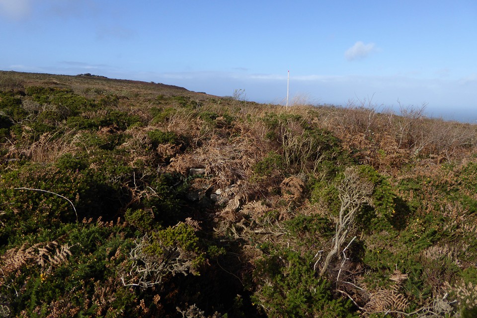
Just to add to my previous fieldnotes, the round houses are even more overgrown in midsummer now. The most easterly (nearest the path) is quite clear and easy to see, but as you go west along the line they are harder and harder to get to. One for the winter!
Visited on a walk from Zennor to Towednack, via Zennor and Sperris Quoits and Trendrine Hill.
The roundhouses are strung out in a line across Sperris Croft, not the usual sort of grouping. They are quite overgrown in summer.
From “Belerion” Craig Weatherhill (1981 Alison Hodge):
“Sperris Croft consists of seven hut circles strung out in a line along the ridge more than 700ft (214 m) above sea level, exposed and windswept. The huts measure between 20 and 46 ft (6.1 and 14m) in diameter and were excavated by the West Cornwall Field Club in 1956-7. The second and fourth huts from the east have a small chamber attached to their southern sides. Although very clearly seen, little more than foundations remain as stone from them was used in the building of two nearby mines, Wheal Sandwich and Wheal Sperris. It is ironic that very little remains of either of these mines.”