Image credit: A. Brookes (15.6.2015)

Looking through the inner doorway to the outer. The interior is filled with bluebells and must have looked spectacular a few weeks ago.

The doorway between the beehive chamber and the rectangular chamber. The corbelling can be seen above the doorway, as can the little alcove to the right.

The original outer doorway into the beehive chamber.

The beehive hut.

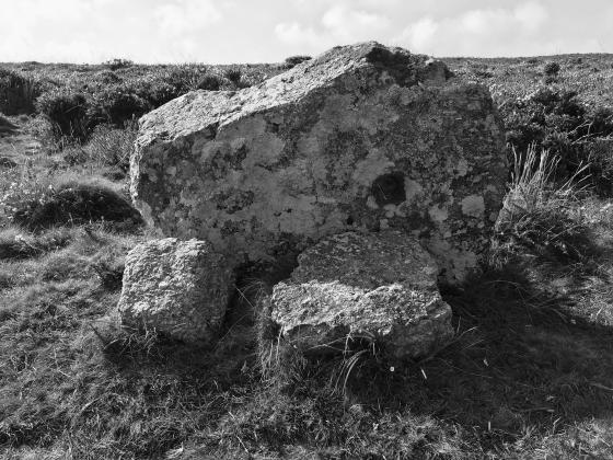
How did these two get here? Must have been brought all the way from the coast near Land’s End....not an easy job!

Gatepost at the NW courtyard houses.

Looking into the NW courtyard house. There are remains of a cobbled path very like those found at nearby Chysauster. The inner entrance with the fallen post (see previous image) can be seen beyond.

Entrance to the NW courtyard house. One of the posts has fallen and now lies half-buried.

NW courtyard houses.

NW courtyard houses. Looking southeast, with the Beehive Hut just visible, built into field walls on the far left. The Beacon is the hill beyond.

The best preserved of the courtyard houses are at the NW of the settlement. Although rather overgrown, the walls survive to a good height. Looking northeast.

Another view of the earlier hut circle, looking NW towards the Beehive Hut and courtyard settlement. Slopes of Hannibal’s Carn on the left.

Simple hut circle at approx SW438359, looking ENE.

Looking into the round chamber.

Beautiful veined orange granite block in the wall of the Beehive Hut.

Reverse of the previous image, looking from the round chamber into the rectangular one.

Looking through the original low entrance into the round chamber, from the rectangular chamber.

The “modern” entrance into the round chamber.

The Beehive Hut from the southern courtyard house field.

Surviving stonework of the southern courtyard house.

Inside the southern courtyard. The drystone courses in the centre of the site are the remains of a medieval shelter.

Fine courtyard house in the field immediately south of the Beehive Hut. A medieval structure (beyond the upright gate/door post) has been built inside the Iron Age remains.

Another shot of the low remains of the eastern part of the settlement, looking NW to the sea.

Two fields ENE of the beehive hut are low, overgrown remains of part of the settlement at approx SW437363.

Hut circle, Bosprennis.

Another shot from within the Bosporthennis settlement.

In the Borthporthennis settlement, east of the beehive hut.

A wee straw offering in the small portal within the hut.

The angle of our approach possibly made this place easier to find...

The beehive part of the structure from the north

The original entrance into the ‘beehive’ (left of centre), looking into the original passage (where the ‘new’ SW entrance is). The so-called ‘cupboard’ recess (right of centre) is a modern addition

‘New’ SW entrance to passage

Ocifant approaches the structure from the SW where it is built into fieldwalls


More ruins at Bosporthennis

Remains of an old settlement?

Beehive Hut from the south-west

Beehive Hut from (pretty much) the north
Visited in June 2002 on the way down from Carn Galva in the direction of Gurnard’s Head. The settlement consists of both courtyard houses and also scattered hut circles. We weren’t looking for this site, but came across two of the hut circles as we crossed the fields.
What a reet bugger to find! With two maps, a diagram AND ocifant’s GPS, we still spent over 40 minutes scouring about eight fields before we spotted it. But it was worth the hunt to see its ancient construction. There was other evidence of quite a large settlement here.
I’m confident that the remains I photographed in November aren’t those of the Bodrifty settlement, as I’m familiar with that site. The pictures I took are all of remains which lie within about 200 yards or so of the Beehive Hut – the Bodrifty village is the better part of a mile to the south-east.
What you found is the Bodrifty settlement and also the reconstruction of the “Beehive Hut” at Bodrifty Farm. You can find my posts on the sites attached to the Wheal Buller Menhir site.
Whilst looking for the remains of Bosporthennis Quoit (in completely the wrong place, it turned out!), I came across the Beehive Hut, and some scattered remains which I took to be remnants of the courtyard houses which are distributed around the area, although I wouldn’t want to put money on this. It was a bright late November day, after several days of heavy rainfall, and I was running out of time, so a few digital pictures were just about all I could manage. Any light that can be cast on the pictures I took is most welcome; hopefully I’ll be able to add some more meaningful ones in the near future.
...in half an hour we were hopelessly lost in an impenetrable jungle. Vainly we scanned the hillside for those beehive huts.
In the end I rebelled, and declaimed, with some warmth that, if we wished to see eight prehistoric things before nightfall we must be humble and seek a guide.
At a farmhouse half a mile away on the hill we explained our needs to the farmer. Turning to his wife, whose face was sunburnt the colour of a nut, he said ‘You take them to the huts‘
As we tramped over the moor I solicited her opinion of Cornish antiquities.
‘Bless you, my dear’ she said ‘people talk a lot about em, but they aint nothing at all, just old stones and things‘
from C Lewis Hind ‘Days in Cornwall’ 1907
In addition to the late Iron Age courtyard house settlement scattered around the Beehive Hut, there is a single, earlier hut circle of simple circular plan lying to the SE at approx SW438359 within a field system.
Craig Weatherhill believes that this is actually an aboveground fogou. In “Cornovia: Ancient Sites of Cornwall & Scilly” (Cornwall Books – 1985, revised 1997 & 2000) he writes of “a scattered settlement of at least three Iron Age/Romano-British courtyard houses and several round houses in a sheltered spot at the eastern base of Hannibal’s carn. In a central position within the settlement is the intriguing ‘beehive hut’, now regarded as an aboveground fogou from its strong resemblance to the Phase 1 structure at Carn Euny. It had a round, corbelled chamber 4.0m across (the lintelled entrance from the south-west is modern), connect by way of a low, heavily built portal to a small, oblong chamber 3.3m by 2.1m, which was its original entrance passage (the wall blocking the south-east end is also modern). Both chambers are now roofless. The best preserved of the courtyard houses, with an adjoining paddock and walls up to 1.5m high, lies 180m to the west of the fogou; another, 60m south of the fogou, has a medieval cowshouse built inside its courtyard.”
The info on this webpage comes from
“Two days in Cornwall with the Cambrian Archæological Association – 1862”
there are five diagrams of the beehive hut and some nearby sites.......
Fallen Cromlech, Bosphrennis
Plan of Hut, Bosullow
Plan of Chûn Castle
Chûn Cromlech
Mên-an-tol, Madron
Plan of St. Madron’s Well
This webpage is the work of Rick Parsons.