
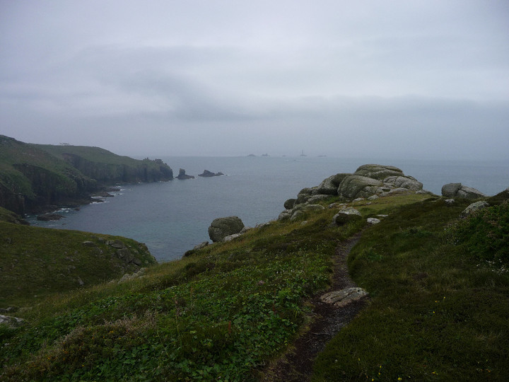
Looking southwest(ish) towards some place called Land’s End? Apparently.
Image credit: Robert Gladstone
Looking southwest(ish) towards some place called Land’s End? Apparently.

The pulverised wreck of the MV RMS Mulheim lies, unseen, below in Castle Zawn. Careful of that edge, now.

Pretty impressive defences, it has to be said.

The entrance passage, looking outwards..

The well-preserved entrance looking inwards.

The powerful cross-bank with rock-cut ditch and counterscarp.

The site from the approx east...

Contemporary field system to the southwest of the fort, built right up to the cliff edge.

Looking out from the entrance.

Looking southwest towards Dr Syntax’s Head (Land’s End).

Looking over the sheer north flank to Castle Zawn (and wreck) far below.

Orthostats revetting the rampart near the entrance.

Approaching through the mist from the north. Double ramparts on the left. The tip of Land’s End can be seen behind.

Open Source Environment agency LIDAR

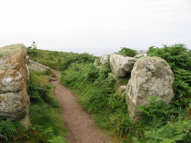
The curving double rampart, seen from the north. The silhouetted walker provides scale.

Upright, presumably placed, boulders inside the fort.

Looking back up the fort’s interior, from the seaward end. Note row of apparently placed boulders, far right.

Further impregnable approaches. Looking towards Land’s End and Longships.

Sea and sheer cliffs provide the defence needed from the west.
The interior of the fort contains a number of rocky outcrops.

Still-impressive stonework flanks the entrance to the fort.

Part of the defensive wall.

Defensive earthworks


This feature is just to the south of the fort and appears to be a boundary.

The footpath next to the large rocks mark the ditch at the narrowest part of the promontory.

The entrance and what remains of the walls.

The entrance from inside the fort.
09/02 the entrance
Tales of cliff forts, cairns and Cornish wrecks.…
This must be the most westerly fortification in mainland Britain, lands end is only about a quarter of a mile away to the south. There is a definite entrance to the fort in stone. There is the vestige of a stone wall, I suspect it’s been robbed for other purposes.
The approaches to the fort appear to have been cleared of large boulders and the ditch can still be plainly seen. This is the oldest clif fort in Cornwall, dating from about 500 b.c.e. it has been excavated and nearby field systems are reckoned to be associated with the fort.
Iron Age hillfort next to the coastal path, entrance and some walls and ditches remain. Great views toward Lands End.
The giant Myen Du was said to live at Maen Castle near Land’s End, and the fairy folk called Coopers banged stones together to warn the inhabitants of St. Ives that rich shoals of fish were approaching.


