Julian Cope at Avebury, photo by Andrew Johnstone

The Modern Antiquarian is a collaborative guide to the ancient sites of the UK and Europe, based on Julian Cope’s epic guidebook of the same name.

Since launching in 2000, the site has grown to be a vital resource for information, images and folklore on the ancient landscapes of the UK and Europe, thanks to the remarkable efforts of all those who contribute.

The Modern Antiquarian – Cope's Notes #6

Julian Cope
The Modern Antiquarian

25th Anniversary

48-page booklet & 40-minute CD of all new-material

More info

Latest Posts

Miscellaneous

Glenchamber
Cairn(s)

Directions to Glenchamber Cairn: Take the Three Lochs turn off Main Street in the centre of Glenluce. Follow the road for c. 4.3 miles to reach the turn off to Glenchamber Farm on the left. There is room for a car to park here. There is a gate into a field opposite the junction. Walk S for c. 200 yards to a natural knoll in the grass field. Glenchamber Cairn is on the summit of the knoll. My walking route is viewable on Glenchamber Cairn.

comment 0 Comments

Miscellaneous

Carscreugh N Burnt Mound
Burnt Mound / Fulacht Fia

Directions to Carscreugh N Burnt Mound: Take the Three Lochs turn off Main Street in the centre of Glenluce. Follow the road for c. 2.7 miles to reach an entrance to Carscreugh Wind Farm on the right. There is room for a car to park here. No unauthorised vehicles are permitted in the wind farm so you can walk or cycle from here. Follow the track W for around 0.3 mile to reach a left turn just before the first wind turbine. Take the turn, follow it for c. 0.5 mile, bearing right uphill at a Y-junction. You will reach No. 11 wind turbine after c. 400 yards. Continue for c. 180 yards to a solitary gorse bush on the left. A vague sheep path heading NW starts here. The path becomes a 4x4 path heading for an obvious green island in the moorland c. 200 yards from the track. This green oasis is Carscreugh N Cairn. Walk WSW for c. 130 yards across boggy terrain to a grassy crescent shaped mound on the edge of a burn. This is Carscreugh N Burnt Mound. My walking route is viewable on Carscreugh N Cairn.

comment 0 Comments

Glenchamber

Visited 05.10.24

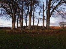
The remains of Glenchamber Cairn are located on a natural knoll in pasture c. 4 miles NNE of Glenluce in Dumfries and Galloway. The low grassy mound is in a field opposite the junction of Glenchamber Farm Track with the Three Lochs road from Glenluce. The cairn has been reduced to a grassy oval plateau c. 1 foot above ground level . It measures c. 30 yards on an ENE-WSW axis and 18 yards on a NNW-SSE axis. There are scattered stones on the platform and a cluster of small stones c. 3 feet in diameter in the centre.

Canmore ID 109479 has details on Glenchamber Cairn.

comment 0 Comments

Carscreugh N Burnt Mound

Visited 05.10.24

Carscreugh N Burnt Mound is located on Carscreugh Fell c. 3 miles NNE of Glenluce in Dumfries and Galloway. It is situated in moorland between two burns c. 130 yards WSW of Carscreugh N Cairn. On approach from the E, the grassy crescent-shaped mound stands out from the brown vegetation. It measures c. 30 feet E-W and 15 feet N-S. Canmore ID 62431 has additional information on Carscreugh N Burnt Mound.

comment 0 Comments

Folklore

Pen-y-Gaer (Caerhun)
Hillfort

This isn't so much a folklore post as proof that cutting remarks have not been invented by the users of social media. Or at least that's the way I'm interpreting it (I think you can't help but hear it read in a pompous voice, and I think things like 'to whom we are, no doubt, indebted' and 'expressly stated' are not kindly phrases. And I think confounding placenames in Wales is probably quite easy especially if you aren't Welsh):

I am indebted to Professor J.E. Lloyd for most kindly furnishing me with the following note with reference to the name of the camp:-

"It was Pennant who first, in his Tour of North Wales in 1773, took note of the remarkable hill-fort above Llanbedr-y-Cennin. He understood it to be known in the district as 'Pen Caer Helen,' and scaled the height in the hope of finding some traces of the Roman road style 'Sarn Helen'. In this respect he was disappointed, though the discovery of the fort was ample compensation.

'Pen Caer Helen', we are assured in the Gossiping Guide to Wales was a mispronunciation of the actual name, 'Pen Caer Llin'; Mr Egerton Phillimore, to whom we are, no doubt, indebted for the correction (Y Cymmrodor, xi, 54) does not mention his authority.

The ordinary form is the shortened one – 'Pen y Gaer' – under which the place appears in the old one-inch Ordnance Survy Map of the district (engraved in 1841).

In the notes to Lady Charlotte Guest's edition of the Mabinogion, Pen y Gaer is identified with the 'Kaer Dathal (or Dathyl)' of theRed Book text. In order to dispose of this conjecture, it is enough to point out, as Mr Phillimore has done, that Caer Dathal is expressly stated to be in Arfon (Rhys and Evans's text), while Pen y Gaer is in Arllechwedd Isaf – two districts which a mediaeval writer was not in the least likely to confound.

Moreover, Caer Dathal was near the sea, and not far from Aber Menai, Dinas Dinlle and Caer Arianrhod, as may be seen from the references to it in the Mabinogion."

From 'The Exploration of Pen-y-Gaer above Llanbedr-y-Cenin' by Harold Hughes, in the 1906 volume of Archaeologia Cambrensis.

comment 2 Comments

Miscellaneous

Carscreugh N Cairn
Cairn(s)

Directions to Carscreugh N Cairn: Take the Three Lochs turn off Main Street in the centre of Glenluce. Follow the road for c. 2.7 miles to reach an entrance to Carscreugh Wind Farm on the right. There is room for a car to park here. No unauthorised vehicles are permitted in the wind farm so you can walk or cycle from here. Follow the track W for around 0.3 mile to reach a left turn just before the first wind turbine. Take the turn, follow it for c. 0.5 mile, bearing right uphill at a Y-junction. You will reach No. 11 wind turbine after c. 400 yards. Continue for c. 180 yards to a solitary gorse bush on the left. A vague sheep path heading NW starts here. The path becomes a 4x4 path heading for an obvious green island in the moorland c. 200 yards from the track. This green oasis is Carscreugh N Cairn. Walk WSW for c. 130 yards across boggy terrain to a grassy crescent shaped mound on the edge of a burn. This is Carscreugh N Burnt Mound. My walking route is viewable on Carscreugh N Cairn.

comment 0 Comments

Latest Comments

Hah. In your face Professor Lloyd.
Yes, because god forbid a Woman might have thought of something they haven't. Edit: Also, you can see the sea from Pen y Gaer.
The cairn is located slightly below the level of the loch on relatively flat land so it may have been visible from Loch Ronald before afforestation.
I'm not saying it's true :) But if something's called Loch Ronald there ought to be a plausible explanation at hand. (btw now I look, 'Ronald' must be Ragnall ua Ímair​… he gets a mention on Wikipedia :) Besides, is the cairn actually on the side facing the other way, you can't see the loch? I might have wanted a view of the loch. But what do I know about the motivations of prehistoric cairn builders. Was there a view there? or were there more plantations in the way so you couldn't see out?
Rhiannon, Thanks for the history of Ronald. I don't even know my local history! Mark
Great photo.. 👍.. it really captures the scene well
Third time lucky​… quite an Irish vibe with this one.
I'd have to agree. Looks like you had to do a bit of a cleanup.
Very beautiful shot. I love the way the ferns are almost translucent.
Probably my favourite Welsh standing stone (sorry, Maen Llia), must try to revisit some time to see the new views. Cracking.
Excellent
That's good​… you really do have to go and see this one. Not seeing the cairn always bugged me, so a return visit's been on the list for years now.
Silbury Hill by William Stukeley

Get Involved

with The Modern Antiquarian to share your photos, knowledge and experiences of the ancient sites across the UK and Europe.