
Image credit: A. Brookes (21.6.2023)

Approaching from the south.

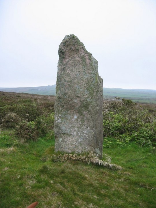
Boswens Menhir on Boswens Common, photographed from the south west on 5 May 2003. © Chris Bond.

Boswens Menhir on Boswens Common, photographed from the west on 5 May 2003. © Chris Bond.

Boswens Menhir on Boswens Common, photographed from the south-south-east on 5 May 2003. © Chris Bond.

Boswens Menhir on Boswens Common, photographed from the north-north-west on 5 May 2003. © Chris Bond.

Boswens Menhir on Boswens Common, photographed from the east on 5 May 2003. © Chris Bond.

Boswens Menhir on Boswens Common, photographed from the east on 5 May 2003. © Chris Bond.

What appears to be a possible kerb is appearing on the edges of the stone’s mound. I’ve never seen this before, perhaps the horses grazing the croft have exposed the stones.


Short shadows as midsummer approaches.


One of my favourite standing stones, I love its many-angled aspects.

Summer Solstice 2018, looking towards Chun Downs.

From William Borlase’s ‘Antiquities, historical and monumental, of the county of Cornwall’ (1695).

September 2014

September 2014

September 2014

September 2014


Standing sentinel over the West Penwith moors.

The barely perceptible round barrow near Boswens menhir (which is on the skyline to the right).

From downhill, the stone takes on the shape of a figure that appears to turn and watch you along the Tinners Way.

Looking towards Carn Bean (with mast), with Carn Kenidjack to the left.

I love the way the stone has a totally different shape from each angle.

Samhain shadows.

Looking towards Chun Quoit and Chun Castle over November moors.

Looking NE from Boswens. Chun Quoit can be seen on the skyline. Across the intervening ground, to the left of the track, is the very overgrown Higher Downs barrow.

Looking NE, Tinners Way follows hedge line, Chun castle, Watch Croft and Carn Galva along horizon (l-r)

Boswens Menhir – 10 May 2004
Boswens Menhir 10th May 2004

Boswens Menhir – 10th May 2004

Couldn’t get too close, due to the (ever-present) gorse...

OK, I’ve tried a couple of times to get here – each time giving up within 100 yards or so of the prize.
My first attempt was along the defined path toward the radio station. Sadly, this got me close, but the barbed wire fencing and waist high gorse combined to thwart me.
Today I tried a different approach. Following the track east from the road, then heading south along what, according to the MAGIC map, is a pathway leading very close to the stone. Unfortunately, the same barbed wire fence continues rght round the area, and the path no longer exists. I did pop over a gate and got into the field though, and the pathway ‘sort of’ exists, but within a couple of hundred yards of the stone is gobbled up by the encroaching gorse, and as the horseflies were having a good feed on my arm and not wishing to encounter any adders in the gorse, I backed off again.
Back at the car, a local lady was talking to Mikki, explaining that the farmers received a lot of money to fence off the area (despite it being Right to Roam land!), and this had detered the horseriders. Subsequently, the path had become unused and is gradually disappearing. I may well raise this issue with CASPN when I see them tomorrow.
Details of site on Pastscape
A low flat-topped mound has been interpreted as the remains of a barrow. A stone measuring 0.7 by 0.9 by 2.4 metres high standing on it is thought to be a standing stone.
[SW 40023290] Long Stone [NR] (1)
Long stone at Boswens Croft, 9 feet in height. (2)
Sancreed, Longstone west of Boswens Common – Scheduled Ancient Monument. (3)
This stone stands on a barrow. (4)
The stone is of rectangular section measuring 0.7m x 0.9m. and is 2.4m. high. It is set in a low, flat-topped, mound of stone and earth, 0.3m. high, which represents the remains of a barrow. No retaining stones are identifiable around the perimeter. Ground photograph: see AO/61/35/5 from NW. (5)
No change from report of 6 1 61. (6)
--------------------------------------------------------------------------------
SOURCE TEXT
--------------------------------------------------------------------------------
( 1) Ordnance Survey Map (Scale / Date) 6” 1908.
( 2) General reference Ancient Crosses of West Cornwall 1858 (J.T. Blight) Page(s)171
( 3) General reference List Anc.Mon. in Eng. & Wales 1958, p.20. (M.O.W.)
( 4a) Oral information, correspondence (not archived) or staff comments
( 4) Field Investigators Comments F1 EG 16-DEC-60
( 5) Field Investigators Comments F2 NVQ 06-JAN-61
( 6) Field Investigators Comments F3 MJF 09-MAY-75


