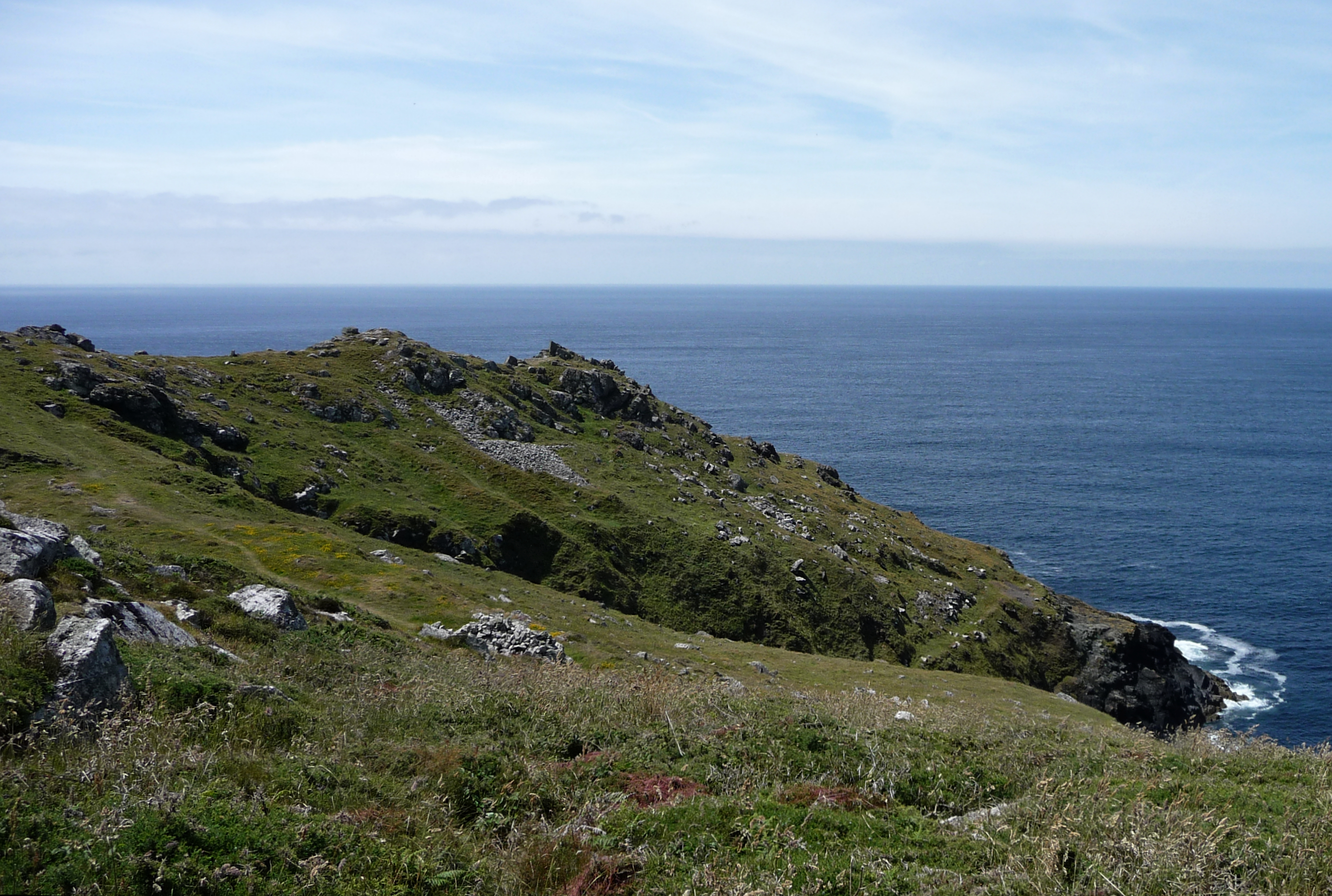
The less well preserved southern ramparts can be made out in the foreground on the left. Looking towards Cape Cornwall, once another cliff fort but with no surviving ramparts.
Image credit: A. Brookes (15.6.2021)
The less well preserved southern ramparts can be made out in the foreground on the left. Looking towards Cape Cornwall, once another cliff fort but with no surviving ramparts.

Looking down on what appears to be a large round house base or building platform.

This may be one of the hut circles inside the fort. There are a couple of courses of stonework over to the right of centre, which don’t appear to be natural clitter.

The rubble construction of the inner rampart on the north side.

The multiple ramparts on the northern side, looking towards Botallack mine.

Hefty orthostat next to the entrance.

Open Source Environment agency LIDAR

Looking landward from the western tip of the fort interior.
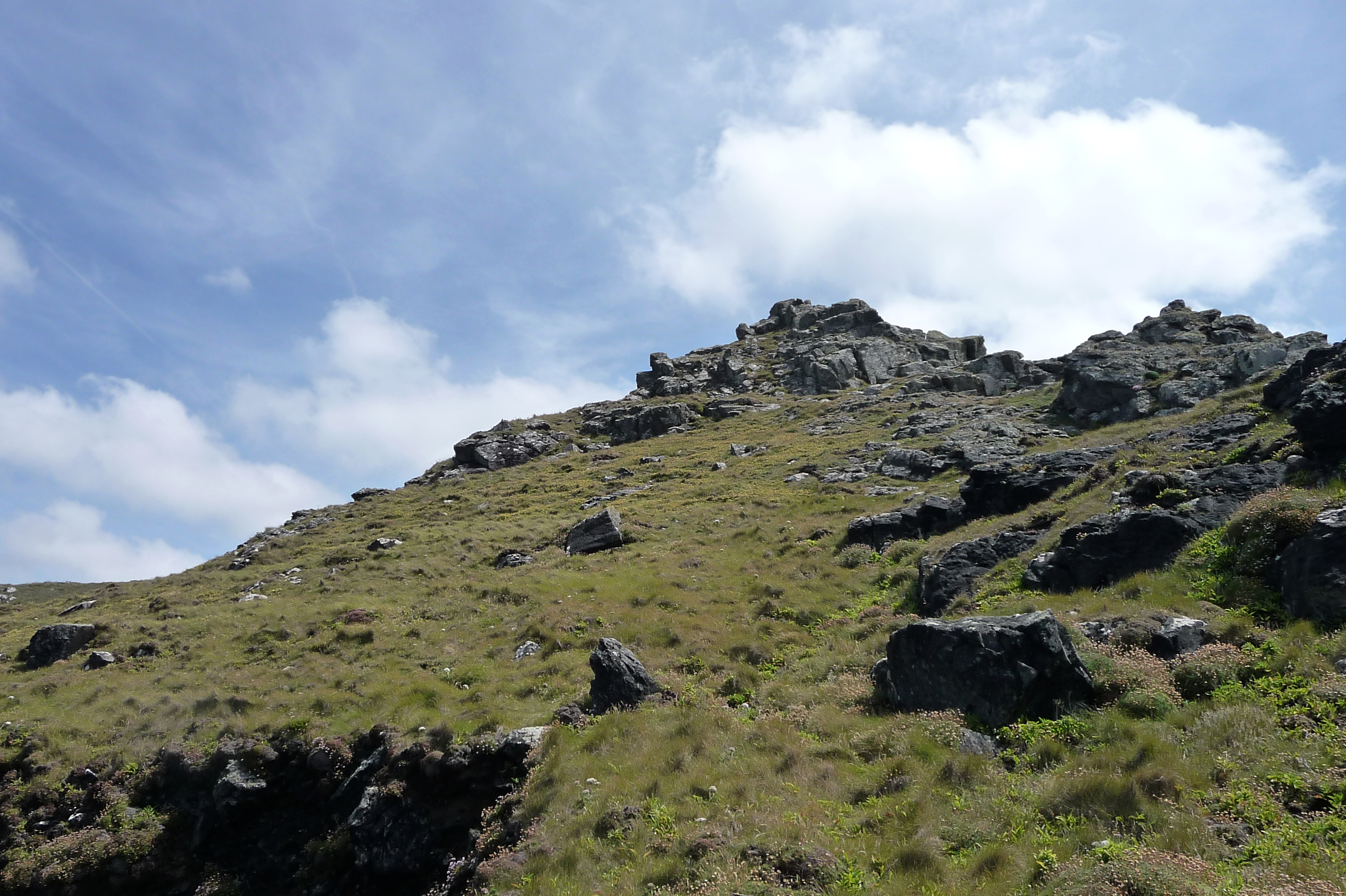
The rocky spine of the fort.

Close-up of the stonework of the inner northern rampart.

At their northern end, the ramparts end abruptly as the cliff drops away to North Zawn.
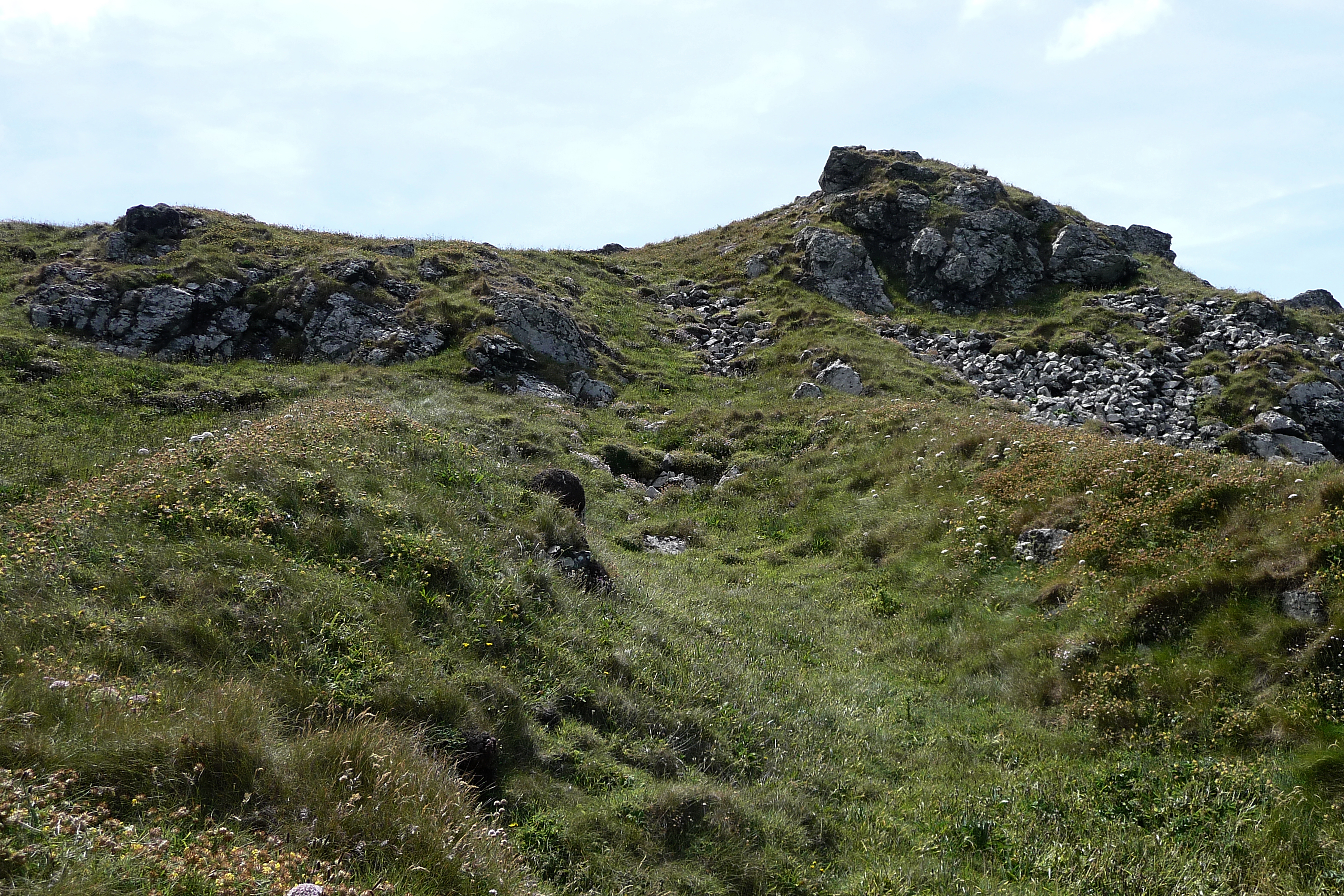
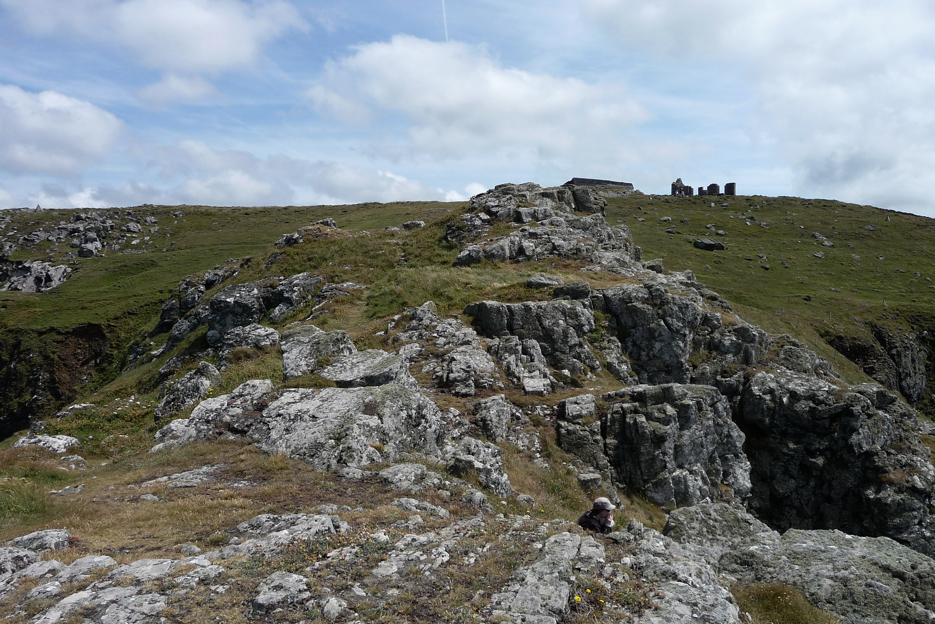
Looking south along the ditch up towards the rocky “spine” of the fort.

The three northern ramparts from above. The stones of the inner rampart are disturbed and have fanned out.
Approaching off the coast path, the three lines of ramparts on the north side are clearly visible, including their sudden cliff-edge termination. The outer and middle ramparts are covered in vegetation, while the stonework of the inner rampart is exposed.

The entrance.

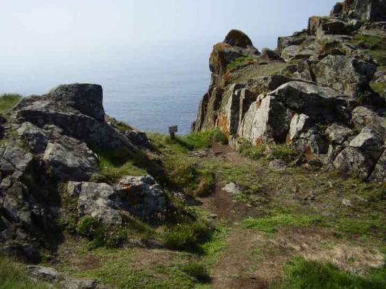
The tip of the headland.

The hillfort fom the landward side.


Random sheep


Kenidjack headland taken from the cape. On the horizon you see the ruined cottage near to the castle.

Part of the ditch, showing the sheer drop.

This shows the drop into the sea on the south side of the narrowest part of the headland.

Three banks lie right on the edge of the eastern side of the headland. There are others on the west bank but not so prominent.
Kenidjack Castle is one of several Iron Age cliff castles making use of the natural granite fastnesses of West Penwith. For some reason we have never been here before, despite walking this stretch of the coast path a decade ago. A small stile gives access to the headland itself, and then the rocky “spine” looms ahead. Approaching from the northeast, the most impressive part of the fort’s defences is readily visible.
The neck of the headland was protected by a triple row of ramparts, dropping steeply from the spine before terminating abruptly at the edge of a near vertical cliff, above crashing seas. On the northern side, this triple rampart is very well preserved. The outer and middle ramparts are covered in vegetation, but protruding stones indicate that the construction uses granite blocks rather than earthen embankments. This is writ even clearer in the exposed inner rampart, the stones of which have been scattered into a fan shape. I pick my way down to get a closer look, discovering quickly that the footing is somewhat treacherous, as the grasses and succulent plants hide the position of potentially ankle-twisting stone blocks beneath.
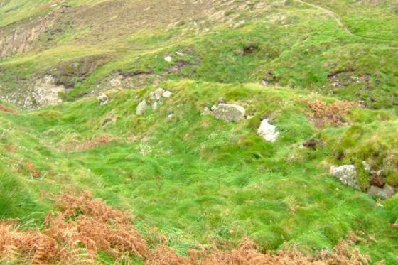
At the bottom end of the ramparts, the drop off the cliff-edge is somewhat vertigo-inducing and I don’t get too close. Heading further seawards, the remains of hut circles have been found, but I don’t see anything of these in the area I cover. Instead I head back up onto the central rocky spine, where an easy scramble gives access to the sloping tip of the headland, facing westwards down to the sea below. This is a brilliant place, wild and desolate. Most of the visitors are of the avian variety. There is a real feeling of being at the edge of everything, especially as this really was the edge of everything for the Iron Age people who inhabited the headland.
Another stunning Cornish cliff castle, which is slightly north of another probable fortification at Cape Cornwall. There are the remains of a triple ditch defence line. Also a very well defined stone entrance. It doesn’t enclose a large area and would have been easy to defend and very hard to attack.
They say the devil has all the best tunes...Iron Age man had all the best forts
Although little remains on Kenidjack headland except three banks on either side of the narrow istmus it is easy to see how this place could easily be defended. Two ridges of rock run along its crest and according to Robin Payne in “The Romance of the Stones” it may have been used in the Bronze Age as a natural defence.
The area all around is heavily mined and tin streaming would have been going on in the valley below to the west since those far off days.
Forget Lands End...come here to experience the end of the world!
Oh...and if you come in the spring you may get to see the peregrins.
Mentioned by Craig Weatherhill, in “Cornovia: Ancient Sites of Cornwall & Scilly” (Cornwall Books – 1985, revised 1997 & 2000) – “The high central spine of this headland is protected by natural outcrops, but there are faint signs of a wall here. North of this is a well preserved triple Iron Age defence. The outer ditch is 1.2m deep and the stone ramparts behind it are 2.4m, 3.3m and 2.1m high. An entrance roadway, its north side revetted with stone, hugs the foot of the central rocky spine; two round houses lie beyond. The southern defences are behind a natural rocky ridge, and consist of two battered stone banks 1.2m high with traces of outer ditches. There are two hut platforms immediately behind the inner bank.”
Just off the coastal footpath.