|
|

|
Latest Posts — Weblog |
The Ridgeway - Part Two |
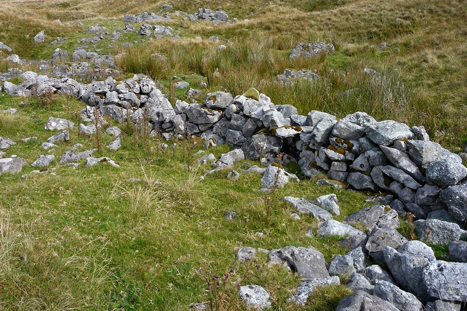
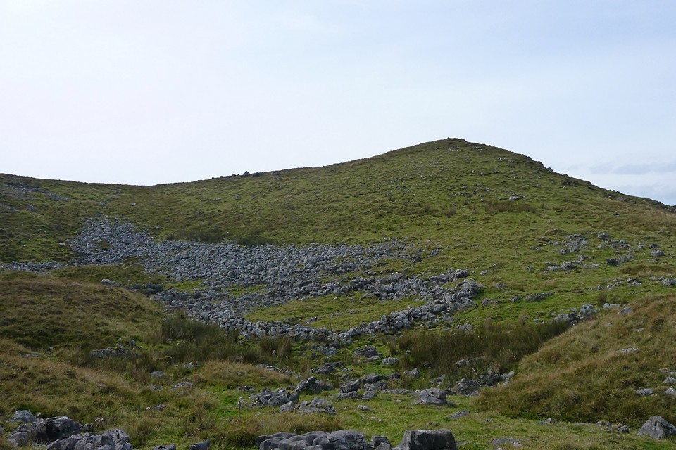
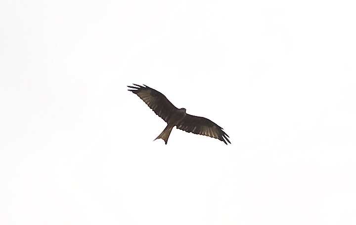
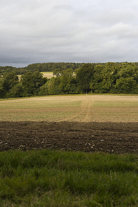
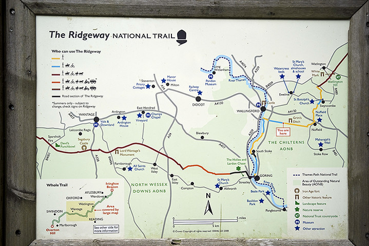
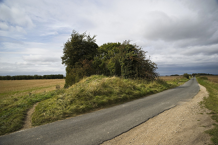
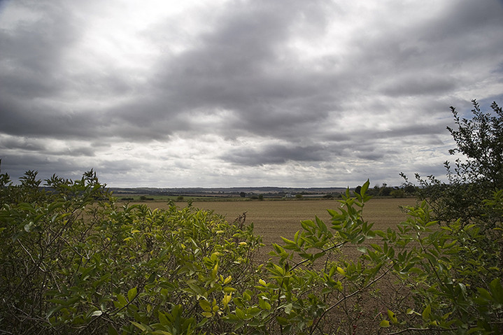
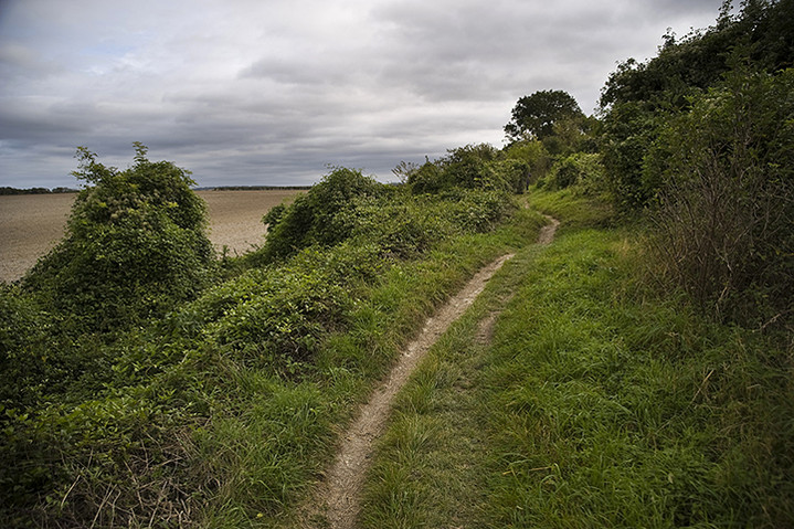
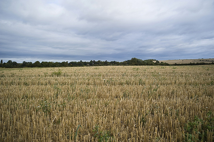
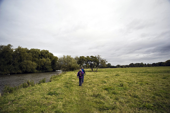
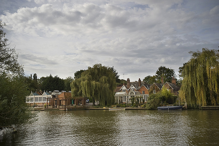
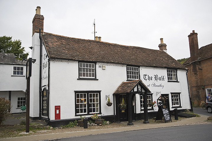
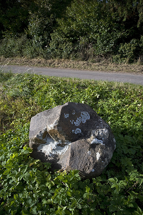
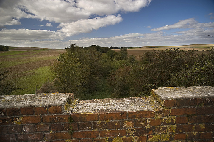
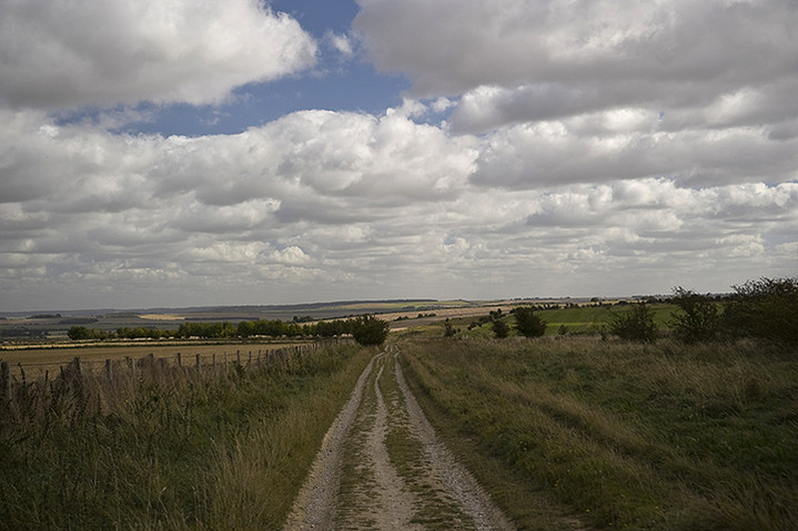
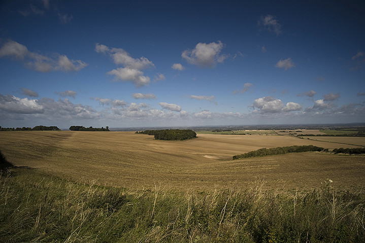
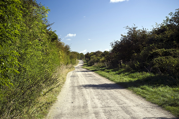
The Ridgeway - Part TwoSegsbury Camp to Watlington Hill A promising sky greeted us as we made our early morning meander from Basingstoke to Letcombe Regis to begin the second phase of our walk from Segsbury Camp. Having parked her car at the bottom of the hill it wasn’t until we were two thirds of the way up that our sister realized she’d left her phone in the car and my brother obligingly set off back down to get it. Ho hum. This didn’t look to be the most promising part of the walk in terms of ancient sites, barring the Way itself, but at least it was going to be easy on the feet. With the ever-present cooling towers of the Didcot Power Station as a progress gauge, most of the walk was on level ground, especially the section that follows the Thames northwards from Streatley, but that was for day two and in walking, talking and laughing terms, some way off. The first site that appears on the map, but which proved eminently indiscernible was Grim’s Ditch. This Iron Age boundary marker comes and goes along almost all of this section in fits and starts, but proved much more interesting on the second day. The first non-prehistoric feature you come across is the monument to Baron Wantage who seems to have spent a large chunk of his early life slaughtering Johnny Foreigner on behalf of his fellow Victorians. However, on post-walk reading I learnt that the monument was erected on top of a Bronze Age barrow. Shame. Next up is the quaintly named Scutchamer Knob hidden discreetly in a small copse on the southern side of the ridge. This is a sizeable round barrow, but because it’s been burrowed into on its north side it looks slightly like a Cotswold Severn Long Barrow with turtle-like flippers sweeping around in front. Only the lack of a tail end suggests otherwise, but there again who knows whether it wasn’t ploughed out centuries before? Despite the joke-worthy name this is a very enigmatic spot with tremendous views and was a historic meeting place in the past. After this the track begins to dip down some before crossing beneath the thundering A34 whilst surrounded by numerous gallops. Horseracing is BIG in this part of the country and the sweeping downland provides excellent training facilities for the local stables, obviously why they were there in the first place. Shortly after an abrupt left turn at Compton Downs the track crosses a disused railway line which is of some significance to my siblings and me. If we’d followed it south back to Newbury it would connect us to the road we lived in back then as youngsters. I can just about remember the steam and noise of steam trains as they puffed along the track on an irregular basis before Beeching put an end to all that. Ah, nostalgia! So, on to a slight diversion to Lowbury Hill which, according to the map, has a R***n temple on top of it and where there’s a temple there’s almost always something of earlier interest. My sister and I decide to go and investigate while my brother lies down in a field after his earlier exertion with her phone. The temple proves to be a huge disappointment with only the barest traces of anything visible on the summit. There is however a low and lonely barrow and the inevitable view of the DPS cooling towers. “That was amazing!” we lie to him at the base of the hill, “You really missed out there”. “No I didn’t”, he replied, “There’s nothing up there because I asked someone coming back down”. Smartarse. We are now coming to the end of our days walk and the track slowly descends into Streatley, a posh little town on the Thames and my brother and I are wondering if we can get to a pub showing the Man U v Spurs game before the 5.00 kick off. One of the few things of notable interest, other than the outstanding natural beauty of the valley on the way down, is an amazing field system that I would guess to be medieval, though there’s no reference to it on the map. There’s also a large sarcen stone near Thurle Grange on the side of the road but little to relate to it. A word of warning! If you are on the right hand side of the road, as we were, when you come into the town the pavement suddenly stops and you have to face speeding oncoming traffic as it comes round the corner. We encountered a twat in a hatchback who showered us with expletives and to whom we replied with suitable hand gestures only to be followed by, we assume, his father in a minibus. He passed so close that I put my hand up to avoid his wing mirror taking my head off and thus caused his mirror to be bent back. More verbals ensued but I don’t think he fancied his chances against our sister. The YHA in Streatley is run by very nice people and I thoroughly recommend it. They even told us where we might catch the game and so we sped off to locate the only pub in town likely to be showing it. Sadly there was something wrong with their TV but they redirected us to a workingmen’s club down the road where we ‘might’ get in. Imagine our surprise when we walked in to see that Spurs were 2-0 up! Now imagine our disgust as we were ejected from the premises for not being members!! So we had to make do with lovingly relayed scores from Mrs. Cane while we sat through a ‘more tense than usual’ pub dinner. Well, Spurs 3 – 2 Man U! Who’d have thought it and what a superb day. Singing Andre Villas-Boas’s praises we set off the next morning into a not quite as sunny day. There are some interesting sarcen stones next to ‘The Bull’ pub which is located near the YHA in Streatley and another sarcen built into the corner of the adjacent house. Whether they’re of any significance or not I don’t know, but these and the large stone we’d seen at Thurle Grange the previous day were the only sarcens we saw along this stretch. The track was now heading north following closely the course of the Thames which seems a little unnatural as you presume that for some parts of the year in past centuries it might largely be underwater and therefore unwalkable. Passing through South Stoke and heading for North Stoke I decided to make a slight solo detour to investigate what looked like (on the map) large barrows in the corner of a nearby field at Barracks Farm. This proved to be another huge disappointment on a similar scale to the Lowbury Hill R***n Temple. Whatever had been there in the past was now long gone, ploughed out by some merciless farmer. I strained to see the slightest of bumps but it really wasn’t worth the effort and so I departed to catch up with my brother and sister in North Stoke. Arriving at Mongewell the path veers east again away from the river and after crossing the A4074 you suddenly find yourself walking along a raised path across level fields - the resurgence of the Grim’s Ditch! Only it’s a dyke here rather than a ditch and becomes bigger and more impressive as you progress. Also, strangely enough, there’s a trig point on the track about half a mile in and as you look across the fields you can’t help wondering why you’re not on the low hills to the south (presumably the beginnings of the Chilterns)? After a few miles the ditch begins to climb and grow in size and character and at some points there’s a good twenty-foot difference between the path and the bottom of the ditch. It’s strange that this is so overlooked, as it’s just as impressive as, say, a hill fort and the amount of manpower needed to create it would have been almost equal to the largest of those forts. Nobody seems to know just what its function was. Certainly not defensive as it’s far too small and generally misplaced to be of any practical use. A boundary marker perhaps? There is a similar structure, the Devil’s Ditch, which runs along a section on the southern side of the South Downs Way and that has been described as such though it’s certainly not as impressive as the larger sections of Grim’s Ditch. We finally departed company with the ditch at Nuffield and here you have to be quite watchful as the path crosses a golf course and although it tells you to ‘follow the markers’, presumably to stop you getting into fights with irate idiot golfers, we managed to get lost and it took about twenty minutes to regain our bearings, throw away miscellaneous golf balls that we came across and get back on track. The reward is a nice pub, The Crown, on the edge of the common and we stopped for a quick one before beginning the final ascent. Crossing the A4130 we found ourselves crossing a large open field with a very faint footpath. Over our heads soared at least a dozen Red Kites. These beautiful birds had been present throughout our journey but not in these numbers. Until relatively recently the Red Kite had been in terminal decline in England with only a handful of surviving pairs in Wales, but successful introductions of continental birds have now made it one of the most prevalent species in the area. They really are wonderful to watch. The remainder of the walk to Watlington Hill was pretty routine. Nothing much in the way of pre-history, just a burning desire to put our feet up, particularly our sister who’s feet were beginning to hurt due to new boots which she’d not worn in beforehand and the prospect of a long drive home. We had one last glimpse of those damned cooling towers at DPS and a good view of the Wittenham Clumps from near Ewelme Park which made us appreciate how far we’d traveled and then it was just a quick final dash to Watlington Hill and back to my car. The next section of the walk in December will be back in hill territory, the Chilterns, and hopefully we’ll encounter more and interesting sites, certainly ones that we’ve never visited before. The Ridgeway — Images07.11.12ce
|
 Posted by A R Cane
7th November 2012ce |
NORSEMAN TO FINSTOWN BY REDLAND ROAD May 5th 2012May 5th 2012 |
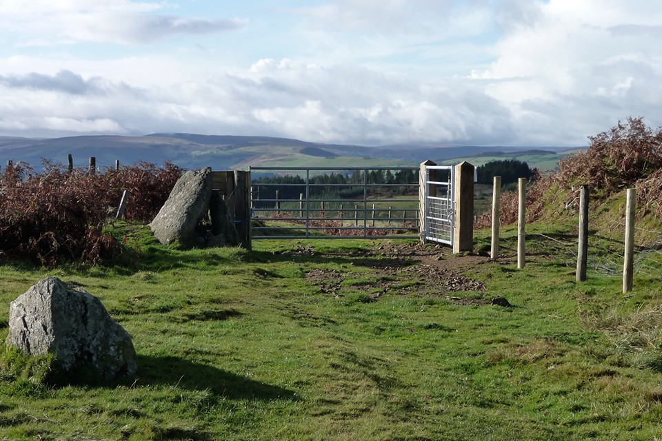
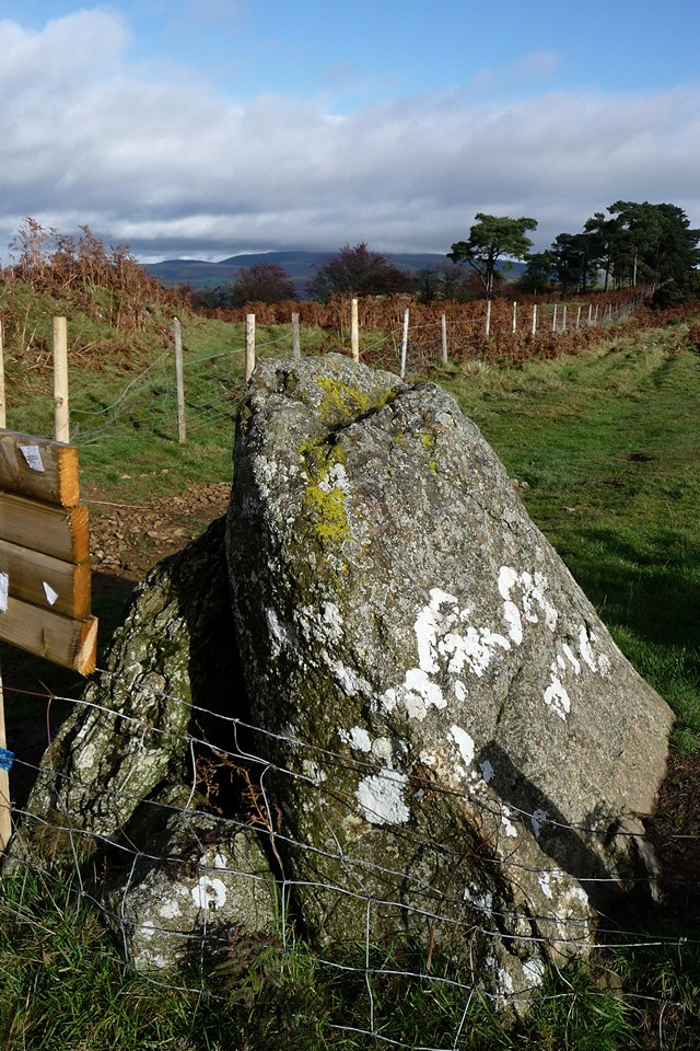
NORSEMAN TO FINSTOWN BY REDLAND ROAD May 5th 2012May 5th 2012Getting off the bus at Norseman Village I thought I would have a look along the coast to the east in case I could see the Knowe of Dishero. Unsurprisingly I couldn't, but what I did see much closer to were mounds on the coastline directly right of me. Petrie describes a group about a quarter of a mile from Isbister mill. These are the Oyce of Isbister mounds (NMRS record number HY31NE 8) - oyce/ouse 'tidal inlet'. What I could see was the dominant one. A gap between the houses let me get to a field fence to use my camera a fraction closer, not intending to add to my planned itinerary. My photos show me a mound with an earth scrape that is surrounded by gorse bushes. The O.S. list this as 'A' at HY39021802, and this is the significant one not only owing to its size but because there can be seen on it most of a cist (at least 3'6" long, the east end missing). In 1946 this mound of earth and small stones stood 5' high and 45'D (though in 1966 this is revised to oughly 14m E/W by 12m N/S). The rest of the artificial mounds range from about 15' to some 21'D, with a maximum height of 3'. On the O.S. list there are two other probable barrows (B at HY39001802, C at HY38981801) and three probable burnt mounds (D at HY39001808, F at HY39001811, G at HY39001813). On the other hand in 1979 Hedges gives 4 small burnt mounds (on the E bank of a burn emptying into a "lagoon") 60m from twa earthen mounds lying atop slightly raised land. This might be because he wants the two different kinds of site to occupy seperate areas. He describes the burnt mounds as on the E bank of a burn emptying into a "lagoon". What Wedgie calls a lagoon is an area of water behind what will one day [I think] become an ayre diividing fresh water from the briny. It is possible that the barrows were part of a cemetery as in1858 James Muir, tenant of Isbister mill and farm, found several cists close to his house (whatever close means in this case). The largest was 2'3" wide, with the SW side 5'8" long and that on the NE 4'8" long. To help prevent the ingress of water the depth was greater on the longer side (2'10" as against 2'7" max) with a half-an-inch of gravel on the level bottom. A flexed skeleton lay on its RH side at the NW end and another at the opposite end. Petrie noticed what looked to be outline traces of a large barrow in the surrounding ground. Another cist, with a similarly slanted lid, found about 5' to the SW held the skeleton of a woman face down. It was only 1'10" wide by 3' long and deep. The skull was at the ESE, a few bones near the middle and a heap of burnt ones a foot from the other end. Later a third cist a mere foot square was found 5/6' from the SE end of the second cist and had a pile of burnt bone fragments in the centre. So over to the Lyde Road and hang a left at the first junction. I don't know whether the small ?cottage in the peedie plantation first left on the Redland road is occupied, though it is neglected AFAIK in this instance I "leave well enough alone". It is modern but not shown on the 1:25,000). The first definite dwelling appears as Backatown now, a change from the older Vinikelday 'pasture wellspring'. I think that a roofless croft seen on the hill side of the road might be Sinnakilda (sinna 'small drying kiln', but if second element kelder 'wellspring' then surely the first element is either sine 'dried-up' or sin 'hollow' ?). Hereabouts, if I remember correctly, is a delightful twisty burn near the base of the hill. There's a lovely gorse bank flowering bright yellow and a tree that seems to have no trunk ! The road then rises to Nistaben, a collection of long buildings keeping to the ?ridge west of the road. The longest house still keeps the roof of large flagstones that to me are a sign of good age to the farm. In the south-east corner of a field belonging to Nistaben (due east of it alongside the main road) is a slight rise called the Brae of Muckquoy (HY31NE 13 at HY37601740). On coming into cultivation in 1877 the brae gave up numerous yellow flints on each winter's ploughing/harrowing for some time and were still showing up even in the 1920s. At the same time cists with half-burnt bones also turned up. In 1920 the quantity was given as "a great many" but an account in1927 only says "several". The next field south, on the north side of the Redland farm-road, is the find-site for the Redland flints (HY31NE 21 at HY375171), which were one of a number of stone tool collections looked at by Caroline Wickham-Jones, amongst which were mesolithic examples. Over at the Brae of Muckquoy in 2000 fieldwalking by Orkney College's Geophysics unit, of an area only half a hectare in size, produced 300 'finds'. These included bone fragments, stone tools and flints used in toolmaking (also a flint arrowhead) as well as potsherds.Could Redland and Muckquoy be all the same feature ? The 1920 author describes two large erratic boulders on the north side of the brae of such contrasting shapes that they cannot but be indicators for the flints or cists (or both). Unfortunately I only found out about them [again] afterwards in connection with my walk. Presuming they are still there the tradition is that these were thrown by a Gairsay giant, only for one after the other to fall short of their mark. The first has five indents and measures 4' by 4' by 2' thick, the second is a 6' triangle tapering from 2' to 9". On the other side of the main road from the Redland flints the broch of the same name is shown, though remains should be down as scant remains as it is almost entirely gone apart from possibly some banks. It may have stood by a lochan. NMRS record HY31NE 12 at HY37801715 hints that this might not have been your average broch. Another name for it is Steeringlo, which is obviously a variation of the broch name Steiro. A different spelling is Stirlingow, and I notice there is a Starling Hill up in Evie next to Starra Fiold, which brings to mind George Marwick's "starra kirks" and their stones. Pictish symbol stone HY31NE 15 is said to have come from nearby before being removed to take its place above someone's hearth. The record says that no-one has found the cottage this fireplace was in. Surely it can only have been Nutfield on the other side of the burn. At only about half-a-kilometre due south it is much closer than Redland and the owner could well not have been a tenant of that farm (always assuming the current farmer's family were around in the 19thC anyway, they tend not to check these things [cf. Crantit souterrain]). The field directly west of that where the Redland flints were found had the name Chapel Field. Redland Chapel (HY31NE 9 at HY37151713) was on a prominent rise, where light soil still gives up old building stone. Like Berstane Wood the large plantation above Redland (home to burnt mounds - maybe a barrow cemetery - and WWII remains) can be seen for miles - a good indicator of where your eyes are at when looking from Kirkwall for instance. I take it that the set of roofless building at the lower edge of the farm are the original Redland. Now you have gained height a new perspective is gained on Damsay. Taking Damsay as being 'twin island' there is still the question of whether this is Damsay + Holm of Grimbister or a reference to the low-lying land where the broch and kirk were (and the mansion house is, despite being abandoned because of spooky goings-on) contrasted to the hilly section [high enough to hide the two storey building despite how low it appears from Mainland] where Sweyn's castle is now thought to have been at the apex (the broch having been excavated as this previously). My friend Dave Lynn has done an extensive survey of Damsay recently and found a lot more going on than known before - perhaps some group could 'do an Eynhallow' on it ? I saw a comment on a Holm of Grimbister image that the present causeway is natural (they erroneously contrasted it to one that really is natural) whereas depth soundings show what looks to be the one on a SW diagonal line from the eastern end. Boats look to have landed at the Sand of Fidgeon as there are modernised steps (with a locking gate) at the mainland cliff-face. And that causeway would have given shelter. There is a very grand house, complete with what might be a low-walled garden, on the hillside just past Redland. This is Barm. The exterior is largely intact, with only minor damage to the north end wall and the cross-hatch design roof just above that (I don't mind the flaking of wall faces as buildings in old Orkney photo books show bare stone as being the vernacular - and don't get me started on harling dear boy). Near this, at right angles to it, are the roofless remains of a ?older building. Its east end is totally obscured by thick ivy. In front of it is a very low mound that I think used to be the platform for another building rather than a tell as it is level on top and backs into the slight slope. The next place to take my fancy is Vinden where the road dips. I believe that there might have been a mill just upstream. On the west side of the road there is another fine long old building setting off the modern house beside it. Approaching Finstown I look down at The Ouse, an oyce 'tidal inlet' at the entrance of which is The Hillock. This broch mound has a pillarbox on top of it. And up here again is a different perspective, one my high-zoom camera appreciates. On the road is a place called Horraldshay. This means 'Horrald's height'. The Dingieshowe broch is alternatively named Duncan's Height, which makes me think that Horraldshay originally signified The Hillock alone. Late last century some darn fool sliced off the eastern side of the broch to make the cliff-face straight ! At the coast between the broch and the Kirkwall-Finstown Road is Thickbigging where the remains of Black Chapel hide out. The chapel appears in the 1946 RCAMS list not on the present NMRS. Early chapels are most often found in association with Viking or early mediaeval halls in Orkney. There isn't a traditition of one here however one might have expected one. Horraldshay itself is a fine accumulation of buildings wholly uninhabited not long since - one unroofed building still has a modern window with glass intact. Leaving the main body behind after a distance there are the remains of the end of yet another building. Coming to this spot I can see an earthbank flanked track going to the rest of the buildings. The impression of faded grandness. Perhaps an early settlement, even an old tunship. But the various ages of these structures, some multi-phase, do not make matters clear.and I'm guessing mostly ;-) At the old quarry on Snaba Hill can be seen a cairn or two, but in the past several others could be found at other places on the hillside also. They might stil be there, slighted or obscured. |
29th October 2012ce Edited 30th October 2012ce |
AROUND THE GARSON SHORE AND OVER BRUNA FEA September 15th 2012 |
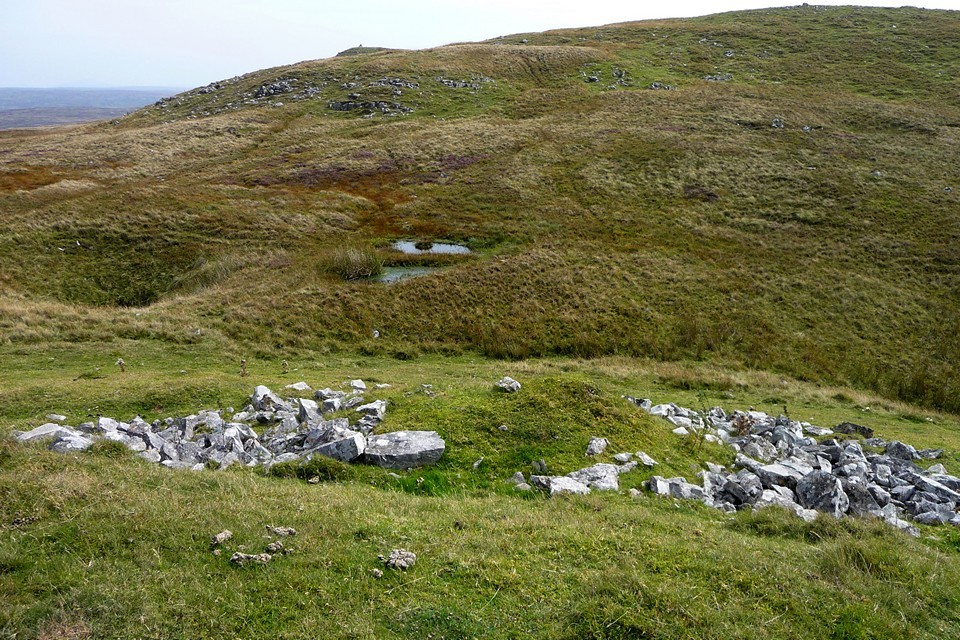
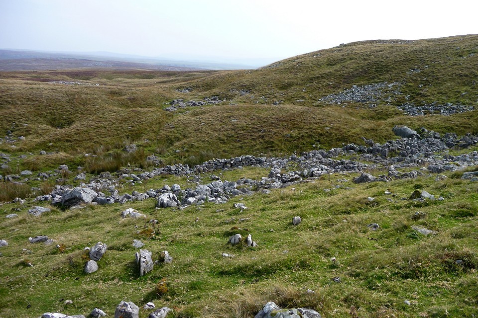
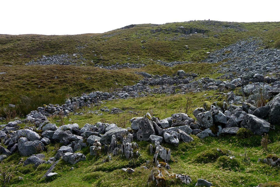
AROUND THE GARSON SHORE AND OVER BRUNA FEA September 15th 2012Now that they have the go-ahead for the new Stromness pier I thought it time to re-visit the (at latest) Early Iron Age remains of Quoyelsh in case the approach to the point became blocked by this development, at least while it is being made, and fortunately this day the low tide fell during the day (though not as low as when I walked the shore al the way from the Bridge of Waithe). It has been a while since I have been to the Hamna Voe, and the building works at the head of the inlet are far advanced. The way I wanted to go said Building Site Only so I retraced my steps and found another way in. I took a chance on this and it is only when almost at the new path that I finally saw a notice that you could still use this whilst construction continued - it would only have served a purpose if stuck at the perimeter gates ! Coming round the bend I partly used the tarmac and grassy paths and partly the low grassy cliff beside it. You can get down onto the shore at a couple of places, but when you reach Copland's Dock either you cross a slippery stretch where a very shallow stream outflows or you go back through the dock. What from a distance looks like a ruined pier is the line of the White House Rocks, which form a short breakwater. The old dock hasn't been used in a very long time and now presents as an enclosure surrounded by high brownstone walls, on the spot formerly occupied by the White House of Pirate Gow Fame (though there is another over in the town of Stromness that came to replace Cairston as the chief area of the parish. Garson is the present phonetic name of Cairston, 'cairns tunship' named for all the mounds in the locality, the best known being the fully excavated and partially dug brochs. The dock interior is covered with grass but there are perhaps ruins of internal structures underfoot so you stick to the walls pretty much. Against the east wall is the only upstanding structure, a drystane fireplace. Not your typical hearth, what with small refectory bricks and and rusty iron plate supporting a large 'lintel' over the entrance. It is difficult to work out what purpose it served though it does seem more industrial than what you would think belongs in a dockyard - would be nice if it occupied the place of a fire in White House but seems unlikely. I'm more certain that the gates and walls could have come from back then. One odd feature in the wall itself is a long rectangular gap near the base that has been blocked up with several courses of thin slabs and has a wooden 'lintel' above. Despite low tide the seaweed rendered the beach an awkward route from here, and so I followed the track to the western tip of the Bay of Navershaw - the Point of Quoyelsh. What I hadn't observed before was that there is a small low mound on the broader part of the headland - probably to intent on looking for a rise where the Iron Age settlement is revealed in the cliff-face (though what is thought by the discoverer to be a corner resembles a cell rather). The pottery evidence found is possibly even Bronze Age, the mound is surrounded by damp ground so perhaps a teenie burnt mound ?? The whole cliff top on the western side looks suspiciously level to me. I think the term is lens. Let your eyes travel right and a stoney half-circle in some turf below the clifftop is all that can be seen of the Quoyelsh site (though later I find one isolated lichen covered stone on the surface just back from the edge here, though this may be simply lying there). It is definitely a built feature, but even I had to confirm with the archaeologist that this was it ! There are narrow courses, kind of, but these aren't all that even and consist of every kind of non-circular stone like the worst conceivable drystane dyke precursor. Perhaps it represents a deep platform rather than a standing wall. Something else new is a three-lobed stone just below the clifftop abouthands of where the headland starts, with its back to the cliff-face. But when I eventually manage a decent look I see modern graffiti and my hopes are dashed - found object or brought here to show off, no context as they say. Near the point I carefully make my way down. I need to have slides and (by my 'stills' camera) video to add to what I took last time. Oh, darn that seaweed... and the slippery rocks... and the howling wind. I' not sure I didn't feel safer up on the rocky surface up in front of the 'site', even with that gale tugging at me. Strangely enough the site seems stable as it is, because the thin slab sticking ot on its own at forty-five degrees is unmoved a whole two years later. There may be further archaeology nearer the actual point but it is only a few scattered stones apart from a long white stone below at shore level that could be part of a moulded ?floor (or merely an outcrop - forget its place again, must do better). Couldn't get to the site's left and so eventually went up top again. Headed straight for the peedie mound, very squishy ground away from the cliff. Actually much of the apparent height is grass, a vertically enhancing 'cropmark', so there is probably depth to whatever it is. Leaving the Point of Quoyelsh to look for another Iron Age site near the eastern tip of the Bay of Navershaw the way between fieldwall and clifftop soon narrows. Shortly after the fieldwall ends I find myself crossing what seems to be a very short bridge. A little further on the track disappears entirely and I am forced to retrace my steps virtually all the way back to the point before I can go onto the shore and continue. I find that the 'bridge' goes over a tall narrow hollow and I remember my previous walk along this coast seeing what I took for a small cave. I had no time to investigate then but this is by it. I can see that that fieldwall end over to my left is matched by another to my right. The assumption is that the stonework is from a wallbase from these two continuing and meeting. But for one there was no sign either visually or underfoot of any such fieldwall. And for another the bridging stonework is far too good for any drystane dyke I am familiar with - six shallow courses filling a small hollow and set back into the earth with a perfectly flat face. And there is no wall surviving at ground level. Curious. To find Dave's other site (NMRS record HY20NE 4 near the northernmost part of the bay, at HY268092 about halfway towards Bu Point). As well as pottery and a midden signs of structures are described as five single-face walls in the side of the cliff. I decide to hug the coastline in case I see anything for myself. Where the clffs come down the shore is a visited beach at times, but not quite that now. At the shoreline there is a broad swathe of low carpeting vegetation, Beneath which there may be stones, though my feet didn't say whether natural or man-made of course. Across this section there is a long patch of darker brown forming a shelf in the 'cliff'. My brain says breccia but I questioned this - looked like compressed seaweed but I hoped for archaeology of course. Went closer and touched it. A slightly less than hard matrix with a few stones. Much later my second-guessing mind was proved wrong when I found online pictures of breccia. When the cliffs rose again I still hadn't found the 'Garson' Settlement. But a) I could no longer see the fences to place myself [though I suspect it is close], and b) my way on was blocked by the sea on this occasion. And so I clambered up to the field's edge and tried to work out the way the people I saw last time came down because I know it exists. My hopes lay eastward. Along the edge there is no crop and the NW corner even the wild vegetation is sodden. Between this and the next field a broad drain empties over the shore, however surely if the marshy area is merely overflow the farmer would have tried to stem it ? Across the drain a path does come toward the shore but looks to stop short and there is barbwire at the coast. Tried going up the field's eastern edge but the footpath here stops at the top and I see no gate for folk coming from Garson way to use and turn back. Approaching from this direction the Quoyelsh site seems to be the northern bump of a saucer-shaped depression whose other side is at the headland point itself (where threadbare possible archaeology needs the leap of faith). Much later I find a webpage on the geology at the Point of Quoyelsh that shows this being where the Lower Stromness Flagstones give way to breccia, into which a felsite outcrop intrudes from the point (the outcrop being the fully exposed rocks at the end) - see http://www.landforms.eu/orkney/Geology/Basement/basement%20Quoyelsh%20Felsite.htm . Maybe not a coincidence that the site is at this landform, as tools were made from felsite. Ventured down again and took some more photos. The site has a rock shelf, and if it hadn't been blowing a gale I might well have tried to get to this from the cliff as I did at the Knowe of Verron in Sandwick. No, no, not this day. Starting off again I saw the tide at low ebb allowing a 4X4 to make its way from Inner Holm onto the mainland. I am fairly sure that the new pier's architects will not have done modelling with a tank to see what effect this will have on the coast here and wouldn't be surprised to see a build up of material joining Inner Holm to Cairston on a more permanent basis (for the first time since prehistory I would hazard). I went back through Copland's Dock and then turned left up the broad farmtrack to the new estate. I must say this has boomed since my last time there when all the houses were by the coastline. And now the industrial side of Garson has filled up, it now has a specialised Park like Haston Industrial Estate. Walking between this and the elevated housing estate I could have been in any town down south [specifically it reminded me of a road in Bury St. Edmunds I used to walk]. Had thought about a walk through Stromness but researching walks for the Blide's Out and About I realised that whilst I had lived at Garson I had never been on the track that goes from the Howe Road to the main Kirkwall- Stromness road. So at the road bridge over the mill burn I turned left onto the Howe Road and strode uphill. Up above me below the track a large cut in the hillside looked awfu' bonnie in the sun, the long disused Maraquoy quarry topped with bright flowers. I have a thing about grassy tracks and love to photograph them when they present themselves just right, and this one hit in several places. It passes over the highest point of Bruna Fea and there is a mast here enclosed by a steel fence with the other repeater station gubbins. This is a gae exposed spot and the winds were even stronger than down off the coast. The gale wasn't content to just pluck at me but buffeted my whole body. Invigorating. From here you can see the whole of the town of Stromness laid out before you. This will be a grand vista to photograph when the air clears ! That was to my left. Looking straight along the track to the Quholmslie area there is amongst the modern buildings a nice old brownstone farmstead, now fallen into decay, that I have seen atop a hill when going to the Stromness Loons. From there it is more isolated. This is Viewfield ( HY21SE 77 at HY25681104). On the first 6" O.S. this is shown as two buildings (one still roofed) in an enclosure, but on the present 1:10,000 as only a roofed building. I think the phrase is 'economical with the truth' as it is all obviously still there - I think maps nowadays can tend to simplify what is seen, as I have seen a very similar thing with a site by Saviskaill on Rousay (though PASTMAP shows the reality near enough). Coming down the other side of Bruna Fea I gazed down on Cairston Mill (Millhouse) and up the Burn of Sunardee millstream to Stairwaddy (whose first element 'rocky' appears as steiro in two broch names) and the wide weir before it. On reaching the main road from Rosgar I considered going across onto the road to Sandwick for closer shots of Viewfield. However I felt the bad weather closing in again and so turned right to precede the next bus, which caught up to me when almost at Deepdale. Safe but wet in myself (from the heat) and my claes (from the heavy rain). Quoyelsh — Images07.10.12ce
|
7th October 2012ce |
Foel Drygarn - a favourite place |
Foel Drygarn - a favourite placeFoel Drygarn, Have been to this solitary fortress a couple of times, taking the path through the stone strewn field sheep watching warily, leaping the stream and yet have never written any field notes, probably because this area of Wales is so close to my heart. Sat on high watching the sheep brought down from the hills with chad bikes and sheepdogs, once on Carn Meyn as we stood by the car three chad bikes and nine sheepdogs all from the same honey coloured family raced up the hill, the lazy dogs taking a very bumpy ride to the top. Then the flow of white sheep pouring down the hill almost like a Tibetan prayer scarf against the green turf. This great ridge of rock at Carn Meyn then the break to the Foel Drygarn ridge reminds you that this grassland part of Wales rests ever so lightly on very rocky ground. An exuberant thrust of the rocks has forced its way upward, this is the 'Welsh Ridgeway,' traders and itinerants have wandered across this landscape from Ireland down to Stonehenge. The first thing to strike you on gaining the height of Foel Drygarn is the verticality of the stones in the rocky outcrop that faces you, broken into decent sized stone, ideal for standing stone material in prehistoric times. N.P.Figgis describes it thus......This hillfort is thought to have originated in the Late Bronze Age, and to have continued, though not all the time, into Roman times, and that the three separate enclosures may represent three stages of expansion. "The first enclosure, containing the cairns is surrounded by walls joining rocky prominences on the south and everywhere else by an impressive ditch and bank. The second enclosure, built in a crescent outside the first, is thought to be a response to the increase in the overall population in the Iron Age and is less substantial. The succeeding annexe lower and to the north-west, were thought to function as stock pens". Now there is some questioning to the three cairns in taking up so much room in the middle of the hill fort, that they are not in fact Bronze age cairns but Iron Age look-outs, but I suspect this is just a red herring, and defensive needs being a priority sometime during the I/A people built a hillfort around these three rather unmovable large stone cairns.. Figgis reckons that Foel Drygarn was an important centre in Celtic times and that gifts were exchanged here; there have been a few scrappy finds of Llanmelin pottery, and a few pale green beads, but they were halved these beads as if such precious gifts were hard to come by, one had been glued even. Welsh landscape is often remote and wild even today, but the sense of power and grandeur in the Carn Meyn range is still there, if people worshipped anything you can feel it in the magnificent craggy summits. Later Iron Age or 'Celtic' world saw them in perhaps a different light, but the 'otherworld' lies heavy in the scenery, water seeps from the earth in springs everywhere, under stone so that you can hear its quiet trickle but no visible signs. There is a prehistoric story round here in the wider landscape, where monuments lie scattered here and there and it is well to read 'Prehistoric Preseli' by N.P.Figgis to realise that interpretation of how monuments relate to each other are waiting to be discovered and revealed by archaeology, it is still unexplored! |
 Posted by moss
25th September 2012ce |
Boat of a million years |
Boat of a million yearsVery early o'clock Saturday the 22nd of September, sees me up and at 'em and once more en route to North Wales, the epicenter of me. It's the Autumnal equinox again, I've only failed once in twelve years of getting out and being somewhere good on a solstice or equinox, not in any real pagan way you understand, I really only use it as an excuse to definitely go out, come what may, my works annual leave is always March, June, and September, cant get Christmas off, that ones a sicky this year. By passing Chester I take the coast road, dual carriageway all the way to Conway, it's my route 66, this drive got an even more spiritual bent to it this morning, behind me high and bright was the planet Venus, stars were everywhere, several shooting stars go by (space junk !)and as the road got higher mist started to come and go, the car seemed to be flying amongst the clouds, my boat of a million years. As you come off the dual carriageway you enter the Conway river valley, the hills and mountains to the west are as jam packed with megalithic and natural wonders as anywhere you care to think of ( with maybe a few exceptions). Cross the river turn left onto the B5106, turn right after a black and white pub called Y Bedol. The mad twister of a hair-pinned road should be taken slowly and carefully. Stop and park at cattle grid. It was most definitely getting light now, I donned my waterproof lower half, it was not going to rain but dew is a soaker and there's that river to cross as well, then I was off down the hill towards one of my most favorite of places Hafodygors wen. A northern four poster with a ring cairn around it. I've already removed one small Gorse bush, and almost all of another, it was time to finish the job and catch the place in its best light, sun rise. The brown patch where I removed the first bush has now almost completely grassed over, but the fingers of the bigger bush have started to regrow, bloody Gorse. I unpack my secret weapon, a flick saw, like a flick knife but a saw, ten minutes in and the sun comes up. I know from copious map staring and Google earthing that the hill known as Waen Bryn-Gwenith http://www.themodernantiquarian.com/site/12542/waen_bryngwenith_stone_ii.html is directly east of Hafodygors wen, the big stone right on it's summit is very visible from almost everywhere round here, and if that wasn't enough, fifty yards down hill from it is a probable collapsed dolmen http://www.themodernantiquarian.com/site/12543/waen_bryngwenith_stone_i.html , A good place for the sun to rise on such an auspicious morning, and the perfect place to see it from. The sun shone full and bright as it came up over the hill, if it was a more flatter place it would have been a big orange ball, but from here the sun has more chance to accrue it's brilliance. And it was brilliant. The sun seemed to be coming up over the dolmen rather than the big stone, cant be a coincidence surely, two other hill tops near here have big stones on there summits dissuading me of a solar alignment. Behind me the sun light slowly moved down off the mountains and creeped down the hill side to my little stone circle, and bathed us in light. I tried to capture the moment on camera but it never sees the same as me. I renewed my attack on the Gorse remnants till it was all but gone, a small hard knot of root was clutching strongly to some cairn material so I cut it back some but ended up having to leave it as I don't want to damage the stones in any way, hopefully, I killed it, horrendous, I know and I feel badly for it, but each thing has it's place, and seeing as only two people have ever been here, Ive decided that I am the one who decides what goes where. This time next year it will all be grassed over and all will be well for this strange little beauty, if only it was a bit easier to get to, it might get more visitors. But, that's not all folks. First I head over to the other very nearby cairn, it is just a bump now, but I decide to take a closer look any way. Nothing much to see at all really, but interestingly the big stack of rocks is half way between cairn 1 and 2. I return to the four poster and make ready to walk about. I remember Coflein saying something about a hut circle round here somewhere, I follow the river, with a vague memory that its near to it. I didn't find it first time I came here, but I did this time. A large ring of small stones, on a slightly higher than the ground platform, two small wind shelters/sheep pens ??? have been formed from the stones. Not a particularly inspiring ancient monument, but it's position is in a gorgeous setting, rushing river below, more recent ruined building across the river and every where trees, ferns and mosses, with mountains never far from view. The megalithic portal brought to my attention that a standing stone is up the valley some more towards the mountains, never needing much of a reason to get nearer the mountains I set off, tired but in good spirits. Following the Afon Dulyn to the dam, then a footpath takes us to the Afon Garreg-wen, It's only a small river but crossing it was found difficult as I'd come to the waterfall bit, moving about in dense wet undergrowth wasn't easy, my leg disappeared down some dark hole, banging my knee cap on my other leg, I pulled out my soaked leg half expecting a Lovecraftian monster to be clinging to it, but it was just dirt and wet. Ok. Watching out for a big cluster of sheepfolds I knew I was in the right place. and there it is, vaguely helping a fence to stand up. The stone is 1.75 meters tall, that's up to my chin. It is only by a fence and the farm dude has tied a wooden fence post to it with new shiny wire, I try half heartedly to undo it but to no avail. The stone clearly predates this fence, even the river is named after it, the fence runs for 1.5 miles from Pant y Mynach hill top to far across the valley to the footpath at Clogwyn-yr-Eryr. There are two stones right next to it, this one and another fifty yards higher up, but its smaller than this one. Brilliant views over to the Carneddau and Pant y Griafolen, and every where else the eye settles on. One more place on the way to the car, I follow the fence line all the way across the valley crossing the Afon Dulyn in the process, I saw three other people on the way. High up on the other hillside I come to the track and start walking carwards, that is east. First I refind the single standing stone that is situated by a dip in the hill top perhaps pointing towards Pen Llithrig y Wrach, then from there the other stones can be seen, one good tall stone has holes in two sides one all the way through, the fallen stone is perhaps smaller, with another hole in it. The last stone is the smallest and the most northern. It has no holes in it. These three could be a stone row, but the other stone up hill is out of line. It's all very confusing, they were at one time part of a fence line, but the ancients breath has been down my neck all morning, its just as strong here as it was at sunrise. What a beautiful place, I must find a reason to come back, thought of one already, because I can. One more place to go. Back to the boat of a million years. On the way taking note of the big stone on Waen Bryn-Gwenith, and I spot the tree guard of Cae Du on my right on the shoulder of Moel Eilio. I drive the car back to Tal y Bont and then immediately back up into the mountains skirting by and below Pen y Gaer, hill fort extraordinaire. There is a small car park west of the fort, i've been up the fort before, so instead I now crawl up the nearby mountain? of Penygadiar. There is no cairn or stone here, just a view to end all views, some places have a good views but compared to this they're just looking over the wall at old ladies drawers. Expansive isn't the word, try all encompassing, it's closer, I wont name all the places seen from up here, but its well over twenty, the nearest is the hill fort, which is why I came up here, on zoom we can see it all. But now, that really is all folks, a leisurely float home and two hours later I'm crashed out on the sofa not watching tele . |
 Posted by postman
23rd September 2012ce |
Over Gelli Hill, the hawk hangs still – 23 October 2010 |
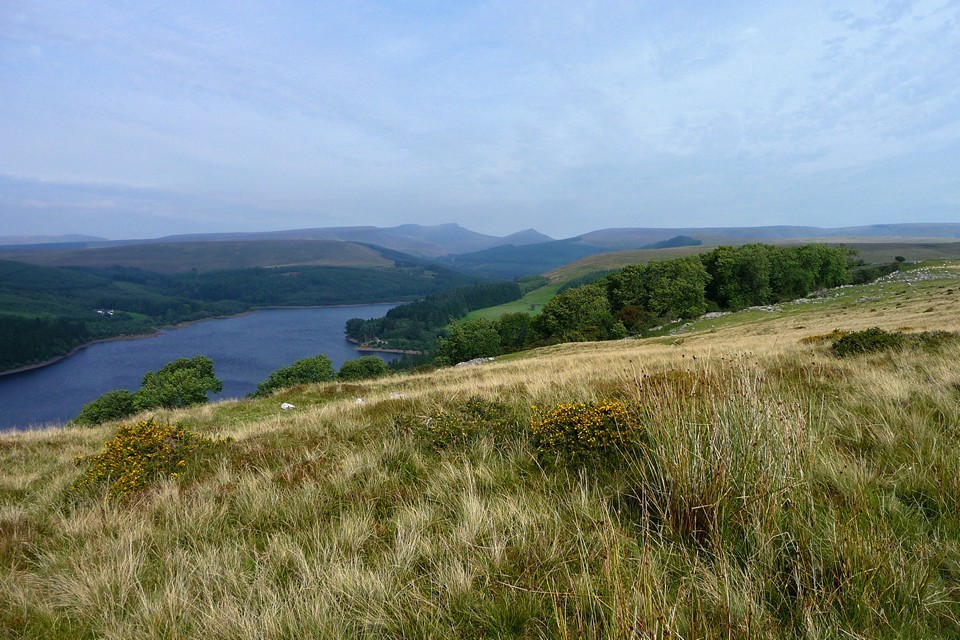
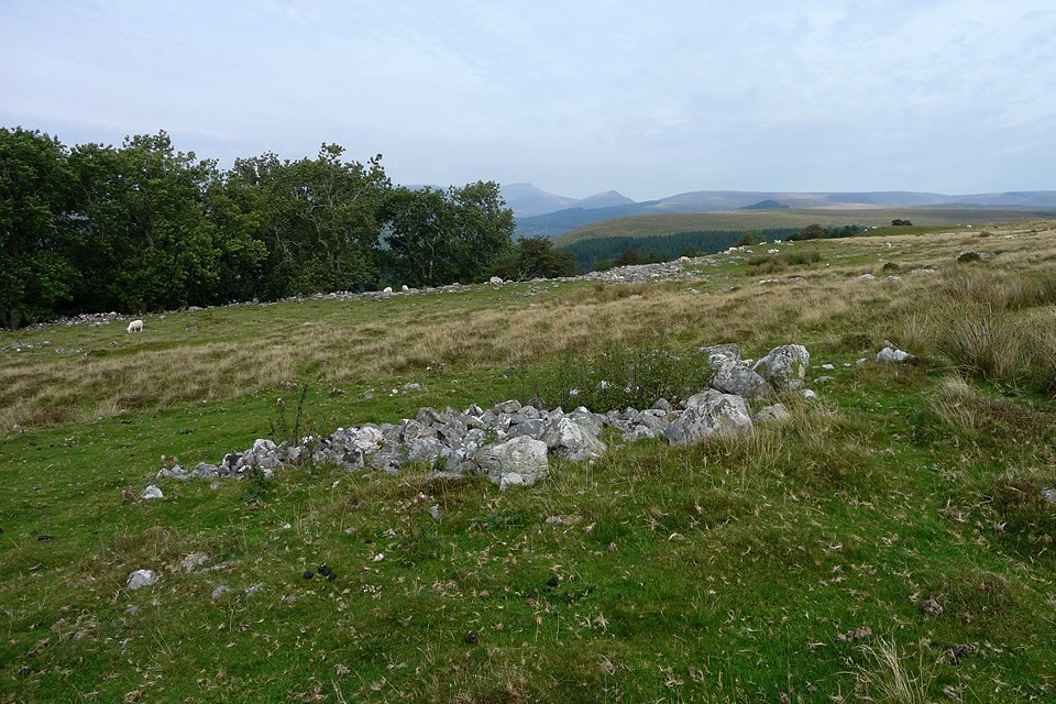
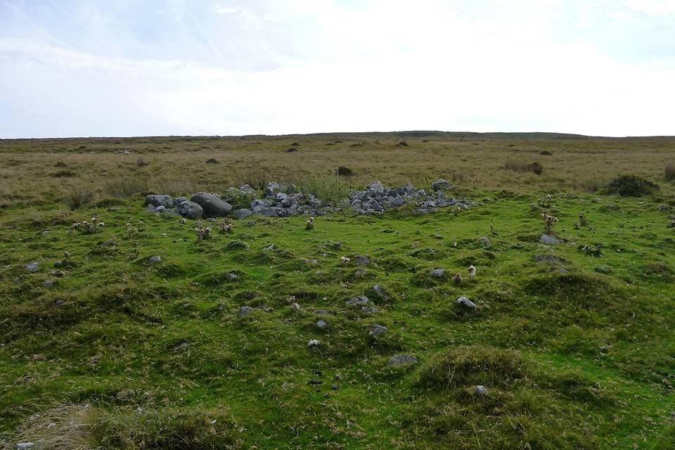
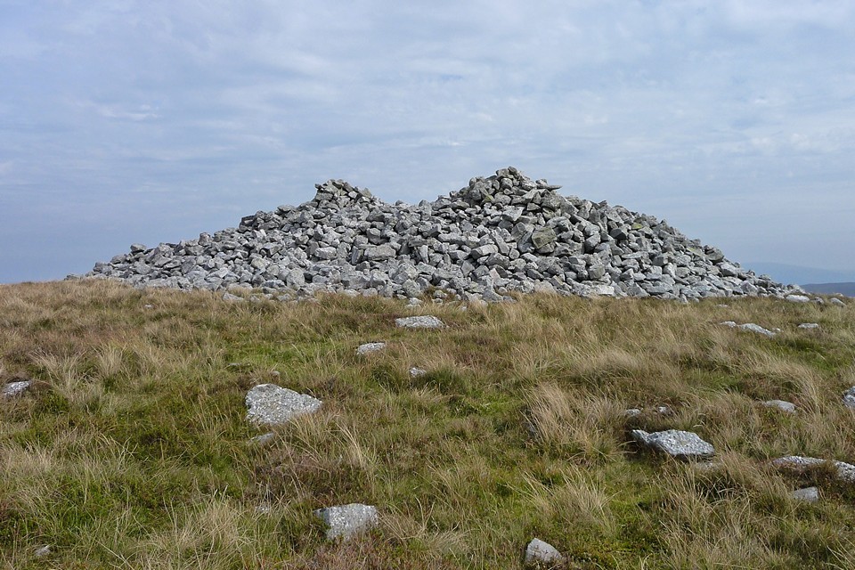
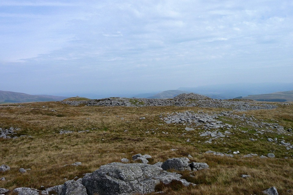
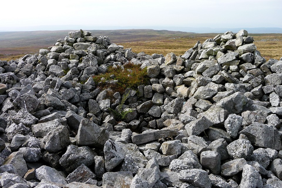
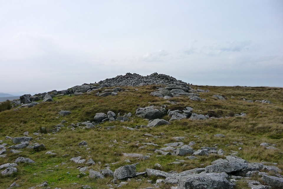
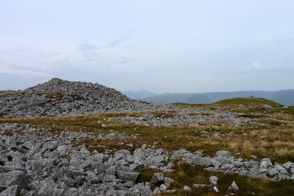
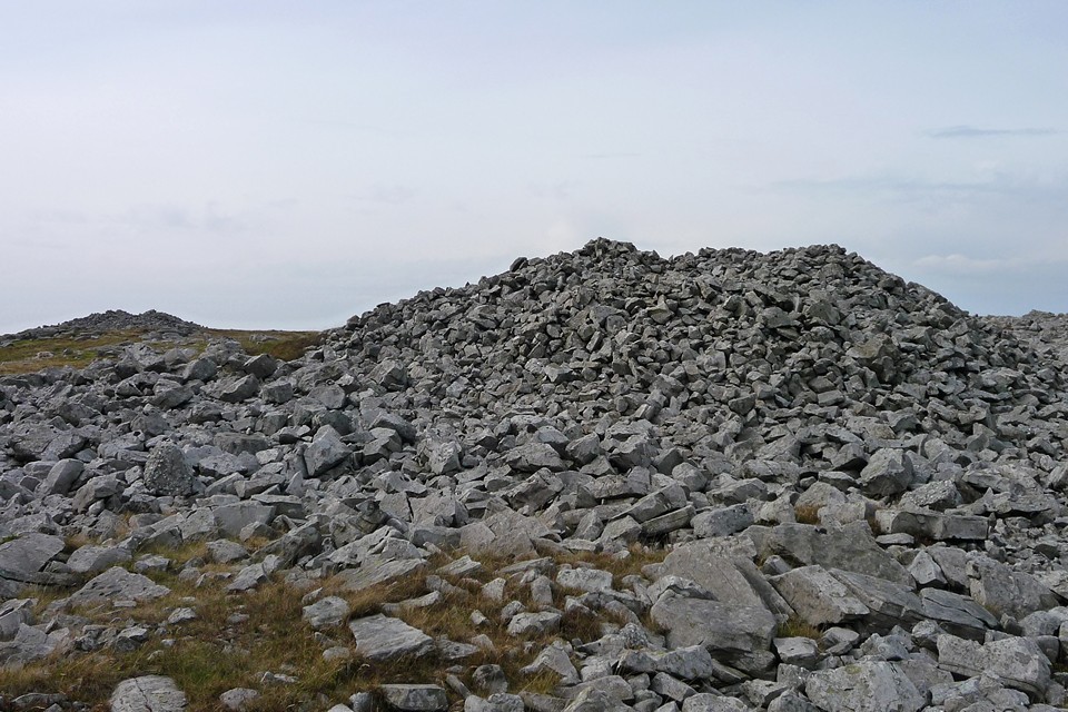
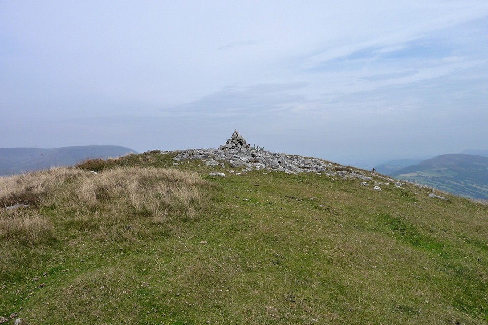
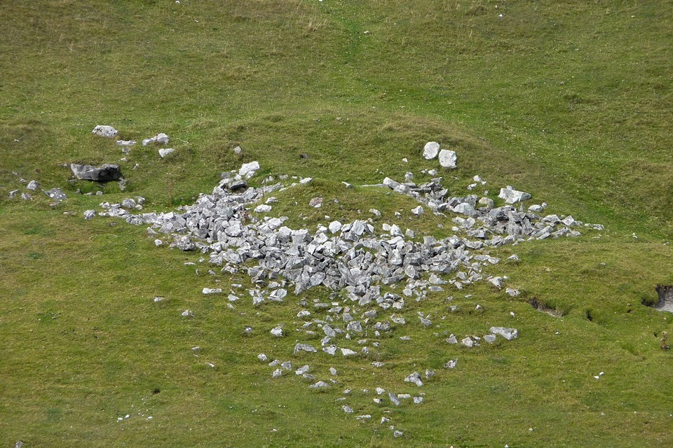
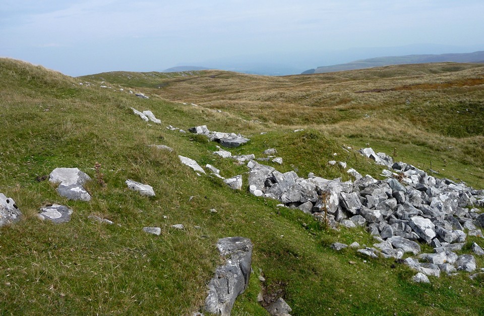
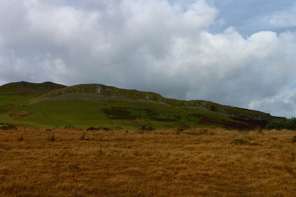
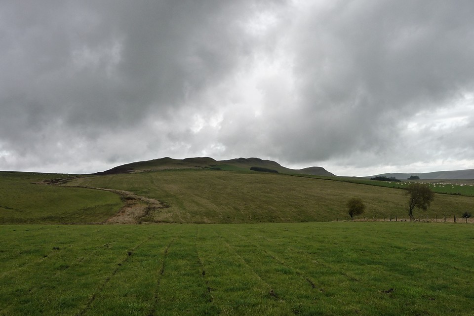
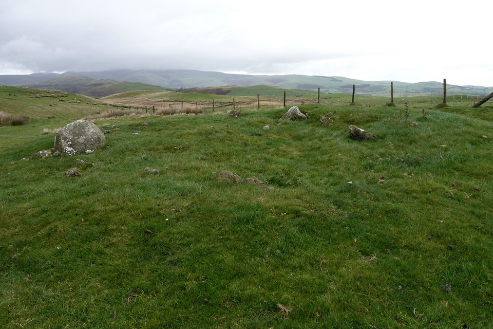
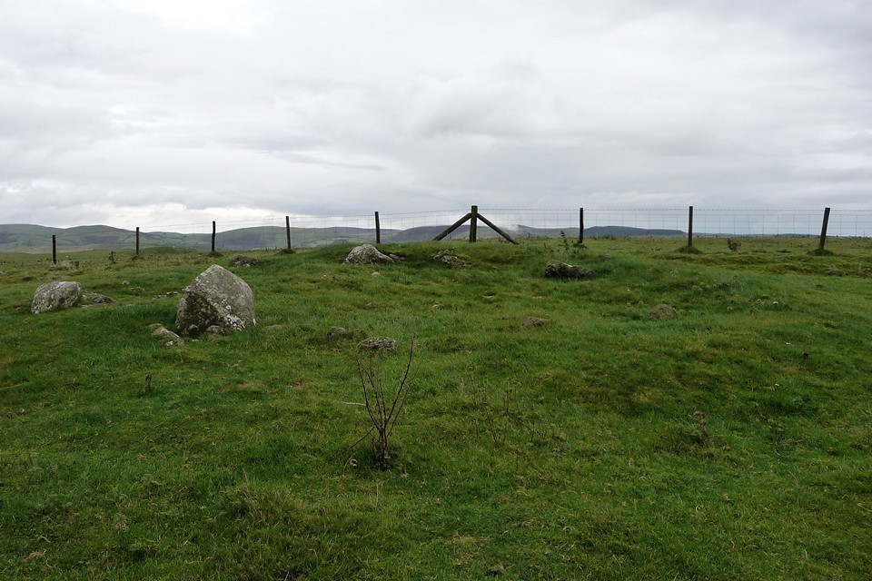
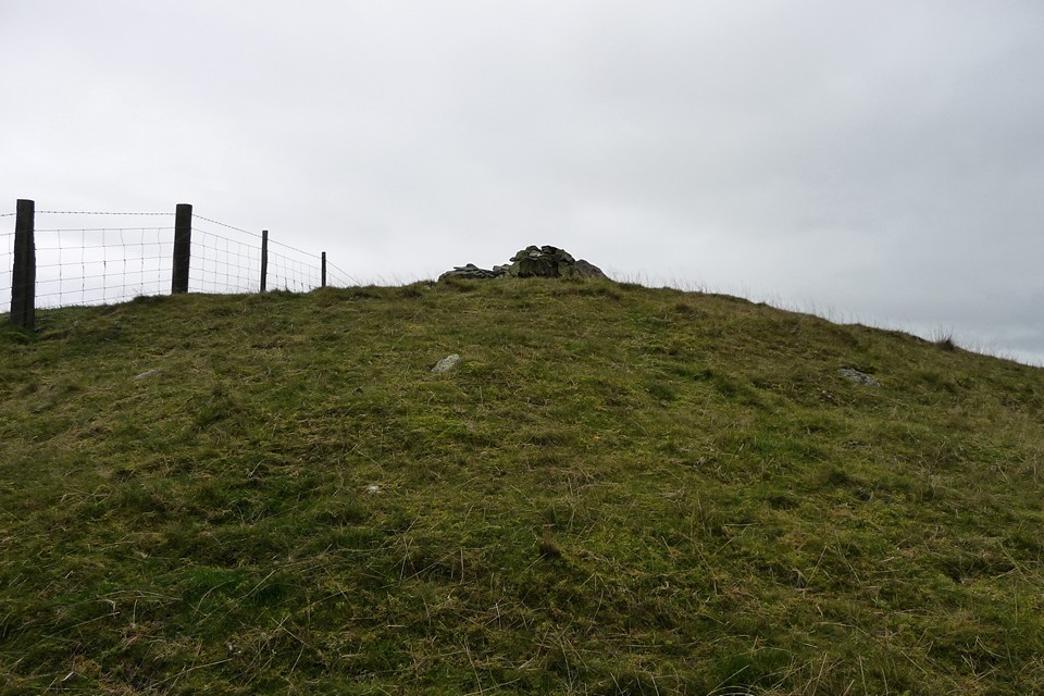
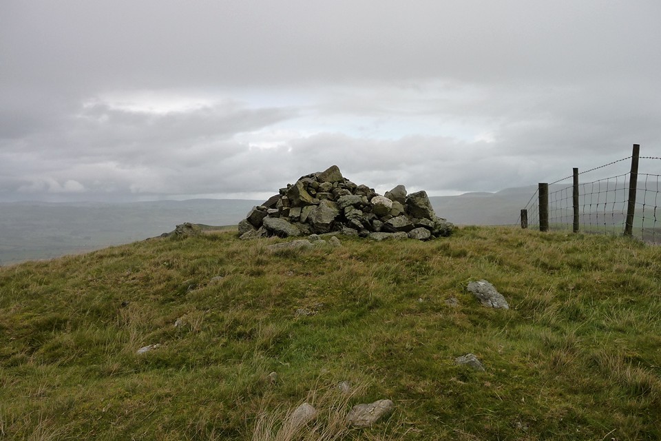
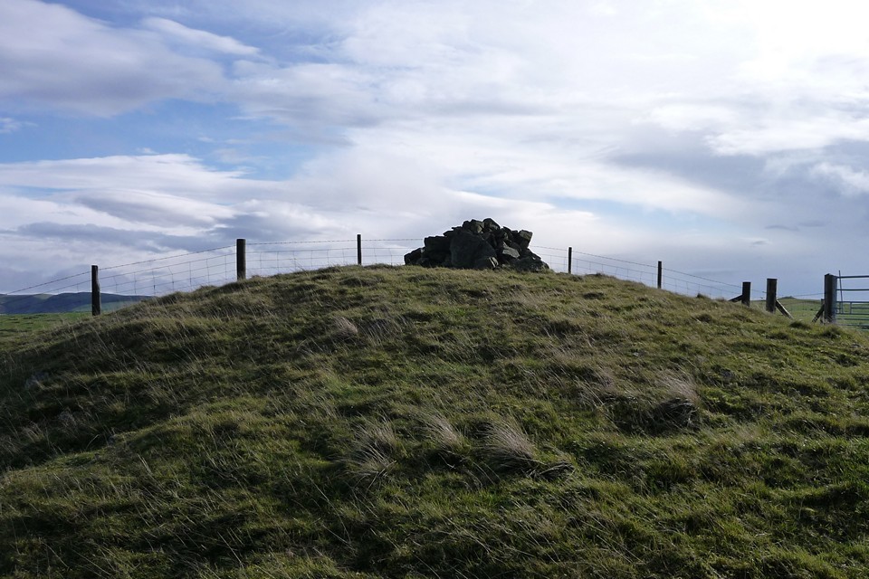
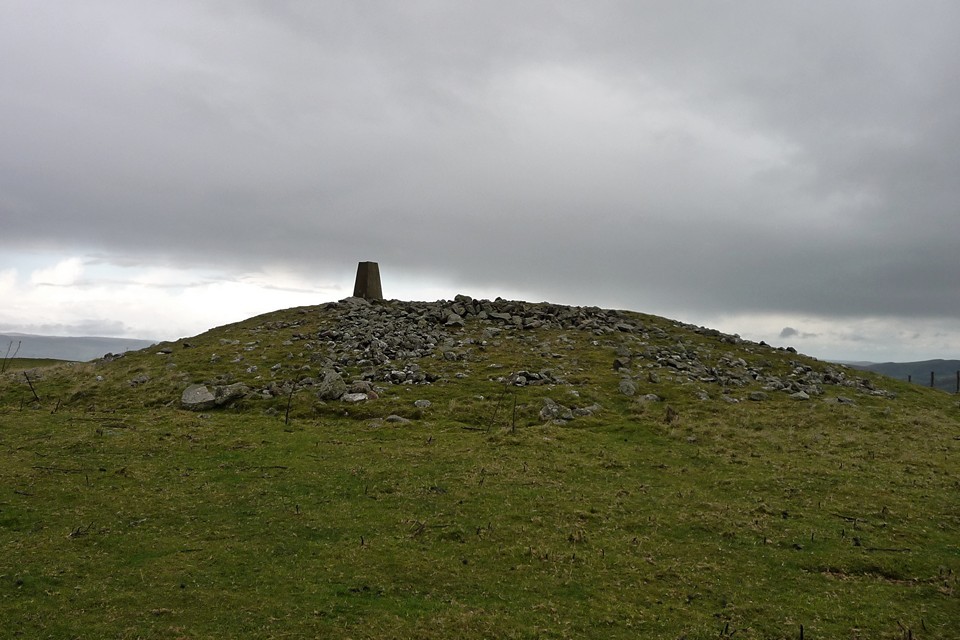
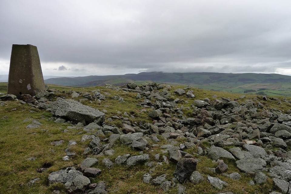
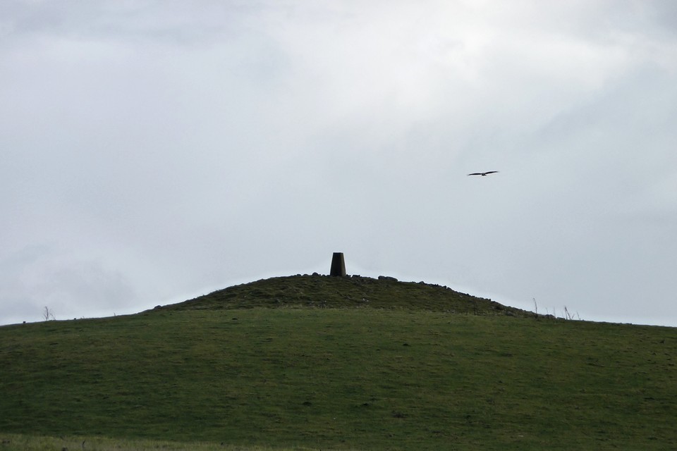
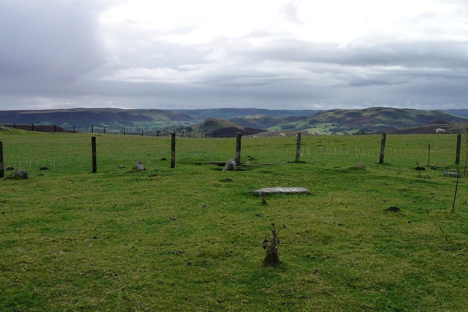
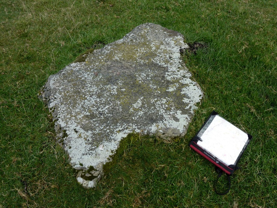
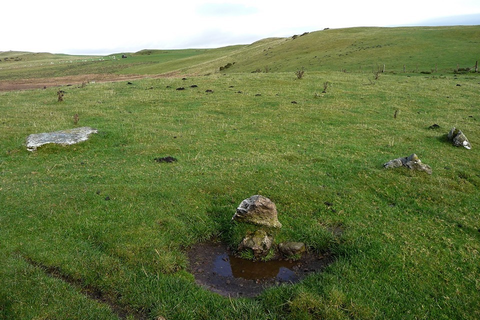
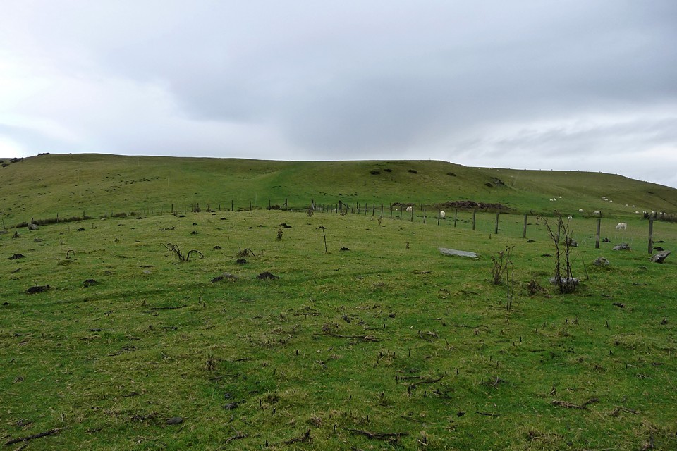
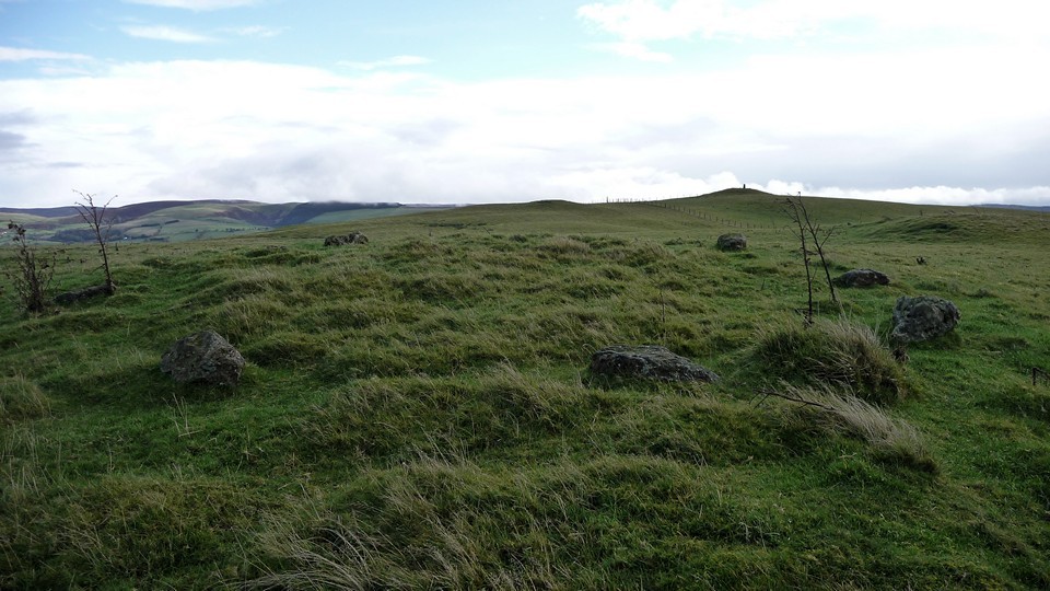
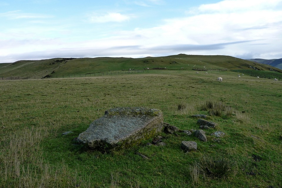
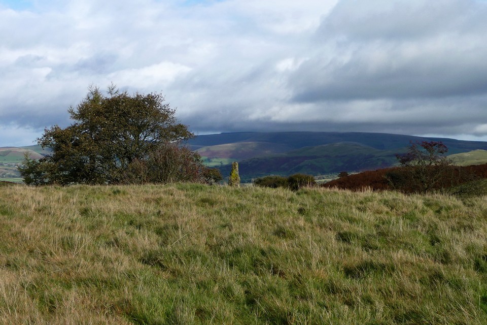
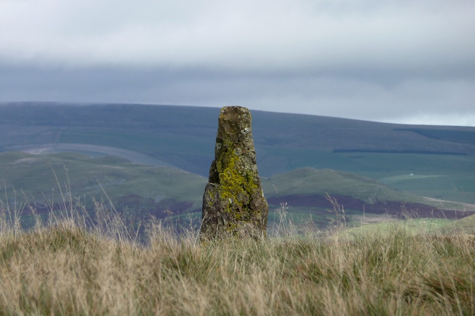
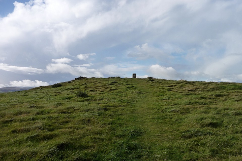
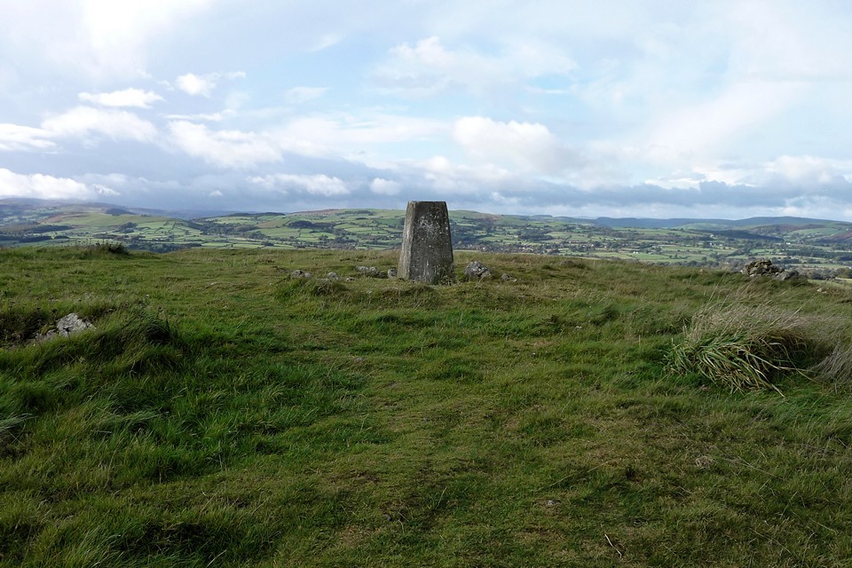
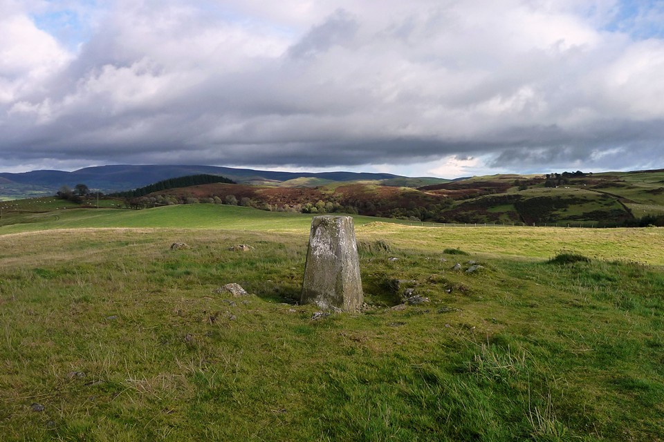
Over Gelli Hill, the hawk hangs still – 23 October 2010The obliging driver on the bus from Kington drops me right at the end of the bridleway opposite Larch Grove and she wishes me a nice walk. You’ve got to love public transport in these rural areas. Stepping onto the verge I’m greeted by a cacophony of barking from the house, as hidden hounds warn me off their territory. A minute later their owner (or their “human”, depending on your notions of the canine/human relationship) appears to bid me good morning and ask where I’m walking to. I tell him I’m off to Llandrindod. “Over the hills!” he says “nice day for it”. With the second set of good wishes in five minutes ringing in my ears, I take the bridleway onto an area of open common, covered in scrubby gorse and reedy grass. Larch Grove — Fieldnotes13.09.12ceMy ostensible purpose for starting the walk here is the “Standing Stone (recumbent)” marked on the OS 1/25000. Unfortunately, despite wandering back and forth across the general area for about 20 minutes, I find no stones. The vegetation makes it difficult to see and it could easily be hiding sneakily under a gorse bush. So reluctantly I give up and head on my way. There are good views of the prominent rocky ridge of Llandegley Rocks from here. The ridge is home to an Iron Age settlement, but it’s one for another day as I’ve got quite a walk to my next site. Crossing the common, a slightly alarming sight greets me to the southwest, as the hills in that direction are rapidly disappearing under a low-lying band of rain cloud. It’s starting to look increasingly like my last trip into the Radnor Hills a few months previously, when I stumbled through fog and bog over Great Rhos and Black Mixen. The streaked blue sky that started my day so nicely is looking increasingly ephemeral. The next unwelcome interlude is an encounter with a large party of men with shotguns and walkie-talkies, forming a perimeter within which presumably something alive will soon be dead. To be fair, they’re friendly enough, and we nod and grunt at each other, as you do. But I’m not sorry to be out of sight and sound of their activities. By the time I reach Hendy Bank, the Radnor mountains behind me have been engulfed in weather and it’s not looking too great where I am either. The route is an easy stroll along a byway, so I crack on. At Bwlch-llwyn, I note a “something” beside the path, a fairly small upright slab, clearly erected deliberately, leaning against a couple of blocks. Not sure what it could be (if anything). Nothing on Coflein. More interestingly, I get a nice view of Gelli Hill from here, my primary objective for the day. It still looks quite far off but the enormous cairn is already clear. Pawl Hir — Fieldnotes13.09.12ceFirst though, there’s the small matter of a ring cairn discovered on a late-night trawl of Coflein’s blue dots but not shown on the OS map. As I climb the hillside up towards the cairn, a red kite comes to check me out, swooping low above my head to display the characteristic forked tail of the species. Nearing the hill top, a low mound appears on the right of the path, with a number of stones protruding from the top. Here it is! It’s a decent ring cairn, fairly well-preserved, nothing spectacular but nicely sited on a high-point, with good views of the surrounding hills. If you covered it in heather instead of grass, you could sneak it onto Stanton Moor as an embanked stone circle and you’d get away with it. Definitely worth the walk and shame on OS for missing it off the map (hooray for Coflein obviously). My newfound red kite friend comes back to see what’s occurring. Not much, actually. Gilwern Hill — Fieldnotes13.09.12ceOne field on from the ring cairn, I leave the comfort of the broad byway and head uphill on a footpath that leads direct to the cairns on Gilwern Hill. At this point, the cloud and light drizzle turns inconveniently into a proper mid-Walian downpour. The top of the hill is cairn II itself, a large grassed-over mound the best part of 20m across and well over a metre high, with a little walkers’ addition on top that I didn’t expect to find in such a remote spot. Evidence of the mound’s stone construction is apparent from protruding stones, otherwise it could easily be taken for an earthen round barrow. A modern post-and-wire fence cuts across the southeastern side of the cairn. Aside from the lashing rain, this would be a fine spot with extensive views, particularly of the neighbouring Gelli Hill cairn. Gilwern Hill cairn III is supposedly close by. I can’t see any sign of another cairn here. I head on down the hillside, southwest, hoping to find cairn I. This is shown on the map, but I fail to see any sign of it either, as it’s at this point that I begin to realise that the field patterns shown on the OS map have been altered and replaced by post-and-wire fence lines in other places, as well as a re-routed farm track. These re-arrangements will come back more strongly later in the walk, but here it conspires to confuse me and I fail to find cairn I. A pair of red kites hangs over cairn II on the hilltop behind me; this is obviously a little haven for these magnificent birds. Gelli Hill Cairn — Fieldnotes13.09.12ceDespite the confusion of fences, the Gelli Hill cairn is a big bugger, so there’s no missing it. It helps greatly with orientation and perhaps it was always that way, helping visitors to find the diminutive stones of the nearby stone circle over the millennia. A proper, stone-built monster cairn this, damaged by digging and the addition of an OS trig pillar to the cairn’s top.There are big blocks amongst the smaller rubble, perhaps there was a central cist of some sort? It’s reminiscent of the cairn on Bache Hill not far away. To re-inforce the point, the top of the Whimble peeps into view briefly through the cloud. There would be great views of the Radnor mountains from here, but sadly the tops are still enduring a deluge and are hidden within a curtain of grey. Luckily for me, the heavy rain that marred the visit to Gilwern Hill a short time earlier has mostly passed over, leaving behind light drizzle and a substantial drop in temperature. Gelli Hill — Fieldnotes13.09.12ceThe stone circle is close to the big cairn and should be really easy to find from it, look, just follow the fence northwest until it meets the bridleway, follow the bridleway along, job done. But it isn’t, because the ground is more up-and-down than you’d think and the fences have all moved! So it takes a while to locate the circle, Mr Burl’s description helps, although he doesn’t mention the big slab in the middle of the circle (off-centre). One of the new fences hems the circle in closely on its southwestern side, not like the open field shown on the current 1/25000 map. The circle is a ruin, and even when it was brand-spanking new would have been a little underwhelming for anyone who’d been to any other stone circles anywhere. Perhaps they hadn’t though, or perhaps the ritual quality was so impressive that the circle was nothing more than a performance space. It was all about light and magic here, maybe. To be fair, the setting is fine, with nice views especially to the west where the ground drops down to the Wye valley. The off-centre slab is intriguing, unsure whether it’s an original feature or a more recent interloper. Big though (see picture with map for scale). The other stones are pretty small, none more than a foot or so tall, some are buried – there are mole-hills inside the circle that are taller than some of the stones. Burl reckons it’s one for the “determined”, I won’t disagree as that should be enough to bring many TMAers anyway. I spend a good while here, wandering around the perimeter rather than sitting as I’m feeling the cold a bit now - the sky has started to clear and blue patches have appeared but there’s a distinct chill in the air and my boots are squelching a bit from the earlier downpour. Gelli Hill stone — Fieldnotes13.09.12ceI head on over to the outlying stone. It can be seen from the circle, so isn’t hard to find in clear weather. Wedge-shaped, is it fallen, was it always recumbent? There are various smaller stones scattered nearby which would make for promising packing material, but might equally just be random scatter. It has very decent views of the big cairn and over the valleys and hills to the west and northwest, I guess maybe towards Pumlumon and the major watersheds of mid Wales. Returning to the circle, a red kite hovers over the cairn, I’d love to know if it’s the same one that’s been tagging me since Pawl-hir ring cairn. I decide to head back to Gilwern Hill for another look at the hilltop cairn without the pouring rain. As I head east from the circle, not following the same route I came on, I come across a ring of earthfast stones in the next field and realise that this is the “other” circle that Postie had posted pictures of. This is a weird one, it looks genuine, it’s very nicely placed, but there’s no record of it anywhere, not on the OS, not on Coflein, not in Burl. All of which suggests it’s modern. Nice though, I’d have one. I head back to Gilwern Hill by a more direct route, climbing a fence and avoiding a quad-biking farmer on the way. In sunshine now, this does have a nice feel to it. The views have opened right up and stretch away over gently rolling hills, fertile farmland and pleasant valleys. Yep, this is a good spot to sit a while. Ffrwd Stone — Fieldnotes13.09.12ceFrom the Gilwern Hill cairn I head back north to byway and past a scenic little lake at Ffrwd. A padlocked gate across the byway is accompanied by an chunky upright megalithic slab, spotted with yellow lichen and leaning against another smaller slab. Coflein places Ffwrd stone hereabouts, this fits the (limited) description, but is it “it”? The location is only approximately near the Coflein blue dot, so it’s not certain. Carregwiber (stone 1) — Fieldnotes13.09.12ceI skirt the hill below Carregwiber fort, I had tentatively hoped to get a visit in but I’m tiring and quite cold now, so decide to press on. Instead I manage a quick stop at Carregwiber stone, which is a small stone that in many places would be dismissed as a rubbing post, but here we seem to be surrounded on all sides by standing stones so it’s part of a complex. It’s a shapely, tapering stone, set above a slope to give greater prominence and a terrific view of the Radnor mountains. The ambience is rather spoiled by the carcasses of a rusting car, caravan and assorted junk in close proximity, but don’t let that put you off (too much). From here the path drops much more steeply to Llanoley, where someone is making a living carving and polishing tree-trunks into gorillas, marlins, bears and seals. There’s a good view of Carregwiber fort from here, displaying the natural defences of the slope. A minor road heads west, to the penultimate site of today’s walk. The Beacon (Llandrindod) — Fieldnotes13.09.12ceThe second trig-surmounted cairn of the day, The Beacon is less impressive than Gelli Hill cairn. It’s quite reduced and low, but it does boast similarly expansive views to many of today’s other sites, especially to the northwest where Llandrindod nestles in the valley below. Carregwiber fort can be seen, and the Radnor Mountains provide the backdrop to the northeast. It would have been a fair size, judging by the footprint and stonework protrudes here and there through the grass. Access is easy, a footpath leads straight to the cairn across a single field from the road. I don’t stay long, but head on to Little Hill VII. Little Hill VII — Fieldnotes13.09.12ceLittle Hill VII proves to be a rather uninspiring end to the day. A very overgrown cairn, on a golf course. Not one to make a special effort for, unless you like golf (I don’t). I always feel sorry for barrows on golf-courses though. If they manage to avoid being turned into a landscaping feature (like a couple of ones on Ludlow racecourse), they seem doomed to be “in the rough”, where vegetation is encouraged to smother them and legions of pringle-clad middle-aged men assiduously try to avoid them. Shame. The final walk down to the pretty town of Llandrindod is easy and uneventful. I like the monster in the lake though. This area of Wales deserves to be better known in TMA circles, I reckon. You are practically falling over stones and cairns at every turn, the countryside is strikingly beautiful and very quiet. Hmm, perhaps I shouldn’t tell anyone after all? Llandegley Rocks — Images26.12.10ce
Pawl Hir — Images26.12.10ce
Gilwern Hill — Images26.12.10ce
Gelli Hill Cairn — Images26.12.10ce
Gelli Hill — Images26.12.10ce
Gelli Hill stone — Images26.12.10ce
Ffrwd Stone — Images13.09.12ce
Carregwiber (stone 1) — Images26.12.10ce
The Beacon (Llandrindod) — Images26.12.10ce
Little Hill VII — Images26.12.10ce
|
 Posted by thesweetcheat
13th September 2012ce |
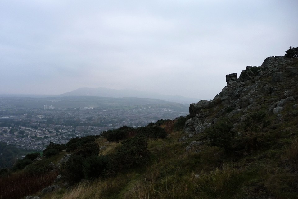
So many pathways that lead to the heart – Arthur’s Seat 10 October 2010 |
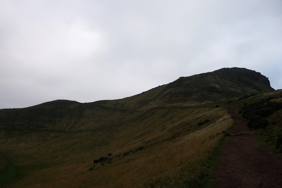
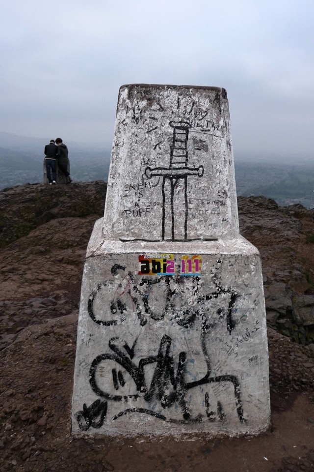
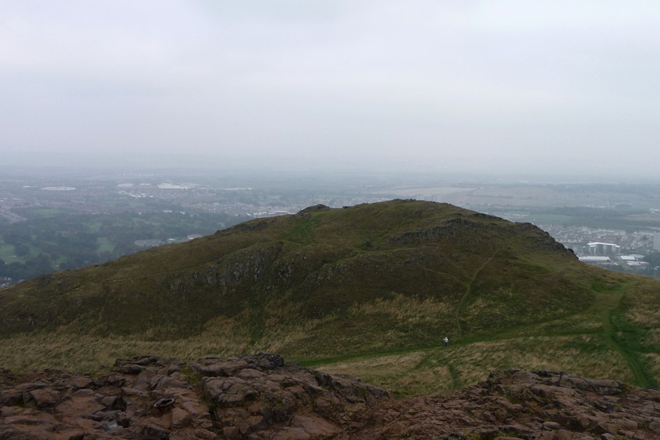
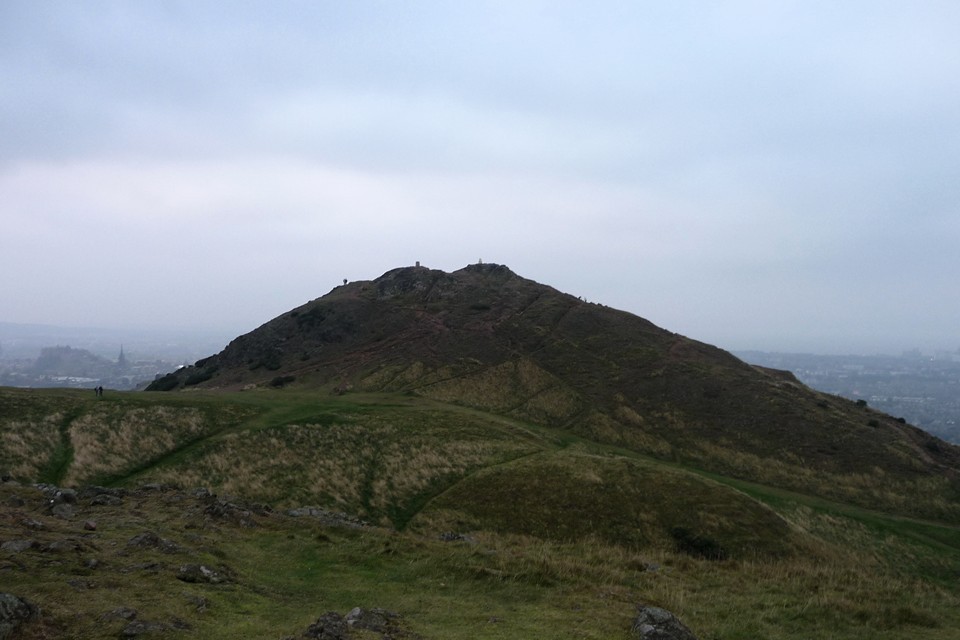
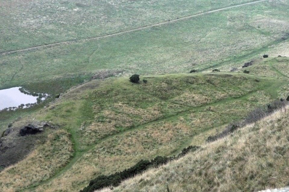
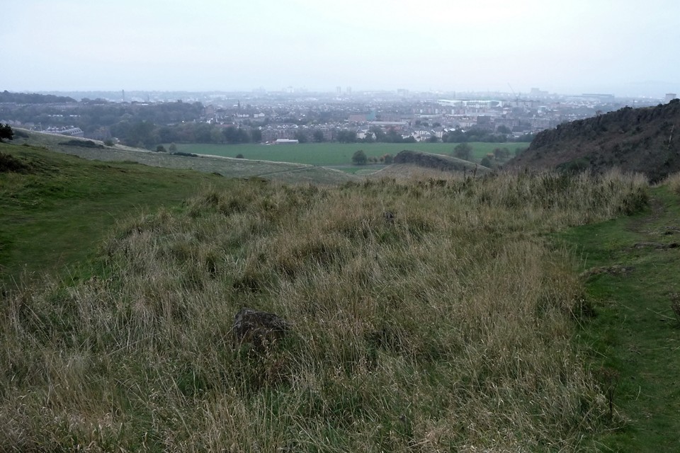
So many pathways that lead to the heart – Arthur’s Seat 10 October 2010The end of our first Scottish holiday finds us back in Edinburgh for a one-night stopover. G/F is tired and unenthusiastic about a post-tea walk, but I’m restless as ever and decide to go out on my own for a while. I briefly considered a bus ride to see the Caiy Stane, but the lure of Arthur’s Seat, the craggy volcanic lump towering over the city’s skyline, is too much. I walk up through the Georgian streets of Calton, before reaching the splendid Holyrood Palace and the contrast of the Scottish Parliament building, which I rather like. Arthur's Seat and Crow Hill fort — Fieldnotes14.08.12ceHolyrood Park stretches out before me, a relative wilderness at the heart of such a cosmopolitan city. I’m immediately glad to be wearing boots, for the paths are muddy and slippery. No gentle urban promenade then. I take a path marked “Dry Dam” on the Ordnance Survey map, skirting the southwestern end of St Margaret’s Loch and passing below the fragmentary remains of St Anthony’s Chapel, perched on a rocky shelf above the water. The whole of the park appears covered in archaeological remains of one sort or another. Dry Dam becomes Long Row, a gently sloping climb up the valley between Whinny Hill and the higher Arthur’s Seat. Tiny figures surround the trig point on the summit, a popular walk even on this grey October evening. Whinny Hill, over to my left, looks the perfect spot for a hillfort, being encircled by a series of natural terraces, but the hill is actually bare of any remains. After a while, the view to the east reveals Dunsapie, where a kidney-shaped loch provides a natural moat on the north and west sides of the flat-topped hillfort. One for another day though. My path continues to climb, before a fork offers a choice of the lower Crow Hill straight ahead or the steeper route to the main summit to my right. I take the latter, eager to get up to the top while the best of the light remains. It’s not the best of visibility either way, a misty grey cloud hanging low and blotting out anything much further away than the centre of the city, the Pentland Hills are little more than a blue smudge. The climb steepens, providing a view down onto the flat plateau above the Salisbury Crags cliff tops. At the top, the path turns to bare rock and becomes a near-scramble. Being a volcanic hill, the rock is hard and glassy, making it very slippery in the slight damp of the evening. The summit is marked with a graffiti’d trig pillar showing, rather enterprisingly, a sword in a stone. There are also quite a few people (mainly tourists like me) who’ve made the walk up. Calton Hill looks a long way below and even the rocky promontory of Edinburgh Castle is dwarfed by this hill, despite its relatively modest height. There is an excellent view of neighbouring Crow Hill, but from this side no traces of the hillfort remain that I can see. So I head off over there for a closer look. The summit of Crow Hill is lower and much flatter than that of Arthur’s Seat, more suited to enclosing for settlement or defensive purposes. However, there are no obvious remains that I could see on the hill, the possible exception being on the eastern slopes. Here, some bands of rock suggest the possible remains of a rampart, but these could equally be natural. Below these, a series of cultivation terraces cut across the hill as it slopes towards Dunsapie. I walk around the hilltop for a while, still finding nothing obvious, before heading back towards the path below Arthur’s Seat. Arthur's Seat and Crow Hill fort — Images22.12.10ce
Arthur's Seat — Images14.08.12ce
Arthur's Seat and Crow Hill fort — Images22.12.10ce
The Dasses — Fieldnotes14.08.12ceFrom the rocks below and to the north of the summit, I hope to be able to see a line of six (yes, SIX) hut circles shown on the Ordnance Survey map along a rocky ridge above the forbidding sounding Hunter’s Bog. But the aerial view offers nothing, so I head down the steep path to the ridge to investigate further. The location is great, with good views and a flat surface. But of hut circles I can find nothing. Not even one, let alone the six that the map promises. There are some stones scattered about, protruding through the grass, but that’s about it. I spend a while walking up and down, sure that either I’m not in the right place or that sooner or later I’ll find something, but still nothing. Failed notes it is for this one. [I’m slightly relieved when I get home to find that the RCAHMS 1998 visit was similarly unable to find any hut circles here. Perhaps we’re all looking in the wrong place?] The Dasses — Images22.12.10ce
St. Margaret's Well — Fieldnotes14.08.12ceI head back to Long Row and down to the road again. Alongside the road, I stop for a quick look at St Margaret’s (or Margret’s, as Ordnance Survey have it) Well. The well is behind a grill set into a modern stone façade, topped off with railings. Sadly, it lacks any kind of ambience or even much in the way of interest, behind the dense grill. I don’t linger, but head off for a walk around the various monuments on Calton Hill, as the dusk closes in. I’m surprised to find a lot of activity going on, but it turns out tonight will see a parade and burning of enormous effigies for the Hindu Dusherra festival. I stay and watch the marching band and the procession, not at all what I was expecting when I left the hotel! The festival celebrates good conquering evil, and I wonder what festivals of light and fire the inhabitants of Edinburgh’s forts and settlements held in the Iron Age. Perhaps not too dissimilar and no doubt answering to a similar call. A continuity of sorts then, on these volcanic hills of Scotland’s beautiful capital. |
Posted by thesweetcheat 14th August 2012ce |
Lyde Road to Harray Junction |
Lyde Road to Harray JunctionTook the Evie bus to what is now called Norseman Village. Not absolutely sure whether to go all the way west to Harray by the Lyde Road or branch onto the Redland road that runs beside hill bases back south into Finstown. Leaving the junction near a modern house on the right a large bank of gorse faces you roadside, bright and dashing with that heavy nougat scent. The landscape glows and the grasses bordering the burn on my left almost overpower the camera with their hazy golden aura. Just off the Redland Road a thin sliver of mixed plantation is very out of place - IIRC it contains the remains of a long-lost building, perhaps one shown on the first 25" O.S. but gone a scant 20 years later. This day I decided to continue on the Lyde Road. Before me Netherhouse peered from behind the small wood bordering the cornering road creeping up the hill. Far away up on the hillside left of the road there's a small unroofed square building in splendid isolation set into (I think) a false crest. On the outside of the bend an old stone buil cottage has a for sale sign by the front wall but I don't think it is. Though the pitched flag roof is in disrepair the lichened top to the roadside end wall shines bright white. There is a cogged six-spoke wheel leaning against the door and coming almost half-way up the doorway. This is dwarfed by a large wheel to its left almost the height of the door having only four spokes but with a wide rim having raised unequal angles racing around it. At its feet visible behind is the top half of another its equal. All these painted red. Makes a colourful change from stacked flagstones. -------------------------------------------------------------------------------------------- Managed a photograph of a greenfinch at the tippy top of a conifer. High up over what I now know is the Cottascarth RSPB reserve two birds of prey soar and glide in what must have been a mating display as at one point they hold claws and wheel about one another as they fall. I hoped they might be eagles or one of the larger hawks. Though I failed to capture the initial moment when they were nearest to me in the images I have I can tell, just, that they are harriers. This is why if such things as sea serpents and yeti exist you will never have a really good picture, lost in awe I simply watched until I came back to myself a little ! Had a slightly closer view of the hillside ruin - perhaps a quarryhouse ?? In the valley north of the road I also had several views of a ruinous single-storey house that once had pretensions, or so it seems to me. I don't remember seeing its like before. Of mostly traditional stone build but not centuries old, as evinced by the substantial chimney stacks at either end of the main building. Against both of these end walls abut stone lean-tos with their flag roofs intact (unlike the roofless house to the top of whose walls they come). In Kirkwall these all look to have had slate roofs. Posh I guess. This house's roof sprang from long horizontal slabs that still sit atop the walls. They aren't much wider than the walls but the longest covers almost half of one, being about 4m long ! Also on my photos I see in front of the house a stone ?hut with a similarly sprung slanted roof whose middle flags only remain (perhaps a partition supports these). Shame the farm remains nameless as I didn't note where it is on the modern map. At Fiold I found myself pleasantly surprised to see a gentlewoman outside the house at this time of day. After Hindera Fiold and Rowamo the land levels out somewhat, an arena played out between two barrow cemeteries. To the north of the road at the foot of Hindera Fiold the 1:25,000 names only the Knowes of Trinnawin, but the tumulus to their north is a remnant of the Knowes of Stankieth, and surely they belong together as counterpoint to the famous Knowes of Trotty below Trundigar Hill. In terms of watery boundaries this area lies between the Burn of Corrigal to the north and the Burn of Nettleton to the south [springing from Muckle Eskadale, hinting at an earlier name for there are no ash here], with Lyde Burn seperating ?territories. I would like to include the Winksetter mounds but these seem to face a different region. There is definitely an axis though. The Trottie tumuli have been found to date to the transition from Late Neolithic to Early Bronze Age because they were dug not long ago, whereas Trinwaan and Stankieth were dug when most of Harray's mounds were deemed Viking. But from the reports they are probably of comparative date. From the road the Knowes of Trotty in the distance present the form of a saddleback hill with a mound at either end, though this is more than likely owing to perspective. In the images I can see a sharp cut like a bow wave in front of the mound nearest me - another trick of perspective or perhaps either raised natural on which the knowes perch or some monumental ditch about them or that mound. From later times I see London up from the road sitting on a low farm mound or platform, another scenic ruin. It looks to be two houses of slightly differing length joined by a wall at the back, though that at the right's front wall might have extended across somewhat (the left's end wall is by contrast complete). Every one a gem. In this direction I saw to London's left, except in the background, a long mound. At first I took this for one described as near London. However the line from me to London didn't sight that way and I realised this mound is the more prominent of the Knowes of Trinnawin. Told you before I am useless at directions, so it is good that the mound HY31NW 39 at HY33031821 is a mere 70m from the road and appears on the map. It is a 9m diameter ?barrow, mostly of earth, on a slight rise. As it is only 70cm high I can excuse myself for not seeing it. A fellow TMAer seeing it in July wasn't impressed by it. However I have known many a mound that I had to climb on to before features could be made out, though I suspect that is not the case here. The small field it is in is called King's Moss. Over the way a large irregular field between the road and Trattlaquoy to the south has the name The Bu recorded for it though, there is no Bu now. To my mind this is part of an old practice, because in Orphir the King's Ferry Road runs past the Bu and in Stromness parish the Bu of Cairston is close to Congesquoy ' King's enclosure '. In The Bu field is a much more impressive mound (HY329180) than that recorded across the road. Strange there is no record of this that I can find on a map or anywhere else, even if only to assert it a natural feature. Aligned E-W as far as I can tell, standing as high as a man where it peaks towards the western end. I would hazard it as a long trapezoid in plan - the National Library of Scotland' mosaic viewer can't aid me [a circle on a long stem anybody !!!]. Could it be a farm mound, maybe even Bu, or is it prehistoric in origin. From the road and the Trattlaquoy farmroad you can see large stones on top of the mound and in the exposed earth of the western end which might be from a rocky outcrop below. ----------------------------------------------------------------------------------------------- There is another area heavy with archaeological discoveries as you come to Garth, in my vision going down to Howe Farm (the howe itself is natural) and bounded on the west by the base of the hill on which St Michael's Kirk sits. In 1894 roadworks just west of Garth uncovered two long cists and, a little distance away, a [?cinerary] urn. Only the larger of the two cists remained complete, measuring 4'6" long by about a yard square. Unfortunately no reference is given as to contents. Next along the road is Werne (HY32171800), where in 1981 Andrew Appleby (now more famous as the Harray Potter) spent his evenings one fortnight recording three (? Bronze Age) cist, uncovered during the leveling of ground for a house. The following year Rankine Firth, the owner made another find on the same line as the others, though this time the cremated bone lay in a small shallow cut. This last does not appear in the record for HY31NW 56. The first cist had been dug into sometime in the age of cans but still contained cremated bone at the bottom as well as potsherds and textile. It sat in a 2.5m by 1.83m by ~1m pit, measured 1.18m by 0.75m by 0.8m had an ENE/WSW orientation and probably sat under a mound originally. The second cist, aligned E/W, came in at 1m by 0.63/0.54m by 0.8m and sat in a pit 2.5m by 2.65m by 1m ! Far less bone came from this. The south side slab had former use, most likely to hold a doorpost. The second cist had also been dug into previously. Alas a mechanical digger trashed the smallest of the cists, only 0.4m by 0.2m by 0.5m, sitting in a 0.8m by 0.9m by 0.64m oval pit. No finds were found in it. We have one calibrated radiocarbon date for the site, 2400-1960 BC, and this isn't that far off the two dates of 1880-1690 & 1740-1530 recorded for HY31NW 102. Found in the side of knoll (HY32881751) on Geroin farmland north of Howe Farm, an emergency dig of this 1.03m by 0.66-0.78m by 0.71-0.76m cist discovered burnt bone, potsherd and copper alloy over horizontal slabs in the centre. Where the Burn of Nettleton crosses the Harray Road near the old Post Office you will find the Bridge of Brennanea, a.k.a. the Brig of Brinnanea/Brenaniar. Shortly before 1921 the Knowe of Huanan nearby having been explored turned up cremated burials, though nothing else ["nothing of great importance" that is]. Unless the mound had been entirely removed I would equate this with the triangular island in the burn shown on the 1st O.S. at this place, what is visible being by the east side of the road. ------------------------------------------------------------------------------------------------------ Of course one mustn't forget the Nettletar broch. In collating the descriptions of this and taking a direction from the outside in it seemed to me that this hadn't been a greenfield site, there had been earlier features, possibly including the subterranean passages. But I chose to go down the manse road to Howe for yet another fruitless chase for the site of a standing stone. There are/were the remains of turf-walls encircling the triple tunships of Mirbister-Corston-Corrigall and Bimbister+Winksetter+Grimeston. The Faalstone/Fallstone was a large prostate stone on the lands of Geroin & Peerie Howe (presumably the northern half of Howe Farm) and Gregor Lamb thought that the Faal Stone o' Howe might have been at the boundary of the latter, though this would surely need Grimeston replaced by Nettletar (aka Overhouse) which is where a survey of field names placed it. It was broken up and removed back in the early 1800s. Over in Grimeston is the Stone o'Hindatuin, but the Faal Stone may have had a nearer neighbour. I say this because in December 1928 a standing stone stump (originally "a somewhat flat flagstone") was found south of the Burn of Nettleton on Glebe farm "not far from the site of the Faen Stone of How". The glebe lands belonging to the manse are quartered by staggered tracks like Gyre. Nettletar on the east side of the Manse Road originally had no name and so presumably took this from the broch (just as Glebe at a bend in the Burn of Nettleton, one of whose grieves/tenants lost a cock below the floor of his house, took its from the church lands above). On the other side from this Nettletar the 1st O.S. shows a dam and a sluice to control it. Coming down this road before Nettletar I noticed some rum looking stuff by the east side of the road. Decided not to take photos as no NMRS records for there. But just possibly (only just I admit), I saw the remains of a 'lost' site. Because in 1893 a pair of underground chambers, aligned roughly N/S, were found some 300 yards NE of the broch of 'Netletar' at a place once called Stead-in-groe [?Steading-ros 'stone-farm'], This would put them abouthands of the east quarter of the Glebe or just outside it, presumably the latter as it was found on Garth farm's land. The twin 6'D chambers were connected by a two foot wide passage three foot long and 3-3'6" deep. Large stones on upright stoness formed the roof of the passage. A large slab on the W side of the southern chamber just covered an area of soil 39" square, the bottom foot of which consisted of pale sticky ashes. A sooty opening from the recess so made ended towards the west 4' up, just below ground level, with an edgeset stone. At this spot there had been earth and stones. The other chamber had less evidence of burning, but the evidence pointed to one or more bodies having been in each chamber. Microscope examination at the time revealed the soot as vegetable growth and in 1894 laboratory work on the 'clay' gave clear indication that the bodies had been interred rather than burned. In 1892 what was considered a similar site had been found less than 2km northwards at Trettigar (the farm north of the start of the side road that eventually leads you to Corrigal Farm Museum). In the end I didn't go as far as Howe because on coming level with the burn and looking across to the Harray Road finally using the map I found the broch in my eyeline. Dimly I made out a mound a smidgin over twice the height of the fieldwalls with a curve at the northern end and a slightly lower bank north of that. In it I could see large white blocks, some of which came together as nice wall sections. So I retraced my steps and continued on to the main main road. I'd been managing OK going down the Manse road, but now I felt absolutely shattered. Amazing I had never spotted the broch from here before - perhaps I thought it continued a fieldwall - long sections of wall an almost blinding white and taller than the nearby field boundaries, with bigger and longer blocks. Took as many different photos as I could and from several places along the road - in some views it looks almost intact. I had promised Andrew another visit but simply not up to it by now. Leaving the Harray Potter behind, across from the larger Overhouse a broad farmtrack going to nowhere looked a good bet for further observations of the broch, but from the south. Exhausted though I was I simply had to try it. The track leads straight into a field without any hindrance, too wide for a fieldgate and yet with no fence to bar it, though it does narrow within to form the southern border. In this end field a large rectangular area of grass is left untouched even though it is partway up the field, inhabited only by a few large irregular stones (though no structure or remains occur here even on the first 25" map). I can't shake the feeling this must once have enclosed something other than crops or livestock, that maybe if the big gap was old there would have been a pair of stone gatepillars for a quietly impressive entrance to some long gone hoose [Nearhouse??]. But they do not look like house stones from where I stood. Anyways I did get my distant views of the broch to complete the set. --------------------------------------------------------------------------------------------------- A lady that I glimpsed earlier from a distance met and greeted me as, IIRC, I reached the juntion of the Howe and Stoneyhill Roads. Must have done the Manse road as I had planned on doing, I think. Last push to the Harray junction now. Thought I say the Orkney Blide Trust chairman (now ex-) Jeremy pass me in his car, very astonied to see me out this way whoever they were. The Wasdale road beckoned me as probably the shorter route. Then I thought to myself that going through the wood and up the hill to Finstown would offset that, plus taking longer to reach the bus route. Coming near to the Kirkwall-Finstown Road there are some WWII foundations in a field at the east side of the road. On reaching the junction I knew I had arrived at the right time because a young woman already occupied the bus shelter there. Five minutes later my transport arrived - good job I hadna stopped for a chat with anyone !! ------------------------------------------------------------------------------------------------------ APPENDIX Disovered In 1892 on Trettigar farm (about HY317188). Several coverstones roofed an E/W aligned chamber 6' wide, about 5'6" and 17' long. Three irregular slabs formed the main part of the roof, extending well beyond the earth walls, the largest being 6" thick and going over two-thirds of the length whilst the other two met in the centre, all three being capped at their common junction where an E/W aligned erect stone with a broad base supported them. Small stones filling in other roof gaps were secured by edgeset stones. Where there were gaps in the rock-cut floor stones levelled this. A foot of uniform black ashy material overlay another two foot of uniform material, yellowish and very sticky. Other indications of fire came from blackened stones and the undersides of the four coverstones, though with the latter it was determined that the ingress of water had followed the slope to N and W of the ground and formed 'stalactites' and 'stalagmites' covered in fine black ash. The roof lay a foot below ground level. Amidst coverstone fragments on the surface was more ash and what they believed to be a crude hammer/maul/?whetstone broken in two. |
29th July 2012ce |
Through wooded glades – Clava 7 October 2010 |
Through wooded glades – Clava 7 October 2010The day after making our acquaintance with our first Scottish stone circle at Aviemore comes the main prehistoric day out of our Highlands holiday. I’m impossibly excited about getting to see Clava, even the prospect of coachloads of tourists can’t detract. We get the bus to the Visitor Centre at Culloden battlefield, from where it’s a short enough walk to the Clava complex, crossing the River Nairn and admiring the impressive viaduct on the way. Approaching from this way, the Mains of Clava NE standing stone is the first monument we encounter, first glimpsed tantalisingly through trees opposite Clava Lodge and then immediately to hand in the field next to the road as we head towards the main site. But we pass straight on for the moment, as the excitement of getting to the central complex is too great, especially as it becomes apparent that there are no cars parked in the parking area, and no people to be seen amongst the trees. Clava Cairns — Fieldnotes13.07.12ceAs soon as we’re under the trees the incredible atmosphere of this place hits home. Under a canopy of leaves turning slowly from green to autumn shades, the NE cairn is the nearest to us, surrounded by an impressive ring of upright stones. It’s almost too much for the brain to compute, the size of the cairn, the exquisite choice of stones for the circle. And then the eye relays the information that there’s two more of the damn things, right THERE. I’ll be honest – nothing I’d read about the site, no photos I’d seen, really prepared me for its raw, in the flesh, splendour. And it’s all ours for the moment, no coachloads of disinterested gawpers, just us in this magical glade. By now I’m wearing the stupidest grin ever. Walking around the NE cairn reveals the deliberate grading of the stones, up to a slender monster all of 9 feet. Both of us walk around the circle for a while, neither somehow quite ready for the cairn itself yet. During our circuits, we admire the amazing cup-marked kerb stone. What a beautiful thing. At length we head into the chamber. It’s a little difficult to imagine this open passage as a low “creep”, in truth. But the stonework inside the chamber is wonderful and the feeling of seclusion, already heightened in the quiet of the glade, is complete in here. When we re-emerge we spend another 10 minutes or so re-circling the circle. I can’t get enough of this. The central cairn is very different. The mound is lower and there is no passage into it (and apparently never was). Although its surrounding circle is similar to that around the NE cairn, it is connected to the cairn by a series of low rubble “spokes”, apparently at random but no doubt anything but. The effect is striking, if typically unfathomable, at least to me. Tucked away on the edge of the site near the central cairn is a lovely kerb or ring cairn, consisting of an open ring of small boulders, one decorated with cup-marks and a cup and ring. I like this little ring very much, although it feels almost like a whimsy in the company of the three main cairns and circles. The first thing that attracts my attention at the SW cairn is the rather unusual “double” stone in the surrounding circle. It looks like a single stone that has been split vertically and then prised apart, leaving an enigmatic upright V shape. There is so much to ponder over at this complex. The cairn itself is very fine, sitting on an even wider low mound. As well as the “double” stone, the uprights in the surrounding circle match the careful choice of those around the other two cairns. As with the NE cairn, we spend a while circling, taking in the stone over the road, sadly divorced from its family, and the couple built into the fence/wall. While we are here a couple on bikes arrive at the other end of the site, the only people we’ve seen so far. We head into the interior of the SW cairn, noting both the lovely cup-marked stone just inside the chamber and another stone built into the walling that appears to have a single cup-mark (although I’m not aware of reading about that). I could sit and look at the different stone textures for hours, but at length we decide to head back around the site again before checking out some of the neighbouring monuments. Apart from the cyclists, we’ve had the whole place to ourselves for over an hour. I can’t put into words how deeply this place has impressed me. I hope we can come back again, although perhaps the perfect visit won’t be easily repeated. Clava Cairns — Images22.12.10ce
Mains of Clava NE — Fieldnotes13.07.12ceWe head back to the Mains of Clava standing stone that we’d bypassed on our way earlier. It stands in a field right next to the road, so unless there are animals about, access is as straightforward as can be. The current OS 1/25000 shows a “Chambered Cairn” to the NE of the standing stone, but all we can see is an overgrown area with some possible field clearance. [Post-visit check of Canmore reveals nothing either.] The stone itself is rather fine, at least six feet tall and very solid and chunky. It appears to serve as a rubbing stone, but there are no animals in the field today. We have a quick look over the wall in the vicinity of the Mains of Clava SE site, but it all looks very overgrown and the wall in between isn’t particularly inviting for climbing, so we decline a closer look. Mains of Clava NE — Images19.12.10ce
Mains of Clava SW — Fieldnotes13.07.12ceInstead we return along the road towards the main complex, where a gate leads into the field in which Mains of Clava SW can be found. Previously dismissed as a hut circle, this site has now been reinterpreted as a ring cairn after excavation. We find a decent sized but rather overgrown mound, with some exposed stonework. Obviously nowhere near as impressive as the main enclosure, but this is still a very decent addition to the group. Mains of Clava SW — Images19.12.10ce
Back onto the road, we take the opportunity to re-visit the SW cairn of the main group. It’s very difficult to leave this site (again). But leave we do, heading along the road in the direction of Milton of Clava. Miltown of Clava — Fieldnotes13.07.12ceThe site is a short stroll along the road from the main Clava Cairns, access is along a neat path from Milton of Clava, where the road bends sharply southeast. The most obvious marker is the lovely “playing card” slab, all that remains of the circle that once surrounded the cairn here. The cairn itself is disturbed and much of the material has been rather scattered, but a low mound remains, still pretty substantial. It lacks the special atmosphere of its near neighbours, and the river is unseen and unheard in spite of its proximity. The valley location is very pleasant and peaceful though, and the site probably sees substantially fewer visitors than the more famous site so close by. Certainly worthy of the very minimal effort required. Miltown of Clava — Images22.12.10ce
On this, our first trip to the Highlands, I am uncertain about access rights. Being a rule-bound Englishman, I can’t quite believe that the freedom to go pretty much anywhere can be for real. So for this reason we don’t attempt to visit the further ruined cairn close by at Culdoich, or another at Culchunaig. Next time, perhaps. Instead we follow the road round to Ballaggan, where a slight elevation is rewarded with a nice overview of the whole Clava complex and River Nairn. We walk along the quiet country lane to Castletown, past fields of inquisitive cows and friendly horses, then drop back down to the Nairn before completing the loop back to Culloden’s Visitor Centre. As introductions to Scotland’s prehistory go, it’s a pretty unforgettable one we’ve had today. |
Posted by thesweetcheat 13th July 2012ce Edited 18th August 2022ce |
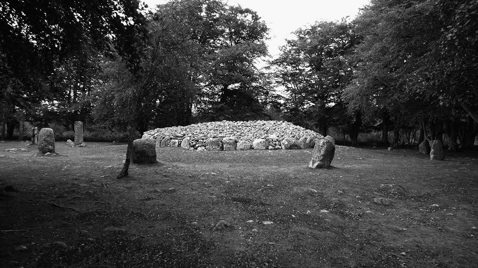
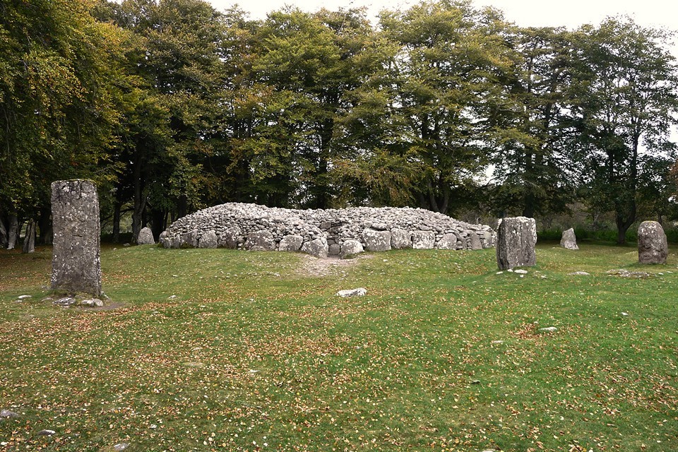
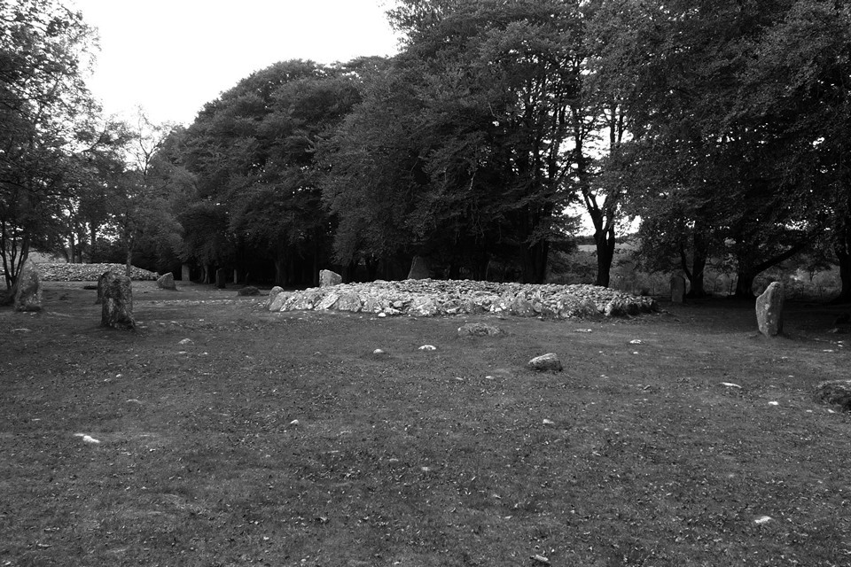
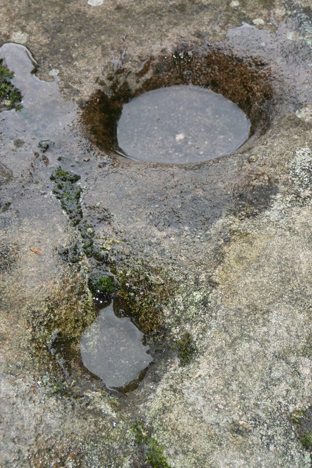
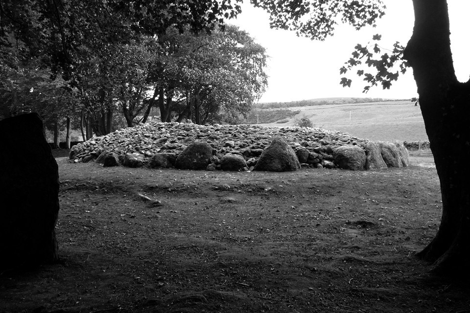
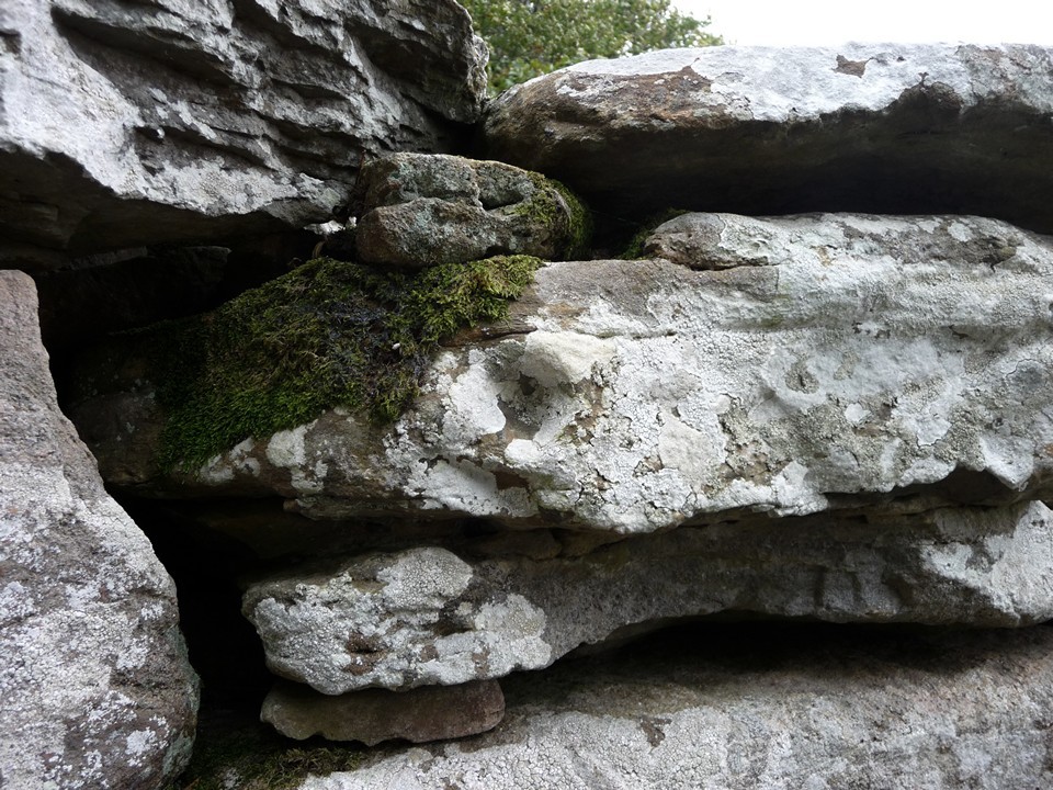
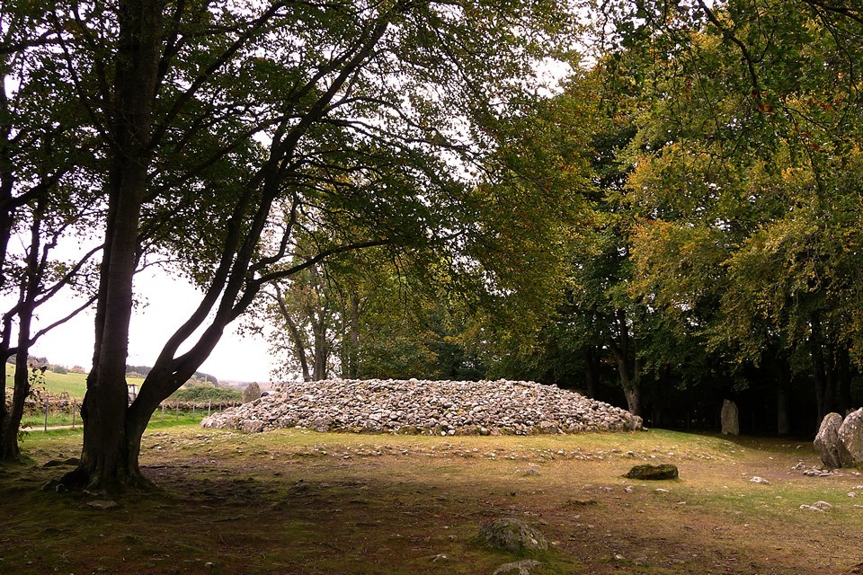
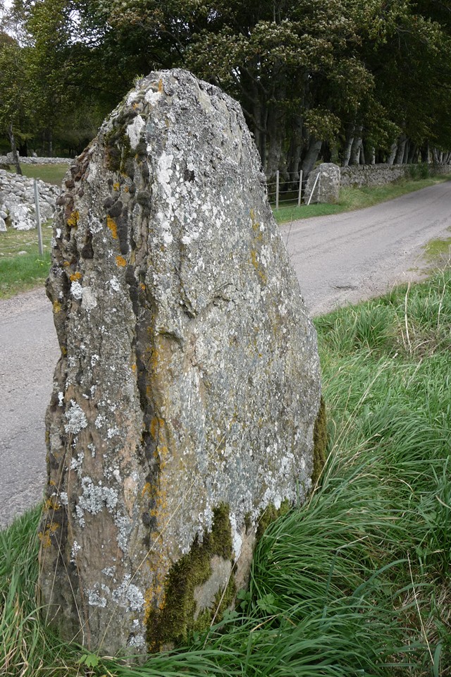
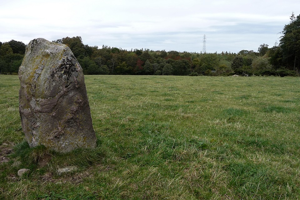
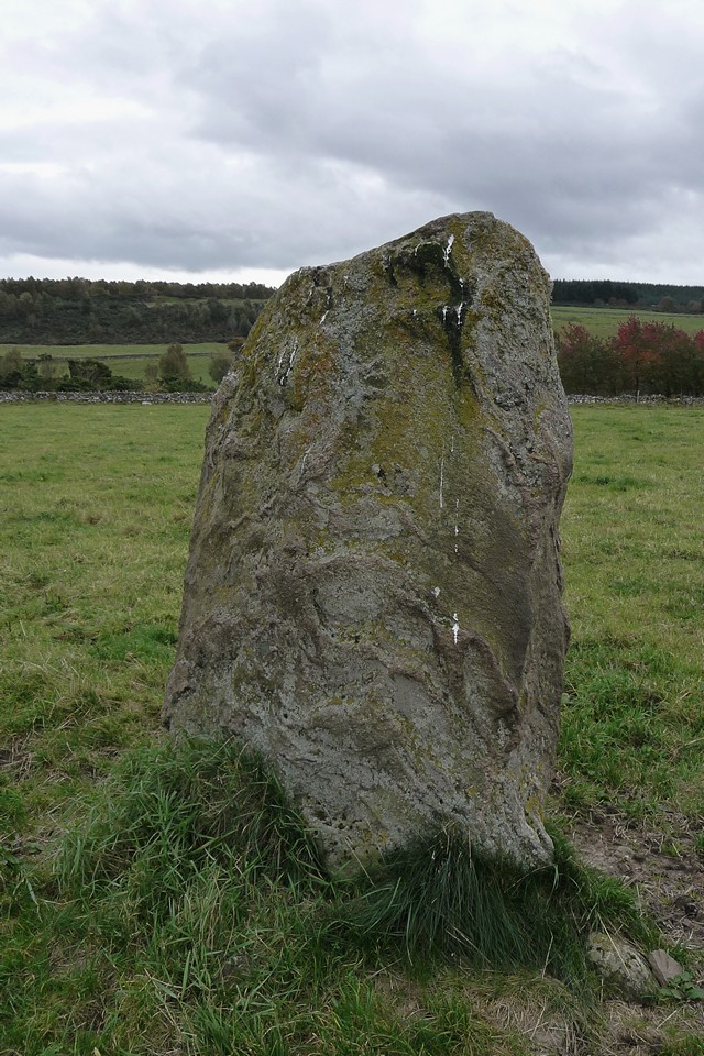
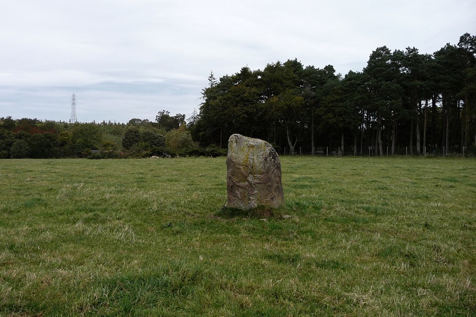
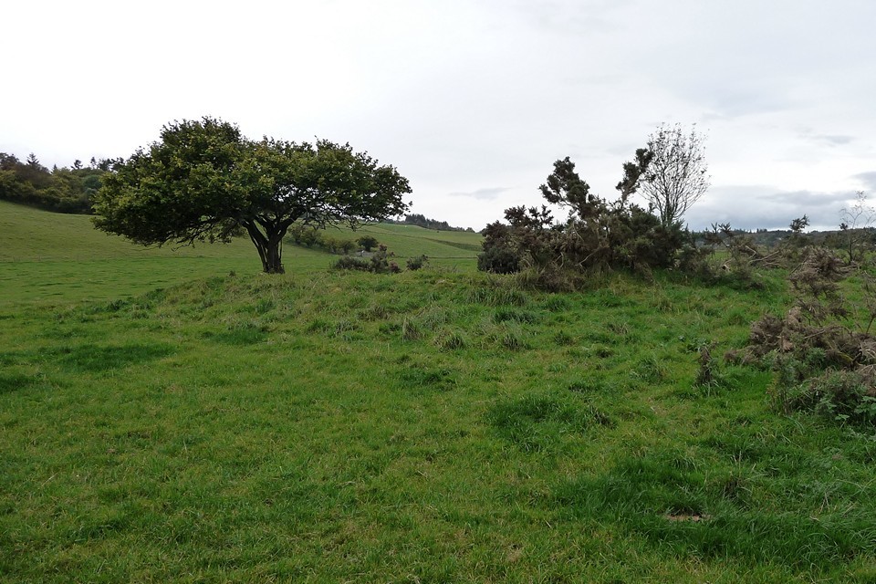
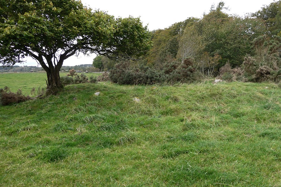
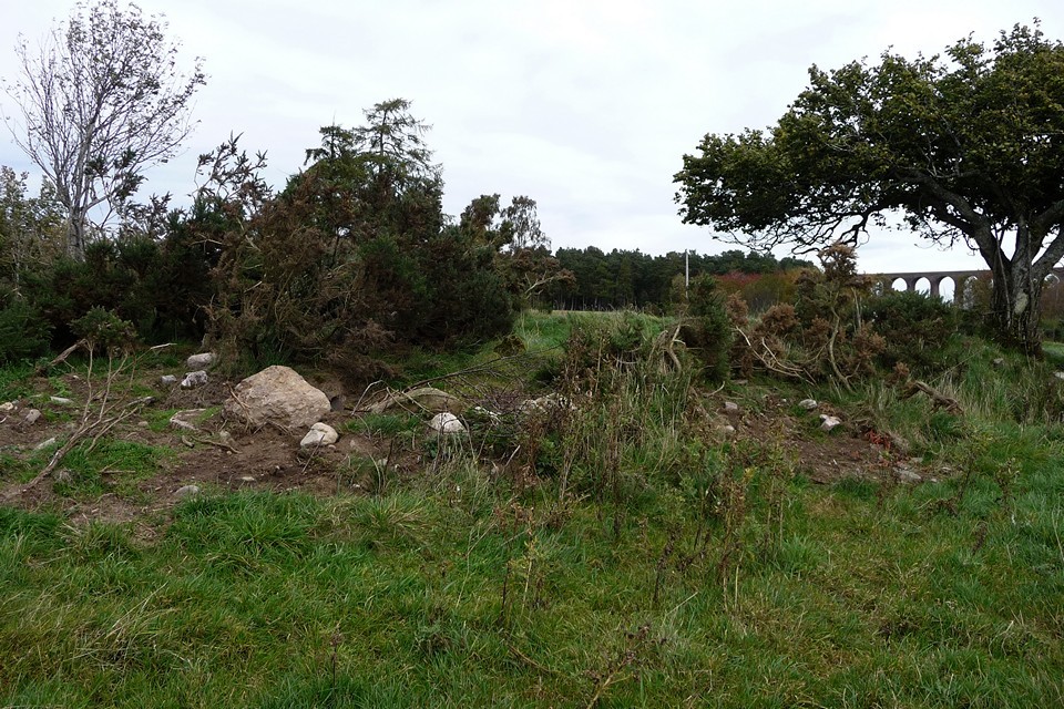
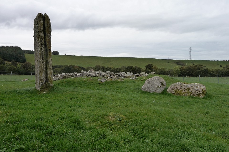
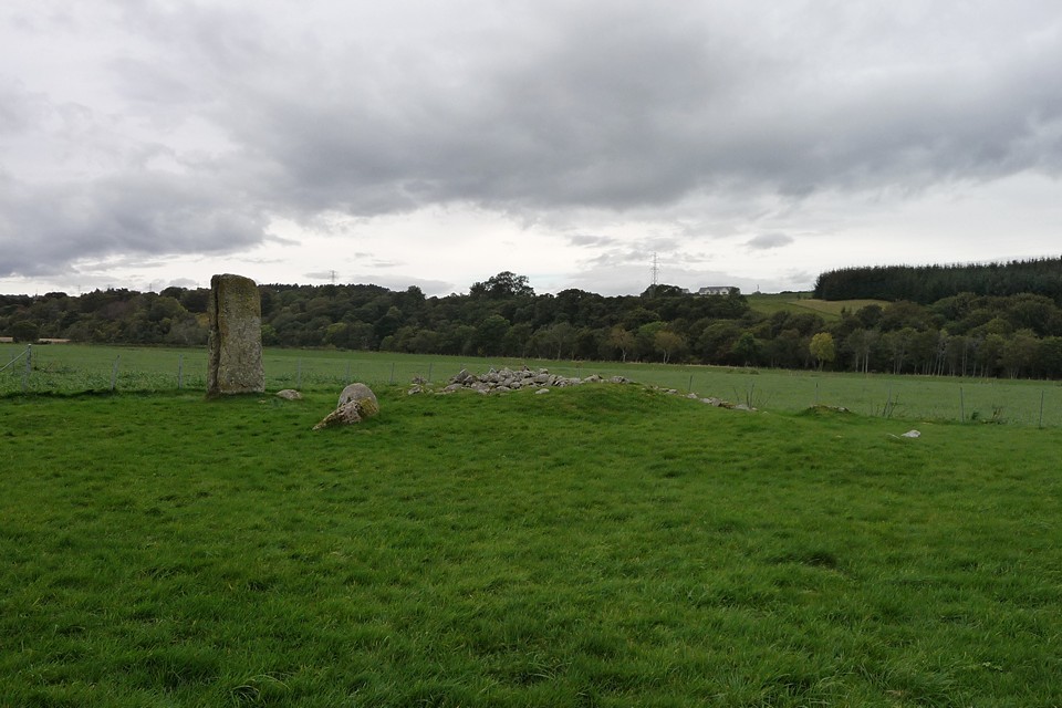
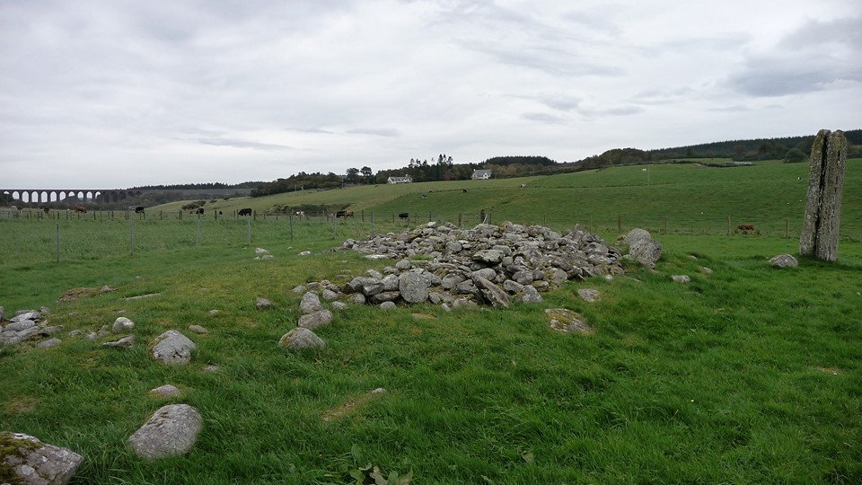
Farm Museums, Auld Krks and Broughs |
Farm Museums, Auld Krks and BroughsSPRING EQUINOX Although I had been to Kirbuster Farm Museum before with my brother I went with the Blide party so that I might look around for archaeology more 'up my street'. Arriving at the farm I first sighted the Burn of Kirbuster corn mill (HY22NE 38 at HY28382535) across the road from it. All that is there now is a low lying mill mound with a few lumps and bumps visible from here to the left of a small roofless building on the opposite bank that might be connected, having a door-sized aperture facing the burn. A pair of Egyptian geese in a small field to the left of the main flagstone path greeted us vociferously. Passing the custodian's building the farm's corn kiln stands at the junction of two structures, a walled yard adjoining the path and on the slope a small building with a low ptitch roof of small slates having a peedie chimney of few courses. Entry into the kiln was through the yard. The down slope wall is really deep walling because there are two deep openings about 5' high next to the kiln, though one has been filled in with small slabs and stones. Their lintels are thick curved wooden beams with one a deep arch. The rest of the folk were in the hoose itself. In the centre of the roof a large hole illuminates the interior and lets in fresh air. This is directed by a primitive fan, the vent and controller being called a liora and kylin board. Below this is a short wall with slate top. Opposite one end an exterior wall has two tall slabs framing a narrower and even taller rectangular aperture behind which lives a big stone 'box bed'. Then there is another long building pointing downslope. Through a side door I see a shallow channel running across the building formed by a paving of two flags and edgeset stones. Either side the floor is slab-lined, so which came first ? Inside is a floor-standing hand-operated churn, a large tub and other items of similar vintage. Coming out I only then really notice that along the outside the path is the same mix of materials as the 'channel'. The open space taking you down to the present lawn is a rounded triangle. Two broad paths of edgeset stone meet, one crossing the slope and the other going from the main path downslope, surrounded by flag paving. The 'garden' corner by the path looks ready to fall. Not sure if its about to collapse or simply not of the same build but it is very roughly keyed in. Between the downhill wall and the more modern building level on the lawn is a narrow angular space that lets you see to the far end, near which is a stone- and smal slab-lined square aperture. I guess this 'window' gives the lie to my garden hypothesis ? The later building has walls of very regular structure and the roof is of smallish square tiles of pastel and brown mix colours. Standing between this and the long 'toolshed' lets you make more sense of the buildings between. Actually a hodge-podge of three plus the corn kiln behind the furthest right. The last has, as mentioned before, a low pitched roof going across slope. At its high side is a doorway with a much broader lintel than necessary. A wall coming forward and abutting the left side is part of a walled yard in front of the middle building. There is a gateway at the yard's LH side and a tall aperture/window in the middle of the building's facing wall. The roof's pitch is lower again and there is turf among the slates that point downhill. The last building starts between the middle building and the yard's front wall ! From its left another short wall comes forward but doesn't perform any function, as if there were an earlier and slightly larger building that has been replaced by this mish-mash. Its downslope pointing roof has the greatest pitch and is made of large thin slabs arranged as long truncated tapering triangles alternating. The walls have the most regularly appearance of the three buildings, the middle building is slightly ramshackle with stones of varying sizes and colour. The one on the right has neater walls but composed of larger stones than the other two with strong colours. My strong feeling is that unless it dates back to the 15th or 16th centuries this has been built of material from the mediaeval/prehistoric structures that once stood nearby. Having taken plenty of pictures of the farm I turned to my first love, prehistory. I went back onto the road and walked west until I was past the burn. Look to the loch margin and you might be be able to see a solitary erect stone left of the burn. This is the Loch of Boardhouse Standing Stone, HY22NE 10 at HY28052520, facing E/W. Its antiquity is doubted. Unlike the Wheebin Stone at the other end there is no tale of its coming down to drink. However its far too close for that, though I assume that like the Loch of Tankerness this lochan's borders have increased since at least the Bronze Age, and there are marshy areas abouts. The stone is much smaller at two foot wide and only showing to a height of 3'2" - probably never stood much higher as the packing stones are visible. Of course in Scotland or England there would be fewer doubters of its antiquity, we just have so many candidates to accept more than a few. Perhaps the antiquarians thought it might be more than a standing stone, because some think there are more stones in the depression in which it sits. Stone circles aside not a few of our acknowledged standing stones have turned out to be the remains of cairns or parts of tombs. Up on the east side of the burn, near the farm, was the site of Kirkie brae HY22NE 12 at HY28222537 (known to the locals more prosaically as Kirk Hill, as the NMRS admits). When the ground was broken up for cultivation though a number of stones were found there was no indication of burials. But then from an indistinct west gable foundation it is estimated that the chapel may not have been any broader than four yards. It is likely that the kirk was demolished in the Reformation as a 16thC red freestone font with an unidentified coat of arms was recovered from the loch. This had an octagonal plan, stands just over a foot high and is 1'8¼" across with a 14" basin (it is now in St Mary's Episcopal Church in Stromness). Kirkie Brae also had a burnt mound - St Duthac's Kirk in Kirkwall was built with material from Pickaquoy Burnt Mound. From the road the site is AFAIK a long slight rise atop the bank, and a close look at the burn reveals that this has changed course until it almost undercuts the site as seen and probably removed other remains previously. On a small promontory a few hundred metres north of Kirbuster are the remains of a prehistoric settlement which produced Iron Age tools etc The Knowe of Nesthouse, HY22NE 6 at HY27942568, is [IIRC] near a small caravan park. Very small. The two metre high mound occupies most of the promontory but has been heavily quarried, and now the two best surviving chambers are in the northern half. As I made my way back the others were finishing their first visit. We had all become so engrossed in Kirbuster that it was felt not enough time had been left to visit Twatt's wartime airfield at Skogar, which is a fair size with much surviving architecture. Before Iceland was finally chosen for this purpose Skogar and Skeabrae airfields were to be united as a NATO base ! It is now looked after by a charity IIRC. So off to Merkister we went, everyone except me and Patrick and Star going in for high tea. From our walk along the Rus(s)land road its Burrian broch only appeared as a convex mound of rough vegetation on the loch edge after we passed North Bigging and looked east, though on the map it appears as a neck and head jutting out. HY21NE 29 is given as either HY29611834 or 29641835. When the Knoll of Burian was partly excavated in 1866 they found a large "brough", but though the rest was being laid bare the outworks were left alone. Farrer found "underground cupboards, partly beneath the floor of the main circular chamber" and three steps he thought to have been part of an (?intra-mural) staircase. A sketch and plan by George Petrie show what are interpreted as a hearth and tank in the central chamber with a built wall dividing this from a long curving room on the north side and 3 small cells ? sleeping-quarters. Now some think it a wheelhouse, which is a round house divided into compartments by radial slabs, though.the few features have been compared to Burroughston on Shapinsay and Bu in Stromness. Not much remains standing. When the road turns again I see a big lump of land sticking out into the Loch of Harray. Kirk Quoy on the map, HY21NE 28 at HY29511774 was another Marykirk (though a fellow Brochaholic has been and thinks it likely there was a broch here before that, and he's a professional archaeologist). Apparently nothing survives. But most of the stone had been quarried for use elsewhere some 50 years before 1923, after which the land of Kirkquoy was broken up in order to be taken into cultivation, so absence of evidence is not evidence of absence here. From the road it presents as two long mounds of middling height and angular appearance and one small circular one, possibly with a lipped ditch around one at least (in fact it does resemble MacKie's photos of the broch, so I just might have them muddled up - in which case what's my other mound). The labradoodle, Star, shot off into a field and ran around it several times before we spotted the rabbit it ran after. A few more circuits and bun escaped, leaving Star to make some half-hearted attempts at a couple of cleverer rabbits. All very amusing to the superior humans. Patrick left after calling her back whilst I continued on to photograph the last remaining complete building of the WWII ground intercept station, a small but beautiful structure composed of the familiar multi-coloured wartime bricks. Not plain walls but having columnar projections from the ground to the thin concrete roof. Three concrete steps lead to a vestibule (with its own thin concrete roof) attached to the side that is the door to the inside. On the opposite wall is a small narrow window. There are other relics of the station about, like odd bits attached to farm buildings or built into walls. Peering up the burn before turning down to the Mill of Harray, now converted into an artful dwelling, I can see a part with large stones straddling the burn sides where the water drops down a little that could well be from this having been a millstream (in which case possibly earlier as not mentioned in the monument records for the mill)). A field E of the road between the mill and the hotel appears crammed full of large stones that have the feel of a broken-down old boundary, perhaps even prehistoric though a mediaeval tunship dyke is more likely. As I neared the Merkister I saw the others getting into the van and ran hell for leather to reach it. I was able to convince Patrick to drive the rest of the Rus(s)land Road as this is only the same distance as going back whence we'd come and down the Harray Road. If it had been up to me we would have gone on to the Lyde Road and down through Rendall to Finstown. Again this would have taken about the same time as going via the Harray junction of the Kirkwall-Stromness Road, or even less. To me a trip to see sights should always include those one passes through on the way as part of the whole gestalt. Much more interesting to go back by a different way to that which one came by - coming from the farm museum there is a nice road heading from Dounby to Evie that is equally attractive. MAY 2ND The way to Corrigal Farm Museum from the Harray Road is easy to get lost on as it includes other minor roads and several of these junctions are at sharp corners. At one point Patrick almost took us on the farmtrack to Quoy Christie but we caught ourselves just in time. At the first junction turn left through Upper Appiehouse, at the next turn right and up past Nessbreck on your left to Corrigal (Mid House was the middle house of Corrigal). I shall describe what I saw in the order I took photos, so might stuff out of order. And really I should have bought the guide book !! When you come to the museum there is a fine display of colourful ploughshares running down the lawn facing you and the building with the corn kiln has a distinctive turf on the roof. The areas around and between these are paved with slabs for the most part, though some has kind of linear cobbles like Kirbuster. One building looks to be a byre, with a finely built shallow channel running down it and tall erect slabs down one side as stalls. At the far end of these is a tall chicken coop. Now the stalls contain stools, buckets and horse gear. on the other side it houses a lovely old cart/wagon of sumptuously burnished woods. Another building has a low walled enclosure attached. I'd take this for a planti-cr(e)u(gh) or mini-garden if it weren't for a purposeful lintelled rectangular 'hole' near the building's end wall. Curious. This side lean two small rusty spoked wheels and a squared off slab mostly occupied by a rectangular hole with rounded corners like a primitive loo-seat ! Peats are stacked outside its end wall. The next building along has more of a domestic feel. In one room is a chest-of-drawers surmounted by a tall plate-rack [is that what you call them?] filled with vintage dishes, both circular and oval, of various designs. At the front top of the chest is a writing slate beside a game like Nine Men's Morris. There are also a few cups, ?condiment jars and some metal containers resembling Brasso. Alongside the chest is a plain box chair with rectangular panels carved into it. In another corner storage space has been created by placing a large flat stone across some erect slabs. Here be buckets, tubs, a barrel and a large metal cauldron (amongst other things). Leaving the best until last I reach the corn kiln. Except it is more than a kiln. Facing you is its own seperate dividing wall. You can see daylight streaming into the kiln from outside. On the left two rectangular niches, one above the other, are lintelled by very thick stones. You step up to the high kiln entrance and the way is narrowed in the bottom half by walling of disparate heights, perhaps as an aid to moving heavy bales. And another wall blocks off the lower part of the entrance a little further up again, capped by a thin flag like those 'side walls'. Finally I can peer over the edge. The bright summer sun comes in through the roof's central hole. I am wonderfully surprised to find that in front of me a corbelled floor mirrors the corbelled roof, though the very bottom is flat. Near the kiln straw is stacked in an irregular half-corbelled niche standing over head height like an angular bite out of the wall. Going behind the buildings I can see my ultimate goal, second time I have been here and I still haven't gotten any closer because again I've been with other folk - on the north side of the corry behind the farm museum are the remains of the Corrigal Burrian (broch), NMRS record number HY31NW 33 at HY32351937. From here it is mostly presents as a long grassed over earth mound with lumps and curvy depressions, here and there I see bits of bright wall and in front of the far end a broad sweep that might be the burn or something else. Which is a shame as I'm not seeing the best of it. The stonework survives highest on the NW side with six drystane courses of the outer wall-face standing to 4'6" for about 8' distance. On the N side you can see the inner wall-face (giving a wall thickness of some 16'). Foundation courses visible elsewhere lead to an estimate of 53' for the tower's external diameter. Whilst acquiring stone for building work a previous owner came across a 2' wide passage which he then filled in, alas. Exposure and erosion at the north and west and east have revealed the walls of outbuildings between the tower and an eleven yard ditch which surrounds it at a distance of some 40' for about half the periphery. What appears to be an outer earthen embankment lies on the west lip of the ditch and varies in height from 2'6" up to 5'6". All at last report of course. This broch is "on the steep right bank of Corrigall Burn". Downstream is the Knowe of Haewin, also known as Howen Brough and Howan/Howen Broch. Monument record HY31NW 32 at HY31801914 also appears as Gorston Brough, but Gorsten should read Corston for the tunship and anyway is more properly the Burrian in Corrigal tunship (from where it can be seen) as otherwise this is inexplcably missing from George Petrie's list. It is described as at the brig (bridge) below Garth, and on the map is near the south side of the burn and to the west of a loop in this. IIRC there is a tradition of there being a kirk here, which is more likely going by the flattened summit, the shape and its orientation. In 1923 the pear-shaped mound is said to be undisturbed but the perimeter has been altered and material removed from the E and W ends. Its main axis runs 48' E/W, it is 32' from north to south at the W end and 12' at the E. The mound is steeply banked at the east side (5'3" high) and the south side (2'6" ht.), but they think this may not be its original state. I know that I must have been looking directly at it, but knowing it lies on the opposite bank of the burn is no use if you can't see the burn there from here. Smiley face. Due north of Haewin and half-a-mile from Upper Corston antiquarians placed the Quoys of the Hill standing stone. Most of the brochs would have been visible from it. The modern monuments record has a standing stone at HY31832301, three-quarters of a mile from Nether Corston. It is about the same size, 0.8 by 1.4 by 0.13m as against 1.2 by 0.5m, explainable by continuing erosion (in Orkney stones can decrease in revealed height also). Though the former was aligned SSW rather than WSW/ENE that was an approximate bearing. The distances are certainly the same. To end our trip we went to the Merkister again, this time to celebrate a Blide member's birthday. Sheena had bought some dreamy bakeries, like a cross between a jam doughnut and an iced cake with a strawberry on top (which we ate after she explained the 'do' and asked permission). Yummy. The others had tea and coffee whilst I looked around. Between the boathouse and the pier a man in waders fished, as did two men in a small boat a little further down the loch. On Harray Loch's opposite shore what might be taken for another broch mound attached to the land is instead simply another of Orkney's green islets, this one the Holm of Kirkness. From here I could look straight down over the Burrian Broch and Kirk(a)quoy. In front of the two is the small moundlet with drystane fieldwall (and a central dent from some directions) that I mistook for the broch. And in front of that is another even tidgier spur ending with what might be the remains of an even older wall (or pair of like many another sticking out our lochs' edges - fishing stances ?) level with the lochan's top. There are outstanding views of the surrounding hills as per usual. Below the lawn area steps lead to an ornate sheltered lower garden defined by a low drystone wall, circular with a central bush eye, paving of large slabs and two curved stone seats on carved uprights. Slightly north of the Merkister Hotel is the Harray-Sandwick parish boundary. to the NW, behind the sewage plant. a rise is all that is left of the Wasum mound. On another day we took the Swartland Drovers Road that comes down from Sandwick to end (as a trail leastways) at the Russland Road just east of the hotel. From here I could see Wasum appears to have an answering rise on the other side of the loch. To the south the 1:25,000 has the legend Stepping Stones connected to an unnamed islet. You can tell that Pastmap is no longer being fully updated because this now has a NMRS. HY21NE 93 at HY28891954 is Hourston, causeway and island. So another causewayed island like Wasdale in Firth. Still an incomplete record as (presumably) no one has looked at the island itself for archaeology, and both from the 25" and modern aerial photography this oval islet [??crannog] has a line of stones. The obvious explanation is an enclosure like Wasbister on Rousay, but what about the edges of a flattened mound instead. At first glance I thought someone had missed a peedie broch, but the outline only goes up at the ends of the profile, so maybe more like what the (traditionally) graveyard opposite the Wasdale 'dun' would have looked like, especially height-wise. In between Wasum and 'Hourston' a bite out of the land is shown on a map with stones too. These fill a circle - perhaps there is a submerged cairn here ? It's smaller than the islet for sure. On the same aerial image there is a dark circle maybe the same size as the islet on the loch bed and another less certain one. Perhaps these were more islets, but I am reminded of the circular shapes revealed on the loch bed when I was walking Wasdale one very stormy day. |
26th June 2012ce |
Carnedd Llewelyn Beauty Born – 26 May 2012 |
Carnedd Llewelyn Beauty Born – 26 May 2012Chris and I meet again at Crewe station, the scene of previous encounters on our way to the land of someone else’s father. The morning has dawned clear and bright, promising heat and haze in place of the usual rain and cloud. I’ve been ridiculously overexcited about this trip, a small boy waiting for Santa Claus. Today we’re going to tick the number one box on the notional list of sites to visit. The coastal road trip passes in an effortless blur (at least for me in the passenger seat) and before long we’re heading down the Conwy Valley with the high places clear and bright ahead of us. From Tal-y-Bont it’s single track and occasional gates, but no cars come the other way to delay us, they must have known we have a date with destiny. Reaching the parking area near Llyn Eigiau, we find it full but someone chooses that exact moment to leave and vacate a space for us. I told you they must have known. While admiring the lovely view of Pen Llithrig y Wrach and Cwm Eigiau already presented from our parking spot, I slap on the sun-spray liberally, the day is promising to be very hot despite the breeze that’s already hinting at a blowy time on the tops. Clogwyn-yr-Eryr (possible) stone row — Fieldnotes06.06.12ceOur route will decide itself as we go on, but the first bit of business is to gain some height, so we head north-west along a good track that takes us with a zig and a zag up the slopes of Clogwynyreryr. The Ordnance Survey have helpfully made this all onelongwordthewaythatGermansdo, but actually it ought to be Clogwyn-yr-Eryr (there, that’s better), which translates into English as “Cliff of the Eagle”. Nice. We don’t see any eagles, but Chris does point out the location of the Hafodygors Wen four poster and stone row. There’s a great view of Pen-y-Gaer hillfort too, a site Blossom and I have admired previously from the Tal y Fan area and must get better acquainted with one day. As we round the rocky end of the ridge, a view of the high Carneddau main ridge unfolds, from be-cairned Drum and across to Foel-fras. It looks a long way up yet. Our path turns its face westwards and we pause to look at a couple of suspicious looking stones either side of the track. One is about six feet tall and has a hole drilled right through it, the other is about half the height. Not an obvious pair of gateposts, we joke that it must be a stone row. Then we spot a further six-foot plus stone lying prostrate in the grass and joking turns half serious. We take a couple of snaps and proceed. Perhaps we should trust our instincts more, Coflein has this down as a possible stone row indeed! We note a further upright further up the slope but don’t even give this the respect it perhaps deserved (I don’t even have a photo). But phantom rows aside, our first tangible targets of the day are coming into view now. Most obviously, the rocky summit of Foel Grach can be seen, perched above the intimidating cliffs of Craig y Dulyn. Below it Chris points out the location of the Pant-y-Griafolen settlement. We decide on a direct route, leaving the path and cutting straight down the grassy slopes. Clogwyn-yr-Eryr — Fieldnotes06.06.12ceBefore reaching the valley bottom, we angle our route to take in the small settlement shown on the map on the opposite slope to the larger Pant-y-Griafolen settlement. The map shows three circular features linked by a wall, with a further square feature close by. And this is exactly what we find. Three hut circles/round houses in a line, with the low remains of an enclosing wall around the northern side, with natural outcrops incorporated into the western end. There is a more substantial structure (probably the remains of a sheep fold) adjacent on the north side. It’s not the best-preserved of settlement sites, but the positioning is lovely, on the gently sloping valley side with the mountain ridges giving shelter on most sides. On a sunny day like today, I’d move here. Pant-y-Griafolen — Fieldnotes06.06.12ceWe carry on down the slope to the little river; the intervening ground requiring some bog-hopping. Lucky the weather has been dry, this could be a bit of a problem in wetter conditions. The eastern end of the Pant-y-Griafolen settlement can now be seen under a small stand of trees, from where it stretches away upstream towards Llyn Dulyn. The Afon Melyllyn is easily crossed on plentiful stones, even in spate I don’t think this would cause a well-balanced visitor (that’s us) too much trouble. Like the nearby Clogwyn-yr-Eryr settlement, this is not well-preserved, little more than circular rubble rings remaining. It is however extensive and fantastically well-placed. It’s hard to reconcile the fact that the site is 530m above sea-level with the degree to which it feels sheltered from the elements. The surrounding Carneddau ridges are so much higher that we are completely out of the gale force winds that are blowing over the tops today. You can almost feel the presence of the people, or perhaps they can almost feel ours. I could happily stay for a while in the sunshine, but we have hardly begun the hard work of the day and so we press on. A footpath from the settlement takes us to Llyn Dulyn, which has been dammed to form a reservoir. A sobering reminder of the dangers of these mountains in bad weather can be seen beneath the shallow waters near the lake’s edge – the propeller of a crashed US Air Force Dakota from World War II. But there’s nothing else to disturb the tranquillity of this spot today. A glance at the OS map here is deceptive, I had expected to be able to see the sister Melynllyn reservoir, but a closer look reveals that it’s located considerably higher up and is still out of sight. But that’s where we head next, up a narrow track heading south from Llyn Dulyn that takes us up over the 600m mark. The heat is making its presence felt on these uphill sections and my breathing is ragged by the time we reach the shores of the higher reservoir. The views down Pant-y-Griafolen all the way to Pen-y-Gaer and beyond are the reward though. Steep cliffs bound Melynllyn on its western side, and our next section needs to take us above them. We choose a route from the northern shore of the reservoir that avoids the cliffs but is still a pretty stiff pull uphill. Of the whole walk, this will be the bit I enjoy least. The combination of heat and an underlying lack of fitness make this a bit tortuous to be honest and I’m mightily relieved to drag my aching legs up above the cliff-top of Craig-fawr and to collapse onto a conveniently placed rock to regain my breath for a few minutes. As we’ve climbed, the domed top of Pen Llithrig y Wrach has come into view over the ridge to the south. Still no sign of our principle objective of the day, Carnedd Llewelyn, but we are almost in touching distance of Foel Grach now. In truth we’re still 100m or so of ascent below the summit, but the steepness has reduced now and we’re also experiencing the first taste of the powerful winds that will characterise the next section of the walk. At this stage they provide a pleasant antidote to the fierce heat. Foel Grach — Fieldnotes06.06.12ceWe swing northwest towards the summit. As we come onto the top of the ridge, we get our first view of Carnedd Llewelyn, tantalisingly close and not much higher than we are. At the same time, we are hit by the full force of the wind. Bloody hell. The walk takes on an aspect of farce as the wind tries to tear the sunglasses off my face, while my trusty map-case becomes an evil monster, smashing me about the face and arms each time I try in vain to take a photo. Like two deep-sea divers in lead boots we crawl across the landscape of broken and shattered stone that forms the summit of Foel Grach. Certainly no shortage of cairn material, perhaps the biggest cairn on the planet stood here until the wind tore it down to teach the builders a lesson in humility. I’m certainly learning that lesson right now. We spend some time taking pictures, with difficulty. When you look at our images, dear reader, try to forget the cloudless blue and apparently idyllic setting and imagine us being buffeted and bruised by a howling gale. The things we do to bring you these bloomin’ pictures. I joke that at least no-one has turned this cairn into a shelter, not realising that they don’t need to as there’s a proper one just to the north of the summit. Proper as in roof and mortared walls. We take refuge from the winds for a lunch stop, enjoying the feeling and sound of being in the eye of a raging storm but safe and protected from it. Other pilgrims come to interrupt our reverie and so we head back out into it. Heading south we have the wind largely behind, to speed us on our way – don’t relax though, you’ll be over a cliff if you don’t keep planting the feet firmly. The walk down to the saddle is greatly enlivened by the unfolding view of Yr Elen’s shapely eastern profile. That’s a mountain that’s begging to be climbed, but not today. Carnedd Dafydd appears over the shoulder of its big brother. The climb up onto the summit plateau is straightforward, with little further ascent. Only the battering wind adds any complication, and my map case does its best to knock my camera out of my hands, succeeding in bringing up a horrifying “memory card full” message instead. Not a good time to be out of memory, so I spend a while messing about with deleting stuff to make room, hoping that the card hasn’t been corrupted by the bash. Carnedd Llewelyn — Fieldnotes06.06.12ceThe summit plateau, even more than Foel Grach’s, is a lunar landscape of shattered rock. Although it’s busy, there’s plenty of room to find a patch of solitude away from the cairn and wind shelter. On a day when Snowdon is doubtlessly teeming with hundreds of people, this lofty peak is a much better prospect. The views are simply staggering, from Carnedd Moel Siabod and Moelwyns, across to the Glyderau where Tryfan steals the show from the loftier Glyder Fawr and Glyder Fach. Directly ahead of us Carnedd Dafydd fills the foreground, while the Snowdon massif itself looms beyond. Y Garn and the conical summit of Elidir Fawr complete the vista of 3,000 foot peaks before us. I would defy anyone to come here and not be moved by such a scene. I resist the urge to fall to my knees in wonder (too many pointy rocks for genuflecting). At a gap in the stream of people at the cairn, we make a break for it and snatch a few pictures before the next visitors arrive for their photo opportunity. Much as I like quiet and unfrequented tops, it’s difficult to complain about other people here, as every one of them has had to make an effort to reach this high spot. No rack and pinion railways up here. From here, our onward route looks a little daunting. The stroll down to Tristan’s cairn is straightforward, but it’s what we’ll do afterwards that concerns me. Most “proper” routes suggest that to get back to Llyn Eigiau we should carry on over Pen yr Helgi Du to Pen Llithrig y Wrach before descending that mountain’s gentle northeastern ridge. But that’s a looong walk from here. The alternative is an improbable descent to Cwm Eigiau from the bwlch between Pen yr Helgi Du and Pen Llithrig y Wrach. Luckily Chris does decisive better than me and we press on to Tristan’s cairn (and then we can do some more deciding). Tristan's Cairn — Fieldnotes06.06.12ceApproaching the cairn from Carnedd Llewelyn, it looks like a nothing of a marker cairn. The cairn itself is very small, even a walker looking for a pile to drop a stone onto might turn their nose up. In fact, my eye is drawn far more to the amazing views, down to Cwm Eigiau and Ffynnon Llyfant far below to the left, Ffynnon Llugwy to the right. Not to mention the Bwlch Eryl Farchog ridge below Pen yr Helgi Du. And Tryfan. However, as we draw near it becomes clear that the cairn is beautifully positioned on a natural knoll of rock, right above the cliffs that drop away to Cwm Eigiau. If you want a suitably awe-inspiring place to lay a heroic warrior to rest, you couldn’t imagine anywhere much better. Whether this really was the final resting place of a Bronze Age chieftain, or an Arthurian knight, I still couldn’t say. The sky gods certainly have this place in their eye-line whatever. I leave not knowing any more about its prehistoric authenticity than I did when I came, but I’m glad we came to find out. If you want a high, lonely spot away from the crowds, with breathtaking views, this might do it for you too. We decide to carry on along the ridge to Pen yr Helgi Du. Despite the lack of cairn, I’m happy to be tackling another summit. As we head towards the last rocky bump of Penywaun-wen, I fiddle with my camera, deleting more pictures. Whilst paying no attention to where I’m putting my feet, I stumble and trip on a few strides, Chris exhorting me to stop before I head off the cliff. Luckily the spot wasn’t a “certain death” one and no harm is done. It does re-focus my mind nicely though! I enjoy the scramble down to Bwlch Eryl Farchog and then up the northwestern ridge of Pen yr Helgi Du immensely. There’s something very satisfying about getting your hands onto the rocks to make your way, perhaps a connection with the Earth itself that we lack in most everyday situations. Either way I’m almost euphoric as we reach the top and enjoy the view back to where we’ve just come from, it looks much worse than it felt. The last decision of the day awaits. The easier option is to climb Pen Llithrig y Wrach, but time is pressing and as the adrenaline of the scramble wears off my legs start to feel very heavy. So we are faced with a possible descent off the cliffs below Y Lasallt. Frankly this looks like a terrifying prospect from above, much more daunting to me than the scramble we’ve just done. I start muttering about falling to our doom, but Chris gives me (metaphorical) slap around the face by saying we’re not going to fall because “we’re TMAers”. Oh yeah. With that rallying call ringing in my ears I screw my courage to the sticking place and we’re off down a gully that proves to be steep but hardly impassable. It’s not especially easy though and I’m worn out by the time we reach the floor of Cwm Eigiau. Afon Eigiau — Fieldnotes06.06.12ceLuckily there’s a possible collapsed tomb to be seen at the bottom, which restores impetus and purpose to my aching legs. Next to a (medieval?) settlement, the positioning of the tomb, if that’s what it is, is perfect. It stands on a prominent little grassy knoll surrounded and enclosed by the cliffs that separate the Cwm from the Carneddau tops. The stone blocks involved are very large, well, they’re megaliths aren’t they? They are perched on top of each other in a way that doesn’t seem particularly probable as a natural landform but isn’t conclusively man-made either. But the spirit of the Carneddau is upon me and I give it the benefit of the doubt, someone can always “prove” it’s natural if they’d like to do so. At length we take our leave, it’s still a long walk back to the car. On the way we pass a few more suspiciously megalithic gateposts. I reckon Gladman would be able to descry a processional route along an important water source here, with standing stones as markers. Hell, I’m practically doing so myself. We pass the broken remains of the Llyn Eigiau dam on our final stretch, an attempt by man to harness the primal power of this wild landscape that ended in disaster when it breached and flooded the valley. It seems a fitting final touch to our epic walk. I get the impression that the valleys and ridges of the Carneddau will never be for the taming, but that maybe people could exist here, as they did at Pant-y-Griafolen, if they understand their relationship with the natural order and the passing of the seasons. But those people are gone from the valleys, their chieftains’ bones gone from the high cairns. All that’s left are faint traces for those who seek such things. I’m glad that Chris and I have been to see them for ourselves. |
Posted by thesweetcheat 6th June 2012ce |
Offa’s Dyke III – Llandyrnog to Rhuthun 12 September 2010 |
Offa’s Dyke III – Llandyrnog to Rhuthun 12 September 2010Our Offa’s Dyke endeavours have stuttered and stalled somewhat, as funds and work have contrived to delay our return to North Wales. In truth, it’s only about six weeks since we finished our last walk in the village of Llandyrnog, east of Denbigh, but it seems like forever. We had originally intended to stay in Denbigh for this leg, but having spent an hour or so awaiting a bus there last time out, we took against the idea and instead have returned to the B&B near St Asaph that we stayed in on our previous visit. Luckily there is a fairly decent bus service between St Asaph and Denbigh [at least there was at the time of our trip, funding cuts may have changed this now]. Arriving on the Saturday, we manage to get into Denbigh to have a look at the excellent CADW-managed castle that dominates the town. The sun shines down on us, ice-cream is eaten and all is looking good for the weekend’s efforts. Needless to say, Sunday morning dawns rainy and overcast, damp and drizzle being the apparent order of the day. We are learning never to take the weather in North Wales for granted. The bus deposits us in Llandyrnog (a pleasant village with a couple of pubs) and we head eastwards along quiet lanes that rise slowly at first, then with increasing sharpness. As we climb, we get a first sight of Moel Arthur, the steep-sided hillfort that marked the end of our last trip. It looks very far above us! There is good news though: as our legs start to acclimatise to the uphill, a Clwydian rainbow appears over the northern hills of the range and ragged patches of blue start to appear through the cloud. By the time we come into sight of Penycloddiau, the other main hillfort we tackled last time, it looks as though the weather gods may have taken pity on us after all. There are a dozen cars parked in the parking area in the pass between Moel Arthur and Moel Llys-y-Coed as we arrive. If the lanes have been pretty steep getting here, they have nothing on the climb that awaits us. Offa’s Dyke Path mounts a direct, unforgiving assault on the northern slopes of Moel Llys-y-Coed. Luckily there is only a little over 100 vertical metres of ascent, so it’s tough but mercifully over soon, 10 or 15 minutes of exertion. Pauses for breath are also rewarded with a terrific view of Moel Arthur’s southern aspect, reinforcing the fort’s defensive capability. By the time we reach the top of the hill, Penycloddiau has come into view as well. Moel Arthur — Images25.09.10ce
We find ourselves atop a rolling landscape broken only by a few drystone walls, where thick heather makes any foray off the path unappetising. The view to the south now starts to unfold, the first taste of our way forward. Grabbing the attention immediately is the dark bulk of Moel Famau, the highest point in the Clwydian range at 554m. We saw this on our last trip, where it still seemed a far-off challenge, but we can’t avoid it today and before long we will be climbing its slopes. Westwards the green and fertile Vale of Clwyd stretches away far below us, across to the range of hills separating it from the Conwy Valley. Our eyes are now set on the top of Moel Famau, crowned with the broken remnants of the Jubilee Tower. Although the path largely follows a contour just below the crest of the Clwydian spine, there is still a bit of descent and re-ascent as we climb Moel Dywyll. One of the more intriguing sights on this section are two very large clearance cairns placed on natural hillocks above Pwll-y-Rhos. These do look suspiciously like they might be be standing upon something rather older. It’s certainly a brilliant spot, with extensive views of the Vale below. The cairns are also a very prominent landmark on our approach from the northwest. Coflein assures me that they are both modern though. The cairns’ location also offers us a view of our first “new” hillfort of the day, Moel y Gaer. Located off the path, and quite some way below us, I had tentatively hoped for a diversion down to this fine-looking fort. Seeing it now, it looks a long way off our route and neither of us really fancies the prospect of losing the height we’ve gained now. Sadly it looks like we’ll have to ignore this one today – but it goes on the notional list! Instead we plod on up towards Moel Famau. Moel y Gaer (Llanbedr Dyffryn-Clwyd) — Images25.09.10ce
Further details of our onward route are coming into view now. To our SSE along the range is Foel Fenlli, a further member of the Clwydians’ magnificent hillfort chain. Beyond that, rising higher still is our first hint of what will come once we leave the Clwydian range behind. The flat top of Cryn y Brain, an expanse of moorland dotted with cairns, can be seen straight ahead. Due south we can see the conical shape of Llantysilio Mountain, crowned with its own hillfort. Beyond that the Berwyn Mountains fade into the blue. Foel Fenlli — Images26.09.10ce
The final approach to the top of Moel Famau is tiring, as the day is getting warm. For the first time we also meet people in significant numbers where previously it has been ones and twos. It becomes apparent that this is the area’s prime Sunday picnic location, as there is a car parking area immediately to the SE of the hill. All that remains of the Jubilee Tower itself are low foundations. The tower was started in 1810 to commemorate George III’s jubilee, but never finished. Now it boasts a set of very handy toposcopes, as well as some shelter from the wind that sweeps over this exposed top. The views are well worth the effort and I can see why so many people come here. As well as the Clwydian range itself stretching north and south, Snowdonia is visible to the west, although largely obscured today. The nearer Aran range is clear though. Eastwards the Dee estuary and Merseyside can be seen, as well as the Stanlow oil refinery, made famous in OMD’s homage to its industrial grandeur. We leave the tower and its picnicers and head south along a solid and well-maintained path. There are still good views of Moel y Gaer and again I feel a pang that we’ve had to leave this unvisited. Moel y Gaer (Llanbedr Dyffryn-Clwyd) — Images26.09.10ce
The path descends the hill at a gentle angle, then swings southeastwards, presenting us with a daunting view of Foel Fenlli, our last test of the day. We continue to drop to a carparking area with info boards about the fort. Foel Fenlli — Images26.09.10ce
Foel Fenlli — Fieldnotes05.06.12ceFrom Bwlch Penbarra we have another steep, steep climb to get up to the ramparts of Foel Fenlli. Like the opening ascent of the day some two hours earlier, this is short, sharp shock. Our legs are more tired now that they were then though, and the hundred metres of vertical ascent is harder work this time. However, the reward is utterly worthwhile. Foel Fenlli is multi-vallate, like the other Clwydian forts. It has the benefit of terrific natural defences by virtue of its positioning atop a hill with steep drops on three sides (only the eastern approach is anything but knackering for any would-be attacker). Iron Age status symbol? You bet. The Vale of Clwyd looks a looong way below us. There are good views of the nearest of the neighbouring forts, Moel y Gaer. Foel Fenlli — Images26.09.10ce
Foel Fenlli cairn — Fieldnotes05.06.12ceAt the very highest point of the hill (511m), protected by the encircling ramparts, is a burial cairn of an earlier date. With views to die for, this was a fabulous resting place for someone. I can’t help but feel that Moel Famau to the north might have been similarly crowned, before the Jubilee Tower swept away any archaeology. As with many similar cairns, the visible stonework piled in a cone is a modern reconfiguration/addition. The mound proper sits below, with its much wider diameter covered by short turf. We carry on around the eastern end of the fort’s circumference, until the ground drops sharply once again on the southern slopes. Steps have been built to minimise erosion from the fort’s many visitors. Although Offa’s Dyke Path skirts the western end of the fort, I imagine a lot of people make the short detour to have a look at this magnificent show of Iron Age strength. As we drop back to the path, we meet a group of teenage lads, shouldering enormous rucksacks as they climb the steeply sloping hillside. They are friendly, cheerful and polite, clearly happy to be out in the hills. Perhaps some of the TMAers of the future are in that group? It’s certainly the kind of place to inspire an interest. Foel Fenlli cairn — Images26.09.10ce
Foel Fenlli — Images26.09.10ce
Our way heads southeast, at first a careful tip-toe down the slippery slopes, trying to avoid a stumble that would take us a long way down in too little time. At length we reach the Bwlch Crug-glas, below the cone of Moel Eithinen (thankfully not a hill we have to climb). We exchange the heathery Clwydian slopes for gentle farmland. This is cow country, rather than sheep, but we are thankfully untroubled by any bovine intervention as we make our way around the flanks of Moel Eithinen and Gyrn. Ahead of us lies the shapely profile of Moel Gyw, with its summit barrow, but that’s for the next part of the adventure. Moel Gyw — Images02.08.11ce
Reaching the busy A494, we complete our Offa’s Dyke Path section for the day, 23.5 miles of the path now under our belts (which leaves plenty to go at!). We turn our now weary feet away westwards, for a walk/stagger down to Rhuthun, pausing for a last look back at Foel Fenlli. The main part of the Clwydian range is behind us, with its magnificent hillforts and rounded hilltops. Finally I feel like we are making some progress. Perhaps the stutter of the start may turn into the swagger of a finish yet. |
Posted by thesweetcheat 5th June 2012ce |
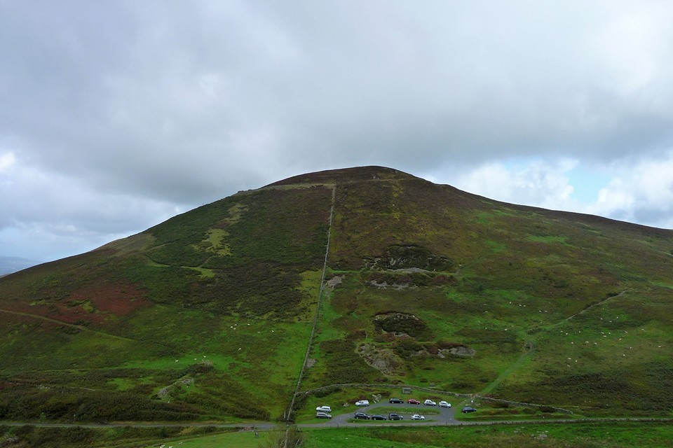
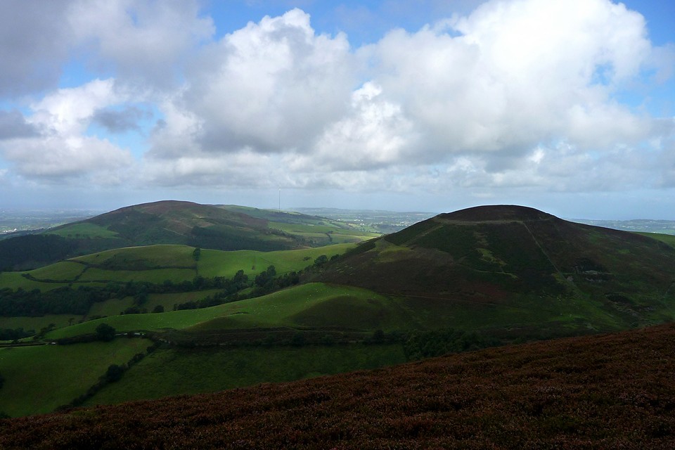
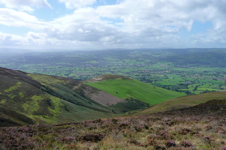
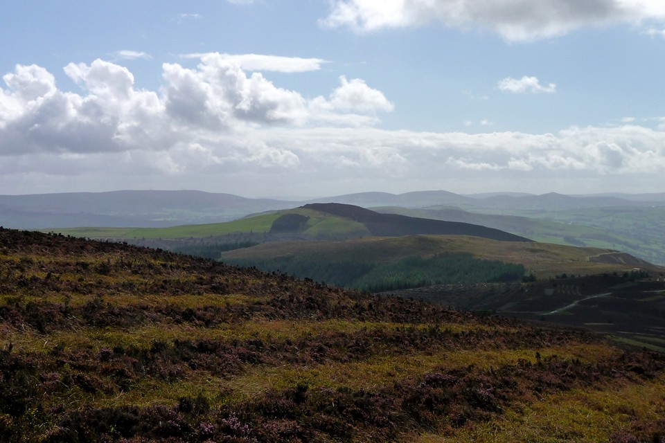
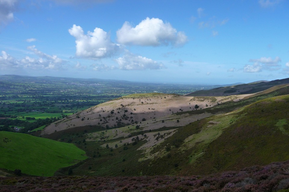
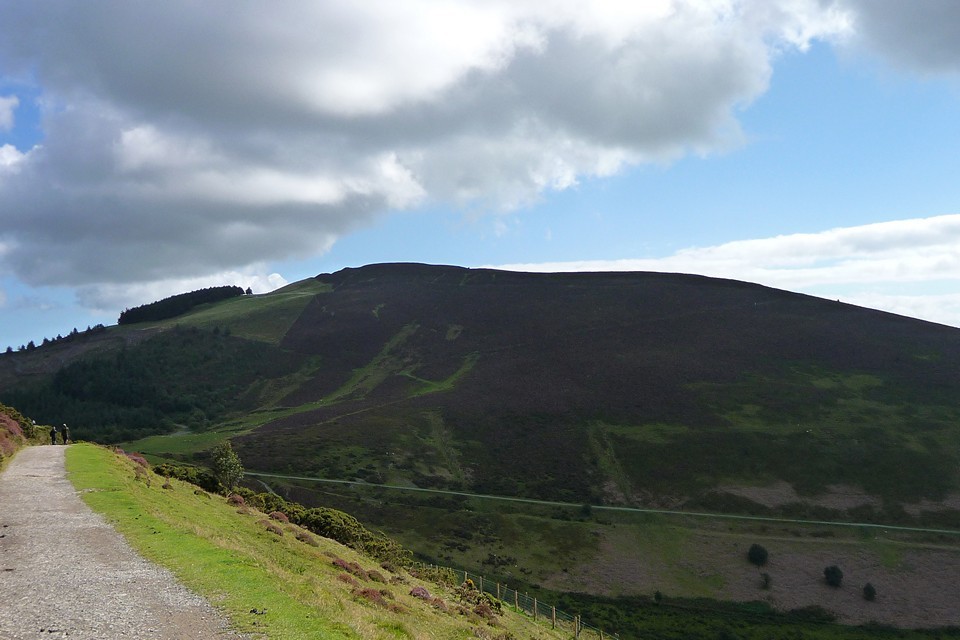
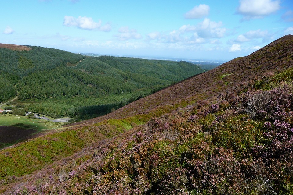
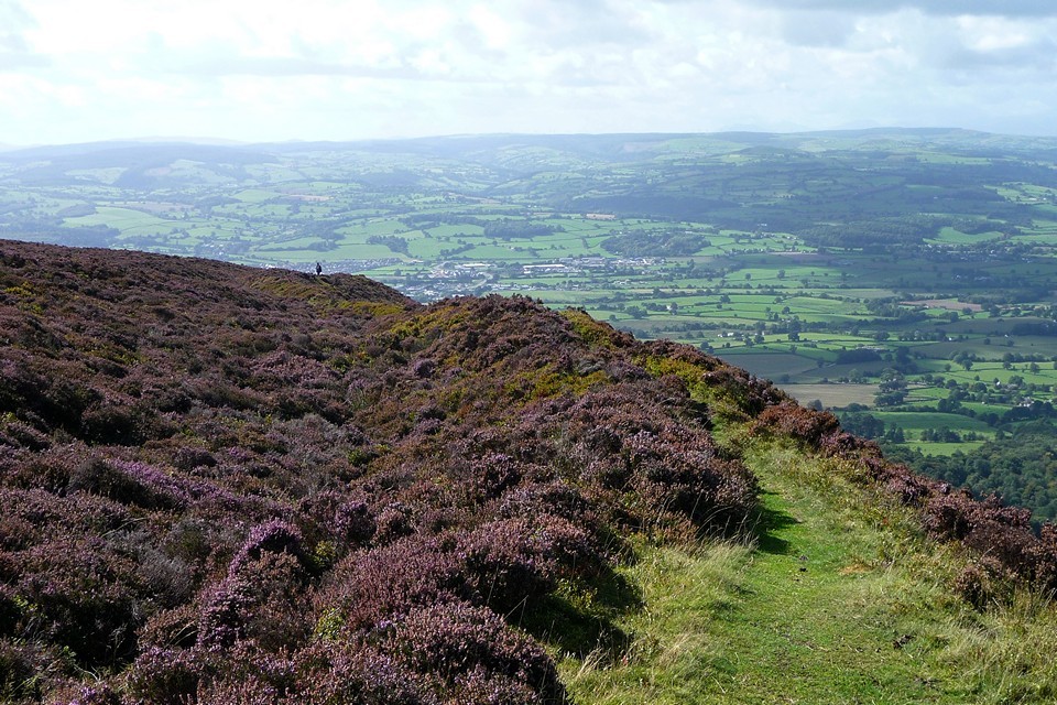
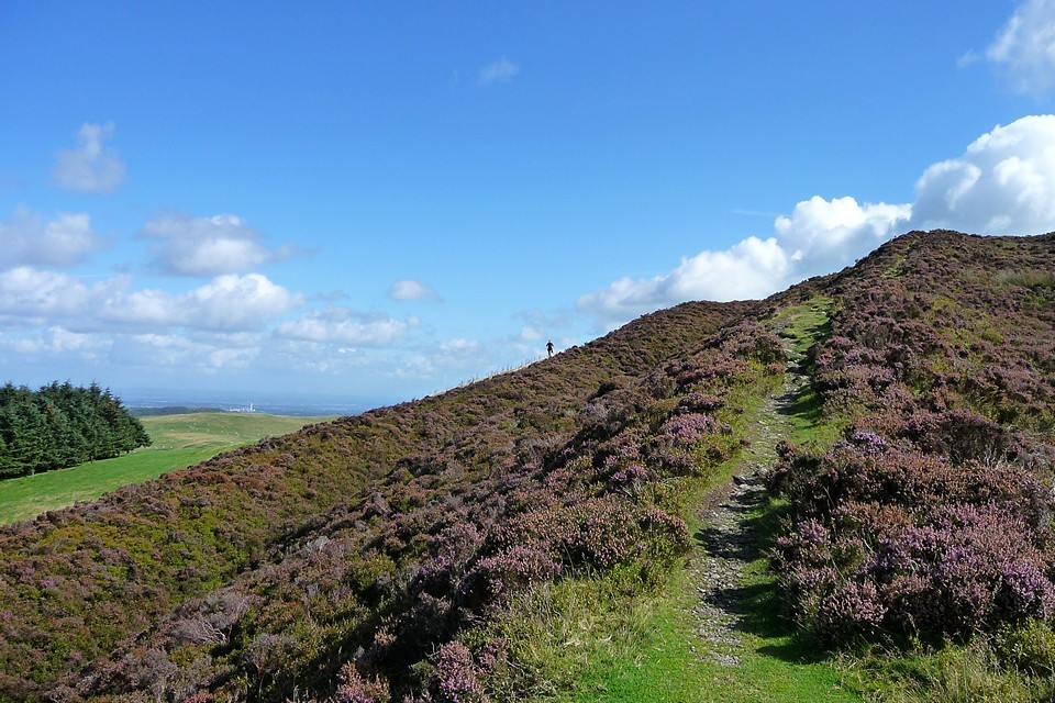
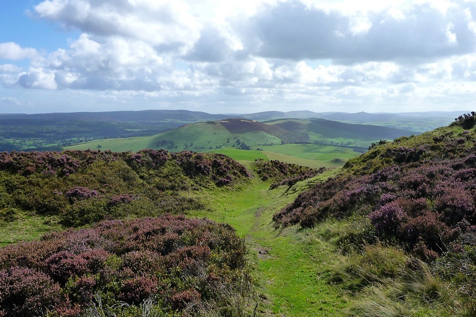
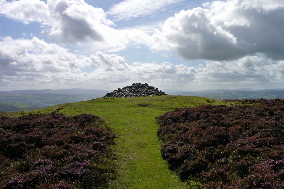
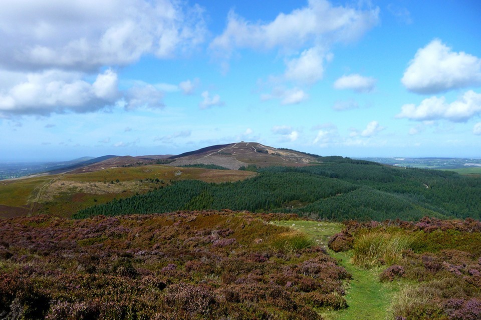
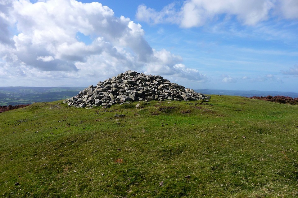
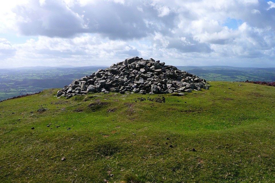
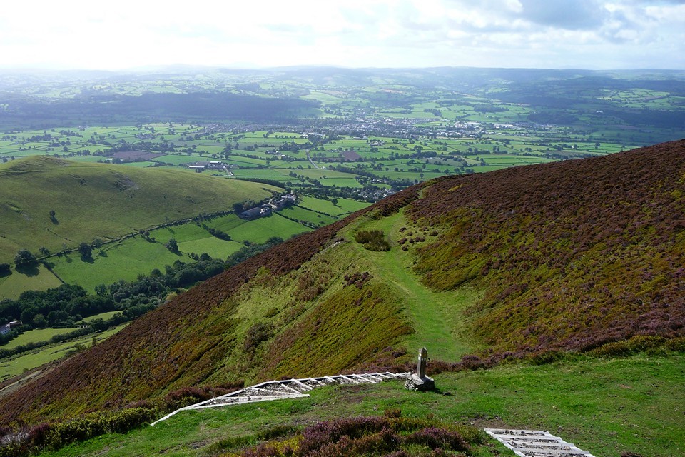
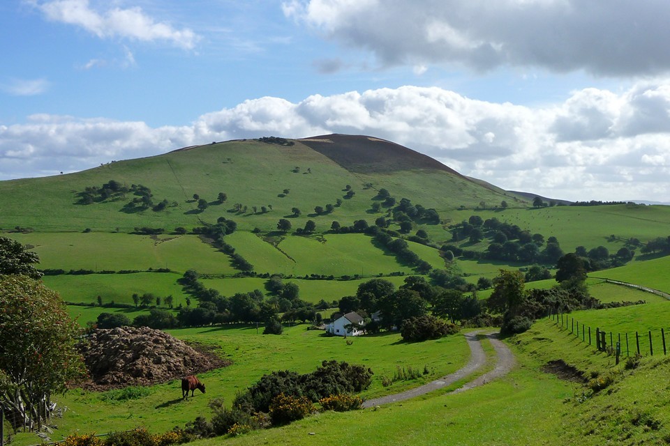
The Ridgeway - Part One |
The Ridgeway - Part OneThe Sanctuary to Segsbury Camp. Over the previous 4 years I walked the South Downs Way with my brother and sister, generally doing a section of 2 days walking once a year till we had completed the whole 110 miles from Winchester to Eastbourne. Last year we didn’t do any walking, but decided that we’d undertake the Ridgeway this year, walking the 87 miles in the course of one year. On Saturday 19th May we set off on our epic journey from The Sanctuary on Overton Hill (near our childhood home of Wroughton) under a grey, cloudy, but not unpromising, sky. Of course I always have an ulterior motive when we do these walks in that I’m constantly waving a camera about and pointing out things of interest in the passing landscape but the primary reason is really about talking absolute bollocks and having a damned good laugh. The initial part of the walk is a personal favourite as you leave the stunning views from the Sanctuary over East and West Kennett, Silbury and the numerous scattered Bronze Age barrows on Overton Hill and make your way North towards Hackpen Hill and Barbury Castle. I’d forgotten just how many sizable sarcens hug the path in this area mostly dragged from ploughed fields over the centuries by generations of taciturn Wiltshire farmers. Today dotted across the landscape are herds of hardy Downland sheep barely discernable in the distance from their stony namesakes and in the space above the ever-present accompaniment of skylarks. A section on Overton Down has a string of large sarcens lining it and it made me wonder whether these hadn’t been part of some ruined monument nearby which had succumbed to clearance, but given the proximity of the Grey Wethers to the East maybe not. You can always tell when you’re near a parking area on the downs because the number of people, dogs and kids on bicycles rises and so we knew that the White Horse figure on Hackpen Hill was imminent. As children we often used to take this minor road passing through Rockley and Old Eagle as a shortcut to Marlborough or sometimes just for a picnic up by the Gallops. Passing on we began to make out the mighty banks of Barbury Castle, another childhood playground. This is quite a busy section of the Ridgeway as it’s open to motor vehicles during the summer months so you’ll quite often encounter 4x4 freaks or strings of young men on cross-country motorbikes, the whine of their engines buzzing in your ears five minutes before you encounter them and five minutes afterwards. I’m not sure who’s more selfish; me for wanting peace and quiet or them for seeking thrills. Arriving at Barbury around 1.00 we stopped for lunch and sat on a section of the bank looking down on the beech copse and reminisced about the bendy branch of one of the trees that we used to take turns sitting in while our dad twanged it up and down. All around us were newly flowering yellow cowslips and thousands of brightly coloured small snails encouraged by the recent wet weather. Moving on to Smeathe’s Ridge we dropped down to Ogbourne St. George and wondered if there was still a pub there. In Wroughton we’d known nine pubs but in the intervening thirty years three had closed so it was with some relief that we discovered that The Inn with the Well was still there. A swift pint and we were on our way again making the gradual climb to Round Hill Downs where the going is relatively flat until you go a little further North and start the climb to Liddington Castle. All day I’d been spotting what I thought were round barrows only to discover upon consulting my OS map that they were almost always small reservoirs, the consequence of a relatively dry landscape. Just before arriving at Liddington there are a series of earthworks one of which runs parallel with the path. It consists of a ditch and bank and strewn along the ditch are more sarcens, which had become scarce since we left the Grey Wethers earlier, and I assume that this was probably a boundary marker. Liddington is a strange place and had always seemed so. It’s about the same size as Barbury but seems to be ‘back to front’, the western side being too big and formidable where you don’t really need it due to the steepness of the hill and the eastern side being too small and under-protected. Perhaps it was never a hill fort at all but a prestigious enclosure or corral? After Liddington we dropped down towards our days destination at Fox Hill crossing the B4192 and then walking along a horrendous section of road across the M4. Because of the abundance of foliage at this time of year you’re forced to walk along the edge of the road into the face of cars travelling at 50 mph just a couple of feet from your body. I don’t understand why there’s not a proper pavement here as this is the official Ridgeway path and must be used by thousands of walkers every year. There’s certainly no other crossing point nearby. So an imperfect end to a perfect day. Following the Saturday evening disappointment of Chelsea undeservedly winning the Champions League cup, and so displacing Spurs from next seasons CL campaign, it was now Sunday morning and the wind was up and blowing almost straight in our faces. We cursed Didier Drogba and set off. Nearby Charlbury Hill looks like it should have had an ancient settlement upon it but apparently didn’t. There’s not a lot of pre-history other than the Way itself until you get to Wayland’s Smithy, which was still some four miles off. So you have to be content with rolling downland, vivid yellow and green fields and path side flowers like speedwell, forget-me-nots, cowslips and borage. That’s fine by me. Wayland’s didn’t disappoint and we spent a good half hour wondering around, climbing in and out and taking pictures. My sister assured me that the hole on the back of one of the largest stones is where you place your silver coins when leaving your horse to be shod, but I’m not sure how she can know this and we have no way of testing it out other than leaving our brother there overnight dressed in a suitable costume. Obviously he’s not willing. Next up is Uffington Castle and The White Horse. We made our way to the edge of the hill near the horse’s head and spent a while gazing over the Manger, Dragon’s Hill, a crop circle in a field of rape and the steaming towers of Didcot Power Station. We decided to have our lunch in the ditch of the castle, but whichever way we turned we couldn’t escape the blustery wind and eventually moved on to a strip of woodland near Ram’s Hill. Later, approaching the Devil’s Punchbowl, the sun threatened to breakthrough but, sadly, didn’t quite make it. A great shame as it’s a beautiful piece of landscape. Now we were almost in sight of our final stopping point for the weekend at Segsbury Camp. Again this is also a bit like Liddington in that it doesn’t seem substantial enough on the side where it needs to be so I came to the conclusion that this too was not really a fort but more of a gathering place. All the forts we had passed through so far had been quite evenly spaced as were the intermediate ones which are on the edges of the Ridgeway like Bincknoll, Alfred’s Castle and Windmill Hill. I wondered how different each of them might have looked in their heyday with different levels of fortification, palisading and gates, whether they all belonged to one large tribe who roamed between them or to different family groups or clans who farmed the local hills and valleys. What was the decision making process when deciding where to site them? It’s obvious for some but not others and it’s also difficult to know whether they’re all contemporary with each other. There may have been long intervals between them and almost certainly different phases in their individual construction. Ah, questions, questions, questions. So, a good weekends walk and the prospect of more to come when we venture on to unknown territory this summer. The Ridgeway — Images30.05.12ce
|
Posted by A R Cane 30th May 2012ce |
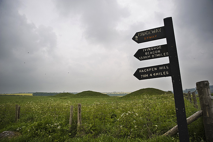
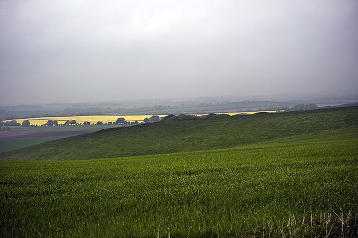
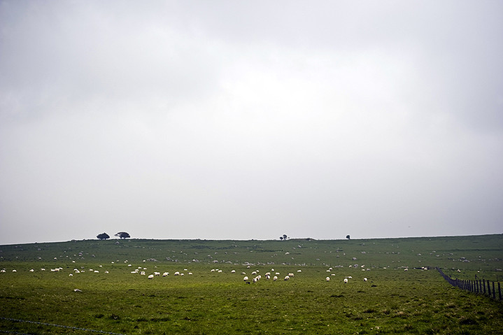
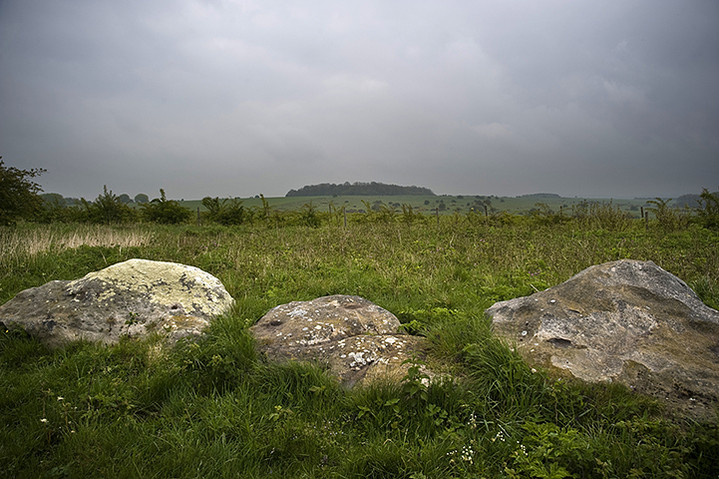
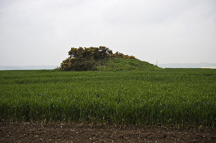
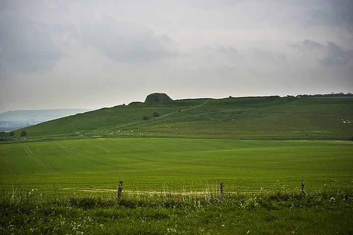
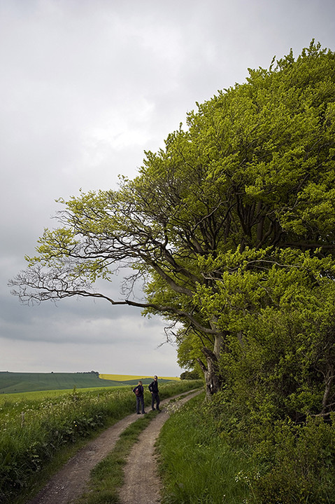
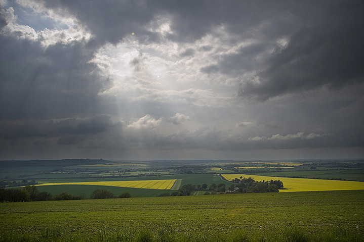
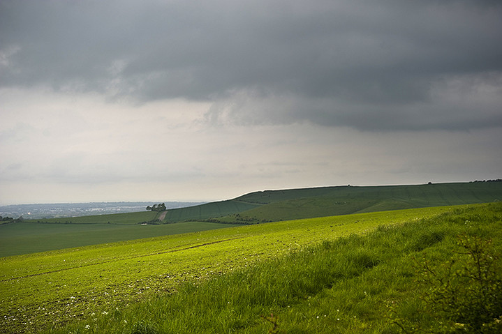
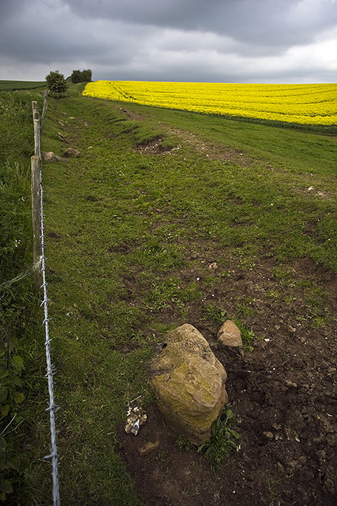
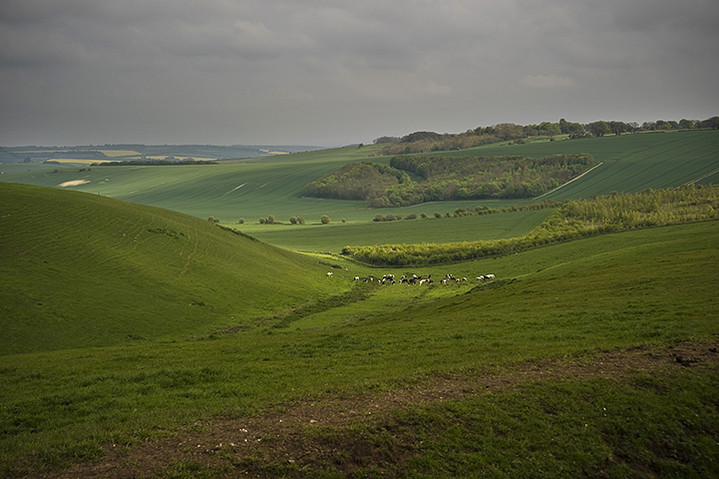
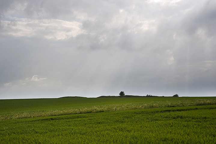
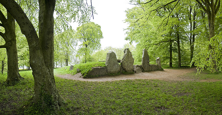
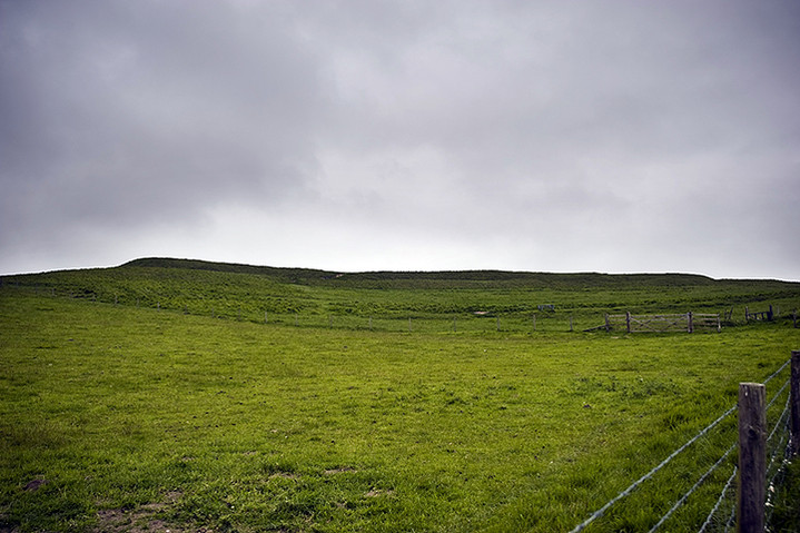
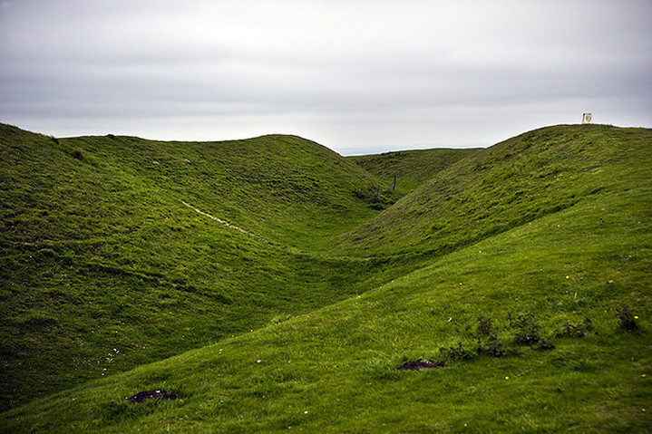
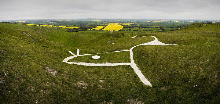
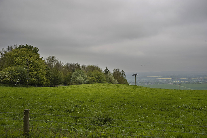
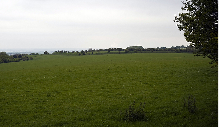
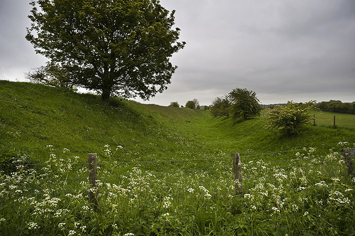
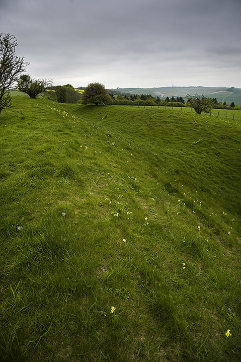
The big three |
The big threeAfter a quite frankly horrible nights sleep in the car, jeez cars are uncomfortable for sleeping in, cheep though. Eric got through it ok but I must have had about four hours, not enough for the day ahead. Breakfast was obtained from a garage in Tredfraeth/Newport, then it was back over the hills to our first destination. Dyffryn Stones — Fieldnotes15.04.12ceThis one had been bumping around the top of my list for ages, years, but seeing as it's so far away, at least a three to four hour drive and North Wales is so much closer, but i'm here now and i'm not going to waste the opportunity. I parked in the entrance to the Electricity sub station just to the west of the circle, reckoning that no-one would be coming this early in the morning, and they didn't. Then we rode the bikes down to the left hand gate , Eric's went under the gate mine over it then a one minute ride up to the medley of animal pens, curious young cows ran alongside the fence, Eric was more interested in them than the stones so I was able to have a quiet moment or ten with the stone circle. For it must be a stone circle, the map says only cairn but what do maps know, bah, who makes cairns with stones this big. Each stone is of a singular shape meticulously chosen for it's odd shape, the corrugated stones are particularly interesting. One of the two tallest stones seems to have been cut in two the line of the cut so perfect it must have been a Sith lord up to mischief with his light saber. If a stone circle it be then it would have been the best stone circle in the whole of the Preselis, Gors Fawr could be walked through without noticing it by someone unused to such things, and Bedd Arthur isn't even a circle. If you know where to look Budloy standing stone can just be seen across the slight valley. I really liked this place, it didn't disappoint at all, even the cows or the farming utensils did nothing to blunt my experience here, just imagine what it would be like if it was in pristine condition, mind blowing. That was the first of the big three, but compared to the other two on my days list it was at the bottom, but only because I really really liked the other two. Anyway just down the road is a tall and shapely stone at Budloy farm Budloy Stone — Fieldnotes15.04.12ceSeeing as it was so close to the Dyffryn stone circle ( I refuse to call it a cairn) we rode our bikes down the road, turning left immediately after going over the bridge over happy waters. Open and close gate, ride down track and umph, a farm, hmmm what to do, worse still the farm yard was full of sheep and lambs with the farmer and his wife. i didn't hold out much hope, the farmers wife saw us but didn't seem to mind. We opened and closed the next gate and we were in the farm yard, I went over to the farming couple and asked if it was okay if we went over to their stone, (they like that) she said it was alright as long as we left our bikes there. Okely Dokely said I and off down the track we went, passing some ruined Reliant Robins and an old boat, which is right next to the gate that leads into the stones field. We entered the field, scaring off two geese and walked over to the well proportioned stone. Tall and pointy it be, if i had a standing stone it would be just like this one. If you know where to look you can just make out the Dyffryn stones. To the immediate north of the menhir is Budloy mountain but at only 287 meters it's hardly a tiring climb. En route back to the bikes which had moved when we got back, we noticed what an idyllic farm scene this was the sheep had gone but ducks were now quacking about the many streams that pass through there yard. If I had a farm I'd like it be this one. From Budloy we made our way through Maenclochog which has more than it's fair share of standing stones strewn around it's outskirts, passing east out of the village we passed Temple Druid standing stone. We just had to stop and say a quick hi to this tall yet squat pointy standing stone. Passing east out of Maenclochog which i'm probably erroneously guessing means loads of stones, as you cant leave the village without passing one, we passed this one. It was a good one, next to wooded streams and small waterfalls, god I wish I didn't live where I do. From there it was only a couple of miles to the next place, it wasn't on today's list but seeing as I was passing very close by I thought I'd have a look at Yr Allor standing pair of stones, but they were safely tucked up behind some houses with no obvious way to get to them, but this is The Preseli mountains and they always come up trumps in the menhir department. Meini Gwyr — Fieldnotes16.04.12ceI was looking for a way to get to the Yr Allor stones when I came across this site, I parked up outside it's field and inspected the map. Hmmm there are so many stones around here that your just falling over them, I get out and walk over, look at the information board and ohhhh it's Meini Gwyr, it wasn't high on the list due to it's ruination but it was there nonetheless . There is still a slight circular bump to be seen, just, and the stones are still quite big, well one of them is, and they still have that inward lean that Merrick mentions in his notes. I can't quite make out Yr Allor from here, and that is where the attraction to the place comes in, not not making things out, but, in it's heyday this would have been a phenomenal place, so many closely fitting sites all seemingly linked together, like a mini Carnac, but it's all over now the crowd are on the pitch it is well and truly over. After that introduction to a lost megalithic playground/paradise, it was time to gain some height, these are mountains after all. Turning left at Glandy Cross onto the A478 we immediately pass a hill fort a cairn circle and a burial chamber, then turn left at Crymych and there rising before us is the second of the big three Moel or Foel Drygarn, a wonderful rocky hill with a fort and three big cairns in it. A beaut of a site. Moel Drygarn — Fieldnotes17.04.12ceBeware ! I will be talking enthusiastically about this place, what we are sometimes privy to is more than just a visit to some stones by someone, sometimes it's a window onto a love affair, for it sometimes feels more like i'm documenting a love story between myself and these ancient wild high places, if I sometimes sound like a giddy child it's because I feel like one, it's just the best feeling in the world. We parked in the obvious place south east of the small mountain, and rediculously I let Eric talk me into taking the bikes up with us, it wasn't that hard going, it's not too steep. On the way up he would look back down the path and tell me how cool it will be to ride back down, pointing out dips and jumps he would go over, we're not mad, we had no intention to ride down from the top that would be suicide, however his second mountain lesson would be coming soon. As we neared the top I could see what looked to be the first line of defences for the hill fort, crawling north around the side of the hill and curling west to keep those pesky invaders out. We pass it by and reach the level ground at the top, lean our bikes against the rocks at the south east, and turn to look at the three ginormous cairns, if a mountain is lucky, no if i'm lucky a mountain will have a cairn on it, if i'm verrry verrry lucky it will have two decent cairns on it, but to get three cairns of such distinction you have to come to the magical playground of the stonehenge builders, the Preseli mountains. I read with disappointment that Carl wasn't impressed with the hill fort, saying little to be seen, ?? the defences can be followed all around the north of the hill and even the entrance is deep and obvious on the south side where there are no defences because of the precipitous rocks , Iv'e seen worse, much worse and whats worse is iv'e driven miles to see them, here though it is an absolute delight, a cherry on the top, for the main gatteau is the three huge cairns perched on top, keeping watch over the whole of the eastern mountain range. The cairns have been recently restored by army preparation students, whoever they are? but they have done a grand job. We could tell by the colouration of the stones where had been restored. But they either left a bit out or someones been at it already as there is a a small scoop in the western end of the western cairn, it's a comfy place to sit out of the wind and watch the clouds scudding over distant Carnmenyn. Carnmenyn, from here it hides from view the Carnmenyn burial chamber and the stone river, had I been alone I would go over there and introduce myself to the genius loci there. But not this time, they will have to wait till our next rendezvous. From up on top, on top of the trig point, we can see it all , west past Carnmenyn to Foal Feddau and Craig y cwm, Preseli's highest point. North is the coast, I can see Dinas head, and closer to somewhere before me is Beddyraffanc, east is Frenni Fawr and cairns and south is Carn Ferched and further off is the megalithic complex at Glandy cross. But the best thing is just sitting up on the central cairn watching the clouds shadows moving across the ground below, the occupants of these cairns must have been important indeed. But the worse thing is on our way back down, on the bikes, Eric went from lower than me, but no sooner had we got fifty yards he went tumbling head first over the handle bars, and I was unable to do a thing but watch it all happen, thankfully he wasn't hurt too much, mostly his pride, and with it comes a valueable mountain lesson, even if your thinking I can do that, it always pays to be conservative, no not them...ptui. That was the second of the big three. After picking ourselves up and brushing ourselves down, we rode the bikes slowly back to the car. Only two more places then we'll go another castle on the way home I told him, this seemed to make him feel better. After reading a post on the Waun Lwyd webpage about e-mailing the new occupants of the property I thought I'd go see these two stones which have until now escaped photography, after a bit of wrong houseing we got to the right place. Time for some food, care of Glandy Cross service station, then it's the short drive to Llanglydwen and one of the best placed dolmens in Wales one of my favorite places Gwal y Filiast, and the last of the big three. Gwal-y-Filiast — Fieldnotes17.04.12ceI can't believe I didn't add any field notes from my last visit six years ago, even though that was more than half a lifetime ago for Eric he still said "oh I remember this one" and that was before we even got to it. Heading south out of Llanglydwen, take your first right turn, then turn right into the track that leads to Penbontbren cottage, they let me park there last time but this time I leave it further up the track in the corner to one side, then walk down to the house and pass it by on it's right hand side, through a red gate. Then take your left hand fork passing a standing stone/old gate post and in one minute the most beautiful of Preseli's chromlechs is revealed. Looking down over the river but not in site of it, is the greyhounds lair, what is it with greyhounds lairs in Wales? there is at least three that i've been to, is it the ancient name for it or a modern thing? I walk around and around it, taking pictures from strange angles that I didn't explore last time, but last time the whole family and the dog were here, this time it's just Eric and me, and he's got a new football, so i'm free to go this way and that. Some chalked/burnt stick graffiti is on the inside, including a spiral in black, it's all old stuff that's wearing away, it'll be gone by autumn. On the edge of the Preseli mountains but not in site of it, this is a must see dolmen, so many pictures of Coaten Arthur and Carreg Samson, this place is well under used, and little visited. A secret little gem, if i'd come a few weeks later there would have been bluebells too, so much beauty and wonder in one place would have made me quiver. Then again at work a bonus is coming my way soon, so I may come back in a few weeks, and I will be a lucky boy. Ps.... the walk back was timed to more or less fifteen minutes, so there's no excuses for not coming. On the way home we stopped off at Newcastle Emlyn castle, not much left of it but we had a good walk by the river and found a duck shoeing us away from her brood, sweeet. Alas I didnt get to go everywhere I had my eye on, no time for the hill fort and standing stone at Bosherston, and no time for Carn menyn and the stone river, oh well it won't be too long I hope. Waun Lwyd Stones — Fieldnotes16.04.12ceI e-mailed the new occupants living in the nearby house asking if my son and I could come and have a look at the stones but received no reply, so we went any way. It took two tries to get the right driveway down to the house (blurred house name on streetview says lots) but we got there eventually. I parked in the farm yard and knocked on the door, farmers wife came to the door so I asked if my son and I could have a look at the stones, using the exact words used in my e-mail, but it didn't seem to register, no matter, she didn't have a problem gave me some directions to the stones and off we went, would have been nice for the asked for e-mail to have made an impact though.
The stones are first seen over the wall, oooh said I they're big ones, then we get to the gate and enter the stones field. Immediately you can see that some work is being carried out here, new fence posts and new barbed wire, not into that, not at all. But also some gorse has been removed and piled up, I am into that though, but not too much mind. These are a fine pair of stones, the smaller western stone is more rounded and blunter, female ? and the eastern stone is taller, sharp edged and pointy, male ? whether it is a gender issue that determines the stones shape I'm not overly convinced but there is a meaning to it i'm sure. Standing south of the stones, they frame Carn Meini, 365 meters of up thrusting weather beaten rock, and next to it the Carn Menyn chambered tomb and coming from that the stone river a most singular natural feature. There's really a lot going on around here, I so wish it was the same in my almost local Snowdonia. I'll have to put in for a transfer down here. |
Posted by postman 24th April 2012ce |
Trefdraeth to Wdig or Newport to Goodwick |
Trefdraeth to Wdig or Newport to GoodwickLooking for somewhere to get something to eat we enter Trefdraeth/Newport from the east on the A487 and pass a sign saying Burial chamber, for a second or two i'm thrown a bit and wonder which one it is, then I recall that the last time I was here it was at half past two in the morning, it's Carreg Coetan Arthur. After a healthy and nutritious sausage butty we head off for the dolmen. A couple dressed exclusively for the outdoors are inspecting the cromlech so we park round the corner slip into our wellies and give them a minute, as expected a minute were all they were willing to give to this curious pile of stones. As we entered the cromlech's private space I could see that some trees have come down, clean cut tree stumps exposing Newport sands, which on my previous three visits was totally invisible due to utter darkness or flora, it was nice to have some placement perspective for it, something I'd thought impossible for it as it's in a housing estate. I reminded myself that even though the dolmen has four uprights under it only two are actually supporting the hefty, shapely and attractively coloured capstone. Eric and me chattered together under the capstone and I pointed out that our new dog (not that new) Arthur is named after this and a few other ancient sites, he looked at me and stated that i've got stones on the brain, something I'm inclined to agree with. Eric was itching to get the bikes out of the car so we exited Newport from the west and headed for Cerrig y Gof, a rather unsung megalithic wonder of Wales. Cerrig y Gof — Fieldnotes12.04.12ceWe parked west of the chambers in a small rough lay by, then rode our bikes back down the hill to the site.(weeee!!!) And what a brilliant site it is, last time I came here the bracken was high and in full obscuring mode, but it was much better this time, no bracken growth at all, it was midday and all the dew and slugs had gone, and I had my inquisitive and questioning son with me. Couldn't be better. I wish i'd read Carl's fieldnotes on this place as I now need to go back and find the big stone he describes a hundred paces away on the other side of the field. But I have read Moss's comment on the Needle rock lookalike stone and tried to recreate Robin Heath's photo without actually seeing it. The two are remarkably similar and it can only be intentional, but when the capstone is in place and the I suppose there would have been a backstone to the chamber also in place and then a covering mound, the stone would be hidden. But I don't think that would matter, the builders would know it was there and the magic would carry on working. Any alignment between the two and the midsummer sun would have to be remembered and passed on verbally as it would be lost from view, and easily forgotten. The ride back up the hill was a bit arduous but it didn't take long, next along the road was Parc Cerrig Hirion, a hidden stone that one previous aborted visit had proved is difficult to get to. This visit was no better, I was too far to the east and compounding that I hadn't read anyone's field notes so hadn't even heard of Mercury garage. blast and double blast, oh well perhaps the third time will prove the charm. On down the road is Ty Meini or more charmingly named the Lady stone, it's much more easily found as it's only six feet from the roadside. I parked to one side in the farm entrance, there's plenty of room it's a wide entrance. Eric elected to stay in the car as my visit wouldn't take long because there are railings hampering a close inspection, I felt sorry for this stone it's a good one but the roadside fumes aren't nice, nor are the railings, if I were to win the lottery I would ask the farmer if I could make a more visitor friendly enclosure for it. other peoples excuses for not getting closer also get on my nerves slightly, if your not going to try and get close why bother at all ? More antiquarian friendly are the burial chambers on Pen Caer the large headland north west of Wdig/Goodwick, our next destination. Garnwnda — Fieldnotes13.04.12ceThis was the only one out of the four I hadn't been to, Garn Wen trio....yes, Pen Rhiw wedge tomb....yes, even Carn Gilfach proved not difficult to find, but it took this my third visit to the area to find time enough for Garnwnda and it's shy outlying menhir. It was well worth the wait. Finding this last one wasn't hard, once the proper place was found to leave the car, I left it next to the phone box more or less directly south of the chamber and the rocks it hides amongst. Once more upon the bikes it's fifty yards back down the road, turn north/right up the footpath that looks like it's going through someones back yard. The path is muddy, but it would be after all it chucked it down most of the way here, standing on tip toes looking over the wall to your right you can see the standing stone of Parc Hen. At the end of the muddy path a gate is reached, once on the other side the footpath diverges into a starburst of desire lines, the one that is in line with the footpath just traversed is the one you want, after a hundred yards look up to the rocks, a tall pointy rock on the highest part has the burial chamber under it. That said I didn't go that way I went straight to the top and just scrambled around until I came across the chamber. When ever I find something for the first time it is impossible not to emit some sort of jubilatory sound, this one was a cross between Yaaay, and woohoo, a Yaaywhoo. The four chambers strung along the headland from Carn Gilfach to Garn Wen are within two hundred yards at most of the same latitude, hard to do if your trying, extremely difficult to do by accident. But the thing that struck me about another similarity between this one and Carn Gilach is that they are both very very close to the rock outcrop and both have a standing stone less than two hundred yards away. I love the mystery, that tantalising hint of something close to an explanation to what was going through the minds of these ancient ancestors, there has to be answer, and here it is close to the surface, luckily I didnt visit Garn Fawr hillfort or it's littler siblings so a return visit is assured. Was the capstone moved to it's current position ? or was it always there and they just jacked up one side and then propped it up on a single stone, either way the single stone looks wholly inadequate for the job, all that weight pressing down on just one small stone, carefully we entered the chamber. Cosy, if you like creepy crawlies, I don't mind most of them, except the slimey ones, in the summer when it's been dry for ages I could imagine staying here all night, yeah all night long. Come to Pen Caer headland and see these four chambers, but clear your mind first and put in some effort. From the southern end of Garnwnda rocky outcrop the standing stone of Parc Hen can be seen, as with the burial chamber it demands some effort in getting to it. Parc Hen Stone — Fieldnotes13.04.12ceFrom the path to the burial chamber you can see the stone in the corner of the field , but the field is covered in brambles, and I mean covered, but there is a gate behind it so I hoped to come at it from that direction, we went back to the car parked at the phone box, then rode the bikes down the road north east. The first gate we came to a stone was in the field but it isn't the one we wanted, whether or not it's ancient I do not know it isn't on the map so must be a rubbing stone I guess set up by farmer. We entered the field and rode over to it, then past it and left the bikes by a knackered old wall, then over that field to the gate, the one I could see from the path to the burial chamber, the stone is about twenty yards from the gate. Tis a really good stone this one, as Merrick informs it is mainly triangular, changing shape as you walk round it and about seven feet tall. A long haired kind of moss clings to it's upper parts, making it look proper ancient. A small stone gathering is apparent under it's northern face, presumably chock stones but they're not chocking, is that even a word. Visited on Monday 9th April and by that I mean right up close and I touched it with my hands. Carn Gilfach — Fieldnotes14.04.12ceMy first visit was hampered by deep impenetrable fog, thankfully I'd left Garnwnda and the Lady gate stone out so this was the return visit eighteen months in the making. I parked in the same place as before, and walked through the same farm , barked at by the same dogs probably and walked up the same path, the sign pointing out the cromlech is still there but the abundant plant growth and slugs were absent, glee ! The giant capstone was easier to define from the ground without the high grasses, and the strange triangles on the upper surface of the capstone still look freaky, are they man made or natural, I don't know but they are stained reddish as though from iron or something. Once more I climb the rocks just a few feet from the chamber and look down upon the mighty stone, held only just aloft by its small orthostats. Then I let my gaze wander around, I can't see the Lady gate standing stone from here the crest of the hill hides it from view, just like Garnwnda does with Parc Hen standing stone, the rocks of Garn Folch hides Garnwnda and it's chamber from me too, a complicated game of hide and seek are afoot, but i'm not sure of it's rules or it's meaning, if there is one. But the forts around and on Garn Fawr are highly visible, but they're not playing the same game. I bid the chamber adieu and set off for the elusive Lady stone, but i'll be back soon enough. Lady's Gate — Fieldnotes14.04.12ceThe path from Garn gifach burial chamber starts off easy to follow but when it crosses over a low old wall the gorse rather chokes the path impeding progress and the brambles arch over trying it's hardest to trip over the unwary walker, I got this far before, but turned back when the path just stops at a large boulder with fencing running off in two diections, knowing all this we stride forward using brute strength, what little I have, and steely determination which I have by the bucket load, Eric found it hard going so he sat on the big boulder and watched me descend onto the gorse ridden plateau, from the big boulder only one stone can be seen in more or less the right place, not knowing whether or not this was it I just gave it a go, and hey presto Lady gate standing stone revealed her self to me. Though standing stone is a real misnomer, it's not totally prostrate, it still clings on to verticallity by it's finger tips. This almost fallen menhir gave me great joy, the usual triumphant sound was absent, just a quiet immense feeling of satisfaction, accompanied by goose bumps, I'd had the words Lady gate floating around my mind for ages, we would be together one day I knew for certain, very strange I know but this was one stone that would not escape my attentions. I waited patiently for the other-wordly lady to make an appearance, but to no avail, I even poked around under the stone, in imitation of treasure seeking, but she must of known that her riches were not in peril from me, probably too much information but I could really do with an other-wordly lady right about now. Eric reminds me of my other respsonsabilities with a shout, I wonder if that was his first call out to me, I bid her a fond farewell and take my leave. After chips on the sea front we head down to Llawhaden castle, i'm not only megalithically inclined but also have a passion for castles, then a couple of beers from a small pub in Tufton, with echoes of An American Werewolf in London, then sleeping in the car at Pontfaen in a sheltered and lovely valley on the edge of the Preselli mountains. |
Posted by postman 15th April 2012ce |
Trio on the way |
Trio on the wayRise and shine it's 4am, luckily Eric had set his alarm clock as well, it was just as well too because restless leg syndrome kept me awake till at least 1am. After serial and bacon butties we were on our way, it's a long way to Goodwick so I decided to break up the long drive with a few hill forts north of Lampeter, there are plenty to choose from, but seeing as I'd added sites but not yet been there they would be the ones. But on the way we had a minor disaster, I took a wrong turn and ended up near Dolgellau, that kind of thing can happen after only three hours sleep, I was well tired . I was well annoyed but the boy wonder took my hand and told me not to worry, we turned round and went back via Aberystwyth, it meant the plan would have to be changed, no time for Darren camp, it's straight to Sunnyhill wood camp. But then on our way down the A485 I recognised where we were , right next to Castell Flemish, thank god for Google streetview Castell Flemish — Fieldnotes11.04.12ceI parked in the small layby off the A485 about fifty yards east from the hill fort, sadly it was persisting it down so we waterproofed ourselves and mozied on back up the road. Also after my directional cock up earlier I wasn't in the mood for niceties so I didn't ask for permission to get in, instead we gracefully leaped the barbed wire fence, well as graceful as wellied feet can any way, it's only a short stroll from the fence, in fact the forts most extreme northern defences seem to be cut into by the road side embankment....shocking. I wondered, then doubted whether any Dutch speaking Belgians had ever lived here, surely they would have been native Welsh iron age folk like anywhere in the country. We kicked a few lambs out of the way, they're only food after all, no, not really, I'm as soft as any vacant minded veggie. In fact it was the lambs that nearly made us turn back rather than any irate farmer, but we remained unchecked for the entire visit, it was early, raining and misty. We started our circuit of the forts defences, noting at least two entrances east and southwest. As we passed by the southwestern gate I wondered if on a clear day we could see Sunnyhill camp the other side of Tregaron about three miles distant. Eric leads the way round the perimeter, he knows we don't leave till we've seen the entire round, and he knows this is just the first of many sites to be got to in the two days we've given ourselves out in the comparative wilds of south Wales, in fact this one of three hill forts is just on the way to where we're going. Just on the way, sadly, a longer visit with a football, kite or other child friendly activity would be better I know. Time for some grub in Tregaron, a nice little town with friendly people, we picked our way carefully through the maze of lanes in the light rain heading for the most interesting of the trio of forts on my new and revised itinerary, the nicely named Sunnyhill Wood Camp Castell Tregaron. Sunnyhill wood camp — Fieldnotes11.04.12ceWe parked in a passing place, naughty I know but I crammed the car into one end still leaving space for passing, then walked back down to a house whose name we couldn't make out from the road. Next to the house is a gate which we quietly crossed and made our way through another sheep and lamb infested field, why do we have so many sheep ? I don't eat mutton or wear woolen clothes and only eat lamb rarely, who is eating all these sheep? We made our way up to the fort, it's quite steep but it only takes ten minutes to get to the top. This is one great hill fort, the map shows it as a spiral earthwork. The banks hiding the central summit are well over fifteen feet high, they don't really leave much room for habitation inside, maybe a hundred, no more. There was a digger in between the two high ramparts and it had scraped back the top layer of earth, exposing much stone and some bones (probably sheep), I'm no law student but that seems illegal to me, digging inside a scheduled ancient monument. Eric wondered if Time Team had been here and we'd come during they're tea break, he then set about trying to hot wire the digger, so I left him to it as I'd seen the battery not hooked up and the whole machine looked pretty knackered, but at least he wasn't asking if we can go now. We then walked a little to the north west and up hill a bit to get a view down over the fort, it was an epic view, the fort really is very impressive, and the hills gain in height to the south west where Bryn Y Gorlan stone circle is. then as we walked back down to the fort a Red Kite flew by, it's fantastic they've made such a come back, and they're so willing to fly right over you're head instead of scarpering like a cowardly Buzzard. It now transpires that Eric's coat isn't nearly as waterproof as we'd hoped, so we stop off in Lampeter to get a kagoul or brolly then it's on to another Pen y gaer the other side of Llanybydder. It's further away from the other two which are quite close to each other. Pen-y-gaer — Fieldnotes11.04.12ceThe last of this mornings trio of hill forts on the way to somewhere else, and the only one that is actually on top of a hill. We decided to stick to the footpath as much as possible, coming from the south west at a house/farm called Glan Tren, but alas we couldn't find hide nor hair of it, perhaps my powers were waining but me thinks it's been removed or hidden, not on. So we went round the other side and parked by a playground, jumped an overly barbed wired fence and slipped and slided up the slippery slope in our well used wellies. This was another field full of sheep and lambs, I guess it's that time of year again, when a young mans fancy is easily diverted up a hill, is that right? The best part of the fort is on the northern side, tall banks and silted up ditches, with sheep and lambs either running away bleeting or strangely following you round. Other parts of the fort are fenced off, this is private property, and they really don't want you up here. I know it's lambing time but really I'm no threat I promise. Trees block the view down over Llanybydder, but south east is open and pretty. Difficult to visit even for the most hardened traveller. Then it's off we go, except for one more tomorrow that's it for hill forts, it's burial chambers and standing stones from now on. |
Posted by postman 11th April 2012ce |
Cheshire's western Peak Part I |
Cheshire's western Peak Part IThis obsession of mine, and it is a fully fledged obsession, costs money, money I don't really have, but as with all addictions you can come up with any excuse to indulge in your passion, today was no exception. I just can't stand sitting round the house looking for something to do, so I asked Eric if he fancied a day out and he physically leaped at the chance. So to keep costs down we didn't even leave our home county of Cheshire. Reed Hill — Fieldnotes03.04.12ceAs previously promised a return trip in the spring for some better views, and man they were better, in fact I could have poked one eye out and still it would have been better than the icy fog last time almost two months ago. Seeing as it's considerably less than a million miles away it was always going to be sooner rather than later. We parked in the same place, where the map indicates 316 meters, we jumped the fence at the same place, but trod a more direct route to the barrow, which was pleasantly in the same place. Nothing more to add to the barrows discription, only that the views have changed since last time, back in February the fog curtailed the view to about fifty yards, today it was at least fifty miles. To the north past the Bow stones (two early Christian sculptured stones) to Lyme Park, north east down to the Murder stone, west is the long barrow topped Spond's hill, east and south is the best view with the evocatively named Windgather rocks on Taxal edge, Cats tor (519m), Shining tor (559m Cheshire's highest point), and way off in the distance Shutlingsloe. I'll be back soon ish to check out the barrows on Sponds hill, and survey the area from that different perspective. We ran back down to the car hand in hand as per usual, jumped back over the fence and got back in the car, gladly, it might be sunny but that strong wind is cold and we came dressed for last weeks weather. Brrrr Murder Stone — Fieldnotes03.04.12ceJust a five minute drive from beside Reed hill with it's still impressive round barrow is this pretty little stone, murder stone or not it's a nice one. The stone was just off the map so I was going on a vague memory from too many years ago, luckily Iv'e got the stone finding knack, I parked by the newly renovated farm house, just off the small lane and five minutes later we were at the pretty little stone. The shape of the stone whilst not unique (superficially Maen Llia like) is undoubtedly intentional, they didn't just pick the nearest likely large stone, this one was special, how so I can not say. But what they couldn't have known (or perhaps they did) was how the colours would come out after being exposed to the elements for four thousand years or so, oranges, yellows, reddish browns, it was really quite beautiful. The positioning was paramount too, very visible from a long way to the south and east and west but not north as there is a big hill behind it. It also has a tentative connection with the barrow on Reed hill, presumably of the same (ish) date, as the stone seems to sit in the lea of the great hill, maybe even saluting the hill and barrow. On the way back to the car we saw two older gents out for a walk, one of them was of African descent, it's always nice to see a diverse mix of people out in the countryside, I hope they had a look at the stone. We retraced our car tyres back past Reed hill turned right back on to the B5470, but only for two minutes or so untill the left turn came up. Charles Head — Fieldnotes02.04.12ceOn the B5470 three miles south of Whaley Bridge turn east off the main road. Park by the footpath sign. Walk up the track towards Charles Head farm then strike off to the right up hill following the wall. The Bowl barrow will come into view soon enough. Mascots short and sweet field notes just aren't good enough, and because he hasn't included any Os ref there's no link to streetmap. That said at least he added it. (OS ref. added - TMA Ed.) The barrow has been delved into, a pity as the barrow is only a couple of feet high, the wall running over it adds to the insult. But it's in a good place, views to the west are long and clear, Kerridge hill a hogs back of a hill dominates the fore ground. To the North the bulk of Reed hill with its large and impressive barrow, and beyond that the Murder stone sits on it's hillock below a higher hill. To the east is Taxal edge with Windgather rocks, which a previous visit to has taught me that they are more impressive close up. Thirty meters south of the barrow is a two foot tall stone, with a sheep ground moat round it, is it a coincidental erratic or an outlying stone connected to the barrow. PS, even in the afternoon sunshine the wind is strong and cold and not for the first time I wish I'd brought my coat. After the obligatory run down hill, I perused the map and the clock and decided a small drive south would do us good, down to Allgreave and the Bullstones, or there abouts. |
Posted by postman 3rd April 2012ce |
Cheshire's Western Peak Part II |
Cheshire's Western Peak Part IIWe leave the hills east of Macclesfield and head south through the hills down tiny little lanes, passing Lamaload reservoir and the unlikely named village of Bottom 'o the oven. Then tantalisingly close to Shutlinglsloe, and through Wildboarclough, alongside Clough brook and on to the A54 Congleton to Buxton road. Then it's across the crossroads down the lane to Allmeadows gueast house. The footpath runs through the property and out the other side. Allgreave — Fieldnotes02.04.12ceWe came down from the north past Lamaload reservoir and down the lovely Clough brook valley, passing the intriguingly named village of Bottom o' the oven. Parking for the stone is at a one car place next to Allmeadows guest house, there is a footpath running through it. The footpath takes one down to where the River Dane joins up with the Clough Brook, a really pleasant place indeed, a Blue Tit let us get remarkably close before flying away. As the path goes down the stone will appear large and obvious on the right, but unnervingly on the wrong side of the fence, we approached as far as the fence, Eric lay down for a while, whilst I went for a bit of a trespass on the other side of the fence. The stone was apparently partially buried then dug up and re-erected by landowners at Burnt house farm. In shape it reminds me of Gardoms edge standing stone. The stone is on a gentle slope coming up from the river and has a different aspect as you walk round the stone, it's best side is seen whilst looking past it up to Shutlingsloe hill, the stone has a dimple with creases leading into it. It's a very nice looking stone. Then it's time for a minus fog revisit to the Bullstones and Longgutter mystery circle. Turning around go back to the A54 turn left then first right. The Bullstones — Fieldnotes02.04.12ceComing from Congleton to Buxton on the A54, turn left after Cluloe cross, well worth a visit in it's own right, as it stands on a natural knoll that has often been taken as a large barrow. A small area on the right side of the lane is good for one or two cars, from the fence/gate the Bullstones can be seen. I'm walking about a hundred yards down to the stone amid the newest born lambs I've yet seen, keeping my distance the lambs and ewes don't seem to my mind my intrusion into their field. It's sooo good to finally be here in good weather, it's been fog and icey fog the last two times, so the warm sun, expansive views and glut of ancient sites seen today have satiated my need to "get out", didnt much care for the cold wind though. The profile of the central stone is almost exactly the same as that great big hill Shutlingsloe, not the highest point in Cheshire but certainly the most recognisable and with the most "I want to climb that" . Even though it is the most prominent landmark on all the horizon, we mustn't forget all the other sites seen from here, Luds church, The Bawd stone over by the Roaches and Hen cloud, The Allgreave stone and the Bosley Minn stones to name but a few. When you do come to see the Bullstones please don't think they are all that's here, if you are able and willing, climb over the fence and have a look at the possible outlier then a bit further on there is the weird Longgutter circle and the strange semi circle of stones, I once thought the Bullstones was a lonely monument far from anything else but now it's getting possitively crowded up there. Then it's home time, my daughter is having tea at nanas and needs picking up, but we are both unwilling to return home when there is such good weather, I stop by the entrance to Bosley minn lane where a couple of standing stones lurk. But just then synchronicity lends a hand and she texts me that she doesnt need me or the car after all but instead of the standing stones we head into Congleton for some tea then head of for the Bridstones. The Bridestones — Fieldnotes02.04.12ceIt's been eleven months since our last visit, and seeing as we were unwilling to return home just yet, we nipped into Congleton for Tea and came up here for the sunset, damn good idea it was too.
Once again we had the place to ourselves for nearly two hours, even on a beautiful day like today, no dogs barking either. In the field next door are two or three time team type trenches, I don't know if they're archaeological in nature or weather the farmer dude is going about his farming duties, which this day include perfectly square tidy trenches. Either way half the trench includes what looks like a low rubble wall running north/south, I wish i'd taken a photo now but was remiss at the time. We sent monkey boys up a conifer in the stones compound to try and look down on the stones, not in a dismissive way you understand but just trying to see something new in a place that we've seen a dozen times. In the end something new did occur to me, but it wasn't found up a tree you wont be surprised to find. Nearly thirty miles away on the Cheshire plain is the Mid Cheshire ridge, part of this sandstone play ground contains Beeston Crag with it's famous castle, but less known is the neolithic enclosure, Bronze age settlement and Iron age hill fort. Well, the Bridestones chamber seems to be directly aligned on the distant crag. Trees and Rhododendrons are blocking any definitive proof but both are neolithic in date, both inter visible and (not related) I live between the two, for the first time ever Crewe isn't such a bad place to live after all. On another tack the rhododendrons are too close to the chamber, we used to be able to walk right round the chamber but are now confined to the southern side, it's not on, this place is too cool to be swamped in vegatation. |
Posted by postman 2nd April 2012ce |
Gower Power I – Rhossili Down 20.3.2012 |
Gower Power I – Rhossili Down 20.3.2012A day off work and the weather maps show a largely dry England and Wales. Prohibitive peak time fares preclude a trip to sunny Derbyshire, so I turn my attention to South Wales, despite the possibility of “drizzle on the hills”. I’ve yet to visit the Gower peninsula, despite the apparent embarrassment of riches on offer there. I intend to put this right today. From Swansea bus station, a number of buses head into the peninsula, providing good links to the major sites (and an “all day” ticket can be bought for £4.50 at the time of writing). The main decision then is what to see and what to leave out. I plump for a bus all the way to Rhossili, right at the southwestern tip, near to Worm’s Head. This will allow easy access to the cairns of Rhossili Down and also the two Sweyne’s Howes burial chambers. From there, well, see how it goes. Armed with a copy of Wendy Hughes’ “Prehistoric Sites of The Gower & West Glamorgan” (Logaston Press 1999) there’s certainly plenty of options. The bus ride is very enjoyable and passes signs for the Parc le Breos chambered tomb, as well as running through the hamlets of Penmaen and Nicholaston, meaning that both Penmaen burial chamber and Nicholaston long cairn should be readily accessible too. We then run alongside the Cefn Bryn ridge, with Maen Ceti hidden over the crest. I’m strongly reminded of West Penwith in Cornwall, where sites are packed into a small area, with the sea providing the backdrop. I’m already hooked by the time the bus reaches its terminus at Rhossili. A keen wind adds chill and the skies are leaden, but you can’t complain when the alternative is a day at work. Old Castle (Rhossili) — Fieldnotes25.03.12ceRhossili boasts some shops and a National Trust shop/info place (closed today), plus public toilets (handy). It also boasts a small cliff fort, a short, easy stroll from the village along the coast path leading to Worm’s Head. Old Castle fort is a small, semi-circular earthwork perched above near vertical cliffs and occupying a small flat headland. The banks back onto the coastal path. At some point in the more recent past a building or structure was built inside the enclosure, all that’s left now is some rusting posts. Worm’s Head can be seen to the west, the wide sweep of Rhossili Bay to the north. The tide is out at present and in the distance the promontory fort of Burry Holms is currently attached to the shore, although it will sever its connection later as the tide comes in. As I walk along the cliff top inside the fort, a cloud of jackdaws explodes noisily from the cliff face below me, as wild and windswept a perch as you could find. Along its western side, the rampart has been badly damaged by what appears to be quarrying, leaving a lumpy, bumpy area in place of the smooth banks surrounding the rest of the site. It’s a pretty fine start to the trip, but there’s much more to see. I briefly consider walking down to Worm’s Head itself, but decide that a coastal walk to Port Eynon deserves another day. Instead I turn back to Rhossili and the high down above it. Rhossili Down — Fieldnotes25.03.12ceBack in the village, a path leads round the back of the church, past a modern standing stone and upwards to the gorse-clad Down. It’s a pretty stiff pull upwards, but thankfully quite short. Worth pausing to look back at the excellent views of the peninsula’s south coast as well, where a number of small cliff forts cluster above the waves. The main group of cairns clusters around the trig-topped Beacon. Some are difficult to make out under the prevailing heather, but this is nevertheless a terrific group with wonderful views. The first cairn encountered (Cairn IV) lies to the right (east) of the path. Apart from a few stones protruding from the heather, it’s not obvious. Some of the stones in the centre are substantial, but it’s probably the least impressive of the group. The next cairn however, you can’t miss. The Beacon is a large stony mound with a trig pillar mounted onto its top. It has a possible/probable kerb of large blocks, particularly apparent on the northern side. It sits on the highest point of the Down and in fact of the whole Gower peninsula, so inevitably it has terrific views. The sea lies below to the west, while to the north and east the other main hills of the peninsula are all laid out, Llanmadoc Hill to the NNE, the hillforted Hardings Down closer at hand, then across the centre of the peninsula to the Cefn Bryn ridge. But the views stretch much further, even on this overcast day. To the northwest the round tops of the Preseli Mountains can be made out across the bay, while to the northeast the familiar shapes of Y Mynydd Du are visible, from Garreg Lywd to Fan Foel, then the view stretches further to Fforest Fawr and the highest central Beacons, Corn Du and Pen y Fan. Wow. Another bit of the Wales jigsaw falls into place. The path heads northwards, downhill. The next cairn – Cairn III - sits on the right-hand side of the path and is a fairly prominent mound, buried in heather. There is an obvious central crater to help ease any doubts of identification. To find Cairn VII, I have to head off the path, eastwards across the thankfully low heather. This one is less impressive, not much more than a slight pile of stones. The blocks do have an attractive pink tinge though and are liberally studded with quartz pebbles. The Beacon and Cairn III are silhouetted prominently against the skyline from here. Back up to the path and onwards to the most impressive cairn of the group. Much lower than the Beacon, what it lacks in views Cairn II makes up for in stony glory. An almost contiguous ring of stones, stood up on edge, marks the extent of the cairn. You can’t miss this one! It’s a bit battered and disturbed, but a fine example of a ring cairn nonetheless. The path continues on to Cairn I, covered in heather and quite low. Underneath a wide spread of stones shows that this one would have been massive. On the north side there are the remains of a clear kerb, again using fairly substantial stones. The material of the mound itself has been spread outwards, some spilling over the kerb into the surrounding heather. The OS map shows one last cairn in the group, the “Ring Cairn”. This one lies further down the slope than the others, off the ridge. It is still fairly easy to locate though, due to the light colour of the stones against the dark sea of heather. A number of orthostatic blocks protrude from a clear ring, reminding me very much of the embanked circles of the Peak District. I could almost be on Stanton Moor! From here, Sweyne’s Howes is clearly visible to the north and it’s in this direction that I head next. As I continue down the slopes towards the burial chamber, I notice a suspiciously round shape in the heather to my right. There’s nothing shown on the OS map, but it’s definitely a manmade something or other. Closer inspection reveals what appears to be the low remains of a very large cairn. There’s not much of a mound and in fact it could easily be a platform cairn, or a larger embanked ring cairn, with a raised rim around a shallower interior. Post-visit investigation of Coflein reveals this to be Cairn V. From here it’s an easy cut across the slopes to Sweyne’s Howes. Sweyne Howes (south) — Fieldnotes25.03.12ceSweyne’s Howes South is a right old state. A roughly circular or oval stone scatter surrounds a jumble of much larger slabs and blocks, some of which remain upright. This is an ikea flatpack of a site, but the assembly instructions were blown away and shredded by the wind long ago. Despite the slight melancholic air, it retains a powerful atmosphere, sat on its heathery slopes, with views of sea and mountain. The better-preserved northern chamber is close at hand and adds to the general feeling of a complex landscape, tantalisingly close yet just eluding the fingertips. In my excitement, I utterly fail to see the ring cairn that lies to the south east of this megalithic puzzle, so a return trip is assured anyway. Sweyne Howes (north) — Fieldnotes25.03.12ceInstead I turn my attentions northwards, to the sibling monument. This one is much more intact, the chamber almost complete but for the slipped capstone, recalling Mulfra Quoit (I get a very similar feeling here to being on the West Penwith moors). Its general shape and proximity to the wrecked southern chamber also brings to mind Dyffryn Adudwy in North Wales, although I’ve never been there. The capstone, in its semi-fallen state, is a heart-shaped block. The stony spread stretches away down the slope, so it appears that the chamber was at the end of an oval mound, rather than in its centre. There’s no indication of a kerb. A tranquil spot, no-one comes to disturb me here as I sit for a while, although now there are walkers about on the ridge above. No-one comes looking for the geocache in the chamber, either. Someone else’s hobby, that. I don’t need a geocache to get me here, the stones speak loudly enough to draw my attention. Rhossili Down — Fieldnotes25.03.12ceEventually I head on, with so much more to see. I head back up to the northern end of the ridge, called “Bessie’s Meadow” on the map. There is another cairn shown, as well as a burnt mound, an enigmatic type of site that I have yet to encounter. I’m not sure if I find the cairn, although I think I have. I’ve certainly found a mound of stones, but it appears to be part of a much larger low bank of stones. Perhaps another very large platform or ring-cairn? I hunt about for anything else, but eventually give up. More post-visit Cofleining shows that the cairn is overlaid by the wall of Bessie’s Meadow. Perhaps this was the bank of stones I found? I head north to look for the burnt mound, but in truth I haven’t got much hope of finding it. The heather is dense and I’m not sure there would be enough to make identification possible, so I don’t waste any more time. I’ve still yet to encounter one of these then! Instead I head eastwards, until I hit a bridleway running north-south along the slopes of the Down. Rhossili Down settlement — Fieldnotes25.03.12ceThe OS map shows the bridleway running right past a hut circle and what appears to be a semi-circular feature either side of it. Worth a look anyway. The bridleway crosses increasingly wet ground and it becomes apparent that these lower slopes are waterlogged and boggy, a complete contrast to the dry heather of the ridge above. But at length I reach the hut circle. It’s quite impressive, although wrecked; the walls appear to be made of double thickness of stones, almost creating a “cavity wall” effect. On either side, a low bank of stones stretches away, very like the robbed-down walls of a Dartmoor pound. The affinities between the sites on this peninsula and the southwest of England feel strong. From here a footpath heads southeast across increasingly wet terrain, towards Sluxton farm. The map shows a “W” for a well here and sure enough, a small standing stone (maybe a metre tall) protrudes through the reedy grass to mark its position. There’s no mention of this on Coflein, and the stone could be relatively recent, but perhaps the builders of the hut circle on the slopes above knew this water source too? I finally leave the Down and head inland, on my way to the hillforted top of Hardings Down. What a place! |
Posted by thesweetcheat 25th March 2012ce |
Kethesgeo Stone in Stenness was five foot under |
Kethesgeo Stone in Stenness was five foot underThe socketed Kethis Quoy stone was found embedded in 1.5m of moss and its position at HY30351136 beside the Ireland Road marked by a wooden stake in boggy land NE of the dwelling of that name. - the stone itself disappeared ~1890. The Ke(i)thesgeo Stone is said to be a nautical mile from Maes Howe and south of the Watch Stone (though this is incorrect as its position was due south of the Brodgar peninsula). From the area you can see a little over a semicircle in front of you, including Maes Howe to the E and the buried Howe of Howe tomb to the W, with both equidistant from the stone. |
12th March 2012ce |
Rent or buy 'Standing with Stones' online. |
Rent or buy 'Standing with Stones' online.Many of you may be aware of the DVD 'Standing with Stones' that has been available for some time now. I know that quite a few of you own and have enjoyed the film - the feedback has been fantastic - so thank you for that. At the moment, the physical DVD itself is not available due to problems obtaining a suitable distributor in this country. However, I am pleased to say that the movie is now available to RENT or BUY online from our website at http://standingwithstones.net. The rental option is a good alternative for anyone who wanted to watch the movie but didn't want to make the full investment in the DVD. The online rental streaming option is only £3.99 for the full two and a quarter hour film. It is possible to reduce the cost of renting or ownership by sharing the film as I am offering a 20% affiliate fee to customers for sales that result from sharing via Facebook, Twitter, their own websites, blogs, etc.. For those of you who don't know already, 'Standing with Stones' is a feature length documentary of outstanding quality that has you travel through England, Wales, Ireland and Scotland, visiting over 100 megalithic sites along the way. I hope there enough of you left out there who have not seen the film to take advantage of this new way of viewing it - and if you need to hear the whole story - and more - go to http://standingwithstones.net All the best to you all Michael |
 Posted by Michael Bott
10th March 2012ce |
In the kingdom of the Brenin Llwyd – around Cader and Arthog 3 March 2012 (2) |
In the kingdom of the Brenin Llwyd – around Cader and Arthog 3 March 2012 (2)By the time we leave the carpark below Cadair Idris, the rain is already passing over. The road southwest follows the ancient Ffordd Ddu trackway (“the Black Road”) along the valley, below the slopes of Tyrrau Mawr. Over a cattle grid, we pass the massive Hafotty-Fach cairn in a field next to the road, then at a parking place “for fishermen only”, the chunky Carreg y Big standing stone. But we’re not stopping, not while there’s a big pointy hillfort to go and explore. Pared-y-Cefn-Hir — Fieldnotes07.03.12ceThere’s a handily placed (and free) carpark next to the picturesque Llynnau Cregennen. From here the hillfort takes on a daunting aspect, what Postie describes as a mini-Matterhorn. An obvious path winds up from the lakeshore, looking like a fairly straightforward ascent. And so it turns out to be, although steep enough to leave me puffing and panting as we get near to the summit ridge. The views are lovely, the twin lakes below us and the Mawddach estuary away to the west, crossed by its neat rail/foot bridge. The higher we climb the more we find ourselves entering the drizzly mist that clings to the much higher ground of the Cadair massif to our south. A choice of paths, little more than sheep tracks takes us up to the top of the ridge. The name of this hilltop, “the Wall of the Long Ridge” I think it translates roughly as, is certainly apt. There is little to show in the way of a fort, even the interior space is cramped and rocky. I get the impression this would a place of desperate refuge, somewhere to make a last stand after abandoning homesteads and farmland in the fertile valleys below. For all its wild desolation, there is a compelling grandeur, even in the wind-lashed rain that prevents photography in most directions. The views on all sides are stunning, from the mountains, past lakes to the still-shining sea. To the east, serried ranks of lower hills, including Craig y Castell where we were earlier, march away into the gloom. The ground drops away vertiginously over slick black rocks. We have a good nose about the interior, but at this western end of the ridge there are no signs of any ramparts. Postie suggests we make for the next mini-summit eastwards, for a retrospective of the fort. The path now takes us along a gully between rocky walls, slightly odd but at least sheltered from the rain and wind. Emerging from the other end we realise that we haven’t left the fort at all, as in front of us is the first tangible proof of manmade defences. A clear rampart of rubble cuts across the neck of the hill, with a gap in the centre, now partially choked with collapsed stones, indicating the (presumably) original entrance. Rather better than we had been expecting! We decide to carry on eastwards along the ridge, as there is a cairn and hut circle shown on the map to look for below the hill’s slopes. As we turn away from the rampart, we are rewarded with a spectacular rainbow arcing over the eastern end of the hill, its pot of gold ending somewhere below us. A breathtaking display of nature. She comes in colours, indeed. A final climb up to another mini-summit (this ridge sure ain’t level) gives us yet another perfect retrospective, the hill behind now a near-black mass before the bleached-out seaboard beyond. We finally make our way down, as the clouds are lifting and the slopes below are lit up, revealing what appears to be the patterns of a small field system, very like the “British” fields you find in rural Cornwall. As we descend, we also come across the ruins of a circular structure, which could easily be a hut circle, or maybe it’s just a sheepfold. Neither of us can say for sure. There is no clear path down, or at least if there is we’re not on it, instead it’s a matter of cutting through knee-deep heather while trying not to fall flat over the slippery rock hidden beneath. I’m tired by the time I get to the bottom! Cairn below Pared y Cefn hir — Fieldnotes07.03.12ceOur descent has been guided by an obvious bulge in the drystone wall below, as the map shows a cairn right next to it. At length we reach the bulge, but at first can see nothing of the cairn. Eventually it reveals itself as a barely visible bump in the heather, slightly lighter in colour than its surroundings. A bit of poking and prodding in the vegetation reveals about three stones, enough to convince us we’ve found the cairn, but not enough to get us overly excited. Anyone planning a visit should perhaps bring a flamethrower (not really). From here it’s an easy and pleasant stroll along level (if wet) ground to the shore of the northern Llyn Cregennen, during which we fail to see the hut circle marked on the map, but do stop off for a quick look at an apparent standing stone on a little knoll above the lake. It turns out that this is probably a naturally placed rock, what Postie describes as a “fortuitous outcrop”. At which point his camera dies and we head back to the car for emergency battery changing. Carreg y Big (Arthog) — Fieldnotes07.03.12ceOn our way again, we stop briefly in the “fishermen only” parking area, where I get ready to pretend I’ve just misplaced my rod, so that I can have a quick scoot up to Carreg y Big. What a lovely stone, what Burl might describe as a playing card. I always like stones that present different aspects from each side, this is one of those. Squat and chunky looking from the south, it becomes thin and pointy from the west, looking along the valley. The mist-wreathed Tyrrau Mawr provides the unbeatable backdrop to the south. The view of Pared-y-Cefn-hir to the north is entirely blocked off by a little hillock that the stone seems to shelter beside. Arthog Standing Stones — Fieldnotes07.03.12ceThe road winds ever on, passing through a series of tedious gates and below the lovely-looking Waen-Bant stone. After this we turn north, descending a steeply sloping lane to park up at the end of the Llys Bradwen track. Postie knows what’s in store, but I have no idea. The map is inscrutable, merely showing “stones” in non-antiquity script. A short walk along the track brings us to a lovely clapper bridge, which could happily grace chocolate boxes the world over. Over it we go, noting the square footprint of a (presumably medieval) building next to the path. We head straight up the hill, where the wrecked remains of a very large cairn come into view. On reaching the cairn (definitely wrecked), Postie points towards the stones. And I’m hooked instantly by the huge blob of quartz, before I even see the other stones, arranged in a ring. Sorry, arranged in a line. No, it’s a ring. And a line. I have no idea what it is. Apart from the quartz block, none of the stones are anything special in themselves. But the arrangement is so weird and inexplicable that the site is a complete winner. My own view is that the locals decided to try something different, an abstract piece, modern art. They would have invited the neighbours round, to inspect this addition to the area’s megalithic creations. “Oh yes, I can see what you’ve done there, very thought-provoking (aside: what the hell is it meant to be?)”. I’m entranced. This is the highlight for me, today. Hafotty-Fach Cairns — Fieldnotes07.03.12ceAs we drag ourselves away, time is pressing on rapidly. We decide to make a final stop off at the two western Hafotty-fach cairns as the sun starts to sink. The overcast gloom that has dogged most of the afternoon has largely lifted, except on the highest slopes, and the light transforms into that beautiful evening glow that illuminates the best of winter evenings. The cairns are in a field next to the road, access land with a ladder stile providing easy access. The field is very wet and boggy near to the gate, but relatively dry where the cairns themselves are. We make for the southwestern cairn first, as it’s the more obvious of the two on the ground. It turns out to be huge, but denuded to little more than a low ring of rubble. It may have been a ring-cairn in the first place, but equally the surrounding drystone walls may tell a tale of robbing out. The sun sinks lower, brushing the hilltops to the west and painting everything with a soft glow. The northeastern cairn is even more robbed out than its companion, so it’s not easy to see until you’re practically on top of it. Stones protrude from the grass, but you could easily be forgiven for walking past without a glance unless you knew what to look for. But who cares? The surrounding hills, the soft evening light, the end of a brilliant day out, all make such quibbles sound petty. I would like to think that the builders of these cairns would appreciate their purposeful, infrequent visitors, providing a continuity of interaction stretching back into the long distant past. As someone once said, “all those people, all those lives, where are they now?” The sun goes behind the hills and we finally bid our adieus to this wonderful part of Wales, a place packed with so much to see that further visits must be assured. On our way back to England, Postie pulls over to point out Jupiter and Venus in the night sky, a wonderful sight and yet another reminder, were any needed, of the fact that we are the tiniest of specks in an infinite universe. Days like today give me some sense of belonging to all of that, if only for a fleeting instant. That'll do though. |
Posted by thesweetcheat 7th March 2012ce |
In the kingdom of the Brenin Llwyd – around Cader and Arthog 3 March 2012 (1) |
In the kingdom of the Brenin Llwyd – around Cader and Arthog 3 March 2012 (1)After a three month absence, North Wales finally reappears in my sights, courtesy of Postman. Leaving Crewe and England in our wake, we hit the highway to the sun (as it proves to be) and on into Wales. We speed past Dolgellau, into the mountain fastnesses of the Brenin Llwyd below Cadair Idris. The first target is the little-known rocky hilltop fort of Craig y Castell, one of two so-named forts occupying a scree-strewn, boggy wilderness between the Cadair massif and Penmaenpool. We park at the Ty-nant carpark, busy today with intrepid sorts off up the mountain, which as we arrive is clear of the ragged mist that often covers the slopes. A bridleway from the carpark leads us northwest, past Tyddyn Evan-fychan farm, where a pair of dogs bark ferociously, trying to herd us like sheep. But we don’t respond well to being herded and carry on past, once past the farm and over a fence we’re onto access land and can roam freely. Craig y Castell — Fieldnotes04.03.12ceThe ground climbs immediately, a mass of broken down walls and scrubby grass. A steep slope, liberally scattered with moss-covered blocks of scree, bars the approach to the fort from this side. This is a very organic feeling place. The whole site is surrounded by a ring of scree, which encircles the top of the hill on its southern side, but lies at the foot of the slopes on the steeper northern side. How much is natural and how much is the product of human endeavour is unclear, the distinction perhaps so blurred as to be unimportant. We head on up to the top of the fort. Within the well defined rubble bank is a small grassy plateau, perfectly defensible but less attractive as a habitation. What it does boast, however, is a superb mountain panorama. The northern face of the Cadair Idris range is presented at is most intimidating to the south. To the west the darkly jagged ridge of another hillfort, Pared-y-Cefn-hir draws the eye. North the ground drops abruptly, giving way to the wilderness of outcrops and bogs that would be our next destination. We wander about the interior, watching as the first signs of mist and rain appear on the summit of Cadair, the breath of the Brenin Llwyd coming down to keep his mysteries, well, mysterious. At the south-east corner there is an apparent entrance, now choked with rubble leaving the encircling ring unbroken. We head out through here, down towards the small stream that runs below the northern slopes of the fort’s outcrop. From this aspect the fort is at its most impressive, a near-vertical jumble of shattered stone jutting upwards from the little valley. Another ridge separates the fort from the group of cairns that is our next objective, so we have the luxury of a bird’s eye view down onto the landscape we are about to enter. From above it appears to be an arid place, brown grassland between rockier outcrops. Cairn, S.W of Woodland saddle — Fieldnotes04.03.12ceA single cairn lies to the southwest of the rest, separated from them by both a stream and a trackway running east-west between two tumbled stone walls. Tracing the field shapes on the OS map tells us where this cairn should be, but we can’t see it (or at least we can’t recognise it). There is no defined path down from the ridge, so we head straight down through the scrubby vegetation to where the cairn should be, next to a small triangular field. And so it proves to be. The cairn is actually very large, at least its footprint is. But it is covered in grass and heather, seemingly set on blending into the landscape. It could be a ring cairn, as little remains beyond the circular bank of rubble that defines its outer edges. Perched on a little knoll, next to a clear-running stream, it positioning reminds me of the cairn across the stream from Maen Llia in the Brecon Beacons, far, far away to the south. We cross the stream and join the walled trackway. It’s a fair bet that this is an ancient route, a drove track perhaps, which might make it a thousand years old or much, much older. Not far along and the first of the main cairn group, the “cairn, on a woodland saddle” comes into view. The dry-looking grass land that we saw from above turns out to be anything but, concealing an expansive bog. No woodland either! Postie has been here before and is expecting this, but my shorter legs are not so well-equipped for tussock-leaping and I soon experience that unpleasant trickling feeling that tells you the water’s just gone over the top of your boot. Ho-hum. Cairn with kerb — Fieldnotes04.03.12ceAt length, having crossed the worst of the wetness we head for the first of the group, the cairn with kerb. This turns out to be a real beauty. The top has been scooped out, inevitably. But around its base, to my surprise and elation, is a wonderfully intact kerb of stones. Some are practically hidden by gorse, but can be seen after pushing the spiky shoots aside. The stones appear to be graded, with the larger blocks (and they are large) on the southwestern side, the smallest on the northeast. Postie comments that you don’t expect to find Clava cairns in North Wales, and indeed it is very reminiscent of such structures. Alternatively, with internal mound removed the stones would be sufficiently large and widely spaced to make for a very convincing freestanding stone circle. The OS map shows another cairn in the group lying “in” the wall to the north of the kerbed effort, so we head off in search. But after a bit of walking up and down, along the wall, we have to admit defeat. There is however a lovely view northeast across the Afon Mawddach valley to the conical Rhobell Fawr and even further to the distant Arenigs. [A post-visit check of Coflein offers no additional help, the sum total of description is “round cairn”.] Cairn, upon a woodland saddle — Fieldnotes04.03.12ceWe head back to the kerbed cairn, passing a small clearance cairn, then over to the cairn on the saddle. Like its kerbed sibling, it's been mutilated in the usual way, with a large scoop missing from its centre. It is another large cairn though, occupying a slightly more prominent position than the others in the group (and visible from the nearby trackway). There is a final cairn shown on the OS map, at the southeastern end of the semicircular group. We head off for a look at this, but only find some apparent clearance cairns. One is slightly bigger than the rest, but we couldn’t hand on heart say that this was the one on the map. As we regain the trackway for our return journey the first spots of rain are starting to fall and the “sunshine and showers” forecast is starting to look accurate. We head west, past the knoll of the southwestern cairn and then head across open slopes towards a wooded stream. On the way we pass a number of suspiciously megalithic gateposts, all weathered and none drilled for latches. Back at the cairns we had agreed that this area was crying out for a stone circle, perhaps it used to have a lot of standing stones too. But it’s easy enough to start seeing every lump as a barrow, every stone as a megalith. That way madness lies, so we head onwards. The walk along the bridleway back to Tyddyn Evan-fechan turns out to be lovely, mature trees clinging to steep slopes, and every now and then the ruins of old cottages, the walls of one thatched with moss and just waiting for a romantic poet to come along in search of inspiration. Back at the farm, the guard dogs are back out, even more aggressive than before, probably irritated by their failure to round us up earlier. After a brief stand-off, we carry on into the now heavy rain, soaked but happy by the time we reach the car. And with much more to see! |
Posted by thesweetcheat 4th March 2012ce |
Shadows and tall trees – Herefordshire hillforts 25 February 2012 |
Shadows and tall trees – Herefordshire hillforts 25 February 2012Another weekend of crocked leg beckons, but the forecast is excellent and I am determined to get out somewhere. Since the turn of the year I have been largely visiting hillforts, filling in gaps that I have put off “for a rainy day”. And very rewarding it has been, particularly those in the borderland between England and Wales, where place-names are often an amalgam of the two languages and where few TMA-ers seem to visit. On our last Offa’s Dyke trip in January the bus home took us close to Wapley Hill, a hillfort I remember from my childhood but which I haven’t been near for twenty years. Time to rectify that particular omission then. Wapley is a wooded hillfort, on Forestry Commission land at the very edge of Herefordshire (the nearby town of Presteigne is across the border in Wales). It appeals today partly as it will be a fairly short walk from the bus-route and partly because the time of year should make it easier to see the earthworks under the trees and vegetation. The day starts promisingly with a beautiful sunrise across the River Severn/Hafren as the train skirts the Forest of Dean. The Black Mountains whizz by, splendid in the early morning sunshine. Then the bus ride from Hereford to Kington is a delight of rolling hills with the backdrop of the Black Mountains escarpment. As we leave Hereford, the bus passes close to Credenhill Camp and I make a mental note to get myself here soon as well. The final leg of public transport, a bus from Kington to Knighton, drops me off at Balls Corner, just north of the charming village of Titley. Then it’s feet the rest of the way. A footpath (part of the Herefordshire Way long distance route) leaves the road at the hamlet of Stansbatch, crossing a paddock with two disinterested horses and then an open field, mercifully dry and mud-free today. The climb here is fairly steep and worth a pause to look backwards, as the Black Mountains come into clear view, the prow of Mynydd Troed marking the western edge. Beyond, further southwest, the Brecon Beacons are now visible as a lighter blue-grey line, the peaks of Cribyn, Pen y Fan and Corn Du, over thirty miles distant, standing sentinel over South Wales. Across the field and I’m into the trees. The woodland here is mixed and actually quite open in comparison with the Welsh forests further west. Although there are tall conifers, they are relatively well-spaced and the sunlight diffuses pleasantly through the branches. Gladman’s photography skills would be rewarded here. The path follows a wide forestry track, climbing steadily as it goes. I remember coming to Wapley Hill when I was at school, with my Dad. The visit sticks in my mind for a particular reason – Dad had found an injured bird (I can’t recall what it actually was, possibly a wood pigeon) and Wapley Hill was known to him as the home of The Birdman. That is to say, there was a guy who lived here who took in and tended injured birds. So we took the bird to see him and needless to say he took it from us. He also showed us the fort. So with these thoughts in mind I carry on through the woods, meeting a dog walker on her way down as I go. At a junction of paths, there is a carved wooden seat, an owl about to take flight, and then other birds as well, a kingfisher, a buzzard. A small plaque on the side of the seat reads: This seat is a gift from friends of Miles Baddeley 1936-2004 ‘Birdman of Wapley’ who lived here and loved this place I’m happy and sad at once, another of those moments when my Dad seems that bit closer, that I’m coming to welcome at sites in this part of the world. And Miles Baddeley, I salute you as a gentleman, in the literal sense. You certainly deserve a memorial in such a lovely place. The path continues uphill, past a house that I think may have been the Birdman’s home when we came all those years ago, now home to a couple of seemingly fierce (and very large) dogs, thankfully there’s a fence between us! Wapley Hill — Fieldnotes26.02.12ceImmediately beyond the house, the trees stop and here’s the rampart and the entrance. Wow! I was expecting the fort to be in the trees but it’s not (other than parts of the outermost ramparts that the forest seems keen to reclaim into its darkness). The entrance is very impressive, banks turning inwards to funnel the visitor into a perfect trap, if so wished. The route takes a sharp turn to the left and then comes out into the fort itself. To my right the bank heads away enticingly, but I want to investigate the multivallate defences in the southwest corner first and so I head down off the inner rampart into the first ditch on that side. Inside the ditch, there is rather more vegetation, self-seeded trees and shrubs and plenty of brambles. I think a summer visit might be more of a challenge. The inner bank is very well-preserved and towers above my head to a height of about 5 metres I would think. At which point I startle a small deer very close by, which disappears off towards the tree line. I can’t help grinning now, as it’s apparent that this is an absolutely magnificent fort. And it just gets better. Beyond the inner ditch is another rampart, lower but still very impressive. The ditch outside that is much more overgrown and I don’t investigate further although I know there are another two lines of defences beyond that. Instead I head back into the inner ditch and follow it along to the southwestern corner of the fort. The manpower that must have been needed to make these enormous earthworks, using available tools, beggars belief. I suspect that if you put the entire population living within five miles of this site in 2012 (including Presteigne’s residents) onto it, it would be an undertaking of years. At the southwestern corner, the ground slopes steeply away to the west. Fleetingly through the trees the unmistakable cone of The Whimble appears. What a vista this place would have if the trees all went! Turning northeast (the fort is triangular in plan), the steep slopes provide the fort with a natural defence that doesn’t require the same augmentation as I’ve seen so far. The nearby valley of Hindwell Brook, on its way to its imminent confluence with the River Lugg, is 200 metres lower than the fort. Forestry works are underway on the northern slopes, although not actively today. I follow the northern rampart round, until the most awesome part of the fort becomes visible. The northeastern rampart is as strong as that on the south side. A gap allows passage alongside the top end of the rampart, where another rampart lies beyond, then another. In total, there are five separate lines of defence here, making this one of the most strongly built forts I have ever seen. As impressive as Maiden Castle, but without any fanfare, I would say this little known fort is up in the front rank of Iron Age earthworks. Outside the two innermost ramparts, the earthworks are more overgrown and once again a summer visit might well be a bit more of a challenge. The “entrance” at the southeast corner is apparently a modern incision into the banks. There is a signboard there, next to a kissing gate that gives access to the fort. Personally I would recommend not coming to the fort this way, as you see the ramparts straight away, whereas the approach through the southern entrance allows the wonders of the site to unfold bit by bit. I have to applaud the Forestry Commission (and English Heritage, with whom they have a partnership relationship for this place). The fact that the majority of the fort is now cleared and has been made open-access land is a brilliant thing and it deserves to be much better known. Standing on the northeastern rampart, the outstanding views just keep on coming. Rolling hills of Mid-Wales over to the northwest, then NNE you can see The Long Mynd and another of the Marches’ premier hillforts, Caer Caradoc near Church Stretton, with The Lawley beyond. Looking northeast, the unmistakable scarp profile of Titterstone Clee draws the eye. Then round to the east, where Herefordshire rolls away in a landscape of pathwork fields and wooded hills, one of which I think is Credenhill Camp. I suspect if the trees were cleared the ridge of Croft Ambrey would also be visible. And round to the south and the Forest of Dean, then the Black Mountains edge and over once more to the Central Beacons. Wow. Walking back along the southern rampart affords a good view of the interior, where ridge and furrow marks show past cultivation and pillow mounds evidence medieval use of the site. Towards the western end, passing the entrance once more, there is a fenced-off well, capped with a concrete lid. This is “ritual shaft” that was uncovered during excavation of the site in the middle of the 20th century. Not much to see now, but an intriguing bonus. At length I decide to head off, as I realise now that the bus times would allow me to fit in a visit to Credenhill Camp on the way home. I walk back to Titley along the Herefordshire Way footpath, itself a pleasant stroll on a lovely sunny day. I don’t often “recommend” TMAers to visit particular sites, but Wapley Hill has deeply impressed me and it deserves your attention. Visit. Credenhill Camp — Fieldnotes26.02.12ceThe Kington bus deposits me near to Credenhill church. As this is an unprompted and unplanned visit, I don’t have a map (the horror), so I rely on the brown tourist sign pointing up a minor road (also signposted “Tillington”). I do at least have Children and Nash’s “Prehistoric Sites of Herefordshire” in my bag, so I have got a plan of the fort itself. Reaching the parking area, there are a number of signboards about, including one with a picture of a rather stylised Iron Age warrior (nice blanket). Of more interest, given my maplessness, are the two trails shown on the plan. There’s a lower trail (red squares) and a higher “ramparts” trail (yellow triangles). Which proves to be invaluable and means that you can easily find your way around without a map. The hilltop is managed by the Woodland Trust and they have allowed access to the whole site. There are quite a lot of cars parked up, so it looks like a popular spot. The path climbs up through the trees, easy walking and not particularly steep. At length I come to a gate (yellow triangle painted on it) and the path curves round to the left. What appear to be earthworks, heavily tree-covered come into view on my left and then an enormous entrance looms. The forestry track cuts straight through and so do I. I don’t realise that I’ve missed a crucial yellow triangle, painted on a tree-trunk above the path to the right, just before it went through the rampart, so I’m actually walking onto the fort interior now. Signs warn me of forestry operations and eventually I emerge at the edge of trees onto a very large open space. Various forestry apparatus is about, but no people, so I carry on. I’m now standing in the centre of the fort. The clearance extends for at least half of the site and a very big site it is too. The largest hillfort in Herefordshire by some distance, and bigger than Dorset’s Maiden Castle too. The views open out, the Black Mountains looking almost near enough to touch to the south, the Malverns more distant to the east. I cross the open and silent interior, heading for the far treeline. Here the vast rampart reveals itself, a tremendous earthen bank stretching away to my left and right around the northern end of the fort. Beyond there is a deep ditch, rather overgrown, and then the natural slope of the hill. I head westwards along the rampart, now back on the yellow triangles. At the northwestern corner I come across the “red squares” trail – it’s apparent that this gives a good view of the rampart from its outside. I climb back up onto the inner trail and head south. The eastern rampart and ditch are strongly built and still rather awe-inspiring despite the covering vegetation. I think though that I’ve been rather spoiled by the earlier visit to Wapley Hill, as I’m not quite as blown away by this fort as I might otherwise have been. The path re-enters the trees and once more I think of Gladman. I think you’d like it here Mr G. Unfortunately my camera battery is now almost dead, the sheer volume of earthworks seen today have been too much for it! I head around the southern rampart, back towards the entrance at the southeast corner where I first missed the yellow marker. Seen from above, the entrance is even more impressive, with massive inturned banks to daunt the visitor (friend or foe). I now carry on around the eastern side. The ditch is partly silted up here, a muddy plunge pool in one place. But the size of the earthwork is enough to make me stop and wonder, as I did at Wapley, the manpower that such an undertaking would have required. Further along to the east is a second original entrance, again with inturned banks flanking it powerfully. I wonder why the two entrances are so close together? If, as has been speculated, this was a regional capital rather than a purely defensive site there must be some significance, but I have no idea what. Tradesmen’s entrance? Back out of the trees, the light is now low and long shadows are cast. Sadly my camera gives up the ghost at this point. This turns out to be not all bad, as I spend a quiet time just sitting on the bank at the northeastern corner of the fort. It’s so quiet, the silence broken only when a woodpecker hammers away in the woods. Eventually I head on, back along the northern rampart but this time head off the rampart onto the “red squares” trail. This gives a different perspective on the rampart from the outside, reinforcing its power. What a statement this place must have made. It’s a lovely walk through quiet woods back to the village. As I emerge from the trees Ysgryd Fawr comes into view, basking in the pinky glow of the lowering sun. A perfect end to a perfect day. It seems these “rainy day” sites have more than enough wow-factor to hold their own. |
Posted by thesweetcheat 26th February 2012ce |
Looking from a hilltop - Cefn yr Ystrad 4 September 2010 |
Looking from a hilltop - Cefn yr Ystrad 4 September 2010Summer draws on after the heat of the August Bank Holiday and another weekend of fine weather beckons. Today's destination is the southeasternmost of the Brecon Beacons 2,000ft summits, an isolated outlier called Cefn yr Ystrad, which is separated from the other peaks of the range by the valleys of the Blaen Taf Fechan and Caerfanell rivers. The former feeds a series of reservoirs, of which the largest, Pontsticill, will provide the backdrop for the opening stages of my walk. A bus from Merthyr Tudful winds a slow route round the villages of Cefn Coed y Cymmer and Trefechan, through a landscape of quarries and industry, before reaching its terminus at Pontsticill village. The friendly driver (I'm his only passenger by now) wishes me a happy day's walking and I set off to skirt the southern end of the reservoir. The water is a deep blue today, with a hazy blue sky overhead. The top of Cribyn, an unfamiliar shape from this SSE perspective, rises on the skyline to the north. As I head east along the road, the imposing peaks of Corn Du and Pen y Fan, unmistakable from any angle, come into view. Oh yeah. To the south of the reservoir, a bridleway heads northeast, where it passes underneath a railway bridge of the old Brecon Mountain Railway, axed during Beeching's reign but now partially reclaimed as a tourist steam line running north into the Taf Fechan Forest. As I begin the steady climb diagonally up the hillside, a wisp of steam and a chuffing noise heralds the passing of a train on the line below. Abercriban — Images25.09.10ce
Abercriban — Fieldnotes26.01.12ceA confused set of fences and gates at the edge of access land appears to bear no relationship to what the map is showing me and I emerge into an area of limestone outcrops and broken pavement, in which somewhere - so the map tells me - are two cairns, the first stop of the day. Rather overshadowing everything is the panoramic view to the northeast, sweeping across the reservoir to the central Beacons peaks. I wander around amongst the limestone for a while, not really looking in the right place and finding nothing cairn-ish. Eventually I come across the northern cairn, a turfed-over mound with limestone blocks protruding here and there. The centre of the cairn has been scooped inevitably, but not recently if the covering turf is any indication. Treasure seekers rather than walkers have disturbed this one, it seems. The view of Pen y Fan is obscured by a small stand of trees, but would otherwise be the perfect backdrop. I fail to find the other cairn and eventually decide that bigger and better sites await. Abercriban — Images25.09.10ce
The bridleway continues NNE, easy walking and giving expansive views to the north and west. The reservoir soon falls out of sight and this quickly feels a remote and wild spot, timeless and unchanging under the gaze of the sentinel mountains. At length the path drops slightly, heading towards Cwm Criban. Half-hidden in a little depression and surrounded by reedy grass, a short upright stone stands beside the path. Coflein places it as medieval and it doesn't have the feel of a bronze age stone, despite the cairns that dot the surrounding landscape. http://www.coflein.gov.uk/en/site/92146/details/PONTSTICILL+INSCRIBED+STONE/ Cefn yr Ystrad — Fieldnotes26.01.12ceTo the north of here the map shows an enormous expanse of quarry, so my route cuts directly east up the slopes of Cefn yr Ystrad. This proves to be much harder going, the grass masking lumps and bumps of limestone and hollows that could turn an ankle with ease. I'm relieved to reach the ridge and even more relieved to see the day's main objective, the enormous bronze age cairn of Carn y Bugail ("Cairn of the Shepherd"). It's still some way off, and the intervening terrain is not the easiest to cross. What looks like a smooth grassy plateau actually takes a tiring 10 minutes of route-picking and step-watching even in this dry weather. But the effort is entirely justified. The OS map shows two named cairns here, but our friends at Coflein are not content with that and have added another two. The named cairns are the real beauties, despite the efforts of many visitors to hollow out their interiors. Carn y Bugail has been moulded into a rather peculiar shape, two piles of stones heaped up on top of the mound giving it an oddly horned shape, like a toad or lizard. Despite this, it's a huge cairn, 3m high, as big as any I've visited and boasting terrific views to the central Beacons and across to the Black Mountains to the northeast. The view north is blocked by the equally massive Garn Felen. ("The Yellow Cairn") and the prominent mound that Garn Felen III sits atop, forming the end of the summit ridge. Beyond that Waun Rydd fades into the deepening haze as midday approaches. To the immediate northeast of Carn y Bugail are a collection of enormous (presumably natural) limestone blocks that form the outer extent of the cairn. To the east of Garn Felen is a small pyramidal modern cairn, with a wooden cross set into its top. This monument to the crew of a Wellington bomber, marked in Gladman's fieldnotes, is indeed poignant. Even more so when you see that small fragments of twisted and melted aluminium surround the base of the cairn, the remains of the plane itself. Cause to stop a while. Despite the sadness of such a sight, there are worse places to be remembered. And remembered the fallen airmen obviously still are. Garn Felen cairn is a match for Carn y Bugail in size. The top has been similarly scooped, but without the pointy rebuild. It remains a seriously impressive monument though, the plentiful limestone scattered all over the mountain's top being an easy source for such a monster. From here the obvious focal point is actually Garn Felen III and the Waun Rydd summit beyond, with a deep valley in between. So it's to Garn Felen III that I head next. The obvious cairn here is a small, pointy, modern thing, but it sits on a great rounded mound of limestone blocks that forms the northern end of the long summit ridge. Coflein has recognised this for another bronze age cairn, although the OS don't mark it. Beyond, the ground falls steeply away, to a lower shelf where Garn Felen enclosure is visible. The landscape below the cairn is a weird, pock-marked sea of natural sink holes and possibly some human intrusion, like a turf-skinned holey cheese. The bigger scarring of the modern quarry is just visible over the ridge beyond. I head back across to the SW to the summit trig point. I think this marks the highest point of the mountain, but the substantial nature of the main cairns means that they may rise above it. The trig has been well placed for the better sight-lines over to the west though. From here the three big cairns are laid out in profile, and what an impressive trio they make. Interestingly there is a flattened, circular patch of limestone blocks surrounding the trig. Could this be the remnants of yet another cairn? It certainly seems possible, although the Uplands Survey recorded the trig pillar but didn't comment on this in doing so. Looking westwards, the ground drops away into a little cwm. On the slope opposite are the remains of Garn Felen II, a shattered cairn in a slightly odd situation. All that remains is a turfed over doughnut, with a scatter of exposed limestone blocks on the downslope side, the whole thing perched halfway down the slope. Compared to the other three cairns it is slight and has no impressive views either to or from it (although the prominent bump of Garn Felen III is in clear view). But it does make for a nice sheltered spot to sit and contemplate the minds of the people who came to this exposed, rugged mountain top millennia ago. They left behind monuments that survive so well and I'm sure they would be pleased to know that the places still exerts such a pull on this visitor. Cefn yr Ystrad — Images25.09.10ce
Garn Felen — Fieldnotes26.01.12ceI head across to the enclosure. Oblong in shape, the stonework of the walls still stands to a few courses high. Much more limestone lies around and about, so building material was certainly not an issue. What is rather less clear is why the structure has been built around a shake hole. I assume (geologists, please help) that the hole was already there when the walls were put up around it. It's not very big, so its mysterious portal-to-the-underworld qualities are fairly limited. Odd. Garn Felen — Images25.09.10ce
From here another local cairn of substantial proportions, Garn Fawr, can be seen across the valley. But closer to hand the blight of the quarry stretches before me, enormous cliffs cut into the hillside many man-heights tall. It's frightening how much damage it's possible to inflict on one small place. A winding maze of tracks takes me through the workings and off to the west, into boggy grass and fading tracks. I come across a pair of car seats, set up as if in a lounge, probably the most surreal sight of the day. My intended route is to go NW onto a byway, then westwards into Cwm Callan forest, but I don't make it that far on account of an urge to cut the corner which proves to be a very bad mistake. Instead I'm into peat hags, bog patches and knee-high grasses, making progress very slow and tiring. I keep crossing little streams, each one a mini-adventure and not getting me anywhere fast. Eventually I find myself trying to head south, or south east to regain the bridlepath I originally came on, which proves equally hard going. At length (much length) I make it to the little waterfalls at Cwm Criban and after a steep scramble find myself back on the bridleway to Pontsticill. As I approach the line of the steam railway, I find myself following a family group of horses downhill. A thunder of hooves behind me and I'm face-to-face with an rather unhappy looking stallion, on the verge of rearing up over me. For reasons that I can't explain and would not like to test again, ever, I turn and face the horse squarely, shout "woah" in an indignant voice and the horse immediately backs down. I make a quick exit under the railway bridge and through a gate, where realisation dawns and my legs turn to jelly. Eventually I stagger back down to Pontsticill to await the bus, where the lovely weather of earlier has turned to the spit of rain. As I sit at the bus stop, a young guy comes up to wait for the bus with me. Seeing my highlighted map, he asks me if I've been to see the inscribed stone. Conversation ensues and he turns out to be Billy Fear! Not what you expect at a bus stop in a tiny Welsh village, but a great end to the day! Hello Billy, if you're reading. |
Posted by thesweetcheat 26th January 2012ce |