|
|

|
|
Wapley HillHillfort
|
|
|
|
Images (click to view fullsize) |
|
Photographs:
 Maps / Plans / Diagrams:
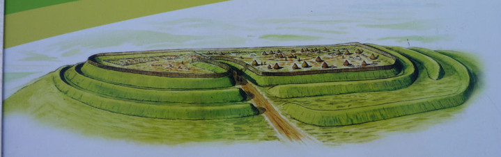 Artistic / Interpretive:
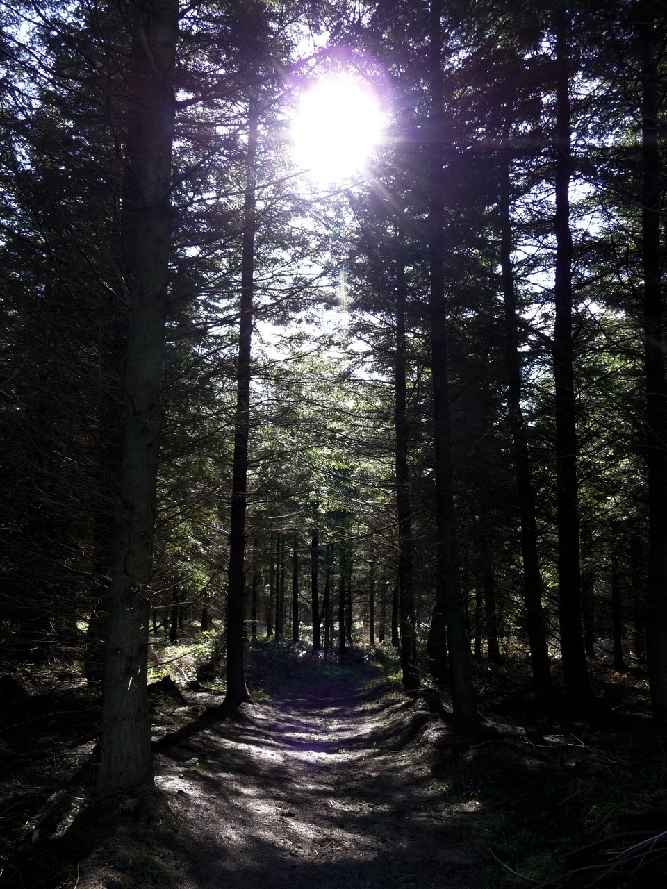
|
Fieldnotes |
|
|
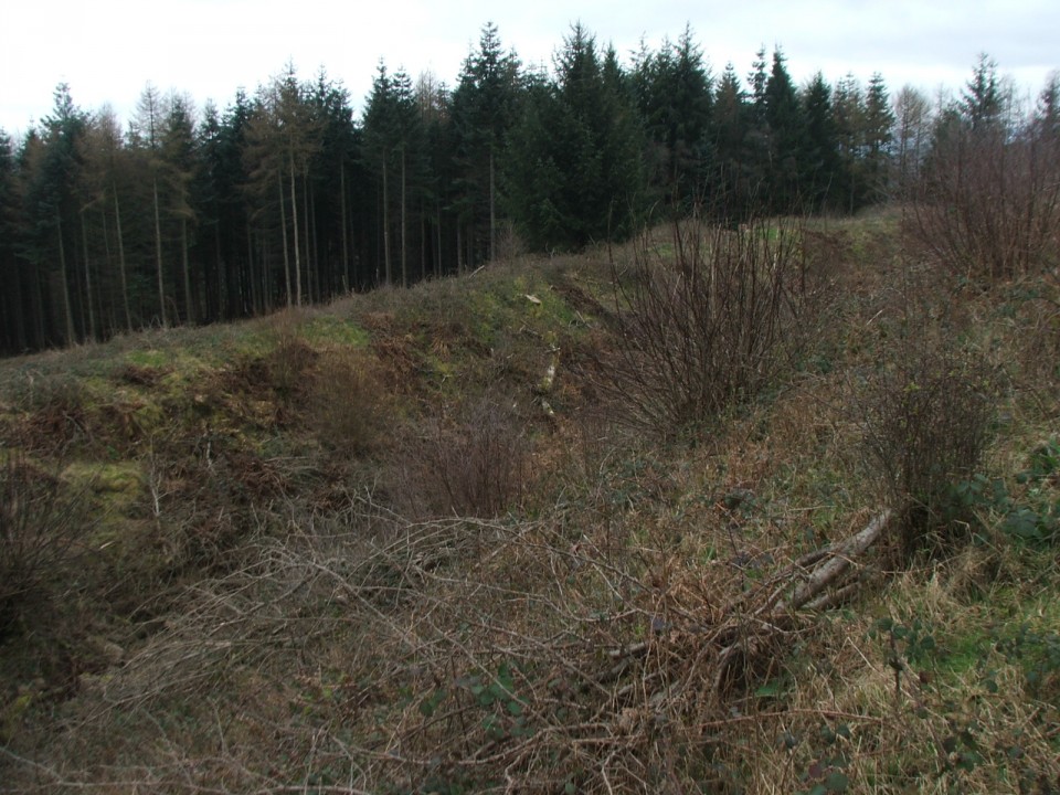
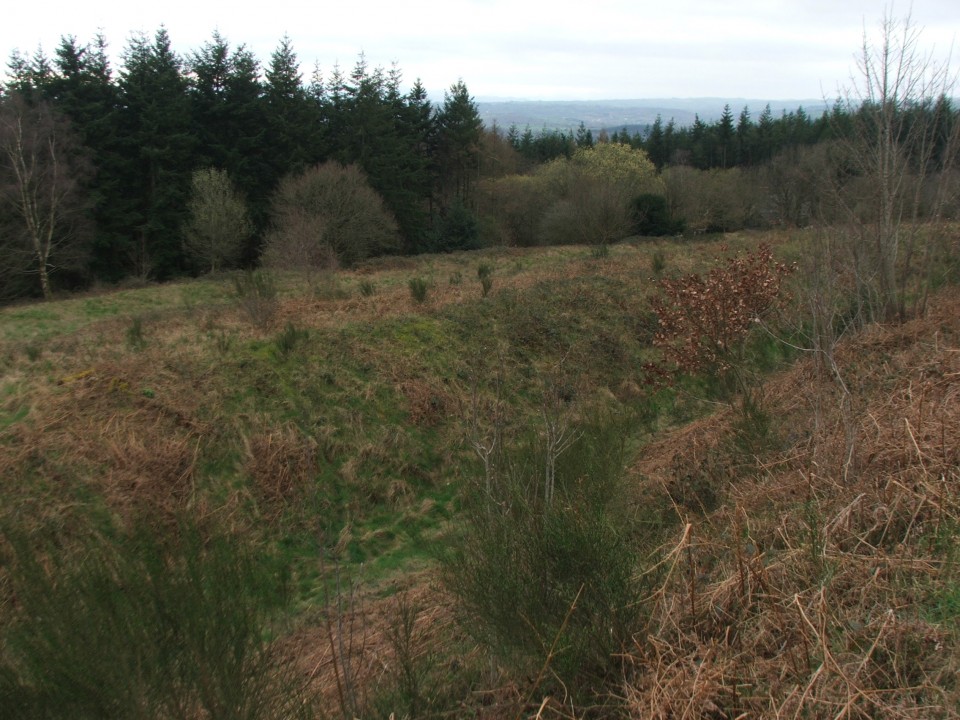
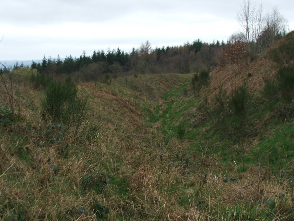
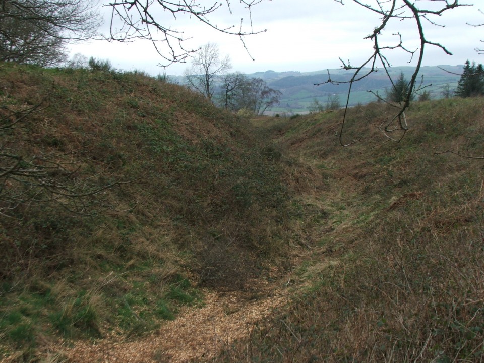
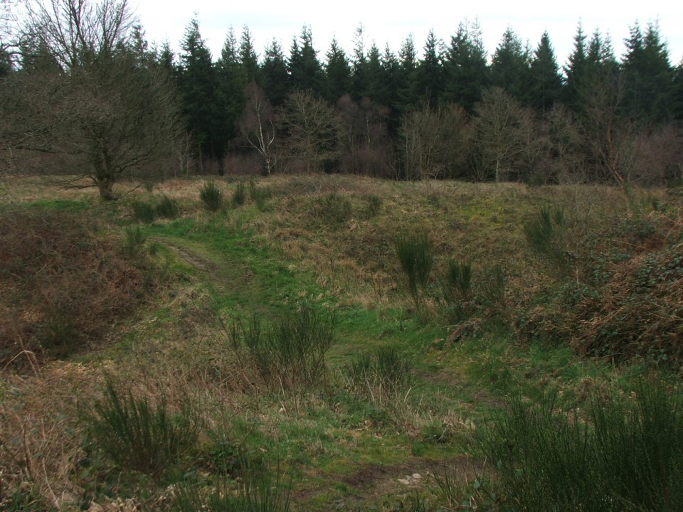
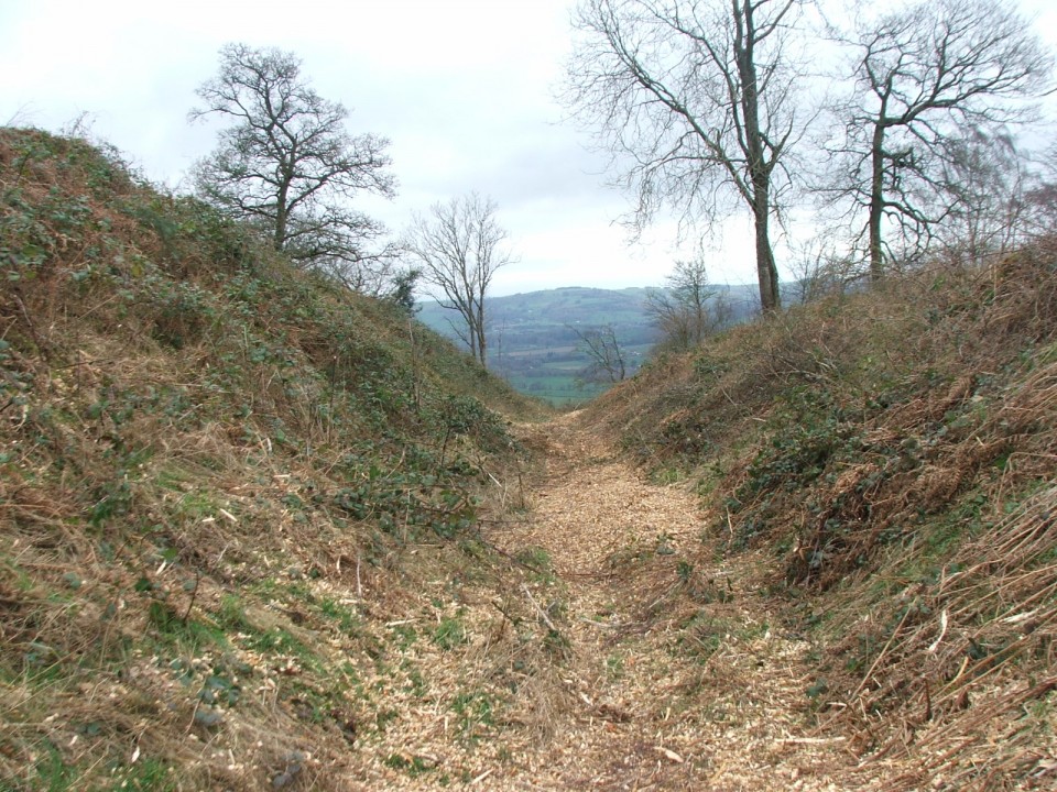
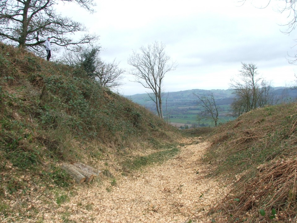
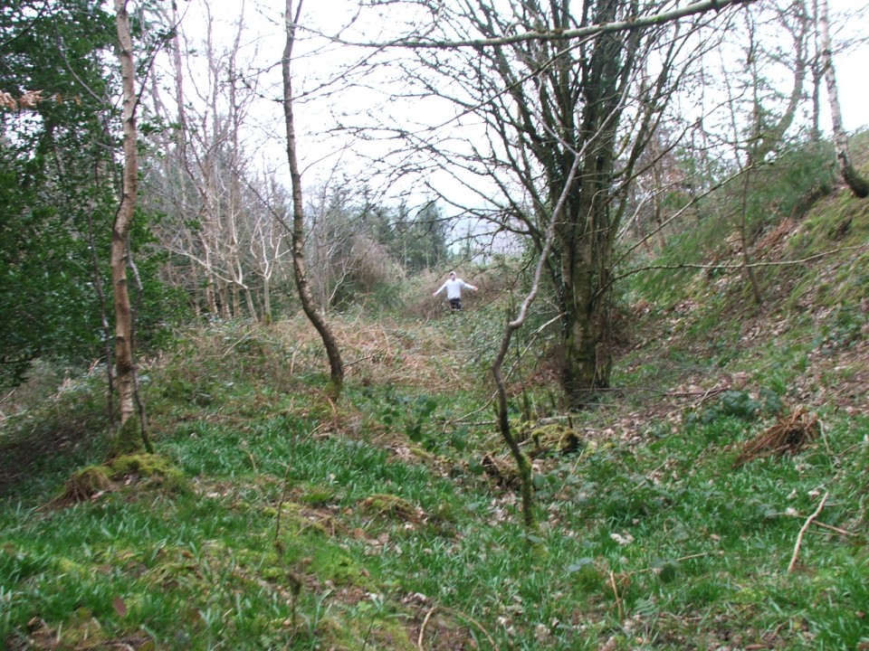
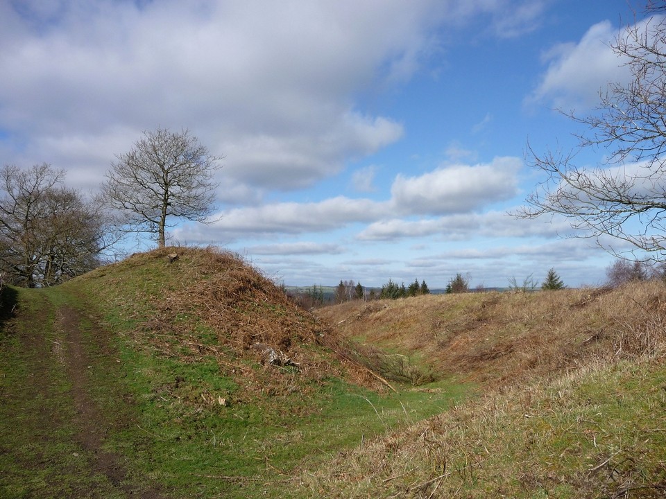
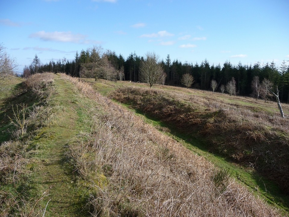
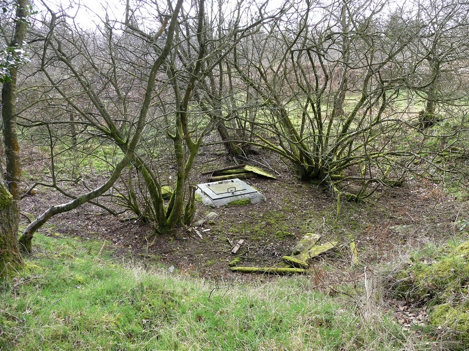
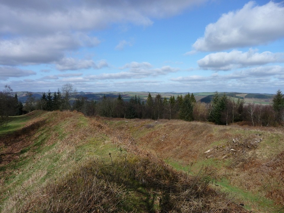
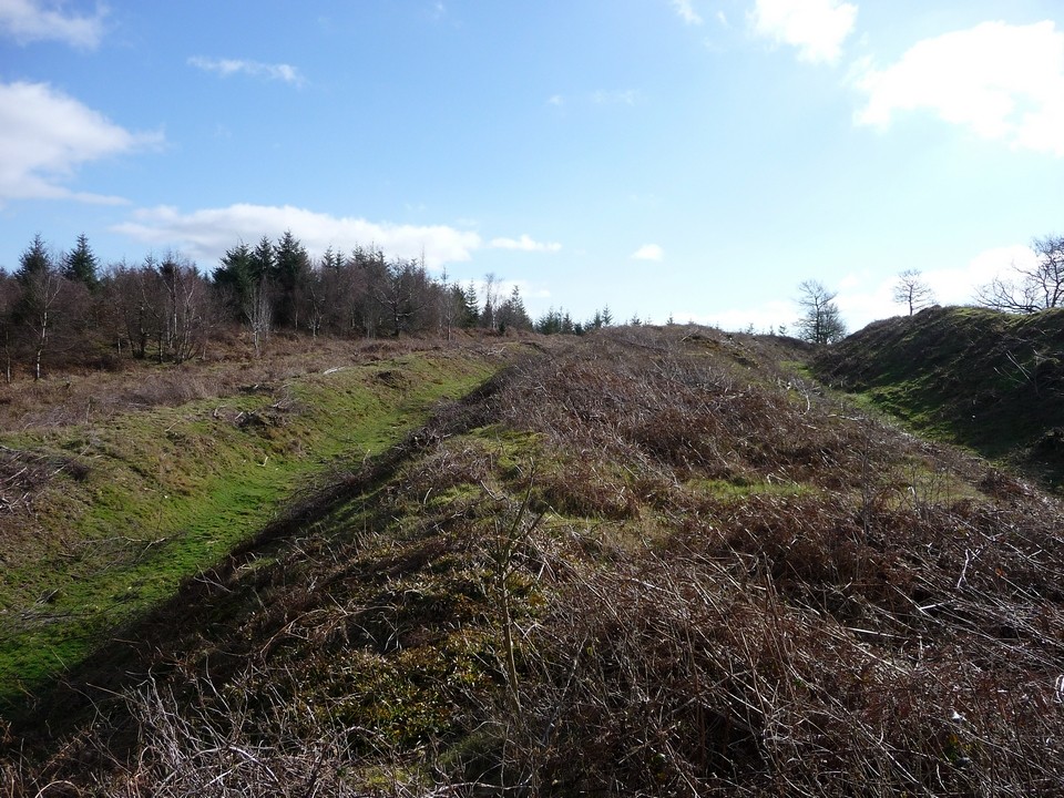
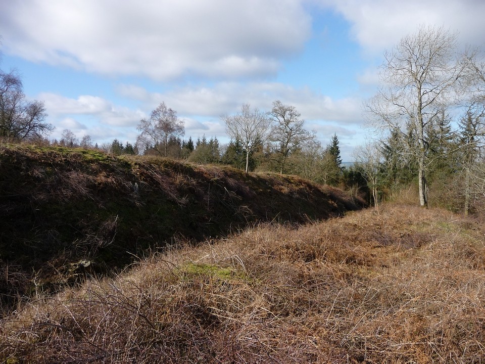
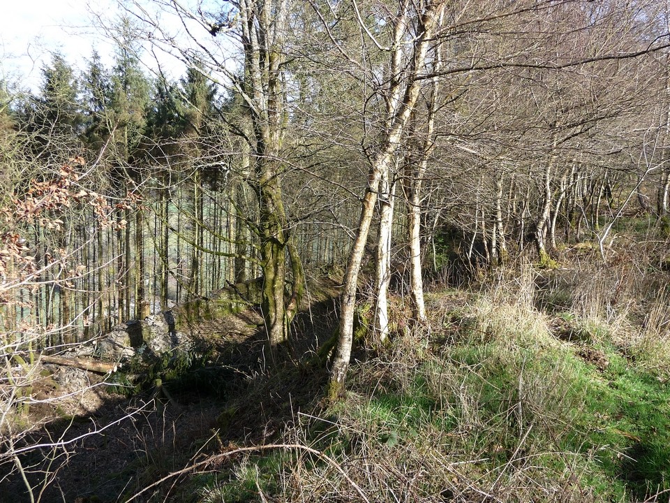
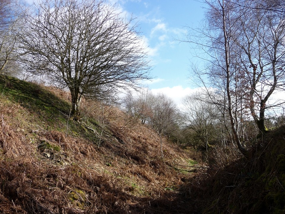
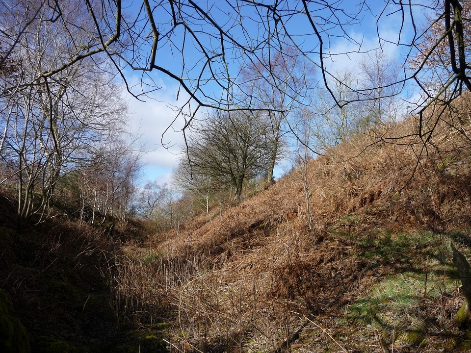
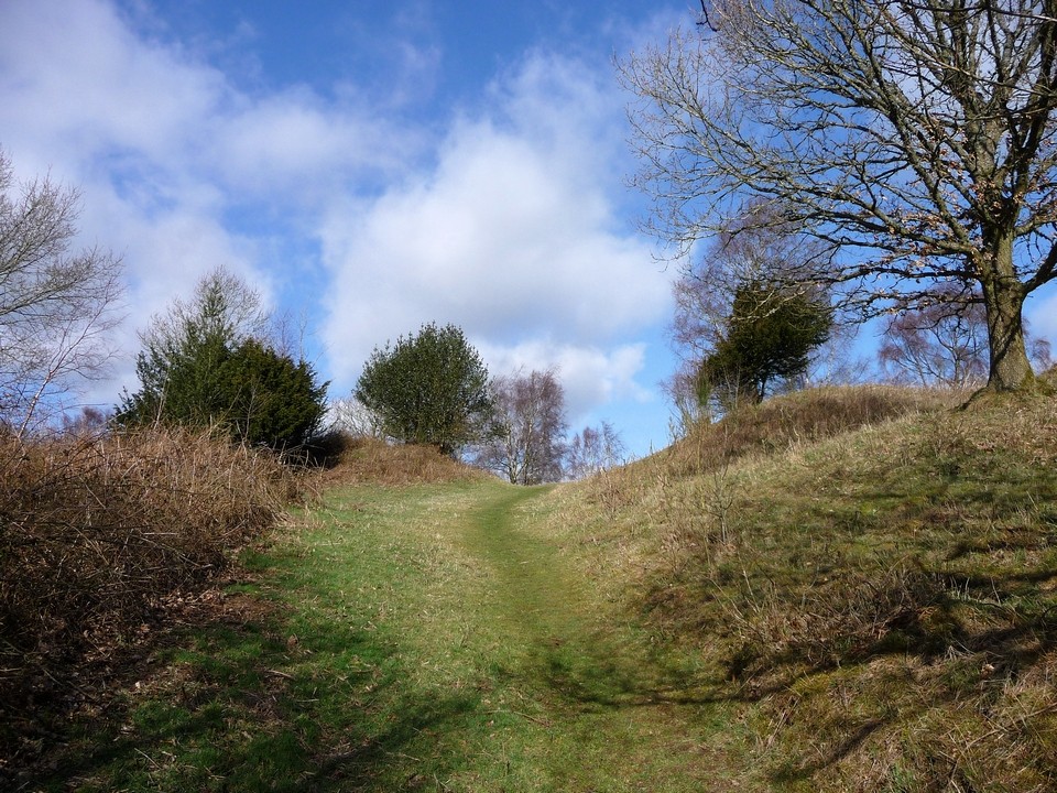
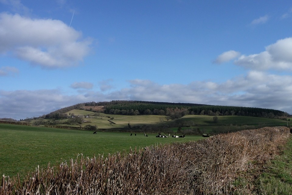
Immediately beyond the house, the trees stop and here’s the rampart and the entrance. Wow! I was expecting the fort to be in the trees but it’s not (other than parts of the outermost ramparts that the forest seems keen to reclaim into its darkness). The entrance is very impressive, banks turning inwards to funnel the visitor into a perfect trap, if so wished. The route takes a sharp turn to the left and then comes out into the fort itself. To my right the bank heads away enticingly, but I want to investigate the multivallate defences in the southwest corner first and so I head down off the inner rampart into the first ditch on that side. Inside the ditch, there is rather more vegetation, self-seeded trees and shrubs and plenty of brambles. I think a summer visit might be more of a challenge. The inner bank is very well-preserved and towers above my head to a height of about 5 metres I would think. At which point I startle a small deer very close by, which disappears off towards the tree line. I can’t help grinning now, as it’s apparent that this is an absolutely magnificent fort. And it just gets better. Beyond the inner ditch is another rampart, lower but still very impressive. The ditch outside that is much more overgrown and I don’t investigate further although I know there are another two lines of defences beyond that. Instead I head back into the inner ditch and follow it along to the southwestern corner of the fort. The manpower that must have been needed to make these enormous earthworks, using available tools, beggars belief. I suspect that if you put the entire population living within five miles of this site in 2012 (including Presteigne’s residents) onto it, it would be an undertaking of years. At the southwestern corner, the ground slopes steeply away to the west. Fleetingly through the trees the unmistakable cone of The Whimble appears. What a vista this place would have if the trees all went! Turning northeast (the fort is triangular in plan), the steep slopes provide the fort with a natural defence that doesn’t require the same augmentation as I’ve seen so far. The nearby valley of Hindwell Brook, on its way to its imminent confluence with the River Lugg, is 200 metres lower than the fort. Forestry works are underway on the northern slopes, although not actively today. I follow the northern rampart round, until the most awesome part of the fort becomes visible. The northeastern rampart is as strong as that on the south side. A gap allows passage alongside the top end of the rampart, where another rampart lies beyond, then another. In total, there are five separate lines of defence here, making this one of the most strongly built forts I have ever seen. As impressive as Maiden Castle, but without any fanfare, I would say this little known fort is up in the front rank of Iron Age earthworks. Outside the two innermost ramparts, the earthworks are more overgrown and once again a summer visit might well be a bit more of a challenge. The “entrance” at the southeast corner is apparently a modern incision into the banks. There is a signboard there, next to a kissing gate that gives access to the fort. Personally I would recommend not coming to the fort this way, as you see the ramparts straight away, whereas the approach through the southern entrance allows the wonders of the site to unfold bit by bit. I have to applaud the Forestry Commission (and English Heritage, with whom they have a partnership relationship for this place). The fact that the majority of the fort is now cleared and has been made open-access land is a brilliant thing and it deserves to be much better known. Standing on the northeastern rampart, the outstanding views just keep on coming. Rolling hills of Mid-Wales over to the northwest, then NNE you can see The Long Mynd and another of the Marches’ premier hillforts, Caer Caradoc near Church Stretton, with The Lawley beyond. Looking northeast, the unmistakable scarp profile of Titterstone Clee draws the eye. Then round to the east, where Herefordshire rolls away in a landscape of pathwork fields and wooded hills, one of which I think is Credenhill Camp. I suspect if the trees were cleared the ridge of Croft Ambrey would also be visible. And round to the south and the Forest of Dean, then the Black Mountains edge and over once more to the Central Beacons. Wow. Walking back along the southern rampart affords a good view of the interior, where ridge and furrow marks show past cultivation and pillow mounds evidence medieval use of the site. Towards the western end, passing the entrance once more, there is a fenced-off well, capped with a concrete lid. This is “ritual shaft” that was uncovered during excavation of the site in the middle of the 20th century. Not much to see now, but an intriguing bonus. At length I decide to head off, as I realise now that the bus times would allow me to fit in a visit to Credenhill Camp on the way home. I walk back to Titley along the Herefordshire Way footpath, itself a pleasant stroll on a lovely sunny day. I don’t often “recommend” TMAers to visit particular sites, but Wapley Hill has deeply impressed me and it deserves your attention. Visit. This post appears as part of the weblog entry Shadows and tall trees – Herefordshire hillforts 25 February 2012
|
 Posted by thesweetcheat
26th February 2012ce Edited 26th February 2012ce |
Folklore |
|
|
"This parish [Staunton on Arrow] has one of the few chalybeate or iron-rich springs in Herefordshire. However, it is the stone-built well on Wapley Hill that is known as a holy well. The well is within the Iron Age earthworks known as 'The Warren'. This site supposedly belonged to Caractacus and his people, and is a perfectly situated 'fort' in a very beautiful spot. A footpath leads from Stansbatch through the Forestry Commission woodland, round Warren House, and up to the well. There was clearly a spring here which encouraged the well-builders to dig this deep shaft; and despite its position almost at the very top of the hill, it has never been know to dry up. The Warren is believed to have been less a fort than a Celtic religious centre, and the well shaft may have been sunk early in the Iron Age as a 'sacrificial pit'." From "The Healing Wells of Herefordshire" - Jonathan Sant (1994 Moondial) referencing "An Archaeological Survey of Herefordshire" vol II - Davies & Bevan (1897). |
Posted by thesweetcheat 6th February 2009ce |
Miscellaneous |
|
Our attention was [...] particularly engaged in visiting Wapley hill, which is famous for its rabbit-warren, but far more for its beautiful and extensive prospect. -- Upon this hill a British incampment with three trenches is easily traced, and it must undoubtedly have been a very advantageous position for that purpose. Nearly in the centre is a remarkable spring, which is constantly full of water, without suffering any increase or diminution. -- Having arrived upon the most elevated ridge of the mountain, we beheld a circular view still more compleat than any we had hitherto observed, for the prospect on all sides was either rich, or beautiful, or picturesque.From The Gentleman's Magazine v84, 1798, in " 'A Tour Through Wales and the central Parts of England' by Charles Shephard, junior. " This suggests Mr Shephard knew TSC's folklore that the spring never dries up. And indeed it may well be true. |
 Posted by Rhiannon
6th March 2012ce Edited 6th March 2012ce |
|
See also Folklore: "The most tantalizing feature of all is an apparent sacred well or 'ritual shaft'. The latter, which are often found within rectilinear earthwork enclosures, have a European ancestry going back well into the Bronze Age. Wilsford Shaft, on Salisbury Plain, may be similar to the Wapley example. Here, a shaft was sunk during the late Bronze Age into chalk to a depth of 33m. Recovered from the bottom of the shaft was a wooden bowl, bucket fragments (dated between 1470 and 1290 BC), as well as animal bone and other evidence in the form of pollen, molluscs and contemporary soil deposits. Both shafts appear to be the openings to the realm of underworld deities*, and as such reflect concepts found in the Greek and Latin worlds. In addition, containing votive deposits of pottery vessels, animal and human bones, and wooden figurines (both male and female in form), such shafts link the cult of the underworld with that of springs and water generally, where Celtic votive deposits are also found. ..... The precise nature of the feature at Wapley remains a mystery; but the discovery within the enclosure of at least four unexcavated pillow mounds** increases the likelihood that Wapley was at least in part an Iron Age sacred enclosure. Perhaps the elaborate system of ramparts was an attempt to emphasise symbolically the share of the land apportioned by local Celts to their gods." From "Prehistoric Sites of Herefordshire" - George Children and George Nash (1994 Logaston Press). *As evidenced by what precisely? The big signpost saying "Welcome to Hades"? **I always thought that these were medieval and to do with rabbits (like the ones at nearby Croft Ambrey). |
Posted by thesweetcheat 6th February 2009ce Edited 6th February 2009ce |