|
|

|
thesweetcheat’s TMA Blog |
|
Over Gelli Hill, the hawk hangs still – 23 October 2010
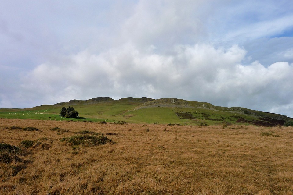
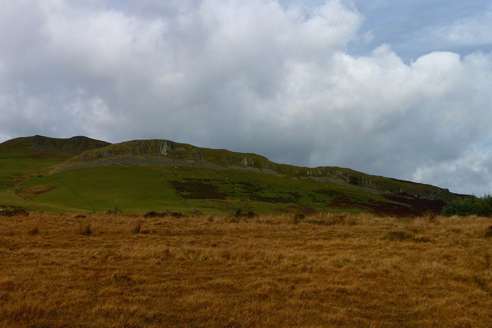
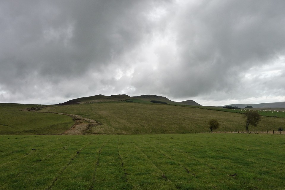
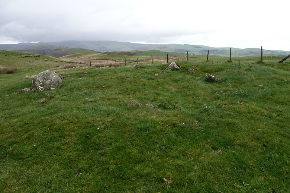
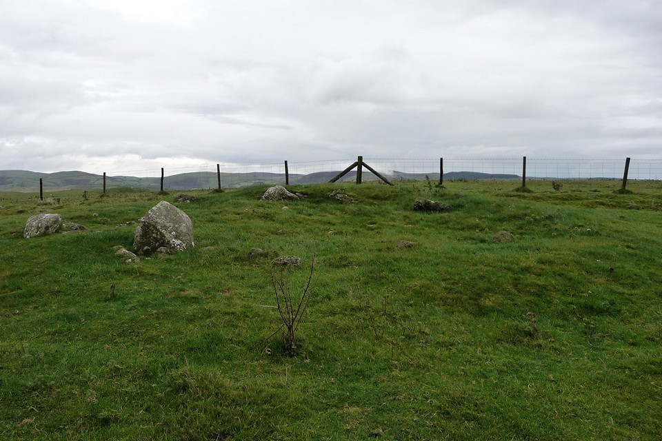
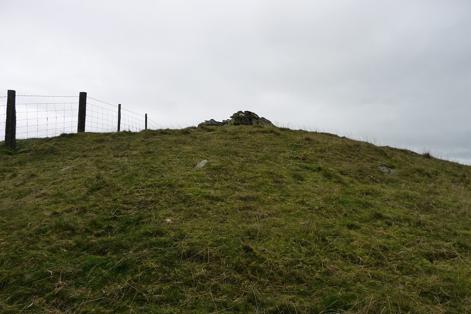
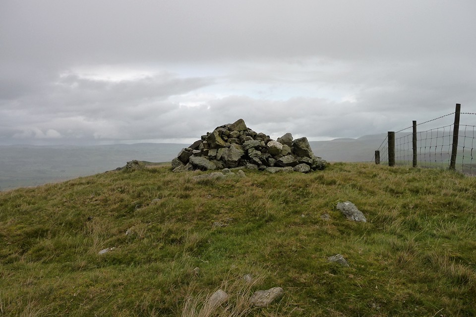
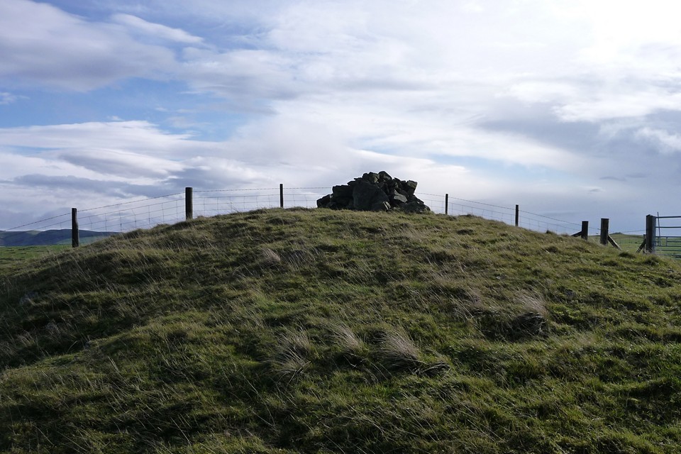
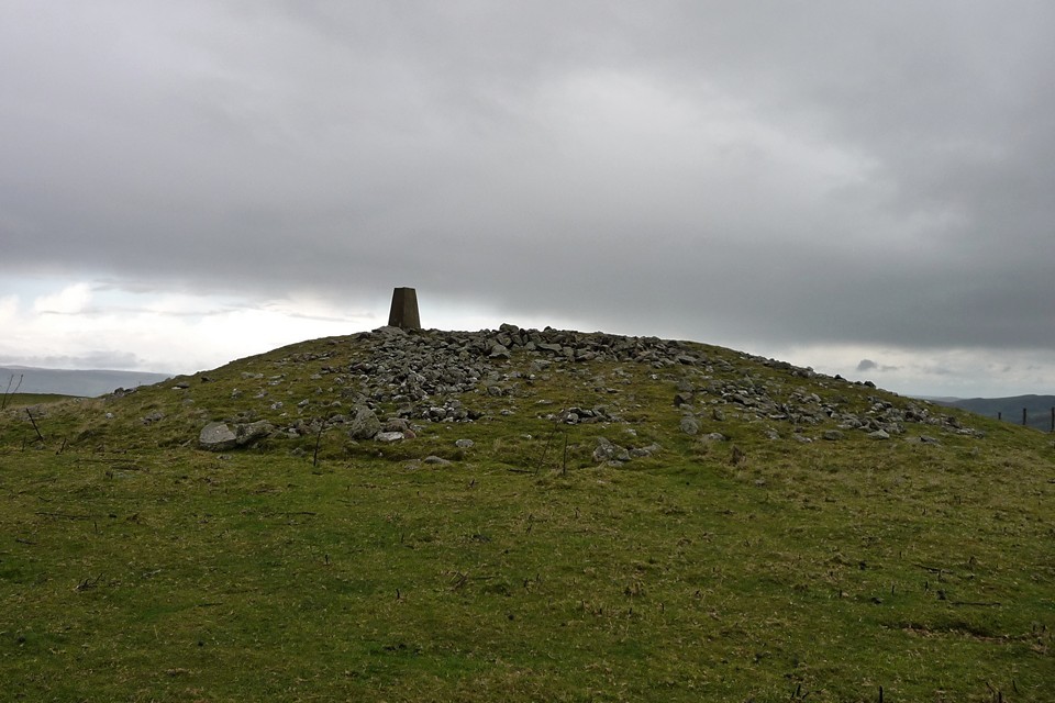
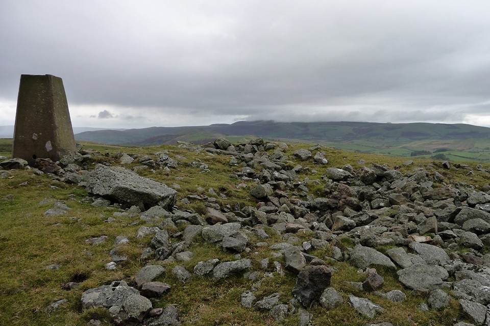
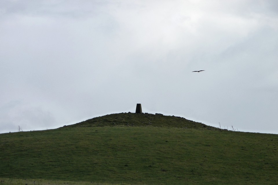
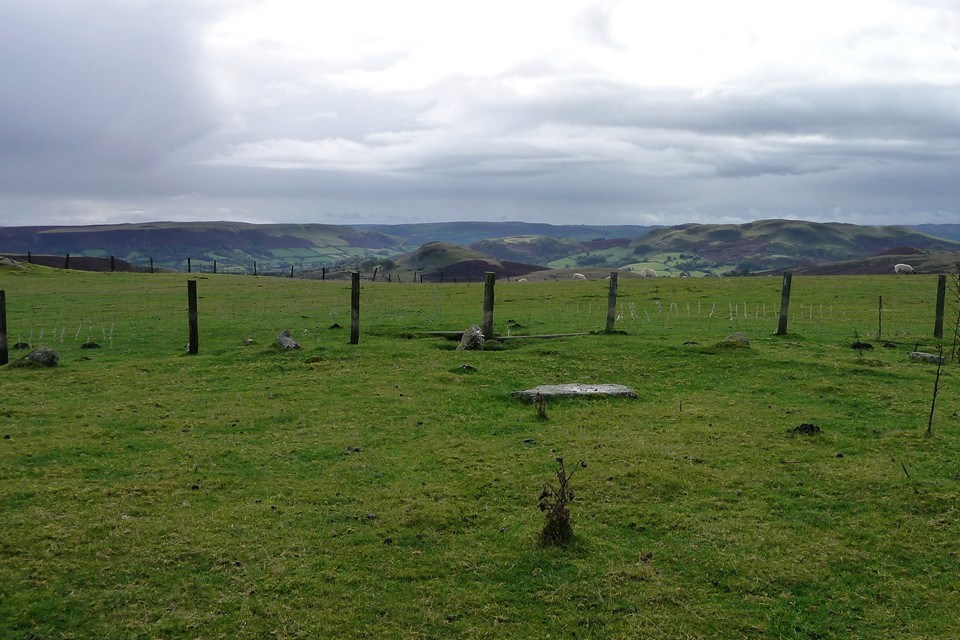
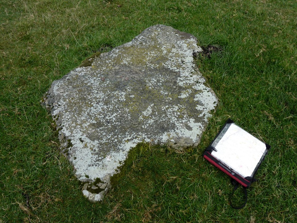
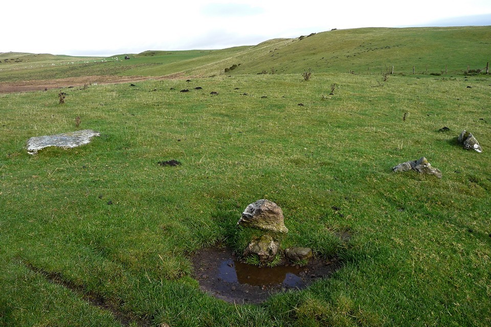
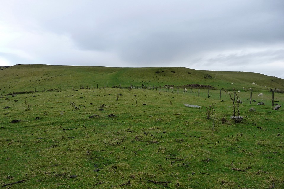
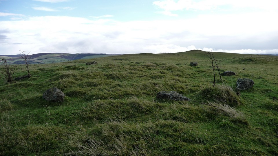
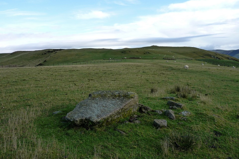
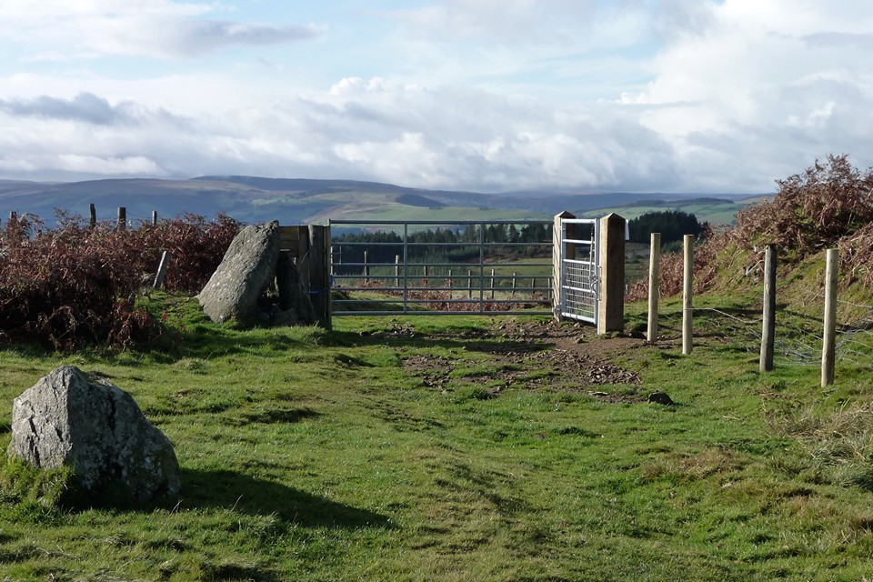
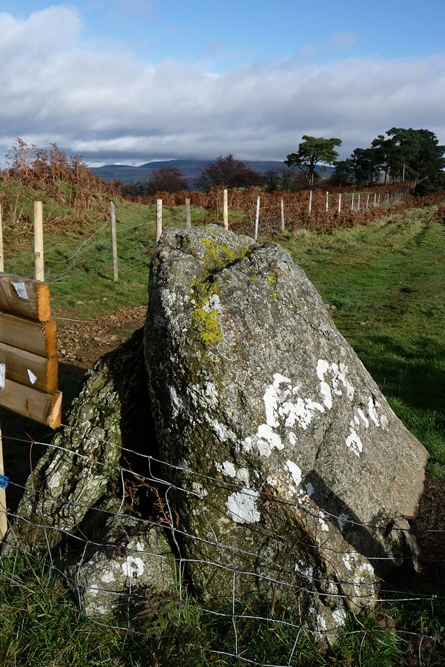
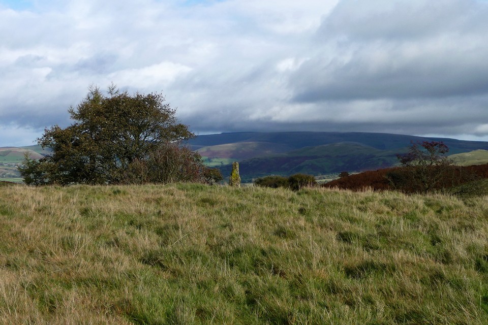
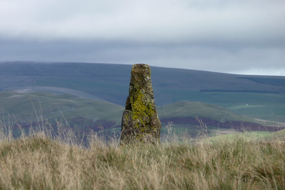
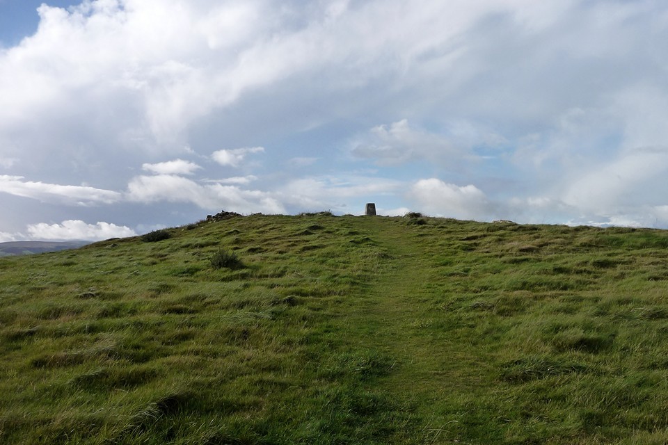
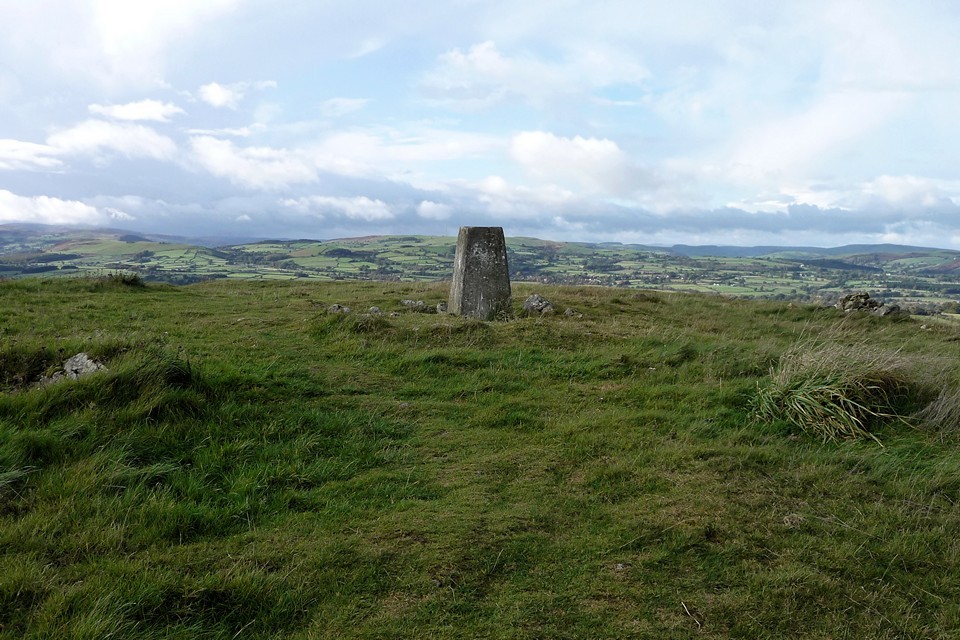
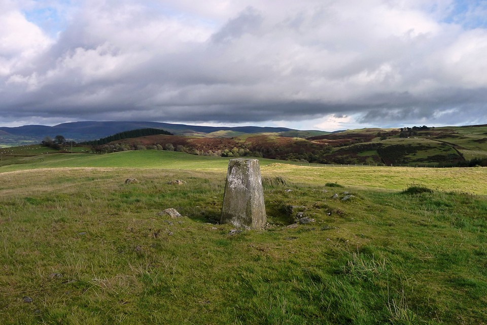
The obliging driver on the bus from Kington drops me right at the end of the bridleway opposite Larch Grove and she wishes me a nice walk. You’ve got to love public transport in these rural areas. Stepping onto the verge I’m greeted by a cacophony of barking from the house, as hidden hounds warn me off their territory. A minute later their owner (or their “human”, depending on your notions of the canine/human relationship) appears to bid me good morning and ask where I’m walking to. I tell him I’m off to Llandrindod. “Over the hills!” he says “nice day for it”. With the second set of good wishes in five minutes ringing in my ears, I take the bridleway onto an area of open common, covered in scrubby gorse and reedy grass.Larch Grove — Fieldnotes13.09.12ceMy ostensible purpose for starting the walk here is the “Standing Stone (recumbent)” marked on the OS 1/25000. Unfortunately, despite wandering back and forth across the general area for about 20 minutes, I find no stones. The vegetation makes it difficult to see and it could easily be hiding sneakily under a gorse bush. So reluctantly I give up and head on my way. There are good views of the prominent rocky ridge of Llandegley Rocks from here. The ridge is home to an Iron Age settlement, but it’s one for another day as I’ve got quite a walk to my next site. Crossing the common, a slightly alarming sight greets me to the southwest, as the hills in that direction are rapidly disappearing under a low-lying band of rain cloud. It’s starting to look increasingly like my last trip into the Radnor Hills a few months previously, when I stumbled through fog and bog over Great Rhos and Black Mixen. The streaked blue sky that started my day so nicely is looking increasingly ephemeral. The next unwelcome interlude is an encounter with a large party of men with shotguns and walkie-talkies, forming a perimeter within which presumably something alive will soon be dead. To be fair, they’re friendly enough, and we nod and grunt at each other, as you do. But I’m not sorry to be out of sight and sound of their activities. By the time I reach Hendy Bank, the Radnor mountains behind me have been engulfed in weather and it’s not looking too great where I am either. The route is an easy stroll along a byway, so I crack on. At Bwlch-llwyn, I note a “something” beside the path, a fairly small upright slab, clearly erected deliberately, leaning against a couple of blocks. Not sure what it could be (if anything). Nothing on Coflein. More interestingly, I get a nice view of Gelli Hill from here, my primary objective for the day. It still looks quite far off but the enormous cairn is already clear. Pawl Hir — Fieldnotes13.09.12ceFirst though, there’s the small matter of a ring cairn discovered on a late-night trawl of Coflein’s blue dots but not shown on the OS map. As I climb the hillside up towards the cairn, a red kite comes to check me out, swooping low above my head to display the characteristic forked tail of the species. Nearing the hill top, a low mound appears on the right of the path, with a number of stones protruding from the top. Here it is! It’s a decent ring cairn, fairly well-preserved, nothing spectacular but nicely sited on a high-point, with good views of the surrounding hills. If you covered it in heather instead of grass, you could sneak it onto Stanton Moor as an embanked stone circle and you’d get away with it. Definitely worth the walk and shame on OS for missing it off the map (hooray for Coflein obviously). My newfound red kite friend comes back to see what’s occurring. Not much, actually. Gilwern Hill — Fieldnotes13.09.12ceOne field on from the ring cairn, I leave the comfort of the broad byway and head uphill on a footpath that leads direct to the cairns on Gilwern Hill. At this point, the cloud and light drizzle turns inconveniently into a proper mid-Walian downpour. The top of the hill is cairn II itself, a large grassed-over mound the best part of 20m across and well over a metre high, with a little walkers’ addition on top that I didn’t expect to find in such a remote spot. Evidence of the mound’s stone construction is apparent from protruding stones, otherwise it could easily be taken for an earthen round barrow. A modern post-and-wire fence cuts across the southeastern side of the cairn. Aside from the lashing rain, this would be a fine spot with extensive views, particularly of the neighbouring Gelli Hill cairn. Gilwern Hill cairn III is supposedly close by. I can’t see any sign of another cairn here. I head on down the hillside, southwest, hoping to find cairn I. This is shown on the map, but I fail to see any sign of it either, as it’s at this point that I begin to realise that the field patterns shown on the OS map have been altered and replaced by post-and-wire fence lines in other places, as well as a re-routed farm track. These re-arrangements will come back more strongly later in the walk, but here it conspires to confuse me and I fail to find cairn I. A pair of red kites hangs over cairn II on the hilltop behind me; this is obviously a little haven for these magnificent birds. Gelli Hill Cairn — Fieldnotes13.09.12ceDespite the confusion of fences, the Gelli Hill cairn is a big bugger, so there’s no missing it. It helps greatly with orientation and perhaps it was always that way, helping visitors to find the diminutive stones of the nearby stone circle over the millennia. A proper, stone-built monster cairn this, damaged by digging and the addition of an OS trig pillar to the cairn’s top.There are big blocks amongst the smaller rubble, perhaps there was a central cist of some sort? It’s reminiscent of the cairn on Bache Hill not far away. To re-inforce the point, the top of the Whimble peeps into view briefly through the cloud. There would be great views of the Radnor mountains from here, but sadly the tops are still enduring a deluge and are hidden within a curtain of grey. Luckily for me, the heavy rain that marred the visit to Gilwern Hill a short time earlier has mostly passed over, leaving behind light drizzle and a substantial drop in temperature. Gelli Hill — Fieldnotes13.09.12ceThe stone circle is close to the big cairn and should be really easy to find from it, look, just follow the fence northwest until it meets the bridleway, follow the bridleway along, job done. But it isn’t, because the ground is more up-and-down than you’d think and the fences have all moved! So it takes a while to locate the circle, Mr Burl’s description helps, although he doesn’t mention the big slab in the middle of the circle (off-centre). One of the new fences hems the circle in closely on its southwestern side, not like the open field shown on the current 1/25000 map. The circle is a ruin, and even when it was brand-spanking new would have been a little underwhelming for anyone who’d been to any other stone circles anywhere. Perhaps they hadn’t though, or perhaps the ritual quality was so impressive that the circle was nothing more than a performance space. It was all about light and magic here, maybe. To be fair, the setting is fine, with nice views especially to the west where the ground drops down to the Wye valley. The off-centre slab is intriguing, unsure whether it’s an original feature or a more recent interloper. Big though (see picture with map for scale). The other stones are pretty small, none more than a foot or so tall, some are buried – there are mole-hills inside the circle that are taller than some of the stones. Burl reckons it’s one for the “determined”, I won’t disagree as that should be enough to bring many TMAers anyway. I spend a good while here, wandering around the perimeter rather than sitting as I’m feeling the cold a bit now - the sky has started to clear and blue patches have appeared but there’s a distinct chill in the air and my boots are squelching a bit from the earlier downpour. Gelli Hill stone — Fieldnotes13.09.12ceI head on over to the outlying stone. It can be seen from the circle, so isn’t hard to find in clear weather. Wedge-shaped, is it fallen, was it always recumbent? There are various smaller stones scattered nearby which would make for promising packing material, but might equally just be random scatter. It has very decent views of the big cairn and over the valleys and hills to the west and northwest, I guess maybe towards Pumlumon and the major watersheds of mid Wales. Returning to the circle, a red kite hovers over the cairn, I’d love to know if it’s the same one that’s been tagging me since Pawl-hir ring cairn. I decide to head back to Gilwern Hill for another look at the hilltop cairn without the pouring rain. As I head east from the circle, not following the same route I came on, I come across a ring of earthfast stones in the next field and realise that this is the “other” circle that Postie had posted pictures of. This is a weird one, it looks genuine, it’s very nicely placed, but there’s no record of it anywhere, not on the OS, not on Coflein, not in Burl. All of which suggests it’s modern. Nice though, I’d have one. I head back to Gilwern Hill by a more direct route, climbing a fence and avoiding a quad-biking farmer on the way. In sunshine now, this does have a nice feel to it. The views have opened right up and stretch away over gently rolling hills, fertile farmland and pleasant valleys. Yep, this is a good spot to sit a while. Ffrwd Stone — Fieldnotes13.09.12ceFrom the Gilwern Hill cairn I head back north to byway and past a scenic little lake at Ffrwd. A padlocked gate across the byway is accompanied by an chunky upright megalithic slab, spotted with yellow lichen and leaning against another smaller slab. Coflein places Ffwrd stone hereabouts, this fits the (limited) description, but is it “it”? The location is only approximately near the Coflein blue dot, so it’s not certain. Carregwiber (stone 1) — Fieldnotes13.09.12ceI skirt the hill below Carregwiber fort, I had tentatively hoped to get a visit in but I’m tiring and quite cold now, so decide to press on. Instead I manage a quick stop at Carregwiber stone, which is a small stone that in many places would be dismissed as a rubbing post, but here we seem to be surrounded on all sides by standing stones so it’s part of a complex. It’s a shapely, tapering stone, set above a slope to give greater prominence and a terrific view of the Radnor mountains. The ambience is rather spoiled by the carcasses of a rusting car, caravan and assorted junk in close proximity, but don’t let that put you off (too much). From here the path drops much more steeply to Llanoley, where someone is making a living carving and polishing tree-trunks into gorillas, marlins, bears and seals. There’s a good view of Carregwiber fort from here, displaying the natural defences of the slope. A minor road heads west, to the penultimate site of today’s walk. The Beacon (Llandrindod) — Fieldnotes13.09.12ceThe second trig-surmounted cairn of the day, The Beacon is less impressive than Gelli Hill cairn. It’s quite reduced and low, but it does boast similarly expansive views to many of today’s other sites, especially to the northwest where Llandrindod nestles in the valley below. Carregwiber fort can be seen, and the Radnor Mountains provide the backdrop to the northeast. It would have been a fair size, judging by the footprint and stonework protrudes here and there through the grass. Access is easy, a footpath leads straight to the cairn across a single field from the road. I don’t stay long, but head on to Little Hill VII. Little Hill VII — Fieldnotes13.09.12ceLittle Hill VII proves to be a rather uninspiring end to the day. A very overgrown cairn, on a golf course. Not one to make a special effort for, unless you like golf (I don’t). I always feel sorry for barrows on golf-courses though. If they manage to avoid being turned into a landscaping feature (like a couple of ones on Ludlow racecourse), they seem doomed to be “in the rough”, where vegetation is encouraged to smother them and legions of pringle-clad middle-aged men assiduously try to avoid them. Shame. The final walk down to the pretty town of Llandrindod is easy and uneventful. I like the monster in the lake though. This area of Wales deserves to be better known in TMA circles, I reckon. You are practically falling over stones and cairns at every turn, the countryside is strikingly beautiful and very quiet. Hmm, perhaps I shouldn’t tell anyone after all? Llandegley Rocks — Images26.12.10ce
Pawl Hir — Images26.12.10ce
Gilwern Hill — Images26.12.10ce
Gelli Hill Cairn — Images26.12.10ce
Gelli Hill — Images26.12.10ce
Gelli Hill stone — Images26.12.10ce
Ffrwd Stone — Images13.09.12ce
Carregwiber (stone 1) — Images26.12.10ce
The Beacon (Llandrindod) — Images26.12.10ce
Little Hill VII — Images26.12.10ce
|
 Posted by thesweetcheat
13th September 2012ce Edited 13th September 2012ce
thesweetcheat's TMA Blog
Latest TMA Blog Posts
|
Comments (0) |
|
| You must be logged in to add a comment | |