|
|

|
wideford’s TMA Blog |
|
AROUND THE GARSON SHORE AND OVER BRUNA FEA September 15th 2012
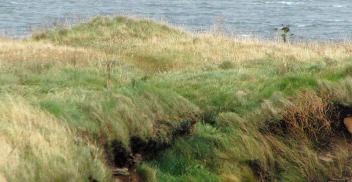
| Now that they have the go-ahead for the new Stromness pier I thought it time to re-visit the (at latest) Early Iron Age remains of Quoyelsh in case the approach to the point became blocked by this development, at least while it is being made, and fortunately this day the low tide fell during the day (though not as low as when I walked the shore al the way from the Bridge of Waithe). It has been a while since I have been to the Hamna Voe, and the building works at the head of the inlet are far advanced. The way I wanted to go said Building Site Only so I retraced my steps and found another way in. I took a chance on this and it is only when almost at the new path that I finally saw a notice that you could still use this whilst construction continued - it would only have served a purpose if stuck at the perimeter gates ! Coming round the bend I partly used the tarmac and grassy paths and partly the low grassy cliff beside it. You can get down onto the shore at a couple of places, but when you reach Copland's Dock either you cross a slippery stretch where a very shallow stream outflows or you go back through the dock. What from a distance looks like a ruined pier is the line of the White House Rocks, which form a short breakwater. The old dock hasn't been used in a very long time and now presents as an enclosure surrounded by high brownstone walls, on the spot formerly occupied by the White House of Pirate Gow Fame (though there is another over in the town of Stromness that came to replace Cairston as the chief area of the parish. Garson is the present phonetic name of Cairston, 'cairns tunship' named for all the mounds in the locality, the best known being the fully excavated and partially dug brochs. The dock interior is covered with grass but there are perhaps ruins of internal structures underfoot so you stick to the walls pretty much. Against the east wall is the only upstanding structure, a drystane fireplace. Not your typical hearth, what with small refectory bricks and and rusty iron plate supporting a large 'lintel' over the entrance. It is difficult to work out what purpose it served though it does seem more industrial than what you would think belongs in a dockyard - would be nice if it occupied the place of a fire in White House but seems unlikely. I'm more certain that the gates and walls could have come from back then. One odd feature in the wall itself is a long rectangular gap near the base that has been blocked up with several courses of thin slabs and has a wooden 'lintel' above. Despite low tide the seaweed rendered the beach an awkward route from here, and so I followed the track to the western tip of the Bay of Navershaw - the Point of Quoyelsh. What I hadn't observed before was that there is a small low mound on the broader part of the headland - probably to intent on looking for a rise where the Iron Age settlement is revealed in the cliff-face (though what is thought by the discoverer to be a corner resembles a cell rather). The pottery evidence found is possibly even Bronze Age, the mound is surrounded by damp ground so perhaps a teenie burnt mound ?? The whole cliff top on the western side looks suspiciously level to me. I think the term is lens. Let your eyes travel right and a stoney half-circle in some turf below the clifftop is all that can be seen of the Quoyelsh site (though later I find one isolated lichen covered stone on the surface just back from the edge here, though this may be simply lying there). It is definitely a built feature, but even I had to confirm with the archaeologist that this was it ! There are narrow courses, kind of, but these aren't all that even and consist of every kind of non-circular stone like the worst conceivable drystane dyke precursor. Perhaps it represents a deep platform rather than a standing wall. Something else new is a three-lobed stone just below the clifftop abouthands of where the headland starts, with its back to the cliff-face. But when I eventually manage a decent look I see modern graffiti and my hopes are dashed - found object or brought here to show off, no context as they say. Near the point I carefully make my way down. I need to have slides and (by my 'stills' camera) video to add to what I took last time. Oh, darn that seaweed... and the slippery rocks... and the howling wind. I' not sure I didn't feel safer up on the rocky surface up in front of the 'site', even with that gale tugging at me. Strangely enough the site seems stable as it is, because the thin slab sticking ot on its own at forty-five degrees is unmoved a whole two years later. There may be further archaeology nearer the actual point but it is only a few scattered stones apart from a long white stone below at shore level that could be part of a moulded ?floor (or merely an outcrop - forget its place again, must do better). Couldn't get to the site's left and so eventually went up top again. Headed straight for the peedie mound, very squishy ground away from the cliff. Actually much of the apparent height is grass, a vertically enhancing 'cropmark', so there is probably depth to whatever it is. Leaving the Point of Quoyelsh to look for another Iron Age site near the eastern tip of the Bay of Navershaw the way between fieldwall and clifftop soon narrows. Shortly after the fieldwall ends I find myself crossing what seems to be a very short bridge. A little further on the track disappears entirely and I am forced to retrace my steps virtually all the way back to the point before I can go onto the shore and continue. I find that the 'bridge' goes over a tall narrow hollow and I remember my previous walk along this coast seeing what I took for a small cave. I had no time to investigate then but this is by it. I can see that that fieldwall end over to my left is matched by another to my right. The assumption is that the stonework is from a wallbase from these two continuing and meeting. But for one there was no sign either visually or underfoot of any such fieldwall. And for another the bridging stonework is far too good for any drystane dyke I am familiar with - six shallow courses filling a small hollow and set back into the earth with a perfectly flat face. And there is no wall surviving at ground level. Curious. To find Dave's other site (NMRS record HY20NE 4 near the northernmost part of the bay, at HY268092 about halfway towards Bu Point). As well as pottery and a midden signs of structures are described as five single-face walls in the side of the cliff. I decide to hug the coastline in case I see anything for myself. Where the clffs come down the shore is a visited beach at times, but not quite that now. At the shoreline there is a broad swathe of low carpeting vegetation, Beneath which there may be stones, though my feet didn't say whether natural or man-made of course. Across this section there is a long patch of darker brown forming a shelf in the 'cliff'. My brain says breccia but I questioned this - looked like compressed seaweed but I hoped for archaeology of course. Went closer and touched it. A slightly less than hard matrix with a few stones. Much later my second-guessing mind was proved wrong when I found online pictures of breccia. When the cliffs rose again I still hadn't found the 'Garson' Settlement. But a) I could no longer see the fences to place myself [though I suspect it is close], and b) my way on was blocked by the sea on this occasion. And so I clambered up to the field's edge and tried to work out the way the people I saw last time came down because I know it exists. My hopes lay eastward. Along the edge there is no crop and the NW corner even the wild vegetation is sodden. Between this and the next field a broad drain empties over the shore, however surely if the marshy area is merely overflow the farmer would have tried to stem it ? Across the drain a path does come toward the shore but looks to stop short and there is barbwire at the coast. Tried going up the field's eastern edge but the footpath here stops at the top and I see no gate for folk coming from Garson way to use and turn back. Approaching from this direction the Quoyelsh site seems to be the northern bump of a saucer-shaped depression whose other side is at the headland point itself (where threadbare possible archaeology needs the leap of faith). Much later I find a webpage on the geology at the Point of Quoyelsh that shows this being where the Lower Stromness Flagstones give way to breccia, into which a felsite outcrop intrudes from the point (the outcrop being the fully exposed rocks at the end) - see http://www.landforms.eu/orkney/Geology/Basement/basement%20Quoyelsh%20Felsite.htm . Maybe not a coincidence that the site is at this landform, as tools were made from felsite. Ventured down again and took some more photos. The site has a rock shelf, and if it hadn't been blowing a gale I might well have tried to get to this from the cliff as I did at the Knowe of Verron in Sandwick. No, no, not this day. Starting off again I saw the tide at low ebb allowing a 4X4 to make its way from Inner Holm onto the mainland. I am fairly sure that the new pier's architects will not have done modelling with a tank to see what effect this will have on the coast here and wouldn't be surprised to see a build up of material joining Inner Holm to Cairston on a more permanent basis (for the first time since prehistory I would hazard). I went back through Copland's Dock and then turned left up the broad farmtrack to the new estate. I must say this has boomed since my last time there when all the houses were by the coastline. And now the industrial side of Garson has filled up, it now has a specialised Park like Haston Industrial Estate. Walking between this and the elevated housing estate I could have been in any town down south [specifically it reminded me of a road in Bury St. Edmunds I used to walk]. Had thought about a walk through Stromness but researching walks for the Blide's Out and About I realised that whilst I had lived at Garson I had never been on the track that goes from the Howe Road to the main Kirkwall- Stromness road. So at the road bridge over the mill burn I turned left onto the Howe Road and strode uphill. Up above me below the track a large cut in the hillside looked awfu' bonnie in the sun, the long disused Maraquoy quarry topped with bright flowers. I have a thing about grassy tracks and love to photograph them when they present themselves just right, and this one hit in several places. It passes over the highest point of Bruna Fea and there is a mast here enclosed by a steel fence with the other repeater station gubbins. This is a gae exposed spot and the winds were even stronger than down off the coast. The gale wasn't content to just pluck at me but buffeted my whole body. Invigorating. From here you can see the whole of the town of Stromness laid out before you. This will be a grand vista to photograph when the air clears ! That was to my left. Looking straight along the track to the Quholmslie area there is amongst the modern buildings a nice old brownstone farmstead, now fallen into decay, that I have seen atop a hill when going to the Stromness Loons. From there it is more isolated. This is Viewfield ( HY21SE 77 at HY25681104). On the first 6" O.S. this is shown as two buildings (one still roofed) in an enclosure, but on the present 1:10,000 as only a roofed building. I think the phrase is 'economical with the truth' as it is all obviously still there - I think maps nowadays can tend to simplify what is seen, as I have seen a very similar thing with a site by Saviskaill on Rousay (though PASTMAP shows the reality near enough). Coming down the other side of Bruna Fea I gazed down on Cairston Mill (Millhouse) and up the Burn of Sunardee millstream to Stairwaddy (whose first element 'rocky' appears as steiro in two broch names) and the wide weir before it. On reaching the main road from Rosgar I considered going across onto the road to Sandwick for closer shots of Viewfield. However I felt the bad weather closing in again and so turned right to precede the next bus, which caught up to me when almost at Deepdale. Safe but wet in myself (from the heat) and my claes (from the heavy rain). Quoyelsh — Images07.10.12ce
|
7th October 2012ce wideford's TMA Blog
Latest TMA Blog Posts
|
Comments (0) |
|
| You must be logged in to add a comment | |