|
|

|
|
Castell Tregaron. Sunnyhill wood campHillfort
|
||||||||||||||||||||||||
|
|
|
Images (click to view fullsize) |
|
|
Fieldnotes |
|
|
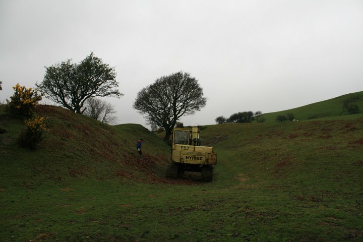
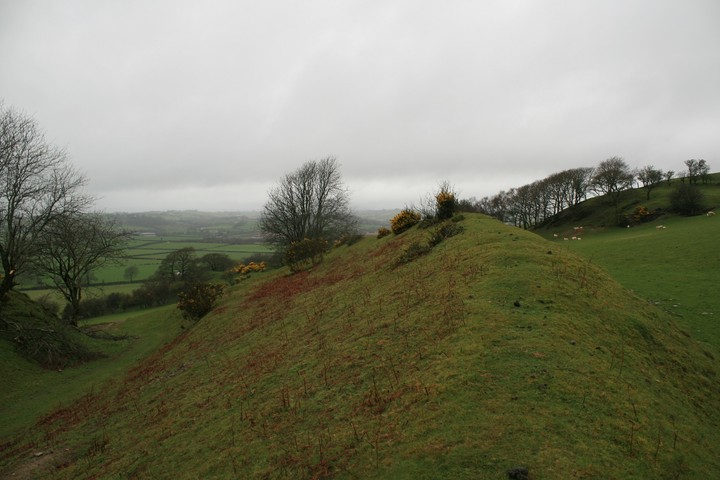
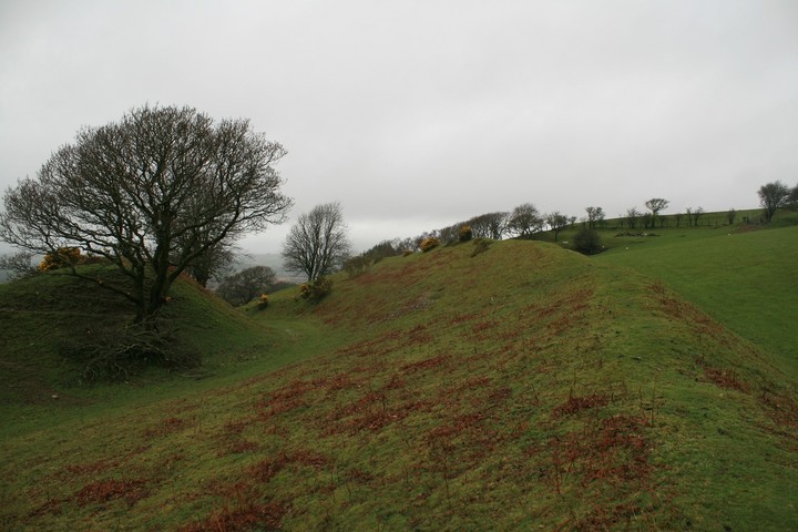
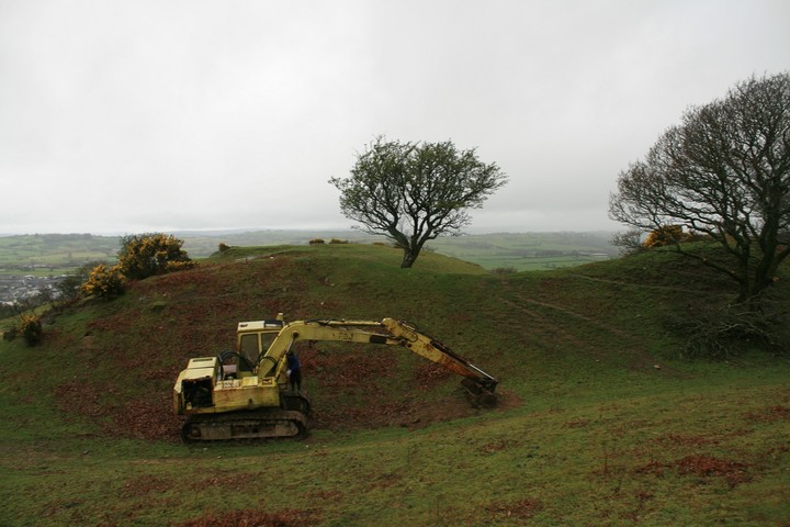
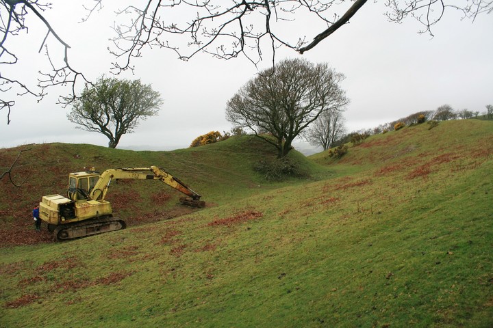
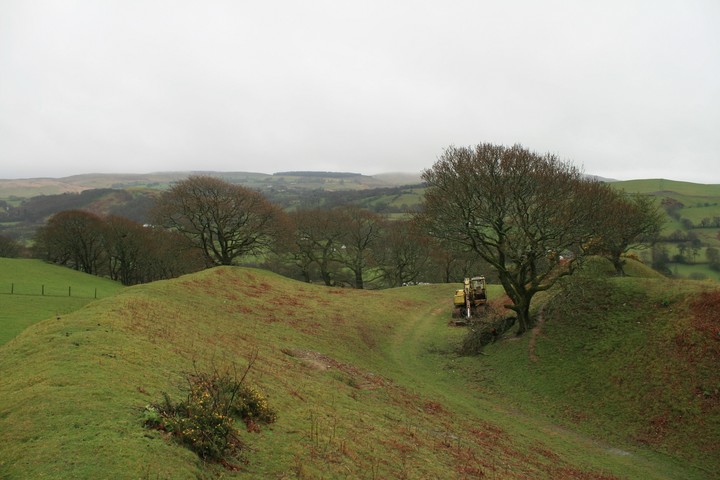
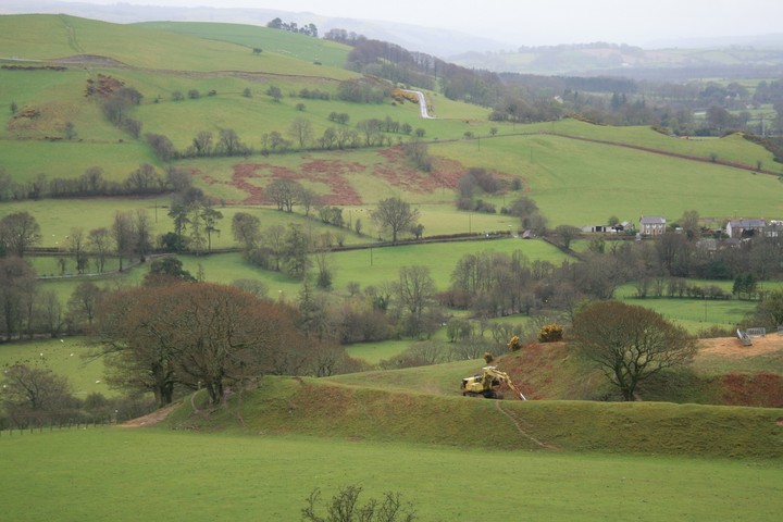
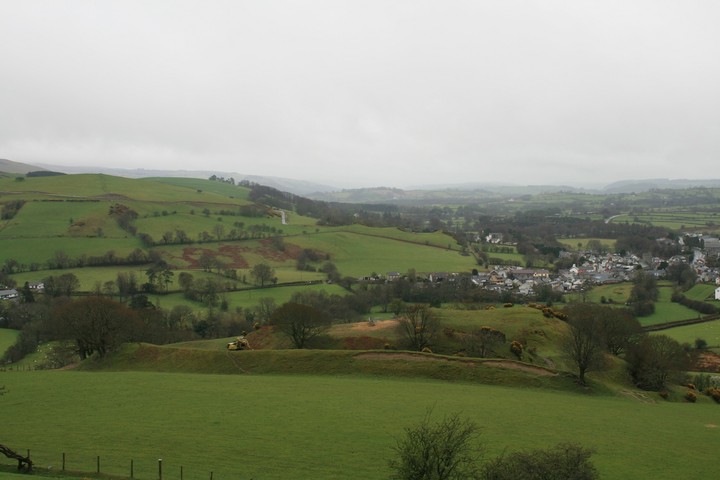
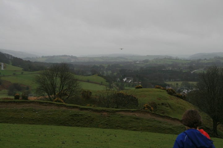
We parked in a passing place, naughty I know but I crammed the car into one end still leaving space for passing, then walked back down to a house whose name we couldn't make out from the road. Next to the house is a gate which we quietly crossed and made our way through another sheep and lamb infested field, why do we have so many sheep ? I don't eat mutton or wear woolen clothes and only eat lamb rarely, who is eating all these sheep? We made our way up to the fort, it's quite steep but it only takes ten minutes to get to the top. This is one great hill fort, the map shows it as a spiral earthwork. The banks hiding the central summit are well over fifteen feet high, they don't really leave much room for habitation inside, maybe a hundred, no more. There was a digger in between the two high ramparts and it had scraped back the top layer of earth, exposing much stone and some bones (probably sheep), I'm no law student but that seems illegal to me, digging inside a scheduled ancient monument. Eric wondered if Time Team had been here and we'd come during they're tea break, he then set about trying to hot wire the digger, so I left him to it as I'd seen the battery not hooked up and the whole machine looked pretty knackered, but at least he wasn't asking if we can go now. We then walked a little to the north west and up hill a bit to get a view down over the fort, it was an epic view, the fort really is very impressive, and the hills gain in height to the south west where Bryn Y Gorlan stone circle is. then as we walked back down to the fort a Red Kite flew by, it's fantastic they've made such a come back, and they're so willing to fly right over you're head instead of scarpering like a cowardly Buzzard. This post appears as part of the weblog entry Trio on the way
|
 Posted by postman
11th April 2012ce Edited 11th April 2012ce |
Miscellaneous |
|
|
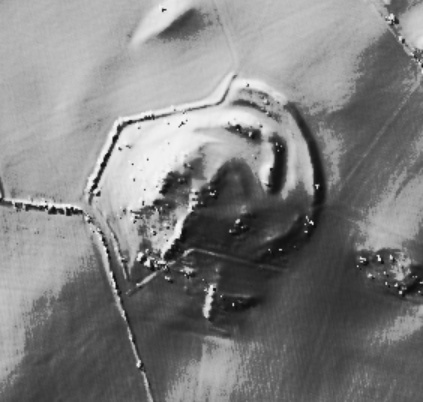
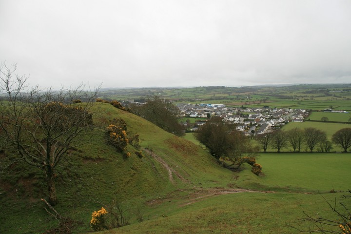
Castell, Tregaron, is a strong and impressive fort, constructed around a flat-topped, rocky promontory with precipitous slopes to the W and S, with two curving ramparts cutting off the landward side to the north east. The two ramparts which comprise the façade still retain steep, almost unclimbable front faces. The outer stands between 3 and 4.5m high and is about 20m broad at its base. It was probably augmented by an outer ditch, now silted up. Mid way along its outer face, and at other points, sections of decayed stone walling and tumbles of substantial stones from erosion features, would suggest that the outer face was once fully walled. The inner rampart is flanked by an outer ditch up to 3m deep, and still stands up to 6m high on the outer face. It has a more pronounced curve than the outer rampart and so the two are not parallel. The top of the inner rampart is also not uniform. It dips markedly in the centre which is perhaps an original feature to make the rampart ends appear taller, but may also be the result of old erosion slippage. The outer face of this rampart still bears several traces of in-situ stone walling. The outer rampart obscures the true position of the main gateway; it is certainly not obvious to those approaching from the east. At the north terminals of the ramparts the inner slope is too steep to climb and where the interior is open to view, it was probably closed off with a palisade. The main gate was reached by passing under the south terminal of the outer rampart where, adjacent to the inner rampart, a low foundation bank forms an oblique gateway against the main inner rampart. The arrangement was probably augmented by timberwork. The interior of the fort provides a good, level area immediately behind the inner rampart and below the outcrop which would have been suitable for settlement. On the outcrop itself, several plateau areas are visible, some cut back into the rock to form platforms. The more obvious of these are marked on the new plan. On the south side of the outcrop, a concavity at a lower level on the edge of the rock may also have been the site of a house. It is unlikely the whole fort was the result of a single phase of work. The differences between the inner and outer rampart suggest two phases of work; it may be that the inner gate was originally `on view', but its direct approach was subsequently blocked with the provision of an uncompromising outer façade rampart. The berm or terrace cut into rear side of the outer rampart at its north end, for whatever purpose, suggests a later modification of the rampart. The strategic role served by the two tall, steep, stone-walled façade ramparts is questionable as the fort rapidly disappears from view from the main approach, to the northeast, after only 200m. The zigzag terminals of the ramparts on the north side do, however, form an impressive feature on the skyline from the lowland approaches to the north. From the main north-east approach, one descends from higher ground and the rocky interior of the fort is fully on view, thus rendering it tactically weak in the conventional sense. There is erosion towards the summit of the outer rampart and if left to continue may eventually undermine the well-preserved top of the rampart and cause it to collapse. At the time of the visit in 2004, the farmer had recently cleared most of the gorse bushes on site. Good for farmer!!! One aerial pic and a few ground ones http://www.coflein.gov.uk/en/site/303561/images/CASTELL+TREGARON%3BSUNNYHILL+WOOD+CAMP/?show=all |
Posted by postman 20th January 2012ce |