Inner rampart with its cleared ditch on the right.
Image credit: A. Brookes (18.6.2024)
Inner rampart with its cleared ditch on the right.

Section of cleared outer rampart on the south side of the fort.

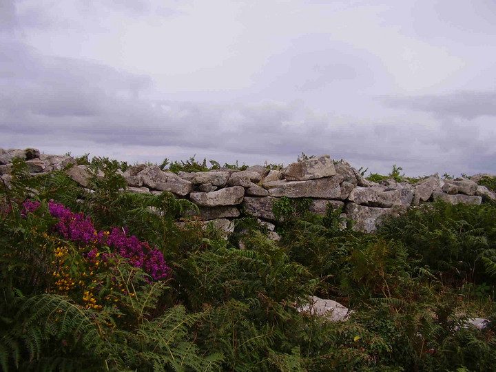
Really impressive stone walls have been revealed in the outer rampart by the clearance of vegetation.

Cleared outer rampart on the western side of the fort.

Clearance work has revealed more of the outer rampart around the north-western arc from the gate.

Stone flanking the outer gate. The northwestern arc of the outer rampart continues over to the right, covered in dense vegetation that hasn’t been cleared for many years.


Outside the gate.

Foxglove summer.


Massive granite blocks marking the outer rampart, with the inner rampart beyond on the left.

Between Chun and Watch Croft there are several Iron Age settlement sites, as well as prehistoric field systems that are still in use today.

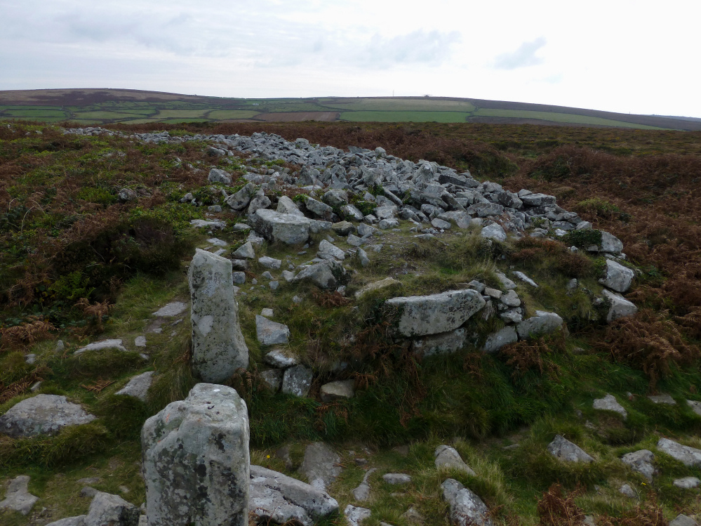
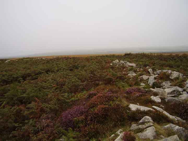
The overgrown outer rampart.


The tumbled stones provide ideal conditions for mosses, ferns and stonecrop to grow.

Inner gate to outer gate.

The outer rampart, also built of stone but rather more overgrown than the inner rampart.

The outside of the entrance

The inside of the entrance, looking into the fort.


Sun prepares to sink into the forts gateway.

It goes round

and round

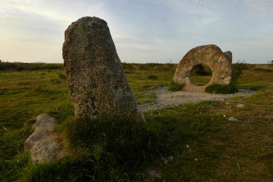
The Castle from the Quoit.

The double entrance to the fort.

Already two years since our last visit.

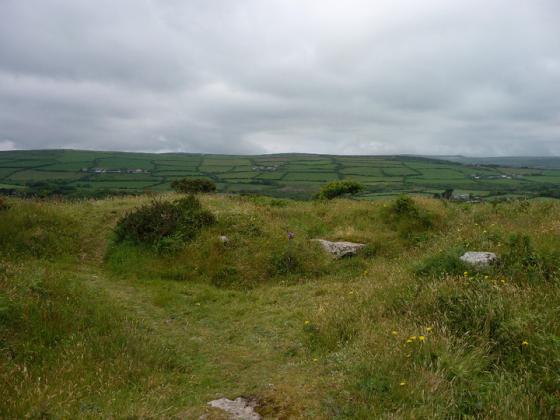
Looking southeast towards Mounts Bay, with the Lizard Peninsula a dark line on the horizon.

Looking east. The prominent hill on the left is Watch Croft, the highest point in West Penwith, marked with cairns and a standing stone. Also in this landscape are Nine Maidens stone circle, Men an Tol, Men Scryfa, various barrows, Bosullow Trehyllys courtyard house settlement – it’s all crammed in here!

Carn Kenidjack and Carn Bean (with radio mast and round barrow) on the western skyline.
The immensely thick inner wall, at its entrance.

Impressive surviving courses of the massive inner wall.

The outer entrance with the inner beyond.

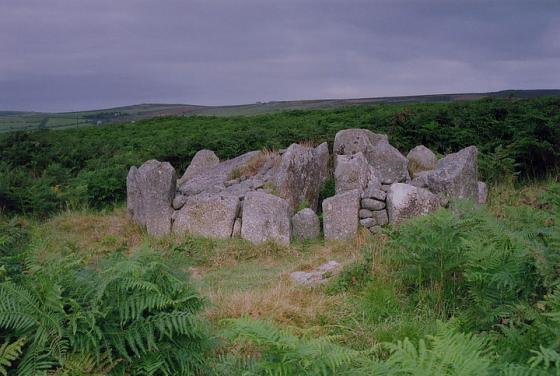
We arrived as a large group of volunteers were doing a great job of clearing some of the vegetation from the site. One of the internal structures emerges from the greenery.

From his ‘Antiquities, Historical and Monumental, of the County of Cornwall’ (1769).
books.google.co.uk/books?id=R2dTAAAAcAAJ&pg=PA346

G/F provides scale for the upstanding rampart.

The south-eastern arc, looking towards Mounts Bay.

There’s water in the well.

Chun Castle seen from Carn Downs to the east. The courtyard settlement at Bosullow Trehyllys is visible in the field system to the bottom left of the picture.

Looking NW, out into the beautiful blue.

Looking west towards the distinctive outcrop of Carn Kenidjack and Carn Bean (with radio mast).

The approach to the fort from the Quoit.

Chun castle, with the quoit to the west from the Trewellard road.

Not one of “gate posts” but another single standing pillar.
The west wall looking south.

The curve of the north wall.

The “well” with some water in it (sept 2006).

Chun Castle, another damp day in paradise.

A well (?) in Chun Castle. 11/8/06
A section of the wall of Chun Castle. 11/8/06

Found this in amongst in bracken.....Usage? I have know idea but........its an impressive piece....the holes are deep and in a regular patten.....mmmmm????

After visiting nearby Quoit, clambering amongst the overgrown ruin of yhis Fort built over a thousand years ago, is worthwhile if the weathers fine..........Tin mine of Boskednan in the distance in direction of Lanyon and Mon Y Tol

Hillfort very near Chun Quoit. Have seen references that it’s Iron Age, but also that it was in use previously, so I thought I’d post it....
This time we’re heading up to the nearby Chun Castle hillfort, which actually we rarely visit on our trips. Its circular walls are satisfyingly chunky and provide a wonderful 360-degree panorama, including the engine house at Ding Dong mine, which is such a ubiquitous landmark from much of the peninsula. But we don’t hang around here for long, as our main reason for heading this way is another site we haven’t visited previously.
Visited 11.4.10.
Follow signs for Great Bosullow / Chun Castle – off the Laynon Quoit road. This is a narrow lane which leads you to Trehyllys farm. There is a small sign post near the farm directing you to the Castle and Quoit. Park near to the farm and it is a 20 minute hike up the hill through the dreaded gorse and brambles. There is a ‘path’ that can be followed where other people have walked up. The site itself is well preserved – the outer wall is clearly seen and in some places still stands about 6ft tall. Once into the Castle the cup marked stone is on the left and the well is directly in front of you on the far side of the hillfort. If you walk across the site to the far side you will see the two standing stones which form the ‘gateway’ (it feels very cool to walk through!) and beyond that the Quoit is clearly seen 5 minutes walk away. This site is definitely worth visiting!
I went here and the nearby quoit in September 2006, I’ve only just found the pictures again. You can probably see more of it in winter, when it’s not so overgrown. It’s difficult to know how much stone has been pinched over the years, but the basic outline is still there to see. It’s a very exposed site, when I was here, there was a low mist and drizzle, but still very atmospheric.
In the neighbourhood of the castle may be traced the obscure remains of several specimens of the edifices generally termed British huts. The country folks call them “the huts of the old people,” – a traditional name agreeing with the results of recent investigation. Upon excavating one of them, there were found a small quantity of charred wood, a great number of burnt stones, and as many fragments of pottery as filled a small bason.
From Rambles in Western Cornwall by the Footsteps of the Giants by J O Halliwell-Phillipps (1861).