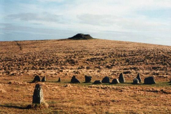
Once again stretching out in front of you taking your breath away in awe, love this place
Images
Great walk there and back from Norsworthy Bridge, up and over Down Tor
Cairn within the circle
10th September 2018
10th September 2018
10th September 2018
10th September 2018
10th September 2018
10th September 2018
10th September 2018
10th September 2018
10th September 2018
10th September 2018
10th September 2018
Small cairn about 50m NW from the cairn circle.
Old photo from 1894 showing fallen stones.
dartmoortrust.org/archive/view/3460
It took a little longer than anticipated to find this beauty, but thanks to some local rangers we sorted out where we were and eventually stumbled on it. And we were not disappointed.
Panorama from East to West. There seems to be an obvious gap, or missing stone, at this end. I know that the largest stones were re-erected earlier in the 20th Century. I wonder if one had gone missing over the centuries?
Looking back along the row westwards to the cairn circle.
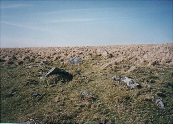
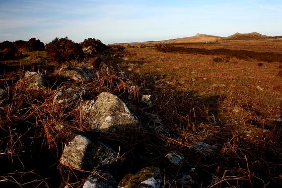
Looking toward Eylesbarrow. Doesn’t look very tempting, does it? But I was... tempted, that is.
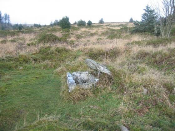
The cairn within the rather fine circle. Eylesbarrow rises beyond
The cairn to approx north-west of the cairn-circle.
The cairn to approx north-west of the cairn-circle. Pretty substantial.
Looking toward the circle from the far end of the row...
Eylesbarrow looks pretty featureless beyond. However it is crowned by two massive cairns and well worth the continuation to visit.
The cairn within the circle....
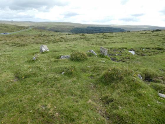
The row from the cairn-circle...
Dragon’s teeth.....
Here the stones seem to have erupted from within the earth itself...
Possibly my favourite stone circle anywhere....
Hingston Tor. Blimey. Personally I think the ponies have got the right idea......
The row from its eastern terminus. The curve is largely an optical illusion created by the contours of the moor.
Even if you ignore the 350 metres of stone row, the 27-stone cairn circle is a winner all on its own.
The dug out centre, showing possible fragmentary remains of a cist.
The disturbed central cairn in the terminal circle.
Looking ENE into Dartmoor’s empty space.
Not the longest row on Dartmoor by a long chalk... but what a circle at the end.
Possibly my favourite site..... a classic cairn circle with a little ‘something extra’ added for good measure. With bloody great Big Ben bells on.
The row terminal stone is approx centre right, background.
The cairn that the stone row leads to but doesn’t reach
20th December 2003
This place was swarming with cattle,but the kindly farmer took em all home,cheers
Hmm cruciform?
the bend only seems evident from this end
...there are some French menhir!
Looking west along the row...French persons to far away to be seen.
Hingston Hill Stone Circle and Row, 349 metre Row.
Circle at W end.
Graded stones at W end of row and circle.
Looking W along row from near centre.
E end terminal stone looking W towards stone circle.
Articles
I’ve parked in the carpark at the eastern end of Burrator reservoir as directed and set off down the main path with the plantation on my right. After passing a picnic area with a ruined house there’s a path to the left up through the bracken emerging out on to the moor and a steady climb up to the top of Down Tor. The views are fantastic, Sheeps Tor away to the southwest, and the sky’s a mix of bright blue and high, fluffy clouds, some darker ones threatening the forecast rain which mercifully doesn’t come. I expect to see the circle and row from the top of the tor but then remember the sweetcheat’s note and put my disappointment on hold, cresting the next rise and there it is, majestically isolated in this epic landscape.
I’m not big on the tecnicalities of these sites, it’s all about atmosphere for me and this place has it in shedloads. The big stone at the end of the row abutting the circle really is a big beast and looks to have been dressed on its south-facing side, so smoothly does it present itself to the circle. I walk to the end of the row and back, a permanent smile fixed on my face and get twenty minutes to myself before someone else hoves into view so I decide to leave it to him, exchanging appreciation as I pass. He echoes Greywether’s comment about it being sufficiently remote to deter visits from most of those parked back at the reservoir, but I pass six more people heading towards it as I climb back up Down Tor. The views remain stunning and I face the prospect of the long drive back to London with spirits lifted.
Once I climb down from the top of Down Tor itself, I’m expecting to see the first of today’s sites. After all, it’s a very well-preserved circle, together with a 350m long row and a terminal stone standing nearly 3m tall. In fact, there’s no sign of it until I head further east. Suddenly I’m over a small crest and practically on top of this megalithic wonder. What a beauty this is! The circle itself is lovely, 12m across and surrounding the remains of a damaged but recognisable central cairn. Another cairn sits a few yards away to the northwest. This really is a terrific site, aided by the splendid isolation I get here today.
And then there’s the row. It extends away to the northeast, heading further into Dartmoor’s magnificent empty space. Clouds race past, drawn towards a convergence over the horizon. At the southwestern end, next to but separate from the circle, the row terminates in a huge upright monolith, almost 3m tall and very thick – it weighs about three tons. Seen from this end, the row appears pretty much straight (which it is). It leads uphill towards another cairn, as well as a small prehistoric enclosure. By the time I reach the northeastern terminal stone, the row appears to curve away back to the cairn circle. This is actually an optical illusion, caused by the gently sloping contours that the row crosses. This weird “not curve” further enhances what is undoubtedly one of the best sites I’ve been to. I still struggle rather with Dartmoor chronology and don’t really know whether the row post-dates the large-scale clearances carried out during the Bronze Age. It’s hard though to imagine creating such a wonderfully designed monument in the middle of trees, where the form could not be easily appreciated.
I managed to witness a fantastic sunrise for the Summer Solstice in 2004. But the sun did not rise in line with the row. It came up quite a bit North of it. It didn’t take any of it’s magic away especially as there was ground frost around. Summer in Dartmoor!
It would be quite interesting to go for the Winter Solstice sunset and stand at the bottom end of the row.
This was my second attempt to witness the summer solstice sunrise at Down Tor, last year my daughter and I camped on a Tor half way between carpark and stone circle/row, but it was raining windy and cloudy so we left it for another time...this time!
Well well well what do you know, despite last nights awsome sunset, I awoke this time to clouds and fog, at least it wasn’t raining, so I gave it another go.
The walk to the stones is long and arduous up and down over three rocky tors the last one not so rocky, in good weather a delight to trek over. But this time on the second hill the fog came in really badly and I got turned around and ended up very lost. five in the morning in fog on the moors alone isn’t the most happy feeling Iv’e embraced. It wasn’t till I stumbled across the cuckoo stone that I realised where I was and with a view to the resrvoir through the fog, I knew which way to go.
Before long the tallest stone could be seen peeping over the low hill, then another and then more, untill my relief must have been obvious even to the small bird that was drawing me on.
Even in the fog this place is cool, the perfect little circle with internal cairn and the stone row, starting of with a whopper of a stone( reset deeper than the original stone hole) but quickly dwindles to knee high stones. I followed the row up to the other cairn, the terminal stone is about 5 ft tall but doesn’t go all the way to the cairn, it stops about 50 m away. The pound is still quite well preserved several stones sticking up maybe entrances to huts.
Now it was time to go and find Yellowmead after a long soggy walk back to the car
A local tells me that the sun rises in line with this row at Midsummer...It is not facing due NE but taking in to account the dip in the hills to the east he may be right. The row dips in the centre as it crosses the hillside rising to the cairn (Stone Circle) at the western end. I did not get to look at the cairn as it was full of French people standing bolt upright pretending to be stones...
This is a wonderful site. Far enough away from the car parks at the E end of Burrator Reservoir to deter casual visitors but a pleasant enough walk in for the rest.
Its open location, the grading of the stones and the way they run downhill and then up make it look like a Richard Long landscape sculpture.
See the links below for directions, descriptions and plans.
would this Circle and Row, be similar to the one’s mentioned in Uriel’s Machine (The Prehistoric Technology that Survived the Flood) by Christopher Knight & Robert Lomas, and would anyone check it out on the Summer and Winter Solstice (while i stay in bed) and every month after plant wooden posts in the ground (take them up again) to see if you can measure the months.
Another Stone circle and row on Dartmoor.
Actually, its a ring cairn with 31 granite stones 11m diameter with a 350m stone row stretching away from it
Topics
Sites within 20km of Down Tor
-
Down Tor NW
photo 1 -
Hingston Hill North
photo 3 -
Narrator Brook Head enclosure
photo 9 description 2 -
Narrator Brook Head cairn
photo 10 description 1 -
Cuckoo Rock
photo 2 description 1 -
Down Tor South
photo 2 description 1 -
Outcombe
photo 1 description 1 -
Eylesbarrow
photo 15 description 3 -
Eylesbarrow South West
photo 9 description 2 -
Yellowmead SE cairn
photo 3 description 2 -
Raddick Hill
photo 17 -
Ditsworthy Warren
photo 7 description 1 -
Yellowmead Multiple Stone Circle
photo 53 forum 3 description 11 link 3 -
Whittenknowles Rocks Settlement
photo 8 description 1 -
Higher Hartor Tor
photo 3 description 1 -
Drizzlecombe Megalithic Complex
photo 122 description 8 link 1 -
Fox Tor Mire
photo 1 description 1 -
Leather Tor South
photo 2 -
Plym Steps Round Cairn
photo 5 -
Plym Steps
photo 10 -
Gutter Tor
photo 2 -
Gutter Tor cairns
photo 6 -
Hart Tor
photo 45 forum 1 description 3 -
Black Tor
photo 17 -
Gutter Tor Cist
photo 12 description 1 -
Leeden Tor South
photo 1 description 1 -
Calveslake Tor
photo 2 description 1 -
Gutter Tor settlement
photo 3 -
Black Tor
photo 8 description 1 -
St Leonard’s Well
photo 2 description 2 -
Goldsmith’s Cross/
Fox Tor Mire photo 4 description 1 -
Peek Hill
photo 1 description 1 -
Devil’s Gully Settlement
photo 8 -
Sharpitor Cist
photo 3 description 2 -
Langcombe Brook /
Deadman’s Bottom photo 35 description 1 -
Great Gnat’s Head
photo 2 description 1 link 1 -
Sharpitor cairns
photo 16 description 2 -
Sharpitor
photo 10 description 5 -
Willings Wall Warren
photo 3 -
Ditsworthy Cairn Circle
photo 1 description 1 -
Hen Tor North /
Shavercombe Brook photo 7 description 1 -
Ringmoor Down cairns
photo 3 -
Grim’s Grave
photo 13 description 1 -
Childe’s Tomb
photo 5 description 2 -
Horseyeatt
photo 4 description 1 -
Ingra Tor
photo 1 description 1 -
Legis Tor Cist
photo 5 description 1 -
Yes Tor Bottom
photo 1 description 1 -
Broken Barrow
photo 10 description 1 -
Willings Walls Warren cist
photo 2 -
Ringmoor Cairn Circle and Stone Row
photo 54 description 7 link 3 -
Ringmoor Kerbed Cairn
photo 6 -
Ringmoor Down Cist
photo 3 description 1 -
Royal Hill
-
Royal Hill Cist
photo 24 -
Brisworthy Stone Circle
photo 64 forum 1 description 8 link 1 -
Ter Hill
photo 2 description 1 -
The Crock of Gold Cist
photo 4 forum 1 description 3 -
Trowlesworthy Warren
photo 1 description 1 -
Trowlesworthy
-
Little Trowlesworthy Tor
photo 2 -
Spanish Lake
photo 1 -
Willings Walls Reave
photo 1 description 1 -
Ringmoor Down Reave
photo 1 -
Stall Moor Stone Row
photo 12 description 2 -
Blakey Tor
photo 5 description 1 -
Pecked Circle
description 1 -
Joan Ford’s Newtake
photo 3 description 1 -
Trowlesworthy Warren
photo 28 description 2 link 2 -
Trowlesworthy Stone Row West
photo 23 description 3 link 1 -
Trowlesworthy Stone Row East
photo 19 description 3 link 1 -
Shell Top
photo 3 -
Yellowmeade
photo 2 description 1 -
Round Hill
photo 8 -
Tory Brookhead
-
Swincombe Ford Newtake
photo 2 -
Wigford Down
photo 11 description 1 -
Tory Brookhead
photo 7 -
Hucken Tor
description 1 link 1 -
Wigford Down
photo 2 -
Erme Pound
photo 4 description 1 -
Merrivale Stone Circle
photo 52 description 3 -
Emmets Post
photo 1 description 1 -
The Plague Market At Merrivale
photo 104 description 19 link 1 -
Penn Beacon
photo 2 -
Stall Moor Cairn
photo 5 description 2 -
Sherberton Stone Circle
photo 28 description 4 link 1 -
Skir Hill
photo 1 -
Erme Plains
photo 1 -
Ranny Brook
photo 3 description 1 -
Saddlesborough summit cairns
photo 3 description 1 -
Saddlesborough settlement
photo 9 description 1 -
Saddlesborough
-
Vixen Tor
photo 20 description 4 link 1 -
West Saddlesborough Hut Circles
photo 9 description 2 -
West Saddlesborough Stone Row & Cairn Circle
photo 19 description 3 -
Hook Lake
photo 3 description 1 -
Hook Lake
photo 4 description 1 -
West Saddlesborough Cairn
photo 5 description 2 -
Merrivale Bridge Settlement
photo 9 forum 1 description 1 -
Stall Moor Stone Circle
photo 23 description 6 link 1 -
Penn Beacon South
photo 3 -
Cholwich Town (destroyed)
photo 1 description 2 -
Dewerstone Settlement
photo 4 description 4 -
Dendles Waste
photo 1 description 1 -
Ryder’s Hill
photo 2 description 1 -
Long Plantation
photo 1 forum 1 description 1 link 1 -
Blatchford Bottom settlements
photo 3 -
Down Ridge
photo 13 description 2 -
Barn Hill /
Whitchurch Down photo 1 description 2 -
Shell Top South West
photo 9 -
Little Mis Tor
photo 8 -
Coombebrook North East
photo 1 description 1 -
Western White Barrow
photo 9 description 3 -
Buckland Ford Cairn Circle
photo 10 -
Collard Tor
photo 11 description 1 -
Heap of Sinners
photo 11 ondemand_video 1 description 2 -
Dunnabridge Pound
photo 4 description 2 -
Harrowthorn Plantation North
photo 1 description 1 -
Stalldown Cairns
photo 6 description 1 -
Holne Moor
photo 1 description 2 -
Stalldown Stone Row cairns
photo 4 description 2 link 1 -
Huntingdon Warren Settlement
photo 1 description 1 -
Wistman’s Wood
photo 2 description 2 -
Stalldown Stone Row Cairn NE
photo 4 description 2 -
Stalldown cairn circle
photo 5 -
Stalldown Stone Row
photo 41 forum 1 description 6 link 2 -
Black Newtake
photo 9 description 1 -
Great Western Reave
photo 1 description 1 -
Biller’s Pound
photo 2 description 1 -
Snowdon
photo 6 description 1 -
Hillson’s House
photo 5 description 2 link 1 -
Stalldown Stone Row Cairn S
photo 3 description 2 link 1 -
Pupers Hill
photo 11 ondemand_video 1 description 3 -
Littaford Tor
photo 1 -
Eastern White Barrow
photo 9 ondemand_video 1 description 1 -
Cox Tor
photo 2 description 1 -
Holne Moor Triple Row
photo 2 -
Bellever Tor West
photo 8 description 1 -
Laughter Tor
photo 7 description 4 -
Mardle Valley
photo 1 description 1 -
Roos Tor Northeast
photo 1 -
Bellever
photo 26 description 7 link 1 -
Langstone Moor
photo 3 -
Langstone Moor
photo 4 description 1 -
Stennen Hill
photo 9 description 1 -
Aller Brook
photo 1 description 1 -
Langstone Moor Stone Circle
photo 25 forum 1 description 4 -
Three Barrows
photo 10 -
Crow Tor
photo 2 description 1 -
Stalldown South-East
photo 8 description 2 -
White Tor Stone Row
photo 8 ondemand_video 1 description 1 -
Roborough Beacon
photo 8 description 2 -
Yar Tor Hut Circle
photo 6 -
Arch Tor (South-West)
photo 3 -
Brockhill Enclosed Settlements
photo 1 -
Sharp Tor
photo 5 description 1 -
Brockhill Foot West
photo 9 description 1 -
Brockhill Ford West
photo 2 -
Conies Down
description 1 -
Coffin Stone
description 1 -
Dean Moor
photo 8 forum 1 description 1 -
Rowtor Bog Cairns
photo 16 description 1 -
Lakehead Hill
photo 53 description 2 -
White Tor East
photo 6 description 1 -
Langstone Moor Stone Row
photo 12 description 1 -
Yar Tor summit cairn
photo 9 description 1 -
Piles Hill stone row
photo 3 description 1 -
Riddon Ridge Field Systems
photo 3 description 1 -
White Tor Settlement
photo 17 -
Rider’s Rings
-
Beardown Man
photo 12 description 2 -
Maristow Camp
-
Burford Down cairn and cist
photo 8 description 1 -
Burford Down
photo 18 description 5 -
Yar Tor
photo 21 forum 1 description 1 -
Kraps Ring
photo 4 description 1 link 1 -
Riddon Ridge
photo 5 -
Boringdon Camp
photo 12 description 1 -
Gripper’s Hill
photo 13 ondemand_video 1 description 1 -
Piles Hill cairns
photo 8 description 2 -
Harford Moor
photo 15 description 2 -
Archerton, Newtake
photo 1 forum 1 description 2 -
Piles Hill longstone
photo 12 description 2 -
Corndon Tor
photo 33 description 1 -
Corringdon Ball Stone Row
photo 15 description 1 -
Glasscombe Corner
photo 11 description 2 -
Chittaford Down
photo 9 description 2 -
Corndon Tor
description 1 -
Glasscombe Ball North
description 1 -
Harbourne Head cairns
photo 2 description 1 -
Glasscombe Ball
photo 3 description 2 -
Chittaford Cairn and Cist
photo 8 description 2 -
Corringdon Ball Long Barrow
photo 18 description 1 -
Butterdon stone row
photo 16 forum 1 description 3 -
Roundy Park
photo 3 -
Roundy Park
photo 16 description 2 -
Butter Brook Ford
photo 5 description 1 -
Glaze Meet
photo 3 description 1 -
Harbourne Head
photo 5 description 1 -
Spurrell’s Cross Stone Row
photo 6 description 2 -
Broad Down Cairn
photo 2 description 1 -
Butterdon Hill (north) cairn
photo 3 description 1 -
Weatherdon Hill
photo 2 description 1 -
Cator Common North Cairn
photo 3 description 1 -
Butterdon Hill cairn circle
photo 4 description 2 -
Butterdon Hill cairns
photo 21 description 2 -
Addicombe
-
Aish Ridge
photo 2 description 2 -
Soussons Common Cairn Circle
photo 26 description 8 link 2 -
Butterdon Hill Chambered Tomb
photo 8 description 2 -
Cuckoo Ball
photo 13 description 2 -
Cut Hill
photo 12 description 4 -
Stannon Newtake
photo 1 description 1 -
Western Beacon
photo 19 description 5 -
Soussons Down
photo 2 -
Hembury Castle
photo 19 description 5 link 1 -
Brent Hill
photo 1 -
Cantrell Stone Row
photo 3 description 2 -
Sittaford
photo 14 forum 1 description 1 link 1 -
Sittaford Tor hut circles
photo 3 -
The Dun Stone
description 1 link 1 -
Water Hill
photo 2 -
Water Hill
photo 1 -
The Greywethers
photo 74 forum 4 description 11 link 3 -
Assycombe Hill
photo 33 description 3 -
Challacombe
photo 19 description 2 -
Hurston Ridge
photo 17 forum 1 description 2 link 1 -
Hurston Ridge
photo 3 -
Wittaburrow
photo 11 -
Birch Tor
photo 13 description 1 -
Tunhill Rocks
photo 1 -
Blackslade Down
photo 7 description 1 -
West Vitifer
photo 2 -
Heathfield Beacons
description 2 -
Brent Tor
photo 21 description 7 -
Fernworthy Round House
photo 19 description 1 -
Hamel Down
photo 6 -
Doe Tor
photo 5 description 1 -
Grimspound & Hookney Tor
photo 52 description 8 link 1 -
Fernworthy SE
photo 2 description 1 link 1 -
Fernworthy Stone Row (South)
photo 7 description 2 -
Fernworthy
photo 61 description 6 link 2 -
Fernworthy Cairn and Cairn Circle (Eastern)
photo 5 description 2 -
East Lowton settlement
photo 17 description 1 -
Foale’s Arrishes
photo 9 -
Whitehorse Hill
forum 1 description 6 link 1 -
Fernworthy stone row (North)
photo 15 forum 1 description 3 link 1 -
Top Tor
photo 7 -
Grims Lake Mire
photo 10 description 1 -
Heath Stone
photo 1 description 1 -
Shapley Tor
photo 6 -
Metherall Settlement
photo 12 description 2 -
Horridge Common (West)
photo 1 description 1 -
East Bovey Head
photo 14 description 1 -
Seven Lords’ Lands
photo 7 description 2 link 2 -
Thornworthy Down
photo 12 description 1 -
Rippon Tor
photo 22 ondemand_video 1 -
King’s Barrow
photo 8 description 1 -
Chagford Common
photo 3 -
Shapley Common
photo 12 -
Great Links Tor
photo 10 ondemand_video 1 description 1 -
Gallows Hill
photo 1 description 1 -
Horridge Common
photo 3 -
Horridge Common
photo 8 -
Hound Tor
photo 24 description 2 -
Shovel Down & The Long Stone
photo 62 forum 1 description 7 link 1 -
Shovel Down
photo 2 description 1 -
Haytor Rock
photo 1 description 1 -
Great Nodden
photo 4 -
Bowerman’s Nose
photo 13 description 5 -
Tolmen Stone
photo 4 -
Kes Tor
photo 7 description 1 -
Scorhill
photo 69 forum 3 description 12 -
Hingston Down East
description 1 -
Fordsland Ledge
photo 18 description 4 -
Black Hill
photo 15 description 1