Looking south from Piles Hill back towards the two prominent Butterdon Hill summit cairns. Western Beacon with its cairns is further to the right.
Image credit: A. Brookes (10.6.2010)
Looking south from Piles Hill back towards the two prominent Butterdon Hill summit cairns. Western Beacon with its cairns is further to the right.

The northerly summit cairn at SX655587. This is close to the southern end of the Butterdon stone row, and its stone circle terminus.

The southern summit cairn.

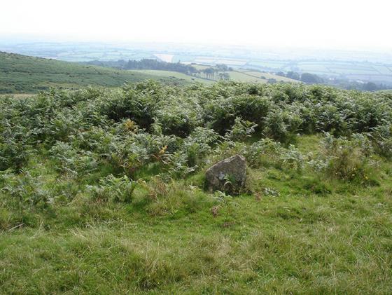
Another picture showing the upright next to the cairn at SX655586. In this picture, there appears to be the remains of low bank running in a semi-circle and including the upright. Could this be part of a ring cairn or hut circle of some sort, which incorporated the upright?

Large summit cairn at SX655586. The stone in the foreground may be part of the boundary line running up from Western Beacon, but it may be part of another feature – see low bank in foreground and next picture.

The approach to Butterdon Hill from Western Beacon, with the Longstone boundary marker in the foreground. The southern summit cairn is visible in the centre of the skyline.

The cairn at SX653588 taken after the reconstruction.

The cairn at SX653588 taken during the survey.

The cairn at SX654585 after reconstruction.

A photo of the cairn at SX654585 taken during the survey.

A photo of the cairn at SX656585 looking from the east.

This a photo of the summit cairn, SX655586, taken during the reconstruction.
This is the summit cairn at SX655586 taken during the survey.

This is the most northerly of the two summit cairns. It is at SX655587. This photo was taken after the reconstruction work had been carried out.

The summit cairn looking from the south east.

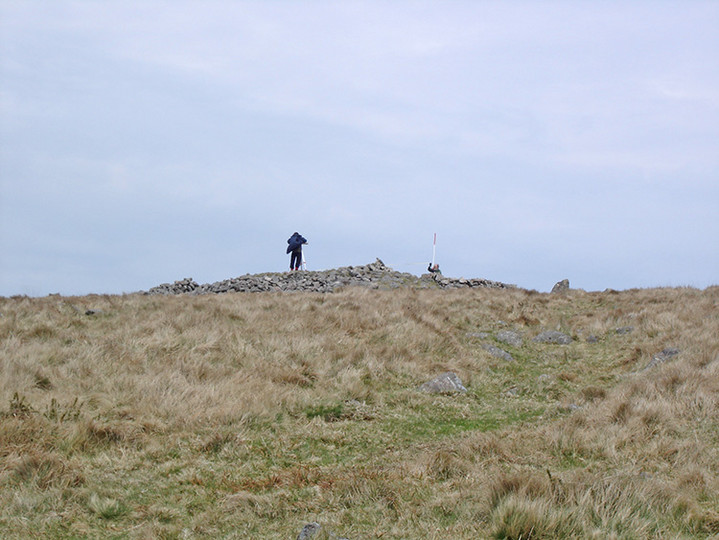
The summit cairn looking from the north east. The stone to the left of the cairn is an O.S. trig point.

The northerly of the cairns looking from the south.This cairn is at SX655587.

The northerly of the cairns on the summit.SX655587

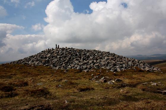
One of the large cairns on Butterdon Hill

Barrow to the north of Butterdon Hill

Just below the summit on the SW side stands this upright. Infront of it is a paved area. Any ideas?
As the ground starts to rise again towards Butterdon, I pass a taller boundary stone, marked on the OS as “Longstone”, while the trig point on the hill ahead is another visual prompt. The first Butterdon cairn is already looking like a monster, silhouetted on the skyline. When I reach it, I find a small triangular stone in front of it, but can’t work out if it “belongs” to anything else – perhaps it’s part of the boundary line, but it looks to be of a different character and I make out (I think) a low semi-circular bank that appears to incorporate the stone. Another, even bigger, cairn marks the northern end of the summit. This is a huge cairn, 30 metres across and still 4 metres high. From here there are excellent views all around, with every hill apparently topped by more cairns.
English Heritage along with the Dartmoor Preservation Association and a few volunteers have undertaken the project of surveying and restoring many of the cairns on Dartmoor. Over many days last year the cairns on Western Beacon and Wetherdon Hill were done.
This years project started on 21st April 2006 with five of the cairns on Butterdon Hill. The largest were chosen as they were in the worst state of repair, having had their shape altered by the public making shelters with the stones. This was mostly done by digging pits into the cairns and building walls with the stones taken out.
On 21st and 22nd of April 2006 eight volunteers set about surveying , recording and reconstructing these five cairns. The larger of the cairns were surveyed using a plain table and the smaller done using the offset method. When this was finished the walls were taken down and the stones replaced into the holes and any of the tumbled stones were replaced into hollows around the edges in order to get the cairn back into the domed shape they would have had when first built.
You will see from the photographs ,especially the cairn at SX654585, what was achieved.