Image credit: Chapman & Son, Dawlish
Images
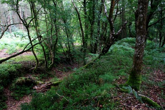
The “Tolmen Stone” on the North Teign approximately 400 metres to the south of the circle . This is a large stone set in the river bank and an adult can easily fit through the hole , being around 3ft in diameter. According to legend if you pass through the hole it will cure you of whooping cough and/or arthritis . You can see that others are starting to form.
Image credit: Peter Castle. ©
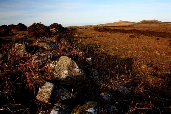
The Tolmen stone is a natural feature situated approximately 250 yards from Scorhill Circle, and downstream from the Clapper bridges (there are 3) at Teign-e-Ver.
Image credit: Doug
The Tolmen Stone
Image credit: Tim Sandel
Sites within 20km of Tolmen Stone
-
Scorhill
photo 69 forum 3 description 12 -
Kes Tor
photo 7 description 1 -
Shovel Down
photo 2 description 1 -
Buttern Hill
photo 1 description 1 -
Buttern Hill Chambered Cairn.
photo 8 description 2 -
Shovel Down & The Long Stone
photo 62 forum 1 description 7 link 1 -
Buttern Hill Stone Circle
photo 28 description 4 -
Throwleigh (b) circle
description 1 -
Fernworthy stone row (North)
photo 15 forum 1 description 3 link 1 -
Fernworthy
photo 61 description 6 link 2 -
Fernworthy Stone Row (South)
photo 7 description 2 -
Fernworthy Cairn and Cairn Circle (Eastern)
photo 5 description 2 -
Fernworthy SE
photo 2 description 1 link 1 -
Thornworthy Down
photo 12 description 1 -
Puggie Stone
description 1 -
White Moor Stone Circle
photo 47 forum 1 description 11 -
Metherall Settlement
photo 12 description 2 -
East Lowton settlement
photo 17 description 1 -
Fernworthy Round House
photo 19 description 1 -
Heath Stone
photo 1 description 1 -
Chagford Common
photo 3 -
Whitehorse Hill
forum 1 description 6 link 1 -
The Greywethers
photo 74 forum 4 description 11 link 3 -
White Hill
photo 20 description 1 -
Assycombe Hill
photo 33 description 3 -
Cosdon Hill
photo 32 description 5 link 1 -
Cosdon Beacon
photo 4 -
West Vitifer
photo 2 -
Sittaford Tor hut circles
photo 3 -
Hurston Ridge
photo 3 -
Sittaford
photo 14 forum 1 description 1 link 1 -
Hurston Ridge
photo 17 forum 1 description 2 link 1 -
The Spinsters’ Rock
photo 39 description 10 link 1 -
Shapley Common
photo 12 -
Water Hill
photo 1 -
Stannon Newtake
photo 1 description 1 -
Higher Tor
photo 7 -
Water Hill
photo 2 -
East Bovey Head
photo 14 description 1 -
Birch Tor
photo 13 description 1 -
Oxenham Arms
photo 4 forum 1 description 2 link 1 -
Cullever Steps
photo 6 -
Shapley Tor
photo 6 -
Meacombe Burial Chamber
photo 11 description 4 -
Challacombe
photo 19 description 2 -
Cut Hill
photo 12 description 4 -
Nine Stones
photo 26 forum 1 description 5 link 1 -
Watchet Hill
photo 6 -
Broad Down Cairn
photo 2 description 1 -
Roundy Park
photo 3 -
Roundy Park
photo 16 description 2 -
Grimspound & Hookney Tor
photo 52 description 8 link 1 -
Grims Lake Mire
photo 10 description 1 -
Fordsland Ledge
photo 18 description 4 -
Soussons Down
photo 2 -
High Willhays
photo 11 description 3 -
Chittaford Cairn and Cist
photo 8 description 2 -
King’s Barrow
photo 8 description 1 -
Chittaford Down
photo 9 description 2 -
Bude Farm Sticklepath
photo 1 -
Yes Tor
photo 23 description 2 link 1 -
Hamel Down
photo 6 -
Archerton, Newtake
photo 1 forum 1 description 2 -
Cranbrook Castle
photo 11 description 1 -
East Hill
photo 11 description 1 -
Soussons Common Cairn Circle
photo 26 description 8 link 2 -
Rowtor Bog Cairns
photo 16 description 1 -
Kraps Ring
photo 4 description 1 link 1 -
Longstone Hill
photo 5 description 1 -
Cator Common North Cairn
photo 3 description 1 -
Lakehead Hill
photo 53 description 2 -
White Tor Stone Row
photo 8 ondemand_video 1 description 1 -
Beardown Man
photo 12 description 2 -
Arch Tor (South-West)
photo 3 -
Prestonbury Castle
photo 16 description 1 -
Stennen Hill
photo 9 description 1 -
Crow Tor
photo 2 description 1 -
Littaford Tor
photo 1 -
Corn Ridge
photo 19 ondemand_video 1 forum 1 description 1 -
Conies Down
description 1 -
Great Links Tor
photo 10 ondemand_video 1 description 1 -
Riddon Ridge Field Systems
photo 3 description 1 -
Bellever
photo 26 description 7 link 1 -
Bellever Tor West
photo 8 description 1 -
Wistman’s Wood
photo 2 description 2 -
Bowerman’s Nose
photo 13 description 5 -
Riddon Ridge
photo 5 -
Giant’s Grave (Dartmoor)
photo 13 forum 1 description 2 -
Sourton Tors Circle
photo 3 description 1 -
Mardon Down Stone Circle
photo 28 description 4 -
Mardon Down Cairns
photo 10 description 2 -
Mardon Down Cairn Circle
photo 25 description 3 -
Wooston Castle
photo 13 description 1 link 1 -
Black Newtake
photo 9 description 1 -
Doe Tor
photo 5 description 1 -
Mardon Down
description 1 -
Laughter Tor
photo 7 description 4 -
Hunter’s Tor
photo 10 description 1 -
Great Nodden
photo 4 -
Hound Tor
photo 24 description 2 -
Long Plantation
photo 1 forum 1 description 1 link 1 -
Dunnabridge Pound
photo 4 description 2 -
Corndon Tor
description 1 -
The Dun Stone
description 1 link 1 -
Sharpitor Nutcrackers
description 1 -
Langstone Moor Stone Circle
photo 25 forum 1 description 4 -
Langstone Moor
photo 4 description 1 -
Corndon Tor
photo 33 description 1 -
Top Tor
photo 7 -
Langstone Moor Stone Row
photo 12 description 1 -
Yar Tor summit cairn
photo 9 description 1 -
Round Hill
photo 8 -
Yar Tor
photo 21 forum 1 description 1 -
Black Hill
photo 15 description 1 -
Langstone Moor
photo 3 -
Black Hill
photo 9 description 2 -
Tunhill Rocks
photo 1 -
White Tor East
photo 6 description 1 -
Yar Tor Hut Circle
photo 6 -
Seven Lords’ Lands
photo 7 description 2 link 2 -
Foale’s Arrishes
photo 9 -
Coffin Stone
description 1 -
Blakey Tor
photo 5 description 1 -
Sherberton Stone Circle
photo 28 description 4 link 1 -
Blackslade Down
photo 7 description 1 -
White Tor Settlement
photo 17 -
Roos Tor Northeast
photo 1 -
Wittaburrow
photo 11 -
Haytor Rock
photo 1 description 1 -
Swincombe Ford Newtake
photo 2 -
Gallows Hill
photo 1 description 1 -
Little Mis Tor
photo 8 -
Rippon Tor
photo 22 ondemand_video 1 -
The Crock of Gold Cist
photo 4 forum 1 description 3 -
Horridge Common (West)
photo 1 description 1 -
Down Ridge
photo 13 description 2 -
Royal Hill
-
Pecked Circle
description 1 -
Joan Ford’s Newtake
photo 3 description 1 -
Great Western Reave
photo 1 description 1 -
Royal Hill Cist
photo 24 -
Bow Henge
description 1 -
Horridge Common
photo 3 -
Broken Barrow
photo 10 description 1 -
Yellowmeade
photo 2 description 1 -
Aller Brook
photo 1 description 1 -
Burley Camp
photo 1 description 1 -
Merrivale Bridge Settlement
photo 9 forum 1 description 1 -
Horridge Common
photo 8 -
The Plague Market At Merrivale
photo 104 description 19 link 1 -
Holne Moor
photo 1 description 2 -
Merrivale Stone Circle
photo 52 description 3 -
Holne Moor Triple Row
photo 2 -
Devil’s Gully Settlement
photo 8 -
Ter Hill
photo 2 description 1 -
Skir Hill
photo 1 -
Cox Tor
photo 2 description 1 -
Higher Bury Camp
description 1 -
Yes Tor Bottom
photo 1 description 1 -
Vixen Tor
photo 20 description 4 link 1 -
Hucken Tor
description 1 link 1 -
Childe’s Tomb
photo 5 description 2 -
Ryder’s Hill
photo 2 description 1 -
Hart Tor
photo 45 forum 1 description 3 -
Black Tor
photo 8 description 1 -
Goldsmith’s Cross/
Fox Tor Mire photo 4 description 1 -
Fox Tor Mire
photo 1 description 1 -
Barn Hill /
Whitchurch Down photo 1 description 2 -
Black Tor
photo 17 -
Raddick Hill
photo 17 -
Ingra Tor
photo 1 description 1 -
Mardle Valley
photo 1 description 1 -
Leeden Tor South
photo 1 description 1 -
Narrator Brook Head cairn
photo 10 description 1 -
Narrator Brook Head enclosure
photo 9 description 2 -
Hingston Hill North
photo 3 -
Sharpitor Cist
photo 3 description 2 -
Sharpitor cairns
photo 16 description 2 -
Down Tor NW
photo 1 -
Down Tor
photo 73 forum 1 description 7 link 1 -
Sharpitor
photo 10 description 5 -
Eylesbarrow
photo 15 description 3 -
Stall Moor Stone Row
photo 12 description 2 -
Down Tor South
photo 2 description 1 -
Horseyeatt
photo 4 description 1 -
Brent Tor
photo 21 description 7 -
Great Gnat’s Head
photo 2 description 1 link 1 -
Cuckoo Rock
photo 2 description 1 -
Peek Hill
photo 1 description 1 -
Leather Tor South
photo 2 -
Pupers Hill
photo 11 ondemand_video 1 description 3 -
Hembury Castle
photo 19 description 5 link 1