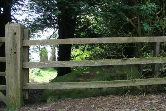
Merryton Low I viewed from the track leading to the barrow looking North-East.
Sites within 20km of Merryton Low I
-
Merryton Low II
description 1 -
Bawd Stone
photo 20forum 1description 4link 1 -
Leekfrith
photo 5description 1 -
Brownlow
description 1 -
Blake Low
description 1 -
Warslow
description 2 -
Brund Low
photo 1description 2 -
Town Low
description 1 -
Hanging Bank, Ecton Hill
photo 2description 2link 1 -
Roylow
description 1 -
Lud’s Church
photo 23forum 3description 14 -
Hollins Hill
photo 13forum 1description 3 -
Gun Hill
photo 10forum 1description 1 -
Sycamore Cave
photo 2description 3 -
Nan Tor
photo 2description 2 -
Hitter Hill
photo 13description 3link 1 -
Wetton Mill Upper Cave
photo 1 -
Mill Pot & Cave
-
Dowel Cave
photo 8description 2 -
Wetton Mill Farm Fissure
-
Hatch-a-way
photo 17description 1 -
Brand End
photo 5forum 1description 1 -
Etches Cave
photo 15description 2 -
Ossum’s Crag Cave
description 2 -
Dafar Ridge Cave
photo 1description 1 -
Stoup High Edge
photo 6description 1 -
Fox Hole Cave
photo 23description 3link 2 -
Pillsbury Hills Castle
photo 2description 1 -
Wetton Hill
photo 1description 1 -
Old Hannah’s Hole
photo 1description 1 -
The Hanging Stone
description 1 -
Waggon Low
-
Harley Grange
photo 13description 1 -
Upper edge
photo 2description 1 -
Thor’s Cave
photo 20description 9link 1 -
Thor’s Fissure Cavern
photo 5description 1 -
Seven Ways Cave
photo 9description 3 -
Elderbush Cave
photo 10description 3 -
Wetton Hill Cairns East
photo 11 -
Pilsbury
photo 5description 1 -
Cronkston Low
photo 6description 3 -
Narrowdale Hill
photo 4description 1 -
Allgreave
photo 4description 1 -
Hind Low (Site of)
photo 3 -
Carder Low
photo 1description 2 -
Grub Low
photo 2description 1 -
Frank I' Th' Rocks
photo 3description 2 -
Wetton Low
photo 2description 1 -
St Bertram’s
photo 1description 2 -
Beeston Tor Cave
photo 2forum 1description 1 -
Steep Low
photo 1description 1 -
Great Low
photo 3description 1 -
Waterfall Low
photo 6description 2 -
Gratton Hill
photo 2 -
Vincent Knoll
photo 1description 1 -
Wolfscote Hill
photo 1description 1 -
Pea Low
photo 15description 2 -
Falcon Low
photo 1description 1 -
Parsley Hay
photo 3description 1 -
Cheshire Wood Cave
photo 1description 3 -
Harpur Hill Cairn
photo 5description 1 -
Fox Low
description 1 -
Long Low
photo 18description 7 -
Longgutter
photo 10description 1 -
Grin Low
photo 10description 3 -
Lean Low
photo 7description 3 -
The Bullstones
photo 31forum 1description 8link 1 -
Moneystone Barrows
photo 1description 2 -
Gospel Hillocks
photo 1description 3 -
Bosley Minn
photo 19description 2 -
Staden
photo 2description 3 -
End Low
photo 4description 2 -
Benty Grange
description 2 -
Liffs Low
photo 3description 1link 1 -
Thirst House
photo 5description 3 -
Gib Hill east
photo 7description 5 -
Gib Hill
photo 31forum 1description 12 -
Chelmorton Low
photo 2description 1 -
Lismore Fields
photo 7forum 1link 1 -
Arbor Low
photo 148forum 11description 39link 3 -
Stanshope Pasture
photo 1description 1 -
Nettly Knowe
description 1 -
Green Low Field Tumulus
photo 2description 1 -
One Ash
description 1 -
Eaton Dale Wood
photo 3description 1 -
One Ash
photo 1description 1 -
Cales Farm SW
photo 2description 2 -
The Lowe
photo 1 -
Toot Hill
photo 7description 2 -
Five Wells
photo 46description 13link 1 -
New Inns
description 1 -
Musden Low (West)
photo 1 -
Cross Low
photo 3description 1 -
Friden Hollow
photo 1description 1 -
Moat Low
photo 2description 2 -
Aleck Low
photo 7description 2 -
Cow Low
description 2 -
Musden Low
photo 3description 1 -
Bostern Grange
description 1 -
Reynard’s Kitchen
photo 3description 2 -
Musden Low (South)
photo 2 -
Fairfield Low
description 2 -
Hawks Low
-
The Bridestones
photo 75forum 1description 15link 4 -
Shining Tor
photo 6description 1 -
Calton
photo 2description 1 -
Cauldon Lowe
description 2 -
Higher Ridgegate
photo 4description 1 -
Ringham Low (Friden)
description 1 -
Ringham Low
photo 2description 2 -
Cales Dale Upper
photo 1description 1 -
Dun Low
photo 3description 1 -
Hazelton Clump
photo 2description 1 -
One Ash Shelter
photo 2description 1 -
The Cloud
photo 5description 4link 1 -
Smerrill Moor
photo 2description 1 -
Kenslow Knoll
photo 7description 1 -
Long Gallery Plantation
description 1 -
Long Dale
photo 1description 2 -
Sharp Low
photo 2description 2 -
Gorsey Low
description 1 -
Stanton Dale Barrows
photo 2description 1 -
Top Low and Net Low
photo 5description 2 -
Chee Tor
photo 2description 1 -
Gawsworth Henge
photo 6forum 1description 1 -
Calling Low Dale
photo 4description 1link 1 -
Gratton Moor
photo 2description 1 -
Broad Oak Farm
photo 3description 1 -
Crake Low
description 1 -
Woodhouse End
photo 3description 2 -
Boars Low
photo 10description 3 -
Foxlow Edge
photo 5description 1 -
Gawton’s Well
photo 5description 2 -
Gawton’s Stone
photo 10description 2link 1 -
Thorswood
photo 3description 1 -
Bee Low
photo 1description 2 -
Sutton Hall
photo 6description 2 -
Borther Low
description 1 -
Bole Hill
-
Borther Low II
-
Old Woman’s House
photo 1description 1 -
Gotham Grange Barrow
photo 2description 1 -
Wind Low
photo 2description 1 -
Larks Low
photo 4description 1 -
Weaver Hills
photo 9description 3 -
Swinscoe
description 1 -
Roystone Rocks
photo 4description 1 -
Ramshorn Farm
photo 4forum 1description 3 -
Over Low
description 2 -
Roystone Grange
-
Roystone Valley
-
Conksbury
photo 4forum 1description 1 -
Powder Barrow
photo 2description 1 -
Cranes Fort
photo 4description 1 -
Basset Wood
photo 1description 1 -
Yearns Low
photo 3description 1link 1 -
Fin Cop
photo 19forum 1description 8link 3 -
Putwell Hill
description 2 -
Hob’s House
photo 6description 5 -
Elton Common
photo 10description 2 -
Burton Moor
description 2 -
Daisy Bank
description 1 -
Grind Low
description 1 -
Minninglow Round Barrow
photo 8description 1 -
Minninglow
photo 58description 12link 1 -
Lime Kiln Barrow
photo 1description 1 -
Lady Low
photo 5description 3 -
Pike Low
photo 5description 2 -
Castle Naze
photo 30description 5 -
The Tong
description 2 -
Bull Ring
photo 30forum 2description 13link 1 -
Bull Ring
photo 3ondemand_video 1description 1 -
Rockhurst
description 2 -
Hay Top
description 1 -
Ginclough
photo 6description 3 -
Gallows Low Lane
photo 2description 1 -
Black Rock Farm
photo 2description 1 -
Blackstones Low
photo 2description 2 -
Haddon Fields South
description 1 -
White Cliff
photo 2description 1 -
Cow Low
photo 5description 2 -
Stoney Low
photo 3description 1 -
Harthill Moor Barrow
photo 1description 1 -
Castle Ring (Harthill)
photo 21description 2 -
Bradley Tor
photo 7forum 1description 6 -
Robin Hood’s Stride
photo 59forum 3description 15link 1 -
Dudwood Tor
photo 3description 1 -
Bunbury Hillfort
description 1 -
Ravencliffe Cave
photo 4link 1 -
Galley Low
photo 5description 1 -
Dudwood
photo 3description 3 -
Hay Dale
description 2 -
Castlegate Lane
description 3 -
Haddon Fields North
photo 1description 1 -
Sanctuary Wood
photo 2description 1 -
Cratcliff Rocks (Defended Settlements and Cave)
photo 27description 5 -
Nine Stones Close standing stone
photo 8description 2 -
Slipper Low
description 2 -
Nine Stones Close
photo 120forum 1description 20 -
Nine Stones Close cup marked stone
photo 6forum 1description 1 -
Ladder Hill
photo 6description 3 -
Bradbourne
photo 12description 3 -
Mayfield
description 1 -
Slipper Low II
description 1 -
Rainster Rocks
photo 5description 1 -
Wigber Low
photo 17description 2 -
Wardlow Hay Cop
description 1 -
Old Man O’Mow
photo 7description 2 -
Rolley Low
photo 1description 2 -
Green Low Barrow
photo 5description 2 -
Cat Low, Dilhorne
description 2 -
Crackendale Pasture
photo 3description 2 -
Green Low
photo 22description 4 -
Rains Cave
photo 4description 2 -
Calwich Low
description 1 -
Rowtor Rocks
photo 73ondemand_video 1forum 3description 11link 2 -
The Boxes
description 2 -
Peter’s Stone
photo 5description 2 -
Henbury
photo 3description 1 -
Charles Head
photo 7description 3link 1 -
Further Harrop
photo 8description 2link 1 -
Doll Tor Standing Stone
photo 9description 1 -
Doll Tor
photo 74forum 4description 15 -
Bank Top Oval Barrow
description 1 -
Bank Top
description 1 -
Reed Hill
photo 18description 3link 2 -
Bearhurst Farm
photo 6description 1 -
The Andle Stone
photo 30description 11