
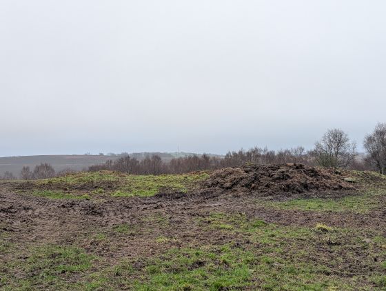
The longbarrow is around 35m in length and is situated in a field to the east of Minninglow. The actual barrow is rather unimpressive and it struggles to get noticed above the long grass.
As with Minninglow it lies on private land.
Articles
The long barrow comprises a low wedge-shaped mound measuring 33.5m along its east-west axis and varying between 14m wide at the east end and 10m wide at the west end. The height drops from east to west from c.0.7m to c.0.2m. The bowl barrow, which is located off the west end of the long barrow, is a roughly circular cairn with a diameter of 9.5m surviving to a height of c.0.2m. The surface of the cairn has been excavated or robbed of its stone but the old land surface in which burials will have been placed is still intact. There is no recorded excavation of the long barrow though it is possible that the bowl barrow was one of those on Brassington Moor excavated by Thomas Bateman in 1849.
Info from NMR.
Sites within 20km of Rockhurst
-

Minninglow Round Barrow
photo 8description 1 -

Minninglow
photo 58description 12link 1 -

Stoney Low
photo 3description 1 -

Gallows Low Lane
photo 2description 1 -
Slipper Low
description 2 -

Galley Low
photo 6description 1 -

Powder Barrow
photo 2description 1 -
Roystone Grange
-
Slipper Low II
description 1 -
Daisy Bank
description 1 -

Elton Common
photo 10description 2 -

Green Low Barrow
photo 5description 2 -

Roystone Rocks
photo 4description 1 -

Gotham Grange Barrow
photo 2description 1 -

Green Low
photo 22description 4 -
Roystone Valley
-

Blackstones Low
photo 2description 2 -

Lime Kiln Barrow
photo 1description 1 -

Rains Cave
photo 4description 2 -
Moot Low
description 2 -

Rainster Rocks
photo 5description 1 -

Harboro’ Rocks
photo 27description 7 -

Round Low
photo 2description 2 -

Gratton Moor
photo 2description 1 -
Borther Low II
-
Borther Low
description 1 -

Bonsall Lane
photo 2description 1 -

Carsington Pasture’s Cave
photo 1description 1link 2 -

Long Dale
photo 1description 2 -

Bradbourne
photo 12description 3 -
Hawks Low
-

Aleck Low
photo 7description 2 -

Smerrill Moor
photo 2description 1 -

Dudwood
photo 3description 3 -

Bradley Tor
photo 7forum 1description 6 -

Robin Hood’s Stride
photo 67forum 3description 15link 1 -
Long Gallery Plantation
description 1 -

Cratcliff Rocks (Defended Settlements and Cave)
photo 27description 5 -

Dudwood Tor
photo 3description 1 -

Rowtor Rocks
photo 73ondemand_video 1forum 3description 11link 2 -

Harthill Moor Barrow
photo 1description 1 -
Ows Low
description 1 -

Nine Stones Close standing stone
photo 9description 2 -

Kenslow Knoll
photo 7description 1 -

Middleton Moor
photo 1description 2 -

Nine Stones Close
photo 129forum 1description 20 -

Larks Low
photo 4description 1 -

Eaton Dale Wood
photo 3description 1 -

Castle Ring (Harthill)
photo 21description 2 -

Ivet Low
photo 1description 1 -

Nine Stones Close cup marked stone
photo 6forum 1description 1 -

Cross Low
photo 3description 1 -

The Stoup
photo 8description 4 -

Friden Hollow
photo 1description 1 -

Sanctuary Wood
photo 2description 1 -
Ringham Low (Friden)
description 1 -
Bank Top Oval Barrow
description 1 -
Bank Top
description 1 -
Crake Low
description 1 -

The Lowe
photo 1 -

Gallows Knoll
photo 2description 1 -

Doll Tor Standing Stone
photo 9description 1 -

Doll Tor
photo 75forum 4description 15 -

Wigber Low
photo 18description 3 -

Liffs Low
photo 3description 1link 1 -

Heart Stone
photo 2description 1 -

Cork Stone
photo 28description 7 -

The Andle Stone
photo 30description 11 -
Nettly Knowe
description 1 -
New Inns
description 1 -

T2 cairn
photo 15 -

T37 cairn
photo 3 -

T44,45 & 46
photo 1description 1 -

Stanton Moor South
photo 17description 5 -

T25 cairn
photo 9 -
Stand Low
photo 2description 1 -
Gorsey Low
description 1 -

End Low
photo 4description 2 -

Green Low Field Tumulus
photo 2description 1 -

Hognaston Barrow
photo 1description 1 -

Gorse Stone
photo 9description 4 -

Boars Low
photo 10description 3 -

T55 cairn
photo 5link 1 -

Stanton Moor Central
photo 20description 8 -

Wirksworth I
photo 12forum 1description 3 -

Moat Low
photo 2description 2 -

Wirksworth II (site)
photo 2description 1 -

Tower Cairn
photo 7description 1 -

Sharp Low
photo 2description 2 -

Wirksworth III
photo 1description 3 -
Nine Ladies of Stanton Moor
photo 97ondemand_video 1forum 26description 50link 1 -

Cat Stone
photo 3description 3 -

Stanton Moor North
photo 23description 5 -

Masson Hill
photo 7description 2 -

Basset Wood
photo 1description 1 -
Bostern Grange
description 1 -

Moneystone Barrows
photo 1description 2 -

Bee Low
photo 1description 2 -

Wolfscote Hill
photo 1description 1 -

Conksbury
photo 4forum 1description 1 -
Haddon Fields South
description 1 -

Lean Low
photo 7description 3 -

Gratton Hill
photo 2 -

Gib Hill east
photo 7description 5 -

Gib Hill
photo 32forum 1description 12 -

Arbor Low
photo 149forum 11description 41link 3 -

Frank I' Th' Rocks
photo 3description 2 -

One Ash
photo 1description 1 -

Reynard’s Kitchen
photo 3description 2 -

Cales Farm SW
photo 2description 2 -

Pea Low
photo 15description 2 -

Stanshope Pasture
photo 1description 1 -

Darley Dale
photo 5forum 2description 4 -

Calling Low Dale
photo 4description 1link 1 -

Cranes Fort
photo 4description 1 -
One Ash
description 1 -

Haddon Fields North
photo 1description 1 -
Benty Grange
description 2 -

Cales Dale Upper
photo 1description 1 -

Parsley Hay
photo 3description 1 -

Narrowdale Hill
photo 4description 1 -

Steep Low
photo 1description 1 -
Hirst Stones (site)
description 7 -

One Ash Shelter
photo 2description 1 -

Carder Low
photo 1description 2 -
Grind Low
description 1 -

Vincent Knoll
photo 1description 1 -

Long Low
photo 18description 7 -
Burton Moor
description 2 -

Ringham Low
photo 2description 2 -

Wetton Hill Cairns East
photo 11 -

Wishing Stone
photo 2description 2 -

Farley Moor
photo 14ondemand_video 1forum 1description 8 -

Wetton Low
photo 2description 1 -

Bumper Castle
photo 1description 1 -
Bole Hill
-

Cheshire Wood Cave
photo 1description 3 -

Wetton Hill
photo 1description 1 -

Cuckoo Stone
photo 4description 1 -

Raven Tor
photo 2description 1 -

Sycamore Cave
photo 2description 3 -

Calton Pastures
photo 11description 2 -

Beeston Tor Cave
photo 2forum 1description 1 -

St Bertram’s
photo 1description 2 -

Raven Tor Triple Cairn
photo 18forum 2description 9 -

Pilsbury
photo 5description 1 -

Seven Brideron (site)
photo 1description 1link 1 -

Old Hannah’s Hole
photo 1description 1 -
Roylow
description 1 -

Hazelton Clump
photo 3description 1 -

Dafar Ridge Cave
photo 1description 1 -

Wetton Mill Upper Cave
photo 1 -

Falcon Low
photo 1description 1 -
Wetton Mill Farm Fissure
-

Hanging Bank, Ecton Hill
photo 2description 2link 1 -

Ball Cross
photo 11description 2 -

Top Low and Net Low
photo 5description 2 -

Thor’s Fissure Cavern
photo 5description 1 -

Seven Ways Cave
photo 9description 3 -

Thor’s Cave
photo 20description 9link 1 -

Pillsbury Hills Castle
photo 2description 1 -
Mill Pot & Cave
-

Nan Tor
photo 2description 2 -
Warslow
description 2 -

Elderbush Cave
photo 10description 3 -

Musden Low
photo 3description 1 -
Ossum’s Crag Cave
description 2 -

Brund Low
photo 1description 2 -

Musden Low (West)
photo 1 -

Fallinge Edge
photo 1description 1 -
Waggon Low
-

Musden Low (South)
photo 2 -
Swinscoe
description 1 -

Dun Low
photo 3description 1 -
Fallinge Edge
description 1 -

Beeley North (South 2)
photo 3description 4 -

Beeley South (South I)
photo 1description 2 -

Lindup Low
photo 1description 2 -

Chatsworth Park
photo 2description 1 -
Blake Low
description 1 -

Beeley Moor
photo 6description 2 -

Calton
photo 2description 1 -
Mayfield
description 1 -
Hole Stone (site)
description 1 -

Beeley Warren
photo 3description 2 -

Beeley Warren NW
photo 1description 1 -

Park Gate Stone Circle
photo 40description 7link 1 -
Town Low
description 1 -

Osmaston Fields 2
photo 2description 1 -

Handley Bottom
photo 1description 1 -

Tinker’s Inn
photo 1description 1 -

Beeley Central
photo 4description 2 -

Crackendale Pasture
photo 3description 2 -

Beeley Warren ??
photo 2description 1 -
Beeley Warren NE
description 1 -

Harland Edge
photo 6description 4 -

Cronkston Low
photo 6description 3 -

Stump Cross Field Barrow
photo 3description 2 -
Harland Edge SW (b)
description 1 -
Harland Edge SW (a)
description 1 -
Harland Edge Cairn
description 1 -

Turning Stone and Robin Hoods Mark
photo 8description 6 -
Harewood Moor
description 1 -

Harland Edge SE
photo 2description 1 -

Harland Edge cup marked rock
photo 3description 1 -
Brownlow
description 1 -

Waterfall Low
photo 6description 2 -

Osmaston Fields
photo 3description 1 -

Bunkers Hill Plantation
photo 3description 2 -

Hob Hurst’s House
photo 25description 13 -

Gibbet Moor Standing Stones
photo 7description 2 -

Grub Low
photo 2description 1 -

Margery Bower
photo 2description 2 -

Stanton Dale Barrows
photo 2description 1 -

Old Woman’s House
photo 1description 1 -

Hob’s House
photo 6description 5 -

Fin Cop
photo 19forum 1description 8link 3 -

Fox Hole Cave
photo 23description 3link 2 -

Thorswood
photo 3description 1 -

Gibbet Moor South
photo 2description 2 -

Ashover
photo 12description 6link 1 -
Gibbet Moor West
description 3 -
Longside Moor
photo 3description 1 -
Over Low
description 2 -

Gibbet Moor and East Moor
photo 9description 1 -

Gibbet Moor North
photo 19description 5 -

Gibbet Moor cist
photo 3description 2 -
Putwell Hill
description 2 -

White Cliff
photo 2description 1 -

Dobb Edge
photo 7description 3 -

Gibbet Moor West
photo 1 -

Great Low
photo 3description 1 -

Dalebrook
photo 3description 1 -

Holymoorside
photo 10description 2 -
Hay Top
description 1 -
Castlegate Lane
description 3 -

Faybrick
photo 2description 3link 1 -

Gibbet Alignment
photo 10description 3 -
Rod Knoll
-

Hitter Hill
photo 13description 3link 1 -
Hay Dale
description 2 -

Weaver Hills
photo 9description 3 -
The Boxes
description 2 -
Calwich Low
description 1 -

Stone Low
photo 3 -
Blake Low
description 2 -

Gardom’s Ring Cairn
photo 8description 4 -
Birchen Edge South
description 1 -

Newbridge Farm
photo 2description 1 -

Five Wells
photo 46description 13link 1 -

The Three Men of Gardom’s
photo 11description 4 -

Rolley Low
photo 1description 2 -

Gardom’s Enclosure
photo 17description 6 -

Gardom’s Pit Alignment
photo 3forum 1description 1 -

Chelmorton Low
photo 2description 1 -

Hatch-a-way
photo 17description 1 -

Ravencliffe Cave
photo 4link 1 -

Gardom’s Edge
photo 22description 7link 2 -
Cauldon Lowe
description 2 -

Harley Grange
photo 13description 1 -

Gardom’s Standing Stone
photo 20forum 1description 8 -
Wardlow Hay Cop
description 1 -

Dowel Cave
photo 8description 2 -

Gardom’s Edge II
photo 6description 2 -

Etches Cave
photo 15description 2 -

Eagle Stone
photo 9description 5 -

White Rake Long Barrow
photo 2description 1 -

Birchen Edge North
photo 1description 1 -

Hind Low (Site of)
photo 3 -

Merryton Low I
photo 2description 1 -

Upper edge
photo 2description 1 -
Merryton Low II
description 1 -

Ramshorn Farm
photo 4forum 1description 3 -
Moisty Knowl (Site of)
description 1 -

Chee Tor
photo 2description 1 -

Thirst House
photo 5description 3 -
Eaglestone Flat
-

Peter’s Stone
photo 5description 2 -

Curbar Edge
photo 8description 1 -

Swine Sty
photo 20description 3 -

Barbrook V
photo 15description 3 -

Hollins Hill
photo 13forum 1description 3 -

Stoup High Edge
photo 6description 1 -

Big Moor (south) cairns
photo 10 -

Gospel Hillocks
photo 1description 3 -
Cow Low
description 2 -

Big Moor
photo 1description 1 -

Barbrook Stone Row
photo 2forum 1 -

Barbrook I
photo 65forum 4description 15link 1 -

Barbrook cairns
photo 35description 2 -
Barbrook II
photo 48forum 1description 12 -
Froggatt Edge cairn
-
Tup Low
description 1 -

Barbrook IV
photo 5description 5 -

Stoke Flat
photo 42forum 1description 12link 1 -

Brand End
photo 5forum 1description 1