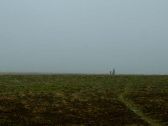
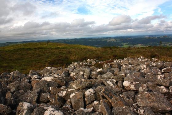
Log in
|
Register
Home
Latest Posts
Forums
Maps
Help
Browse Sites
News
Blog
Contributors
The Books
Select
-
Belgium
Denmark
Eire
France
Greece
Italy
The Netherlands
Norway
Portugal
Republic of Malta
Spain
Sweden
Switzerland
United Kingdom
England
Southern England
Devon
Dartmoor
Blatchford Bottom 2
Ancient Village / Settlement / Misc. Earthwork
Blatchford Bottom 2 (Ancient Village / Settlement / Misc. Earthwork) on The Modern Antiquarian, the UK & Ireland's most popular megalithic community website. 1 image, 1 fieldnote, plus information on many more ancient sites nearby and across the UK & Ireland.
Image © Billy Fear
Nearest Town:
Rattery (10km E)
OS Ref (GB):
SX636643 /
Sheet: 202
Latitude:
50° 27' 43.25" N
Longitude:
3° 55' 19.12" W
Added by
Billy Fear
Images (1)
Fieldnotes (1)
0 discussions
Start a topic
Show |
Hide
Web searches for Blatchford Bottom 2
Flash Earth
Flickr
Google
Google Images
MAGIC
The Megalithic Portal
Multimap 1:25000
Stone Pages
Streetmap.co.uk
Wikipedia
Show map
(inline Google Map)
- Sites within 20 km -
-
Stall Moor Stone Circle (0.14km WNW) (20 posts)
Blatchford Bottom settlements (0.32km SE) (3 posts)
Stall Moor Cairn (0.61km NNW) (7 posts)
Hook Lake (0.89km NNE) (4 posts)
Hook Lake (0.97km NNE) (5 posts)
Stall Moor (1.11km WSW) (1 post)
Erme Pound (1.4km N) (5 posts)
Ranny Brook (1.74km WSW) (4 posts)
Brown Heath (1.9km N) (0 posts)
Stalldown cairn circle (1.94km S) (3 posts)
Hillson's House (2.01km SSE) (8 posts)
Western White Barrow (2.02km NE) (4 posts)
Stalldown Stone Row (2.04km S) (47 posts)
Coombebrook North East (2.08km SW) (2 posts)
Stalldown Cairns (2.15km SSW) (7 posts)
Harrowthorn Plantation North (2.42km SSW) (2 posts)
Three Barrows (2.47km ESE) (10 posts)
Dendles Waste (2.63km SW) (2 posts)
Sharp Tor (2.86km SE) (7 posts)
Eastern White Barrow. (3km ENE) (1 post)
Stalldown South-East (3.1km SSE) (10 posts)
Grim's Grave (3.18km WNW) (5 posts)
Huntingdon Warren Settlement (3.35km NE) (2 posts)
Biller's Pound (3.49km ENE) (3 posts)
Stall Moor Stone Row (3.5km NNW) (15 posts)
Heap of Sinners (3.67km NE) (4 posts)
Snowdon (3.76km NE) (7 posts)
Piles Hill (3.8km SE) (9 posts)
Langcombe Brook / Deadman's Bottom (3.82km WNW) (13 posts)
Shell Top (3.92km WSW) (3 posts)
Penn Beacon (3.94km WSW) (2 posts)
Piles Hill (4.02km SE) (10 posts)
Penn Beacon South (4.1km WSW) (3 posts)
Great Gnat's Head (4.11km NW) (4 posts)
Burford Down cairn and cist (4.15km SSE) (4 posts)
Corringdon Ball Stone Row (4.16km ESE) (16 posts)
Rider's Rings (4.19km ENE) (0 posts)
Harford Moor (4.19km SSE) (10 posts)
Burford Down (4.2km SSE) (14 posts)
Brockhill Foot West (4.23km ENE) (4 posts)
Calveslake Tor (4.24km WNW) (3 posts)
Glasscombe Corner (4.29km ESE) (13 posts)
Corringdon Ball (4.3km ESE) (1 post)
Brockhill Ford West (4.38km ENE) (2 posts)
Corringdon Ball Long Barrow (4.38km ESE) (12 posts)
Glasscombe Ball North (4.38km SE) (1 post)
Glasscombe Ball (4.42km SE) (5 posts)
Hen Tor North / Shavercombe Brook (4.6km W) (8 posts)
Pupers Hill (4.68km NE) (4 posts)
Butterdon (4.69km SE) (25 posts)
Glaze Meet (4.71km ESE) (4 posts)
Spurrell's Cross Stone Row (5km SE) (8 posts)
Tory Brookhead (5.05km WSW) (0 posts)
Spanish Lake (5.08km WSW) (1 post)
Gripper's Hill (5.12km ENE) (3 posts)
Tory Brookhead (5.18km WSW) (7 posts)
Shell Top South West (5.19km WSW) (0 posts)
Drizzlecombe Megalithic Complex (5.2km W) (94 posts)
Butter Brook Ford (5.26km SSE) (6 posts)
Willings Walls Reave (5.28km WSW) (2 posts)
Butterdon Hill (north) cairn (5.31km SE) (4 posts)
Willings Walls Warren (5.46km W) (2 posts)
Cholwich Town (destroyed) (5.46km WSW) (2 posts)
Ditsworthy Cairn Circle (5.46km W) (2 posts)
Weatherdon Hill (5.5km SE) (3 posts)
Harbourne Head (5.64km ENE) (3 posts)
Eylesbarrow (5.66km WNW) (8 posts)
Aish Ridge (5.71km ESE) (4 posts)
Whittenknowles Rocks Settlement (5.8km W) (5 posts)
Butterdon Hill cairn circle (5.85km SE) (6 posts)
Willings Wall Warren (5.87km W) (3 posts)
Trowlesworthy (5.88km W) (0 posts)
Little Trowlesworthy Tor (5.88km W) (2 posts)
Trowlesworthy Warren (5.89km WSW) (6 posts)
Butterdon Hill (5.91km SE) (20 posts)
Butterdon Hill (5.94km SE) (0 posts)
Trowlesworthy Stone Row East (5.99km WSW) (10 posts)
Harbourne Head (6.02km ENE) (6 posts)
Ryder's Hill (6.05km NNE) (3 posts)
Mardle Valley (6.07km NE) (2 posts)
Trowlesworthy Stone Row West (6.09km WSW) (9 posts)
Eylesbarrow South West (6.09km WNW) (2 posts)
Childe's Tomb (6.11km NNW) (7 posts)
Addicombe (6.13km SSE) (0 posts)
Goldsmith's Cross/Fox Tor Mire (6.19km NW) (5 posts)
Butterdon Hill Chambered Tomb (6.27km SE) (7 posts)
Legis Tor Cist (6.29km W) (6 posts)
Gutter Tor (6.34km W) (2 posts)
Gutter Tor (6.35km W) (3 posts)
Gutter Tor Cist (6.48km W) (4 posts)
Trowlesworthy Warren (6.49km W) (2 posts)
Skir Hill (6.57km N) (1 post)
Cuckoo Ball (6.61km SE) (12 posts)
Cuckoo Rock (6.72km WNW) (3 posts)
Fox Tor Mire (6.74km NW) (2 posts)
Yellowmead SE cairn (6.75km W) (5 posts)
Round cairn east of Down Tor (6.76km WNW) (4 posts)
Enclosure east of Down Tor (6.83km WNW) (4 posts)
Ter Hill (6.84km NNW) (3 posts)
Emmets Post (6.86km WSW) (1 post)
Gutter Tor (6.87km W) (1 post)
Outcombe (6.89km W) (2 posts)
Western Beacon (6.96km SE) (21 posts)
Yellowmead Multiple Stone Circle (7.01km W) (49 posts)
Down Tor (7.06km WNW) (39 posts)
Brisworthy Stone Circle (7.18km W) (44 posts)
Ringmoor Down Cist (7.21km W) (4 posts)
Ringmoor Down (7.26km W) (1 post)
Ringmoor Down (7.26km W) (3 posts)
Hingston Hill North (7.41km WNW) (3 posts)
Down Tor South (7.42km WNW) (3 posts)
Holne Moor (7.42km NNE) (3 posts)
Ringmoor Cairn Circle and Stone Row (7.45km W) (43 posts)
Cantrell Stone Row (7.49km SE) (5 posts)
Ringmoor Kerbed Cairn (7.66km W) (5 posts)
Joan Ford's Newtake (7.81km NNW) (4 posts)
Holne Moor Triple Row (7.83km NNE) (2 posts)
Saddlesborough (7.85km WSW) (0 posts)
Royal Hill Cist (7.95km NNW) (4 posts)
Shaugh Moor (8.09km WSW) (3 posts)
Down Ridge (8.1km N) (6 posts)
Ringmoor Down Reave (8.16km W) (1 post)
St Leonard's Well (8.17km W) (4 posts)
West Saddlesborough Hut Circles (8.22km WSW) (3 posts)
West Saddlesborough Stone Row & Cairn Circle (8.22km WSW) (11 posts)
West Saddlesborough Cairn (8.32km WSW) (3 posts)
Aller Brook (8.41km NNE) (2 posts)
Royal Hill (8.43km NW) (0 posts)
Swincombe Ford Newtake (8.6km NNW) (2 posts)
Raddick Hill (8.77km WNW) (3 posts)
Sherberton Stone Circle (8.9km N) (12 posts)
Leather Tor South (8.94km WNW) (2 posts)
Wigford Down (9km W) (8 posts)
The Crock of Gold Cist (9.04km NW) (7 posts)
Hart Tor (9.45km WNW) (3 posts)
Hart Tor North Stone Circle & Rows (9.45km WNW) (3 posts)
Hart Tor (9.54km WNW) (7 posts)
Dewerstone Settlement (9.67km WSW) (8 posts)
Black Tor (9.67km WNW) (2 posts)
Leeden Tor South (9.68km WNW) (2 posts)
Shell Top South West (9.71km WSW) (9 posts)
Black Tor (9.71km WNW) (2 posts)
Blakey Tor (9.79km NW) (3 posts)
Yar Tor Hut Circle (9.85km NNE) (6 posts)
Coffin Stone (9.88km NNE) (1 post)
Hembury Castle (9.9km ENE) (4 posts)
Sharpitor (10.06km WNW) (8 posts)
Sharpitor (10.08km WNW) (12 posts)
Boringdon Camp (10.3km WSW) (12 posts)
Dunnabridge Pound (10.34km N) (6 posts)
Round Hill (10.39km NW) (8 posts)
Horseyeatt (10.69km WNW) (5 posts)
Yes Tor Bottom (10.93km WNW) (2 posts)
Ingra Tor (10.94km WNW) (2 posts)
Laughter Tor (11.3km N) (11 posts)
Yar Tor (11.5km NNE) (4 posts)
Corndon Tor (11.52km NNE) (1 post)
Bellever (12.22km N) (32 posts)
Yellowmeade (12.44km WNW) (3 posts)
The Plague Market At Merrivale (12.94km WNW) (96 posts)
Long Plantation (12.99km NW) (3 posts)
Wistman's Wood (13.03km NNW) (3 posts)
Merrivale Stone Circle (13.2km WNW) (24 posts)
Lakehead Hill (13.41km N) (43 posts)
Stennen Hill (13.53km NNW) (3 posts)
Littaford Tor (13.62km NNW) (1 post)
Merrivale Bridge Settlement (13.66km WNW) (7 posts)
Vixen Tor (13.69km WNW) (6 posts)
Kraps Ring (13.81km N) (5 posts)
White Tor Stone Row (14.09km NNW) (2 posts)
Cator Common North Cairn (14.21km N) (4 posts)
Rowtor Bog Cairns (14.32km NNW) (4 posts)
Barn Hill / Whitchurch Down (14.46km WNW) (3 posts)
Archerton, Newtake (14.49km NNW) (3 posts)
Crow Tor (14.62km NNW) (3 posts)
Blackdown Rings (14.73km ESE) (2 posts)
Soussons Common Cairn Circle (14.81km N) (27 posts)
Blackslade Down (14.85km NE) (1 post)
Langstone Moor (15.01km NW) (1 post)
Chittaford Down (15.09km NNW) (11 posts)
Chittaford Cairn and Cist (15.17km NNW) (5 posts)
Great Western Reave (15.31km WNW) (2 posts)
Roundy Park (15.39km NNW) (11 posts)
Roundy Park (15.39km NNW) (1 post)
Conies Down (15.6km NW) (1 post)
Rippon Tor (15.74km NE) (8 posts)
Beardown Man (15.8km NW) (13 posts)
Soussons Down (15.82km N) (2 posts)
Langstone Moor (15.89km NW) (2 posts)
Langstone Moor Stone Circle (15.96km NW) (9 posts)
Broad Down Cairn (16.58km NNW) (3 posts)
Stannon Newtake (16.78km N) (2 posts)
Langstone Moor Stone Row (16.83km NW) (6 posts)
White Tor East (16.87km WNW) (2 posts)
Water Hill (17.24km N) (1 post)
Water Hill (17.36km N) (1 post)
Challacombe (17.41km NNE) (19 posts)
Hamel Down (17.51km NNE) (6 posts)
Grimspound & Hookney Tor (17.81km NNE) (36 posts)
Hound Tor (17.83km NE) (5 posts)
Birch Tor (17.99km N) (6 posts)
Grims Lake Mire (18.1km NNE) (5 posts)
Denbury Hillfort round barrows (18.42km ENE) (6 posts)
Ritson Barrows (18.44km ESE) (1 post)
Halwell Camp (18.45km ESE) (1 post)
Assycombe Hill (18.45km N) (17 posts)
Hurston Ridge (18.46km N) (20 posts)
Denbury (18.54km ENE) (8 posts)
Hurston Ridge (18.56km N) (3 posts)
Stanborough Camp (18.57km ESE) (1 post)
King's Barrow (18.57km NNE) (2 posts)
Cut Hill (18.75km NNW) (15 posts)
The Greywethers (18.79km NNW) (50 posts)
West Vitifer (18.79km N) (2 posts)
East Bovey Head (18.89km NNE) (4 posts)
Bowerman's Nose (19.25km NNE) (8 posts)
West Lowton (19.26km N) (1 post)
Fernworthy Round House (19.37km N) (1 post)
Hut Circles 2 (19.63km N) (3 posts)
Heath Stone (19.7km N) (2 posts)
Black Hill (19.74km NE) (1 post)
Fernworthy Stone Row (South) (19.87km N) (7 posts)
Fernworthy (19.87km N) (36 posts)
Fernworthy Cairn and Cairn Circle (Eastern) (19.88km N) (4 posts)
- Facilities within 20 km -
-
The Plume of Feathers Inn (Pub: 10.2 km NW)
Warren House Inn (Pub: 17.1 km N)
- Add -
-
Add news
Add an image
Add fieldnotes
Add folklore
Add miscellaneous
Add a link
-
Add a site
Add a nearby facility
Add an alternative name/spelling
Images
(click to view fullsize)
Add an image
Fieldnotes
Add fieldnotes
Only a 100m or so South from the circle of the Stall Moor Row is this settlement. It has 25 rather small huts and 1 bigger one. It might not be one of the most impressive ones but the remote high location makes it a lovely space.
Comments (0)
|
Add a comment
|
Permalink
Posted by
Billy Fear
13th January 2010ce