Skip to content
Julian Cope
presents
The Modern
Antiquarian
Latest
Posts
Sites
Map
Blog
Forum
search
Search
⚠️
Sign in
more_horiz
United Kingdom
England
Northern England
Derbyshire
Big Moor
Barbrook Stone Row
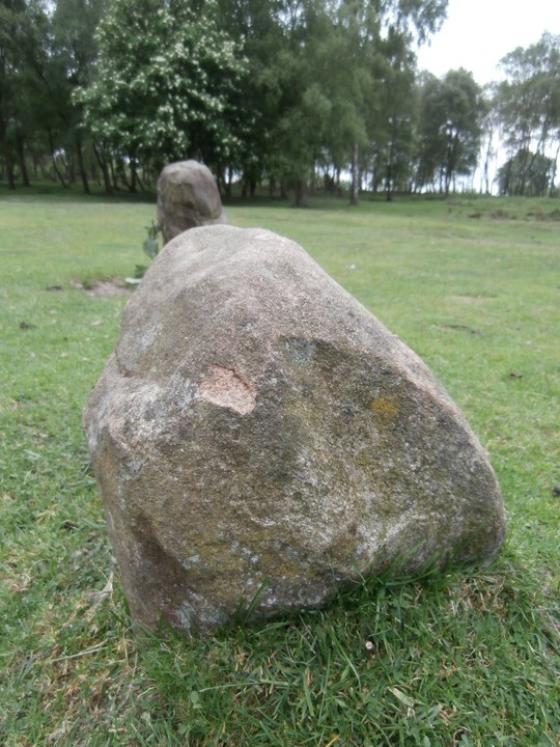
Modern stones erected by the water board. Kept on the TMA database to avoid repeat posts.
Stone Row / Alignment
SK277756
Disputed
expand_more
Nearest town:
Dronfield (8km ENE)
OS reference:
SK277756
OS sheet:
119
Latitude:
53° 16' 34.83 N
Longitude:
1° 35' 4.38 W
Added to TMA by
wiccaman9
Images (2)
Topics (1)
Add
content
Images
wiccaman9
Feb 5, 2016
Image credit: wiccaman9
wiccaman9
Feb 5, 2016
Topics
Eds/wiccaman9. Re - Barbrook stone row.
6
harestonesdown
Feb 2016
Sites within 20km of
Barbrook Stone Row
Barbrook I
Stone Circle
•
0.06km ENE
photo
64
forum
4
description
15
link
1
Barbrook cairns
Barrow / Cairn Cemetery
•
0.22km NNE
photo
34
description
2
Barbrook II
Stone Circle
•
0.26km NNW
photo
47
forum
1
description
12
Big Moor (south) cairns
Cairn(s)
•
0.5km SW
photo
10
Swine Sty
Ancient Village / Settlement / Misc. Earthwork
•
0.78km SW
photo
20
description
3
Barbrook V
Ring Cairn
•
1.01km WSW
photo
15
description
3
Big Moor
Cup Marked Stone
•
1.04km W
photo
1
description
1
Barbrook IV
Ring Cairn
•
1.3km E
photo
5
description
5
Barbrook III
Stone Circle
•
1.8km NNE
photo
21
description
9
Curbar Edge
Cairn(s)
•
2.02km WSW
photo
8
description
1
White Edge Cairn
Cairn(s)
•
2.19km NW
photo
1
description
1
Gardom’s Edge II
Cup and Ring Marks / Rock Art
•
2.3km S
photo
6
description
2
Eagle Stone
Natural Rock Feature
•
2.32km SW
photo
9
description
5
Birchen Edge North
Ring Cairn
•
2.34km SE
photo
1
description
1
Gardom’s Standing Stone
Standing Stone / Menhir
•
2.44km S
photo
20
forum
1
description
8
Gardom’s Edge
Cup and Ring Marks / Rock Art
•
2.63km S
photo
22
description
7
link
2
Gardom’s Pit Alignment
2.75km S
photo
3
forum
1
description
1
Gardom’s Enclosure
Enclosure
•
2.75km S
photo
17
description
6
The Three Men of Gardom’s
Cairn(s)
•
2.87km S
photo
11
description
4
Froggatt Edge cairn
Round Cairn
•
2.94km W
Stoke Flat
Stone Circle
•
2.94km W
photo
42
forum
1
description
12
link
1
Gardom’s Ring Cairn
Ring Cairn
•
3.04km S
photo
8
description
4
Birchen Edge South
Ring Cairn
•
3.33km SSE
description
1
Newbridge Farm
Cairn(s)
•
3.47km SSE
photo
2
description
1
Brown Edge
Stone Circle
•
3.57km NNE
photo
15
forum
4
description
5
Longshaw Estate
Round Barrow(s)
•
3.97km NW
photo
4
description
2
Stone Low
Round Barrow(s)
•
4.17km SE
photo
3
Dobb Edge
Cup and Ring Marks / Rock Art
•
4.2km S
photo
7
description
3
Gibbet Alignment
Stone Row / Alignment
•
4.25km SSE
photo
10
description
3
Gibbet Moor West
Ancient Village / Settlement / Misc. Earthwork
•
4.3km SSE
photo
1
Strawberry Lea
4.41km N
photo
11
description
3
Bole Hill Hillfort
Hillfort
•
4.51km NNE
description
2
Lawrence Field
Stone Circle
•
4.79km WNW
photo
8
forum
1
description
3
Gibbet Moor cist
Cist
•
4.82km SSE
photo
3
description
2
Gibbet Moor North
Stone Circle
•
4.83km SSE
photo
19
description
5
Gibbet Moor and East Moor
Barrow / Cairn Cemetery
•
5.04km SSE
photo
9
description
1
Ciceley Low
Ring Cairn
•
5.09km NNW
photo
5
description
2
Gibbet Moor West
Ring Cairn
•
5.1km SSE
description
3
Dalebrook
Cairn(s)
•
5.12km SE
photo
3
description
1
Fingerem Stone
Cairn(s)
•
5.31km NNW
photo
7
forum
1
description
4
Southwest of Burbage Bridge
Cairn(s)
•
5.34km NW
Gibbet Moor South
Enclosure
•
5.41km SSE
photo
2
description
2
Burbage Rocks
Cup Marked Stone
•
5.44km NNW
photo
1
forum
1
description
1
Mother Cap Stone
Natural Rock Feature
•
5.49km NW
photo
10
description
2
Toad’s Mouth
Cairn(s)
•
5.49km NW
photo
2
description
1
Eyam Moor III
Stone Circle
•
5.5km WNW
photo
8
description
4
Eyam Moor II
Stone Circle
•
5.62km WNW
photo
4
description
4
Hathersage Moor Ring Cairn
Ring Cairn
•
5.65km NW
photo
2
description
3
Toads Mouth Cairn /
Barrow
Cairn(s)
•
5.73km NW
photo
1
description
1
Gibbet Moor Standing Stones
Standing Stone / Menhir
•
5.88km SSE
photo
7
description
2
Winyard’s Nick
Standing Stone / Menhir
•
6.12km NW
photo
6
Carl Wark & Hathersage Moor
6.13km NW
photo
65
forum
2
description
9
link
1
Blake Low
Round Barrow(s)
•
6.15km WSW
description
2
Eyam Moor Barrow
Cairn(s)
•
6.19km W
photo
24
description
7
Wet Withens
Stone Circle
•
6.2km W
photo
32
forum
1
description
15
link
1
Cup stone
Cup Marked Stone
•
6.25km WNW
photo
2
description
1
Bunkers Hill Plantation
Cave / Rock Shelter
•
6.33km SSE
photo
3
description
2
Hob Hurst’s House
Burial Chamber
•
6.47km SSE
photo
25
description
13
Stump Cross Field Barrow
Round Barrow(s)
•
6.51km SW
photo
3
description
2
Handley Bottom
Cup Marked Stone
•
6.65km SW
photo
1
description
1
Rod Knoll
Cairn(s)
•
6.66km SE
Beeley Warren NE
6.7km SSE
description
1
Lindup Low
Round Barrow(s)
•
6.76km SSW
photo
1
description
2
Chatsworth Park
Round Barrow(s)
•
6.79km SSW
photo
2
description
1
Beeley Warren ??
Cairn(s)
•
6.8km SSE
photo
2
description
1
Stanage
Cup Marked Stone
•
6.86km W
photo
20
description
6
Stanage II
Cup Marked Stone
•
6.86km W
photo
4
description
2
Moisty Knowl (Site of)
6.88km WSW
description
1
Beeley Warren NW
Ring Cairn
•
6.9km S
photo
1
description
1
Harland Edge Cairn
Cairn(s)
•
7km SSE
description
1
Harland Edge cup marked rock
Cup Marked Stone
•
7.05km SSE
photo
3
description
1
Park Gate Stone Circle
Stone Circle
•
7.11km SSE
photo
40
description
7
link
1
Beeley Moor
Ring Cairn
•
7.2km SSE
photo
6
description
2
Beeley Central
Ring Cairn
•
7.24km SSE
photo
4
description
2
Harland Edge
Cairn(s)
•
7.26km SSE
photo
6
description
4
Beeley Warren
Cairn(s)
•
7.44km SSE
photo
3
description
2
Ecclesall Woods 3
7.46km NE
photo
1
description
1
Ox Stones
Natural Rock Feature
•
7.54km N
photo
14
Harland Edge SW (a)
Cairn(s)
•
7.61km SSE
description
1
Highlow Bank ring cairn
Ring Cairn
•
7.66km WNW
photo
1
description
1
Harland Edge SW (b)
Cairn(s)
•
7.73km SSE
description
1
Harland Edge SE
Cairn(s)
•
7.84km SE
photo
2
description
1
Highlow Bank Stone
Standing Stone / Menhir
•
7.94km WNW
photo
4
forum
1
description
2
Highlow Bank Cairn
Cairn(s)
•
8.02km WNW
photo
1
description
1
White Rake Long Barrow
Long Barrow
•
8.02km WSW
photo
2
description
1
Beeley North (South 2)
8.04km SSE
photo
3
description
4
Beeley South (South I)
Ring Cairn
•
8.04km SSE
photo
1
description
2
Longside Moor
Round Barrow(s)
•
8.04km SE
photo
1
description
1
Offerton Moor East
Cairn(s)
•
8.12km WNW
photo
3
description
1
Offerton Moor West
Stone Circle
•
8.12km WNW
photo
6
description
2
Ball Cross
Hillfort
•
8.13km SW
photo
11
description
2
Holymoorside
Cup and Ring Marks / Rock Art
•
8.26km ESE
photo
6
description
2
Calton Pastures
Round Barrow(s)
•
8.28km SSW
photo
11
description
2
Fallinge Edge
Cairn(s)
•
8.3km SSE
description
1
Whirlow Hall Farm Henge
Henge
•
8.35km NNE
link
1
Fallinge Edge
Cairn(s)
•
8.41km SSE
photo
1
description
1
Crackendale Pasture
Round Barrow(s)
•
8.48km SW
photo
3
description
2
Harewood Moor
Ancient Village / Settlement / Misc. Earthwork
•
8.63km SE
description
1
Smelting Hill & Abney Moor
Stone Circle
•
8.79km W
photo
10
description
2
Raven Tor Triple Cairn
Cairn(s)
•
8.9km SSE
photo
18
forum
2
description
9
Ecclesall Woods
Cup and Ring Marks / Rock Art
•
8.94km NE
photo
17
forum
1
description
4
link
3
Tup Low
Round Barrow(s)
•
9.06km W
description
1
Raven Tor
Cairn(s)
•
9.1km SSE
photo
2
description
1
Rolley Low
Round Barrow(s)
•
9.48km WSW
photo
1
description
2
Burton Bole
Round Barrow(s)
•
9.64km W
photo
3
Bumper Castle
Ring Cairn
•
9.69km S
photo
1
description
1
Dennis Knoll & Sheepwash Bank
Ancient Village / Settlement / Misc. Earthwork
•
9.74km NW
photo
1
description
1
Castlegate Lane
Round Barrow(s)
•
9.9km WSW
description
3
Wardlow Hay Cop
Round Barrow(s)
•
9.95km WSW
description
1
Hay Dale
Round Barrow(s)
•
9.97km WSW
description
2
Graves Park Round Barrow
Round Barrow(s)
•
10.03km NE
photo
1
description
1
Burr Tor
Hillfort
•
10.1km W
photo
3
forum
1
description
2
White Cliff
Round Barrow(s)
•
10.19km WSW
photo
2
description
1
Peter’s Stone
Natural Rock Feature
•
10.4km WSW
photo
5
description
2
Ravencliffe Cave
Cave / Rock Shelter
•
10.48km WSW
photo
4
link
1
Bamford Moor South
Stone Circle
•
10.49km WNW
photo
21
description
8
Hay Top
Round Barrow(s)
•
10.63km WSW
description
1
Ash Cabin Rock Fall cave /
shelter
Cave / Rock Shelter
•
10.7km NNW
photo
4
description
1
Ash Cabin Flat
Stone Circle
•
10.71km NNW
photo
16
forum
3
description
3
Ring Cairn/
Hut Circle
10.71km NNW
photo
1
Ash Cabin Flat
Standing Stone / Menhir
•
10.71km NNW
photo
4
description
2
Long Cist
Cist
•
10.71km NNW
photo
5
description
1
Cist II
Cist
•
10.71km NNW
photo
1
The Old Woman’s Stone
Standing Stone / Menhir
•
10.71km WNW
photo
4
description
1
Ash Cabin Flat
Hillfort
•
10.8km NNW
photo
4
description
3
Hob’s House
Cave / Rock Shelter
•
10.98km WSW
photo
6
description
5
Bamford Moor Central
Ring Cairn
•
11.04km WNW
photo
2
description
2
Haddon Fields North
Round Barrow(s)
•
11.05km SW
photo
1
description
1
Fin Cop
Hillfort
•
11.08km WSW
photo
19
forum
1
description
8
link
3
Putwell Hill
Round Cairn
•
11.22km WSW
description
2
Darley Dale
Ancient Trackway
•
11.29km S
photo
5
forum
2
description
4
Crow Chin
Cairn(s)
•
11.3km NW
description
1
Crow Chin North
Cairn(s)
•
11.3km NW
photo
3
description
2
Crow Chin South
Cairn(s)
•
11.3km NW
photo
3
description
2
Burton Moor
Round Barrow(s)
•
11.3km SW
description
2
Grind Low
Round Barrow(s)
•
11.47km SW
description
1
Cop Low
11.6km W
description
1
New Hagg
Standing Stone / Menhir
•
11.62km NNW
photo
3
description
1
Bamford Moor North
Ring Cairn
•
11.8km WNW
photo
1
description
2
Head Stone
Natural Rock Feature
•
11.89km NNW
photo
10
forum
1
description
2
Moscar Moor
Kerbed Cairn
•
11.95km NW
photo
6
description
2
Haddon Fields South
Round Barrow(s)
•
12.06km SW
description
1
Seven Brideron (site)
Stone Circle
•
12.12km SE
photo
1
description
1
link
1
Old Woman’s House
Cave / Rock Shelter
•
12.15km WSW
photo
1
description
1
Stanton Moor North
Stone Circle
•
12.23km S
photo
23
description
5
Cranes Fort
Hillfort
•
12.24km SW
photo
4
description
1
Bole Hill
Round Barrow(s)
•
12.33km SW
Nine Ladies of Stanton Moor
Stone Circle
•
12.41km S
photo
97
ondemand_video
1
forum
26
description
49
link
1
Cat Stone
Natural Rock Feature
•
12.52km S
photo
3
description
3
Tower Cairn
Cairn(s)
•
12.54km S
photo
7
description
1
Stan Low (site)
Round Barrow(s)
•
12.67km W
description
1
Stanton Moor Central
Stone Circle
•
12.72km S
photo
20
description
8
Seven Stones of Hordron Edge
Stone Circle
•
12.73km NW
photo
49
ondemand_video
1
forum
4
description
15
link
3
Conksbury
Round Barrow(s)
•
12.77km SW
photo
4
forum
1
description
1
T55 cairn
Cairn(s)
•
12.79km S
photo
5
link
1
Farley Moor
Standing Stone / Menhir
•
12.79km SSE
photo
14
ondemand_video
1
forum
1
description
8
Gorse Stone
Natural Rock Feature
•
12.95km S
photo
9
description
4
Tideslow
Chambered Cairn
•
12.96km W
photo
12
description
4
T25 cairn
Kerbed Cairn
•
12.98km S
photo
9
T37 cairn
Kerbed Cairn
•
13.07km SSW
photo
3
The Andle Stone
Natural Rock Feature
•
13.09km SSW
photo
30
description
11
T44,45 & 46
Cairn(s)
•
13.14km S
photo
1
description
1
Stanton Moor South
Stone Circle
•
13.14km S
photo
17
description
5
T2 cairn
Round Cairn
•
13.15km S
photo
15
Cork Stone
Natural Rock Feature
•
13.21km SSW
photo
28
description
7
Heart Stone
Rocking Stone
•
13.33km S
photo
2
description
1
Doll Tor
Stone Circle
•
13.37km SSW
photo
74
forum
4
description
15
Doll Tor Standing Stone
Standing Stone / Menhir
•
13.39km SSW
photo
9
description
1
Ladybower Tor
Cup and Ring Marks / Rock Art
•
13.42km WNW
photo
10
forum
2
description
2
Sanctuary Wood
Ancient Village / Settlement / Misc. Earthwork
•
13.65km SSW
photo
2
description
1
Bee Low
Round Cairn
•
13.72km SW
photo
1
description
2
Pin Dale
Enclosure
•
13.74km W
photo
1
description
1
Nine Stones Close cup marked stone
Cup Marked Stone
•
13.8km SSW
photo
6
forum
1
description
1
Calling Low Dale
Cave / Rock Shelter
•
13.84km SW
photo
4
description
1
link
1
Cuckoo Stone
13.89km SE
photo
4
description
1
Castle Ring (Harthill)
Hillfort
•
13.95km SSW
photo
21
description
2
Nine Stones Close
Stone Circle
•
13.98km SSW
photo
120
forum
1
description
20
Nine Stones Close standing stone
Standing Stone / Menhir
•
14.07km SSW
photo
8
description
2
Rowtor Rocks
Cup and Ring Marks / Rock Art
•
14.12km SSW
photo
73
ondemand_video
1
forum
3
description
11
link
2
Ashover
Cup and Ring Marks / Rock Art
•
14.13km SE
photo
12
description
6
link
1
Ringham Low
Round Barrow(s)
•
14.16km SW
photo
2
description
2
Harthill Moor Barrow
Barrow / Cairn Cemetery
•
14.23km SSW
photo
1
description
1
Dudwood Tor
Rocky Outcrop
•
14.24km SSW
photo
3
description
1
Cratcliff Rocks (Defended Settlements and Cave)
Enclosure
•
14.26km SSW
photo
27
description
5
One Ash Shelter
Cave / Rock Shelter
•
14.26km SW
photo
2
description
1
The Holmes
Enclosure
•
14.27km W
photo
1
description
1
Robin Hood’s Stride
Rocky Outcrop
•
14.33km SSW
photo
59
forum
3
description
15
link
1
Castle Hill (Castleton)
Sacred Hill
•
14.42km W
photo
2
description
3
Faybrick
Natural Rock Feature
•
14.46km ESE
photo
2
description
3
link
1
Bradley Tor
Rocking Stone
•
14.52km SSW
photo
7
forum
1
description
6
Cales Dale Upper
Cave / Rock Shelter
•
14.54km SW
photo
1
description
1
Dudwood
Ancient Village / Settlement / Misc. Earthwork
•
14.58km SSW
photo
3
description
3
Crook Hill
Stone Circle
•
14.76km WNW
photo
7
description
2
Larks Low
Round Barrow(s)
•
15.09km SSW
photo
4
description
1
Turning Stone and Robin Hoods Mark
Rocking Stone
•
15.1km SE
photo
8
description
6
Brood Low
Round Barrow(s)
•
15.25km W
photo
1
Chee Tor
Stone Circle
•
15.25km WSW
photo
2
description
1
Wishing Stone
Natural Rock Feature
•
15.37km SSE
photo
2
description
2
Hole Stone (site)
15.4km SE
description
1
Ox Low
Round Barrow(s)
•
15.47km W
Lose Hill
Round Barrow(s)
•
15.73km WNW
photo
9
Cales Farm SW
Round Barrow(s)
•
15.75km SW
photo
2
description
2
One Ash
Round Barrow(s)
•
15.81km SW
photo
1
description
1
Five Wells
Chambered Tomb
•
15.9km WSW
photo
46
description
13
link
1
Bonsall Lane
Cave / Rock Shelter
•
15.95km S
photo
2
description
1
One Ash
Long Barrow
•
16.02km SW
description
1
The Tong
Long Barrow
•
16.1km W
description
2
Odin Mine
Cave / Rock Shelter
•
16.24km W
photo
9
description
2
Wind Low
Round Barrow(s)
•
16.25km WSW
photo
2
description
1
Kenslow Knoll
Round Barrow(s)
•
16.7km SW
photo
7
description
1
Windy Knoll
Cave / Rock Shelter
•
16.76km W
photo
4
description
1
Arbor Low
Stone Circle
•
16.77km SW
photo
148
forum
11
description
41
link
3
Borther Low II
Round Barrow(s)
•
16.8km SSW
Borther Low
Round Barrow(s)
•
16.8km SSW
description
1
Long Gallery Plantation
Round Barrow(s)
•
16.81km SW
description
1
Ringham Low (Friden)
Round Barrow(s)
•
16.82km SW
description
1
Eldon Hill Enclosure
Enclosure
•
16.86km W
photo
2
description
2
Mam Tor
Hillfort
•
16.91km W
photo
61
forum
2
description
8
link
1
Benty Grange
Round Barrow(s)
•
16.94km SW
description
2
Mam Tor barrows
Round Barrow(s)
•
16.95km W
photo
12
description
2
Chelmorton Low
Round Barrow(s)
•
17km WSW
photo
2
description
1
Masson Hill
Round Barrow(s)
•
17.01km SSE
photo
3
description
2
Eldon Hill
Round Barrow(s)
•
17.05km W
photo
4
description
3
Pike Low
Cairn(s)
•
17.08km WNW
photo
1
Gib Hill
Long Barrow
•
17.09km SW
photo
31
forum
1
description
12
Gib Hill east
Ancient Village / Settlement / Misc. Earthwork
•
17.15km SW
photo
7
description
5
Long Dale
Round Barrow(s)
•
17.35km SW
photo
1
description
2
Smerrill Moor
Round Barrow(s)
•
17.45km SW
photo
2
description
1
Hirst Stones (site)
17.46km SSE
description
7
Friden Hollow
Round Barrow(s)
•
17.59km SW
photo
1
description
1
Perryfoot
Long Barrow
•
17.62km W
photo
2
description
2
Cow Low
Round Barrow(s)
•
17.65km WSW
description
2
Gratton Moor
17.84km SSW
photo
2
description
1
Elton Common
17.88km SSW
photo
10
description
2
Green Low
Burial Chamber
•
18.15km SSW
photo
22
description
4
Green Low Barrow
Round Barrow(s)
•
18.16km SSW
photo
5
description
2
Parsley Hay
Round Cairn
•
18.21km SW
photo
3
description
1
Lord’s Seat
Round Barrow(s)
•
18.24km W
photo
26
description
4
Wincobank
Hillfort
•
18.38km NE
photo
7
forum
3
description
6
link
1
Lean Low
Round Barrow(s)
•
18.42km SW
photo
7
description
3
Vincent Knoll
Round Barrow(s)
•
18.46km SW
photo
1
description
1
Thirst House
Cave / Rock Shelter
•
18.47km WSW
photo
5
description
3
Harrod Low
Long Barrow
•
18.5km W
photo
7
forum
1
description
2
Great Low
Barrow / Cairn Cemetery
•
18.54km WSW
photo
3
description
1
Gautries Hill
Round Barrow(s)
•
18.61km W
photo
13
description
3
Cowell Flat
Ancient Village / Settlement / Misc. Earthwork
•
18.68km NNW
photo
6
description
1
Cronkston Low
Round Barrow(s)
•
18.72km WSW
photo
6
description
3
Stoney Low
Chambered Cairn
•
18.73km SSW
photo
3
description
1
Moneystone Barrows
Round Barrow(s)
•
18.87km SW
photo
1
description
2
Gotham Grange Barrow
Round Barrow(s)
•
18.9km SSW
photo
2
description
1
Bar Dyke Ring
Cairn(s)
•
19.16km NNW
photo
1
description
4
Aleck Low
Round Barrow(s)
•
19.17km SW
photo
7
description
2
Eaton Dale Wood
Standing Stone / Menhir
•
19.2km SW
photo
3
description
1
Bar Dyke
Dyke
•
19.22km NNW
photo
4
description
4
Rockhurst
Long Barrow
•
19.24km SSW
description
2
Apronful of Stones (Bradfield)
Cairn(s)
•
19.26km NNW
photo
1
description
1
Pike Lowe
Cairn(s)
•
19.3km NW
photo
1
description
1
End Low
Round Barrow(s)
•
19.31km SW
photo
4
description
2
Pilsbury
Cairn(s)
•
19.42km SW
photo
5
description
1
Moot Low
Round Barrow(s)
•
19.46km S
description
2
Slipper Low II
Cairn(s)
•
19.48km SSW
description
1
Gospel Hillocks
Long Barrow
•
19.49km WSW
photo
1
description
3
Minninglow Round Barrow
Round Barrow(s)
•
19.5km SSW
photo
8
description
1
Slipper Low
Cairn(s)
•
19.5km SSW
description
2
Minninglow
Burial Chamber
•
19.5km SSW
photo
58
description
12
link
1
Waggon Low
Round Barrow(s)
•
19.59km WSW
Carder Low
Cairn(s)
•
19.63km SW
photo
1
description
2
Fairfield Low
Round Barrow(s)
•
19.9km WSW
description
2
Middleton Moor
Platform Cairn
•
19.93km S
photo
1
description
2
Roystone Grange
Round Barrow(s)
•
19.94km SSW
More Hall
Cup Marked Stone
•
19.99km N
photo
10
description
1
search
I’m looking for…
location_on
photo
ondemand_video
forum
description
link