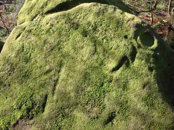
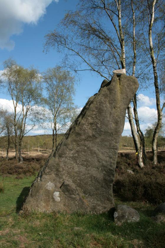
I have been told the Hole Stone has been moved from it’s original position and is now either used as..... A gatepost in one of the field walls near Holestone Farm or Holestone Cottage. Used in the construction of a farm building or just plain (h)ol(e)d lost.
Articles
Sites within 20km of Hole Stone (site)
-

Turning Stone and Robin Hoods Mark
photo 8description 6 -

Ashover
photo 12description 6link 1 -

Cuckoo Stone
photo 4description 1 -

Wishing Stone
photo 2description 2 -

Faybrick
photo 2description 3link 1 -

Seven Brideron (site)
photo 1description 1link 1 -

Farley Moor
photo 14ondemand_video 1forum 1description 8 -
Hirst Stones (site)
description 7 -

Masson Hill
photo 3description 2 -
Harewood Moor
description 1 -

Holymoorside
photo 6description 2 -

Longside Moor
photo 1description 1 -

Bumper Castle
photo 1description 1 -

Harland Edge SE
photo 2description 1 -

Raven Tor
photo 2description 1 -
Fallinge Edge
description 1 -

Fallinge Edge
photo 1description 1 -

Raven Tor Triple Cairn
photo 18forum 2description 9 -
Harland Edge SW (b)
description 1 -
Harland Edge SW (a)
description 1 -

Darley Dale
photo 5forum 2description 4 -

Beeley North (South 2)
photo 3description 4 -

Beeley South (South I)
photo 1description 2 -

Harland Edge
photo 6description 4 -

Beeley Warren
photo 3description 2 -

Harland Edge cup marked rock
photo 3description 1 -

Cat Stone
photo 3description 3 -

Gorse Stone
photo 9description 4 -

Beeley Central
photo 4description 2 -
Harland Edge Cairn
description 1 -

Tower Cairn
photo 7description 1 -
Rod Knoll
-

Bonsall Lane
photo 2description 1 -

T55 cairn
photo 5link 1 -

Nine Ladies of Stanton Moor
photo 97ondemand_video 1forum 26description 49link 1 -

Stanton Moor North
photo 23description 5 -

Park Gate Stone Circle
photo 40description 7link 1 -

Heart Stone
photo 2description 1 -

Stanton Moor Central
photo 20description 8 -

T44,45 & 46
photo 1description 1 -

Stanton Moor South
photo 17description 5 -

T2 cairn
photo 15 -

Beeley Moor
photo 6description 2 -

T25 cairn
photo 9 -

Middleton Moor
photo 1description 2 -

Hob Hurst’s House
photo 25description 13 -

Wirksworth II (site)
photo 2description 1 -

T37 cairn
photo 3 -

Cork Stone
photo 28description 7 -

Beeley Warren ??
photo 2description 1 -

Beeley Warren NW
photo 1description 1 -
Beeley Warren NE
description 1 -

Wirksworth I
photo 12forum 1description 3 -

Wirksworth III
photo 1description 3 -

Bunkers Hill Plantation
photo 3description 2 -

The Andle Stone
photo 30description 11 -

Gallows Knoll
photo 2description 1 -

Doll Tor
photo 74forum 4description 15 -

Gibbet Moor Standing Stones
photo 7description 2 -

Doll Tor Standing Stone
photo 9description 1 -
Rowtor Rocks
photo 73ondemand_video 1forum 3description 11link 2 -

Dalebrook
photo 3description 1 -

Gibbet Moor South
photo 2description 2 -

Ivet Low
photo 1description 1 -

Gibbet Moor and East Moor
photo 9description 1 -
Gibbet Moor West
description 3 -

Gibbet Moor North
photo 19description 5 -

Gibbet Moor cist
photo 3description 2 -
Moot Low
description 2 -

Green Low
photo 22description 4 -

Green Low Barrow
photo 5description 2 -

Cratcliff Rocks (Defended Settlements and Cave)
photo 27description 5 -

Nine Stones Close standing stone
photo 8description 2 -

Nine Stones Close
photo 120forum 1description 20 -

Nine Stones Close cup marked stone
photo 6forum 1description 1 -

Stone Low
photo 3 -

Harboro’ Rocks
photo 27description 6 -

Dudwood
photo 3description 3 -

Lindup Low
photo 1description 2 -

Gibbet Alignment
photo 10description 3 -

Sanctuary Wood
photo 2description 1 -

Bradley Tor
photo 7forum 1description 6 -

Robin Hood’s Stride
photo 59forum 3description 15link 1 -

Dudwood Tor
photo 3description 1 -

Gibbet Moor West
photo 1 -

Harthill Moor Barrow
photo 1description 1 -

Castle Ring (Harthill)
photo 21description 2 -

Round Low
photo 2description 2 -

Chatsworth Park
photo 2description 1 -

Carsington Pasture’s Cave
photo 1description 1link 2 -

Newbridge Farm
photo 2description 1 -
Slipper Low II
description 1 -

Dobb Edge
photo 7description 3 -
Birchen Edge South
description 1 -

Calton Pastures
photo 11description 2 -

Stoney Low
photo 3description 1 -
Slipper Low
description 2 -

Rains Cave
photo 4description 2 -
Haddon Fields South
description 1 -

Galley Low
photo 5description 1 -

Elton Common
photo 10description 2 -
Rockhurst
description 2 -

Haddon Fields North
photo 1description 1 -

Gardom’s Ring Cairn
photo 8description 4 -

Birchen Edge North
photo 1description 1 -
Ows Low
description 1 -

The Three Men of Gardom’s
photo 11description 4 -

Gardom’s Enclosure
photo 17description 6 -

Gardom’s Pit Alignment
photo 3forum 1description 1 -

Handley Bottom
photo 1description 1 -

Gardom’s Edge
photo 22description 7link 2 -

Gallows Low Lane
photo 2description 1 -

Ball Cross
photo 11description 2 -

Gardom’s Edge II
photo 6description 2 -

Minninglow Round Barrow
photo 8description 1 -

Minninglow
photo 58description 12link 1 -
Gardom’s Standing Stone
photo 20forum 1description 8 -

Rainster Rocks
photo 5description 1 -

Hognaston Barrow
photo 1description 1 -

Larks Low
photo 4description 1 -
Borther Low II
-

Stump Cross Field Barrow
photo 3description 2 -

The Stoup
photo 8description 4 -

Conksbury
photo 4forum 1description 1 -
Borther Low
description 1 -
Daisy Bank
description 1 -

Blackstones Low
photo 2description 2 -

Powder Barrow
photo 2description 1 -
Roystone Grange
-

Gotham Grange Barrow
photo 2description 1 -

Cranes Fort
photo 4description 1 -

Lime Kiln Barrow
photo 1description 1 -
Grind Low
description 1 -

Eagle Stone
photo 9description 5 -
Roystone Valley
-

Roystone Rocks
photo 4description 1 -

Gratton Moor
photo 2description 1 -

Bee Low
photo 1description 2 -
Burton Moor
description 2 -

Barbrook IV
photo 5description 5 -

Swine Sty
photo 20description 3 -

Long Dale
photo 1description 2 -
Long Gallery Plantation
description 1 -

Kenslow Knoll
photo 7description 1 -

Smerrill Moor
photo 2description 1 -

Bradbourne
photo 12description 3 -

Big Moor (south) cairns
photo 10 -

Barbrook V
photo 15description 3 -

Barbrook I
photo 64forum 4description 15link 1 -

Barbrook Stone Row
photo 2forum 1 -
Bank Top Oval Barrow
description 1 -
Bank Top
description 1 -

Barbrook cairns
photo 34description 2 -

Barbrook II
photo 47forum 1description 12 -

Crackendale Pasture
photo 3description 2 -
Ringham Low (Friden)
description 1 -

Calling Low Dale
photo 4description 1link 1 -

Curbar Edge
photo 8description 1 -

Big Moor
photo 1description 1 -

Friden Hollow
photo 1description 1 -

Aleck Low
photo 7description 2 -

Wigber Low
photo 17description 2 -
Bole Hill
-

Barbrook III
photo 21description 9 -

Cales Dale Upper
photo 1description 1 -
Blake Low
description 2 -

One Ash Shelter
photo 2description 1 -

Eaton Dale Wood
photo 3description 1 -

Cales Farm SW
photo 2description 2 -

One Ash
photo 1description 1 -
Hawks Low
-

Ringham Low
photo 2description 2 -
Froggatt Edge cairn
-

White Edge Cairn
photo 1description 1 -

Stoke Flat
photo 42forum 1description 12link 1 -
One Ash
description 1 -

Arbor Low
photo 148forum 11description 41link 3 -

Gib Hill
photo 31forum 1description 12 -

Gib Hill east
photo 7description 5 -

End Low
photo 4description 2 -

Brown Edge
photo 15forum 4description 5 -
Crake Low
description 1 -

Cross Low
photo 3description 1 -
Benty Grange
description 2 -

Moneystone Barrows
photo 1description 2 -

The Lowe
photo 1 -

Liffs Low
photo 3description 1link 1 -

Lean Low
photo 7description 3 -

Hob’s House
photo 6description 5 -

White Cliff
photo 2description 1 -

Fin Cop
photo 19forum 1description 8link 3 -
Moisty Knowl (Site of)
description 1 -

Boars Low
photo 10description 3 -

Basset Wood
photo 1description 1 -
Bole Hill Hillfort
description 2 -
Nettly Knowe
description 1 -
Gorsey Low
description 1 -
New Inns
description 1 -
Castlegate Lane
description 3 -

Strawberry Lea
photo 11description 3 -

White Rake Long Barrow
photo 2description 1 -
Hay Dale
description 2 -

Parsley Hay
photo 3description 1 -

Longshaw Estate
photo 4description 2 -

Green Low Field Tumulus
photo 2description 1 -

Rolley Low
photo 1description 2 -

Sharp Low
photo 2description 2 -

Old Woman’s House
photo 1description 1 -
Putwell Hill
description 2 -
Hay Top
description 1 -

Moat Low
photo 2description 2 -

Langwith Basset Cave
photo 1description 2