The row in the summer undergrowth.
Image credit: A. Brookes (30.8.2010)
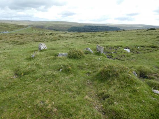
The row in the summer undergrowth.

One of the diminuitive stones of the row, with smaller stones just visible beyond.

The largest stone, at the SW end of the row.
Visited 30 August 2010.
This was our first stop on a hot August Bank Holiday, walking up from Ivybridge railway station. I’d failed to find the row on my previous visit to Western Beacon, having been looking in the wrong place in truth.
It turns out to be heavily obscured by bracken, the diminuitive stones barely tall enough to make their presence known. The terminal cairn is a badly ruined thing. Probably one that would reward a winter visit rather than one in the height of the growing season, but worth a stop on the way up to the cairns on Western Beacon, which is where we headed next.
The row is listed in Volume IV of Jeremy Butler’s ‘Dartmoor Atlas of Antiquities’, page 33 et seq.
The turning off the Bittaford – Ivybridge road is hard by the (what used to be) the Cantrell Clay dries; you can’t miss them, because there’s a ruddy great kiln chimney pointing skywards.
Off the main road, and under the railway bridge, the lane becomes very narrow and high-banked, with a vicious reverse curve about halfway up. Drive up as far as you can – there’s space for about 6 or 8 cars (at a pinch).
Carry on up the slope and take the left of the two gates onto the moor. There’s what looks like the remains of something prehistoric and structured on your left.
Head diagonally up the slope to the course of the old Redlake Tramway; you can’t miss it – it’s the only flat thing around. It runs along the contour.
Perhaps no more than a minutes walk will bring you to a small scoop taken from the hillside. This was the site of the winding gear of an incline plane – the earthworks of which arrow southwards through the remaining abutments of a narrow gauge railway opposite.
At the eastern end of the small scooped area, at the point where the hillside meets the tramway, there sits a large, rounded, half-buried stone.
The row begins here.
It runs North East up the slope of the hill, ending in a very distressed (almost indecipherable) terminal cairn, of which 1 slab remains standing. Butler lists the cairn as:
SX 6570 5717
which I make to be:
Lat: 50.399023N Long: 3.890991W
Butler describes it as a double row, set 3 metres apart, 48 metres in length, and as having eighteen stones in it (of which – in 1991 – only 9 were erect). He lists the average height of these 9 as being 0.4 metres.
We found the 4 at the Southwestern end. The remainder – if they are still apparent – will have to wait for one of those cold, crisp, winter days and the enforced hiatus in the overpowering undergrowth.