
High Baltersan Cairn from Shakeabodie Rock.
Image credit: Andy H
High Baltersan Cairn from Shakeabodie Rock.

High Baltersan Cairn viewed from N.

High Baltersan Cairn viewed from E.
High Baltersan Cairn viewed from S.

High Baltersan Cairn viewed from W.

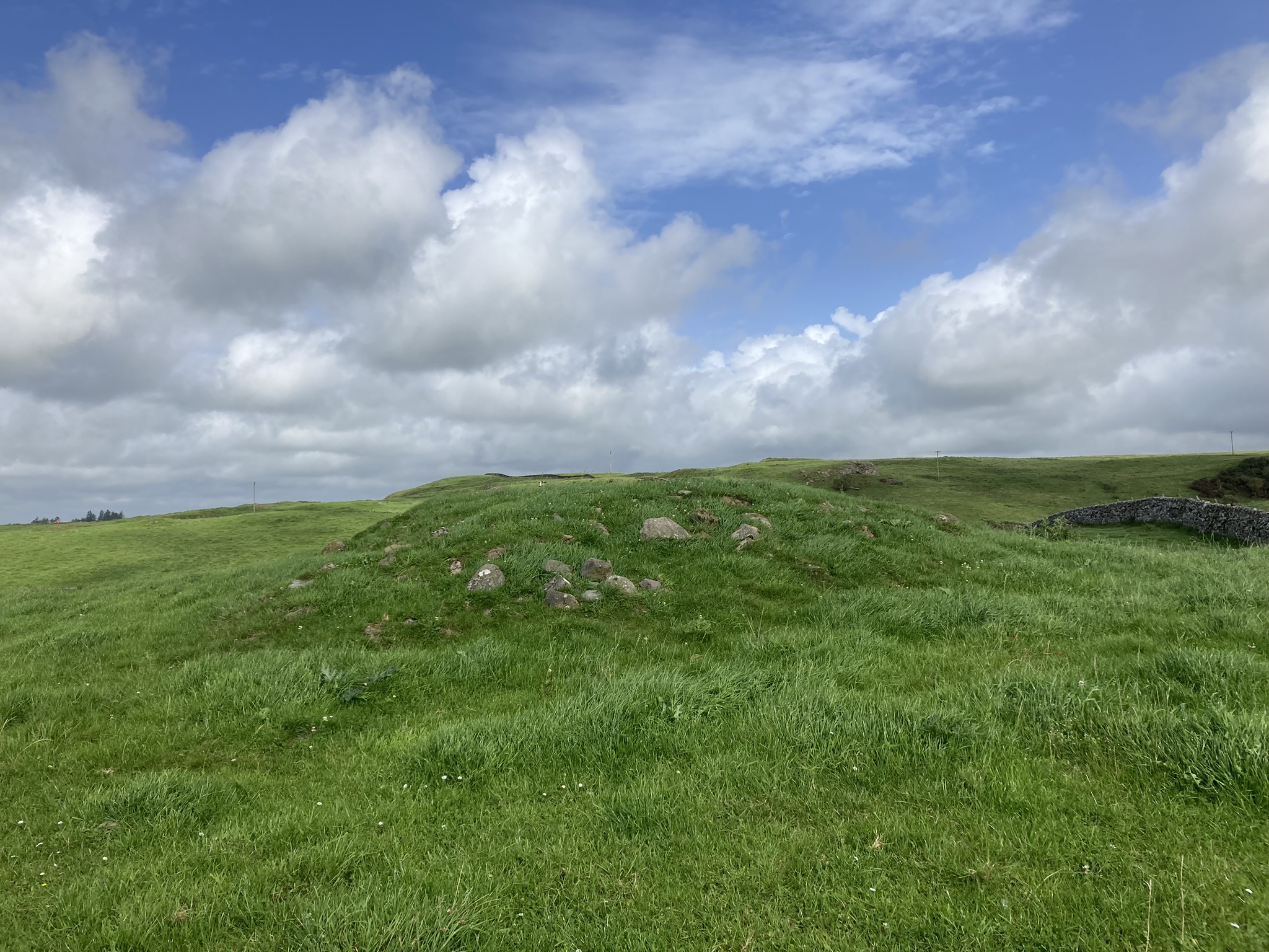
Summit of High Baltersan Cairn viewed from S.
Visited 11.08.23
High Baltersan Cairn is a circular grassy mound located in arable land c. 2 miles S of Newton Stewart in Dumfries and Galloway. It is situated adjacent to a natural rocky knoll which has field clearance stones deposited on its summit. The mound measures c. 33 feet in diameter and 3 feet high. The perimeter is studded with small and medium-sized stones. The flat summit is covered in grass. Canmore ID 63565 has further details of High Baltersan Cairn.
High Baltersan Cairn sits close to a piece of ground known as Foul Hole, described as ‘a portion of waste land or common at the intersection of two roads viz. [namely] Whithorn to Glasgow and Glenluce to Carty Port’. Overlooked by Shakeabodie Rock, which is said to have derived its name from ‘a legend connected with a place called the ‘Foul Hole’. It appears that the Foul Hole has been notorious among the ignorant and superstitious as a place much frequented by spectres, witches, warlocks etc, which caused passers by to shake or tremble from the proximity of the rock’.
Wigtownshire OS Name Books, 1845-1849
Directions to High Baltersan Cairn: Take the Wigtown road off the A75 Newton Stewart roundabout. Stay on the road for c. 1.6 miles. Take a right turn down an unsigned single track road with passing places. After c. 0.7 miles turn left. Park up after c. 75 yards opposite a gate. High Baltersan Cairn is c. 160 yards ESE of the gate up a grassy slope, located c. 15 yards E of a natural rocky knoll. My route is viewable on High Baltersan Cairn.
High Baltersan Cairn Street View on Google Maps.


