WNW Stone (300°) of Claughreid Stone Circle.
Image credit: Mark Johnstone
WNW Stone (300°) of Claughreid Stone Circle.

NE Stone (37°) of Claughreid Stone Circle.

N Stone (356°) of Claughreid Stone Circle

Claughreid Stone Circle viewed from N.

Central Recumbent Stone of Claughreid Stone Circle viewed from WNW.

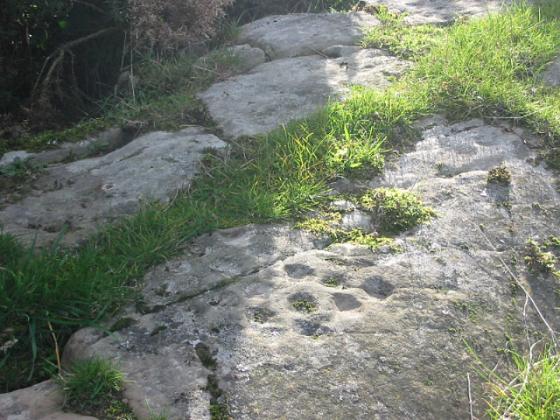
Some landscape perspective, looking approx south-west from Cambret Hill....

Cambret Hill looms on the skyline.......

Looking across the fallen central stone towards what I assume is a glacial erratic – a natural gorsedd?


10/03. Looking north-ish, Glenquickan is just over the hill.
Visited 26.12.24
I returned to Claughreid Stone Circle around 15 years after my first visit. I was able to locate all 10 stones on 04.04.10. On return, it seemed to me that the stone circle was hidden in rough moor grass. I was able to locate 7 outer stones at varying heights: N Stone (356°), NE Stone (37°), E Stone (82°), ESE Stone (112°), SSE Stone (153°), SW Stone (225°) and WNW Stone (300°). I stood on a stone at 180° and exposed the surface of a S Stone. I looked for a stone on the W Arc at 270° but was unable to find any.
Claughreid Stone Circle is in danger of sinking into the moor leaving only the larger stones exposed.
My route to Claughreid Stone Circle was via a track through Claughreid Farm avoiding a trudge through boggy moorland: Turn off the A75 for Cairn Holy at NX 5164 5305. Follow the sign for Cairn Holy for c. 100 yards then bear right onto an unsigned single track road. Stay on this winding lane for c. 0.4 miles to reach an unsigned track on the left at NX 5207 5313. Follow this dead-end track for a mile to reach a small car park at the end: the track becomes increasingly rough and dirty closer to the end.
The walking route to Claughreid Stone Circle starts at the end of the public road from Barholm Farm to Claughreid Farm. Park up and walk along the track to Claughreid Farm. Head W through Claughreid Farm then head downhill. Cross over a ford then follow the track through a dry stane dyke. Continue NW for c. 300 yards to go through a gate in the dry stane dyke. Head NNE from the gateway on vague tracks for c. 100 yards to reach Claughreid Stone Circle, partially obscured in moorland. My walking route along this track can be viewed on Claughreid Stone Circle.
First site of a proposed two week tour of the Scottish ‘lowlands’, following on from a long drive from South-East Essex.... stone circles with central stones are not exactly common place in Britain, so curiosity value alone makes this an essential visit.
Having previously seen the charismatic Cairnholy tombs on the way back from Arran some years ago, I decide to approach from Cambret farm to the approx north, a minor road from the tiny coastal village of Carsluith allowing vehicular access to a point where tarmac gives way to an unsurfaced farm track. Verge parking is possible here, hence boots must be donned for the short walk to the farm, followed by a rough trek to the south, crossing Carsluith Burn.
A large glacial erratic (I assume) is prominent upon the hillside, above to the left, this distracting me from my compass bearing and luring me to the high ground. Yeah, I can not resist the call. In actual fact the circle sits within a field at the northern head of a valley, bounded to the east by Cairnharrow and to the west by Cairnholy Hill.... so ignore the hillside and veer right alongside a fenceline.
Although the fallen centre stone is substantial, the stones upon the circumference are relatively small. But this is of no significance since the ring is in complete harmony with it surroundings. From within, the aforementioned glacial erratic appears an integral part of the monument, perhaps a natural gorsedd? My rough compass bearing is c75 degrees from the centre. Telecom antennae rise upon Cambret Hill to the north. Two further stone circles lie to its left (the fabulous Glenquickan) and right (Cauldside Burn). Hardy souls may visit all in a long day – as suggested by Burl. But I must have time to reflect, so will visit the latter tomorrow. He says.
The only sounds are that of bird song and the wind. It is a good start.
We parked in the carpark at Cairn Holy then crossed several fields skirting the sheep and over a couple of dykes keeping to the west side of the burn. We then followed the path along the side of Cairn Holy hill until the burn almost disappeared. Then crossed the last dyke and up to the circle. We then went on to Cauldside Burn cairn and ruined circle. It all took a full afternoon in fine weather. Would not have fancied it in anything less. On our return there was a warning note from the police on the car about not leaving vehicles unattended.
By far the easiest way of course would be to drive along the lane to Claughreid farm and ask to park then follow the track to the circle.
It’s a bit of a boggy ‘shortish’ trek over the moorland near Cambret Farm to this circle.....but even after getting the shoes sucked off of my feet it in the mud it was well worth it....(nice one Fitz for digging it out).
Eight low stones surround an egg shaped central stone, the ruined little brother of Glenquickan, which stands over the otherside of Cambret Hill. Excellent views of the surrounding hills.
Pics of Claughreid circle.