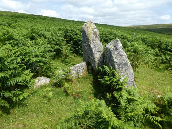
Stalldown Stone Row viewed from NW across Stalldown Stone Row Cairn NW. The hollow in the top of the cairn is evident. Stalldown Stone Row Cairn NE is visible centre frame just below the horizon.
Image credit: Mark Johnstone
Stalldown Stone Row viewed from NW across Stalldown Stone Row Cairn NW. The hollow in the top of the cairn is evident. Stalldown Stone Row Cairn NE is visible centre frame just below the horizon.

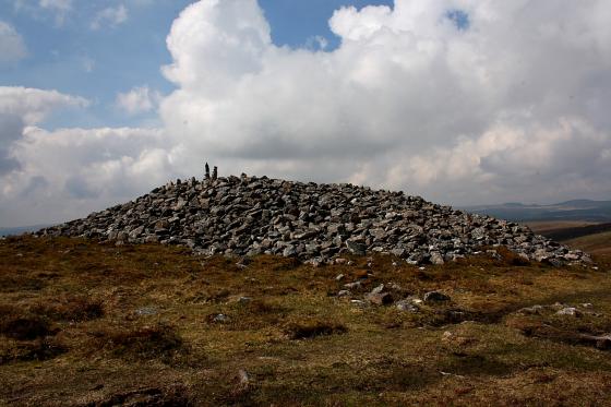
Stalldown Stone Row Cairn NW viewed from E.

The kerb of Stalldown Stone Row Cairn NW is delineated by c. 1.5 feet high stones.

The cairn to the northwest of Stalldown stone row on the right.
Directions: Take the B213 Ivybridge turn off the A38. If you exit from the E, turn R, cross over the A38 and take the first L on the roundabout signposted for Cornwood. If you exit from the W, take the first L on the roundabout signposted for Cornwood. Follow the Cornwood Road for c. I mile until you reach a mini roundabout. Take the L turn onto a narrow lane for Cornwood. Stay on this road for c. 2.5 miles until you reach the Cornwood Inn at a crossroads in Cornwood. Take the R turn for Torr/Harford onto a lane. After 0.25 miles stay straight on the lane. After another c. 0.5 miles stay straight. After another 0.25 miles turn L up an un-signposted lane and bear R after a sharp corner. Follow this narrow leafy lane for c. 0.25 mile then take the L fork. The road will end c. 0.4 mile later just after Watercombe Farm. Park as close as possible and follow the track for c. 0.5 mile past the water treatment buildings reaching the open moorland of Stalldown Moor. When you are 100 yards clear of the buildings strike N uphill towards Stalldown Stone Row relying on GPS or Map Reading to reach the Southern Terminal 0.5 mile N at SX 63218 62074.
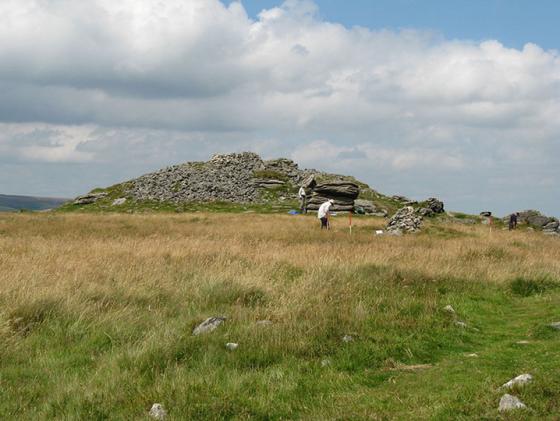
There is a cluster of cairns in or near the Northern third of Stalldown Stone Row. Stalldown cairn circle (listed in TMA) is constructed a few yards to the E of the Stalldown Stone Row axis, a hiatus in the row of standing stones. Around 100 yards NNW in open moorland there is a small grass cairn measuring c. 30 feet across with a 4 feet earth bank. An intermittent perimeter of kerb stones c. 1.5 feet high define the edge of the cairn. There is a shallow hollow in the centre of the cairn suggestive of an excavation. It lies c. 30 yards E of Stalldown Stone Row.
A third cairn, Stalldown Stone Row Cairn NE lies c. 100 yards SE from here, on the E side of the stone row.
The concentration of several sites in a small radius suggests that it was the centre of ritual activities at Stalldown. The inclusion of Stalldown cairn circle into the stone row perhaps indicates that it was the focal point.
Historic England 1015806 (go to Links) has a full description of Stalldown Stone Row and its associated cairns.
Stalldown Stone Row Cairn NW is incorporated within the area of the Stone alignment and cairns on Stalldown scheduled by Historic England.