|
|

|
|
Cheshire
|
|
|
|
Sites in this group:
|
17 posts
4 sites Alderley Edge Ancient Mine / Quarry |
5 posts
Allgreave Standing Stone / Menhir |
4 posts
Bate Mill Tumuli Barrow / Cairn Cemetery |
|
7 posts
Bearhurst Farm Round Barrow(s) |
23 posts
Beeston Crag Ancient Village / Settlement / Misc. Earthwork |
1 post
Birtles Hall Round Barrow(s) |
|
3 posts
Black Rock Farm Round Barrow(s) |
21 posts
Bosley Minn Standing Stones |
96 posts
The Bridestones Burial Chamber |
|
4 posts
Broad Oak Farm Round Barrow(s) |
43 posts
The Bullstones Stone Circle |
13 posts
Capesthorne Park Round Barrow(s) |
|
11 posts
Charles Head Round Barrow(s) |
6 posts
Church Lawton Barrow / Cairn Cemetery |
10 posts
The Cloud Sacred Hill |
|
6 posts
Dropping Stone Cave Cave / Rock Shelter |
23 posts
Eddisbury Hillfort |
11 posts
Further Harrop Barrow / Cairn Cemetery |
|
2 posts
Gallowsclough Cob Round Barrow(s) |
7 posts
Gawsworth Henge Henge (Destroyed) |
12 posts
Helsby Hill Promontory Fort |
|
4 posts
Henbury Stone Circle |
5 posts
Higher Ridgegate Standing Stone / Menhir |
Highfield Lane, Winwick
Round Barrow(s)
|
|
5 posts
High Billinge Round Barrow(s) |
1 post
Jodrell Bank Farm Round Barrow(s) |
3 posts
Kelsborrow Castle Hillfort |
|
11 posts
Longgutter Round Barrow(s) |
4 posts
Mad Allen's Hole Cave / Rock Shelter |
17 posts
Maiden Castle (Bickerton) Hillfort |
|
23 posts
Murder Stone Standing Stone / Menhir |
9 posts
Nab Head Barrow / Cairn Cemetery |
10 posts
Peckforton Mere Promontory Fort |
|
23 posts
Reed Hill Round Barrow(s) |
11 posts
Robin Hood's Tump Round Barrow(s) |
5 posts
Seven Lows Barrow / Cairn Cemetery |
|
17 posts
Somerford Bridge Long Barrow |
8 posts
Sutton Hall Cairn(s) |
9 posts
Toot Hill Round Barrow(s) |
|
5 posts
Woodhouse End Round Barrow(s) |
8 posts
Woodhouse Hill Hillfort |
5 posts
Yearns Low Round Barrow(s) |
Sites of disputed antiquity:
|
9 posts
Ginclough Standing Stone / Menhir |
5 posts
Marton Church Artificial Mound |
9 posts
Old Man O'Mow Cairn(s) |
News |
|
Lindow Man: Gruesome discovery who became 'international celebrity'Thirty years ago, a peat cutter working in the Cheshire countryside spotted what he thought was a piece of wood trundling along a conveyor belt. Tasked with the job of keeping the belt free of debris, he threw it away, but as it hit the ground, the dirt fell from it and the remains of a human leg lay in the summer sun... continues... |
 Posted by ryaner
3rd August 2014ce |
Bronze age life by airport runwayFrom BBC News: Archaeologists have published findings of an important Bronze Age settlement at Manchester Airport... continues... |
 Posted by baza
25th April 2007ce Edited 25th April 2007ce |
Lindow Man to visit Manchester MuseumThe Iron Age man (usually found at the British Museum) should be around "between April next year and March 2009 and the museum wants to hear the views of local people on how the remains should be displayed... continues... |
 Posted by Rhiannon
29th January 2007ce Edited 29th January 2007ce |
Ancient henge discovered near cityBy David Holmes, Chester Chronicle Wiltshire may have Stonehenge but now Cheshire has a wooden henge after archaeologists made the discovery near Chester... continues... |
4th January 2005ce Edited 28th July 2006ce |
Links |
|
E-mapping Victorian CheshireMap fans searching for monuments are sure to like this recently completed site - it's been produced so you can look at tithe maps particularly, but you can also look at 1870ish / 1910ish maps side by side with the modern OS map. You can zoom in and pan about to your heart's content. |
Posted by Rhiannon 7th May 2008ce |
Poynton Little Folk - Olde Cheshire DialectThis page could be useful for figuring out local placenames. Another part of Helena Kennedy's website promotes local studies in schools (including using real historical Cheshire placenames to devise new folklore) - and to keep the old dialect alive. She also has links to her paintings of various prehistoric sites. |
Posted by Rhiannon 25th October 2007ce Edited 25th October 2007ce |
Latest posts for Cheshire |
Showing 1-10 of 551 posts. Most recent first | Next 10 
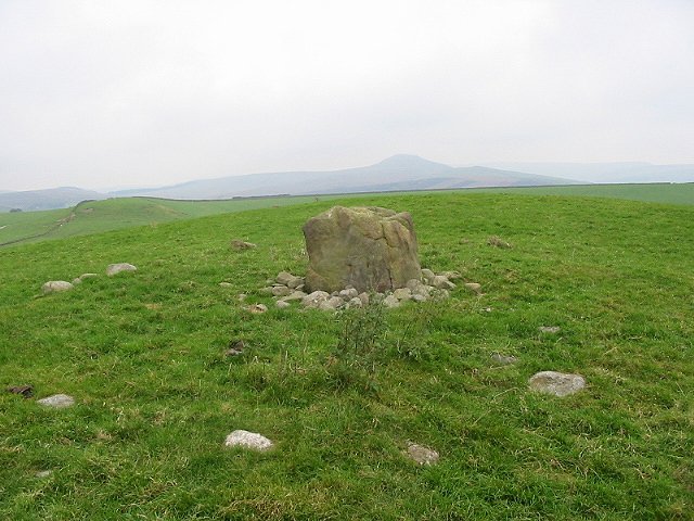
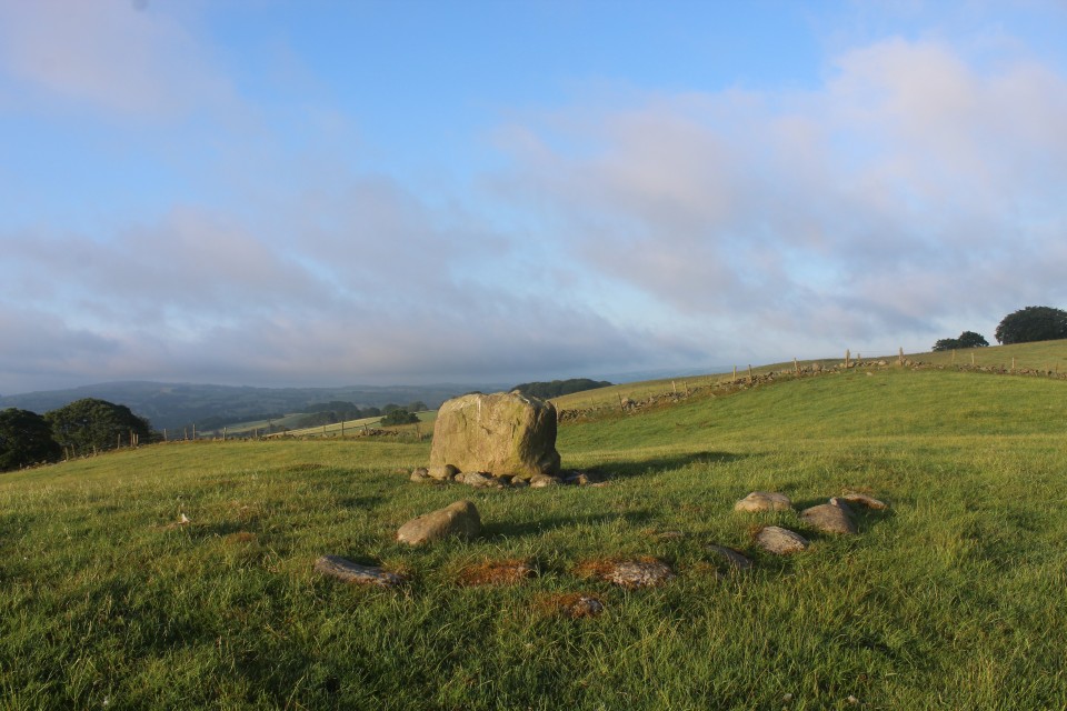
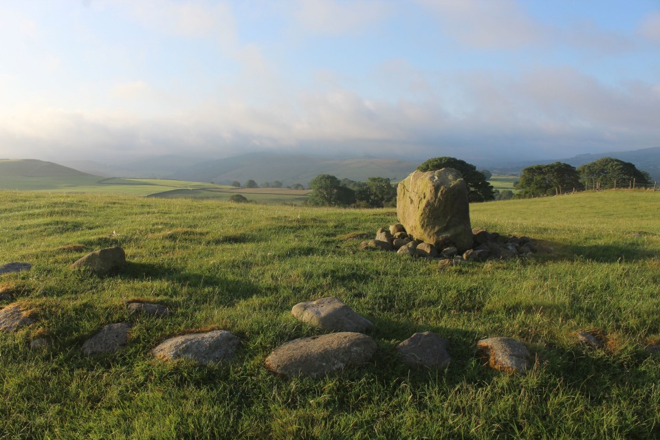
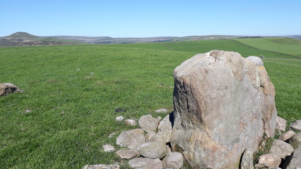
The Bullstones (Stone Circle) — Images (click to view fullsize) |
|
 Posted by blossom
12th June 2021ce |
The Bullstones (Stone Circle) — Fieldnotes |
|
I made this far more difficult than it needed to be to find. Im based at Bosley and this is a few miles away. But I managed to take in quite a few unnecessary bumpy, windy country lanes before i found it. To be fair i had no form of OS map at all and google wasnt playing. On the A54 heading from Congleton to Buxton take the first minor road left after The Four Ways motel. This road is Barlow Hill. Just before the junction with the left hand Withershall lane there is a layby with two public footpath signs. Take the southern one. Follow the FP across two small fields. The stone will appear on the horizon to your right. I got here late afternoon and it was beautiful. The colours of the stone in the late afternoon sun were lovely. And postie was right, the way the stone reflects the silhouette of the mountain/hill beyond is worth note. |
Posted by blossom 12th June 2021ce |
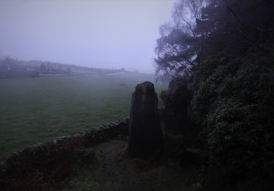
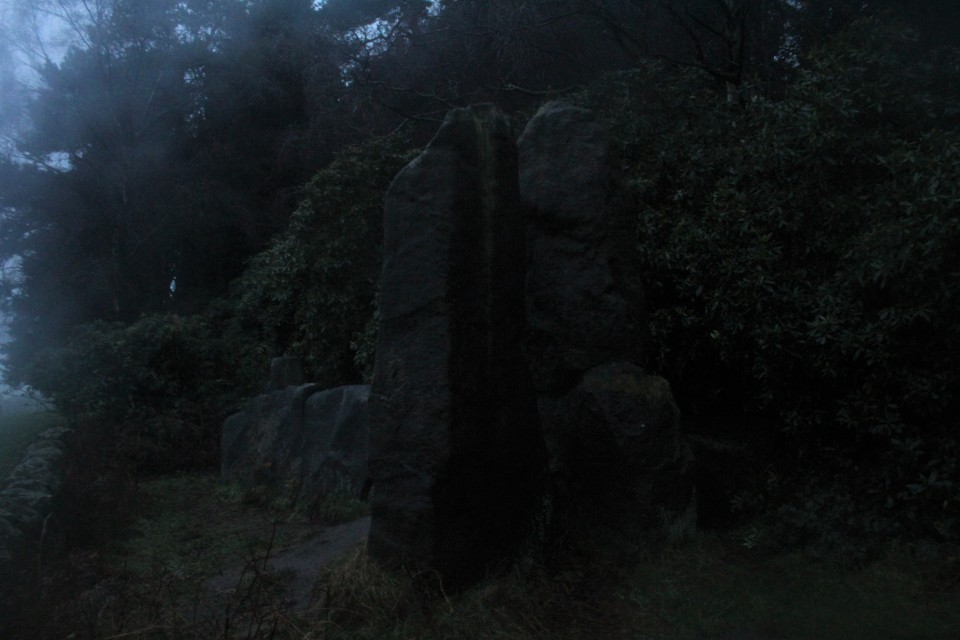
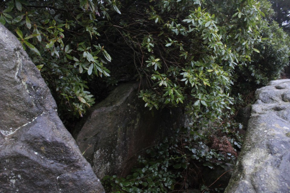
The Bridestones (Burial Chamber) — Images |
   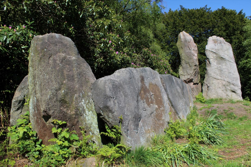 
|
 Posted by postman
12th May 2019ce |
Showing 1-10 of 551 posts. Most recent first | Next 10