Showing 1-50 of 225 posts. Most recent first | Next 50 
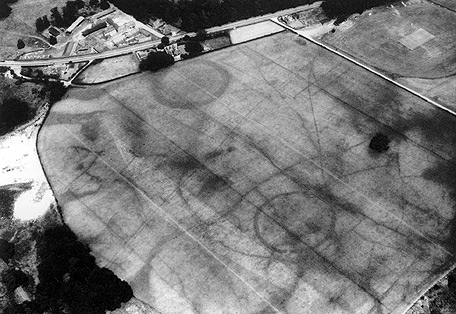
I have recently found on the Coflein website at the bottom of the entry for Cwm Ffrydlas that an archaeology student wrote their dissertation on Cwm Ffrydlas in 2015.
It's really interesting and has lots of maps and overlays and is well worth looking at if you plan to visit this site as it gives some clarity to what can look like a jumble of stones.
It's a PDF document that I can't share here but if you click on the red pdf link at the bottom of the Coflein entry it will take you there.
|

|
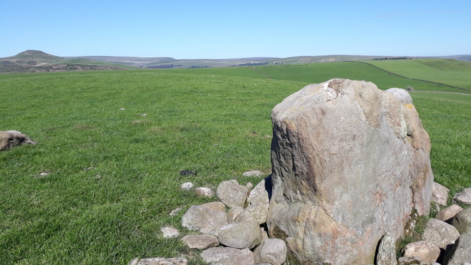
I made this far more difficult than it needed to be to find. Im based at Bosley and this is a few miles away. But I managed to take in quite a few unnecessary bumpy, windy country lanes before i found it. To be fair i had no form of OS map at all and google wasnt playing.
On the A54 heading from Congleton to Buxton take the first minor road left after The Four Ways motel. This road is Barlow Hill. Just before the junction with the left hand Withershall lane there is a layby with two public footpath signs. Take the southern one. Follow the FP across two small fields. The stone will appear on the horizon to your right.
I got here late afternoon and it was beautiful. The colours of the stone in the late afternoon sun were lovely. And postie was right, the way the stone reflects the silhouette of the mountain/hill beyond is worth note.
|
Volunteers for Bryn Celli Ddu dig
An appeal is being made for volunteers to join archaeologists to excavate in the surrounding landscape of Bryn Celli Ddu passage tomb on Anglesey.
The team behind the dig — led by staff from the Welsh Government’s historic environment service, Cadw, University of Central Lancashire and Manchester Metropolitan University are calling on local volunteers to join the team for a two week excavation taking place this summer.
During the dig, due to begin on 11 of June, archaeologists hope to find further evidence of a Late Neolithic / Bronze Age burial cairn located meters from the main Bryn Celli Ddu passage tomb.
There will also be opportunities to explore the surrounding landscape, recording the eight new rock art panels found during the last two years. Dr Ffion Reynolds, from Cadw, said the dig would end on 24 of June and participants do not need any prior knowledge of archaeology to take part, just a curious mind.
She said: “There’ll be opportunities for archaeological investigation, geophysical survey, field walking and we also need people to help record our new rock art panels.”
The main passage tomb and cairn were built around 4,800 years ago, and the project is building up a picture of a complex landscape of activity, from burial locations to sites of pilgrimage. Dr Seren Griffiths, from University of Central Lancashire, said “the nature of the monument and the rock art at Bryn Celli Ddu makes it internationally important.”
Members of the public will also get a chance to experience a real life dig and see the newly discovered secrets, when Bryn Celli Ddu plays host to an open day on Saturday 17 June, between 11am and 4pm.
To sign up to be a volunteer, get in touch with Dr Seren Griffiths from the University of Central Lancashire on [email protected] Public events:
The archaeological open day (17 June, 11am – 4pm) is free to attend, and no booking is required.
The stargazing event (16 June, 9.30pm) is £5 per ticket, places are limited. To book phone Dark Sky Wales on 07403 402114.
Read more: Call For Volunteers For Third Season Of Bryn Celli Ddu Landscape Excavation http://www.news.wales/national/cadw/call-for-volunteers-for-third-season-of-bryn-celli-ddu-landscape-excavation-2017-03-31902.html
|
Stories in stone walk and exhibition launch Saturday 21st July
Sat 21 July; 13.30-16.30
Come and see our brand new exhibition about stone working at the extraordinary Neolithic quarry at Graiglwyd, Penmaenmawr. The launch will begin with a guided walk to visit the quarry site and its surrounding archaeological landscape, led by the Snowdonia National Park Archaeologist. After the walk, come along to New York Cottages Museum for light refreshments and to enjoy our new exhibition. Part of our two week celebration of stone working in Penmaenmawr - 'Stories in Stone'.
Location: New York Cottages Museum, Unit 4, New York Cottages, Bangor Road, Penmaenmawr, Conwy. LL34 6LE. Easily signposted off the A55 between Conwy and Bangor.
Org: New York Cottages Museum, Penmaenmawr
Name: Helen Bradley
Tel: 01492 575 535
Email: [email protected]
Part of the Festival of British Archaeology 2012
|
Possible new cup-marked stone found on Ynys Mon
From 'WRAO' on Facebook:
"Six? possible cup-marks on a stone re-used as a gate post. The hole in the centre is for a gate bolt and is distinctly different in character to the standard bowl profile of the cup-marks. This stone is of an unusual geology but does contain fossils which could cast some doubt over its validity as a Neolithic / EBA stone. However there are a number of factors which work in favour of this hypothesis, which we will go into in more detail as we add it to the database."
http://www.facebook.com/photo.php?fbid=10150659020813087&set=a.316542978086.148860.139105033086&type=1
There is a picture on the site.
|
Prehistoric landscape uncovered at Borth
From the RCAHMW blog at
http://heritageofwalesnews.blogspot.com/2012/03/prehistoric-landscape-uncovered-at.html
"It’s a race against tide this week at Borth in Ceredigion. Archaeologists have a short window of opportunity to record, excavate and carry out palaeo-environemntal sampling of a large expanse of peat recently exposed beneath the sands on the beach. The peat together with a number of tree stumps and branches, provide a glimpse at the earlier Prehistoric environment, a time when the sea shore lay further west and this was an area of salt marsh. Of particular interest are the series of human and animal footprints fossilized in the now hardened peat surface, a line of post holes perhaps part of a causeway that once crossed the marsh, and also scatters of burnt stone, possible burnt mounds that are often associated with the Bronze Age.
A submerged forest to the north of this site has previously been studied by archaeologists http://www.coflein.gov.uk/en/site/506500/details/SUBMERGED+FOREST%2C+BORTH+SANDS/
The emergency archaeological work is being carried out by staff and students of the School of Archaeology, History and Anthropology at the University of Wales Trinity St David. The Royal Commission has provided survey support, mapping the extents of the peat and other exposed features."
|
Open day on 10th march for new archives, with sessions and workshops.
|
I couldn't get the link to work for archwilio (Gwynedd archaeological trust website)
So I have added what they say here:
Description :
Recorded 6" OS.
Maen Hir, 500 SE Hirdrefaig 8 1/4' high x 4' x 1 3/4', with packing stones at base.
As described by RCAHM. Published survey 25" correct.
Somewhat blocky slab with a pronounced lean to W. Local igneous stone with quartz veins. Packing stones on W side. Stands on a rounded E-W ridge - ridge obscures view to EW somewhat. Visible for some distance on both sides of the ridge - most on N & NW where it is on skyline for some places.
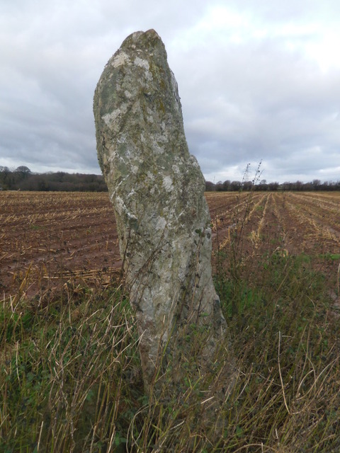
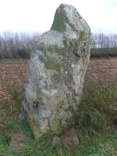
The monument comprises a large standing stone that probably dates to the Bronze Age (c.2300 - 800 BC). It is located within an enclosed field of improved pasture on an E-W aligned ridge. The standing stone measures 2.5m tall, 1.4m wide and 0.5m in depth. It is aligned N-S and has a weathered surface. The stone leans to the W. There are packing stones visible on the W side. The stone is made of a local igneous rock and is notable for its quartz veins.
A standing stone of probable Bronze Age date. The stone is 2.5m tall, 1.4m wide and 0.5m deep. It is aligned north-south and has a weathered surface and rectangular profile with parallel sides that rise to a bluntly rounded point.
Sources :
Prehistoric Funerary and Ritual Monument Survey: West Gwynedd & Anglesey , Smith, G. , 2003 ,
SH47SE , Ordnance Survey , 1963 ,
Inventory of the Ancient Monuments of Anglesey , Royal Commission on Ancient and Historic Monuments , 1937 ,
SH47SE 12 , Ordnance Survey , 1970 ,
Prehistoric Anglesey , Lynch, F. , 1970 ,
Hirdre-Faig Standing Stone , Cadw , 2006 ,
Hirdre-Faig Standing Stone , Berry, J. , 2006 ,
Gwalchmai Booster to Bodffordd Link Water Main and Llangefni to Penmynydd Replacement , Evans, R. T. J. , 2008 ,
Events :
40758 : Gwalchmai Booster to Bodffordd Link Water Main and Llangefni to Penmynydd Replacement (year : 2008)
40526 : Prehistoric Funerary and Ritual Monument Survey: West Gwynedd/Anglesey (year : 2003)
|
     
|
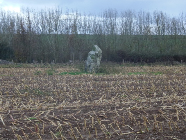
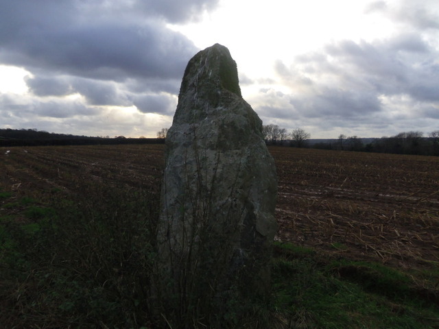
I'd come here in the summer with my daughter after visiting several other stones on the island. We parked up at the gate and as we did someone else was pulling in. The driver asked what I was doing so I explained and asked permission. He looked at my OS map and pointed to a field and said it would be ok to have a look. It was the wrong field!
After walking around for ages we decided that we were in the wrong place. We felt like trespassers especially as there were CCTV camera notices everywhere.
We saw some more folk walking their dogs who knew the stone and took us to the right field. They pointed to where it was but we couldn't see it because the field was full of really tall corn. We did try to find it but by this time we were hot and bothered so gave up, vowing to come back in the winter.
So it's winter now and as I couldn't go with Postie and TheSweetcheat up Moel Siabod because of a nasty cold I decided to try again.
Pulling in through the main gate go down the drive passing a gate house on the left. There is a very short gravel track on the left, just after the house, leading to the field where the stone is. There is room to park here.
The stone can be seen straight away across the field from the gate (as long as there is no corn).
It's about 7 feet tall, chunky and gnarled. There is a chunk missing from the top and the owner, Mr Postnet, has observed that the sun rises and sets in line with it at the equinoxes.
This stone is mentioned in "the standing stones of north-western Wales" by Michael Senior
Coflien suggest that this may be a gateway marker but both Cadw and GAT believe it to be a bronze age standing stone.
|

|
    
|
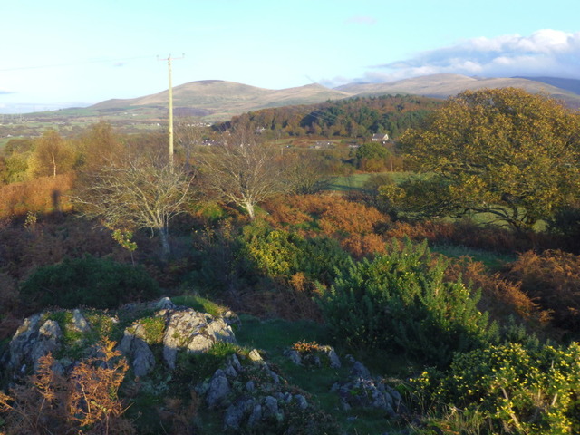
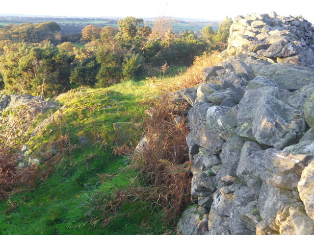
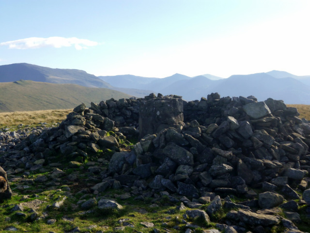
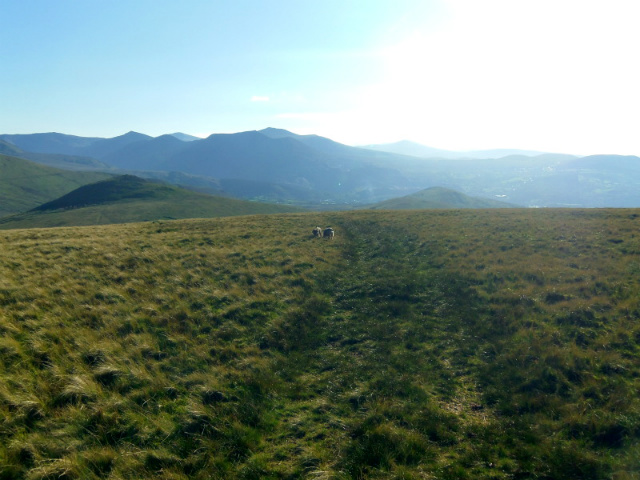
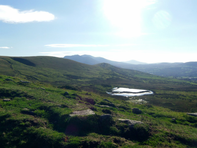
A sunny November afternoon in North Wales is not to be sniffed at, so I decided to take my camera out while walking the dogs and visit this hill fort which is on the lower part of Moel y ci.
I walked my usual route with the dogs feeding the horses on the way, but then had to climb a stile over an electric fence. The dogs aren't keen on these ladder stiles but I think they could sense the electrickery passing through the fence so managed it for once.
Crossing the field diagonally past some suspicious looking stones, that anywhere else would look like a stone circle I passed through a farm gate and followed the track to the entrance to the fort.
Archwilio say that this is almost definitely the original entrance. It's on the east side of the fort.
I walked all the way around and could see how well defended it was from the south, the cliff face was quite sheer. I walked around the western side and could see the flatter ramparts below the modern wall.
In the western area of the fort is a large rocky area and standing upon this I had wonderful views across to Moel Wnion, Moel Faban and out to Puffin island and Ynys Mon.
The slope on the Northern side is steep and high, with more electric fence halfway down.
There is a large enough flat area in the middle of the hillfort.
Just my luck my camera ran out of battery so I couldn't take many pics. So I shall go back and take another look. I find this whole area quite interesting and I am sure there is more up there.
|
 
|
  
|
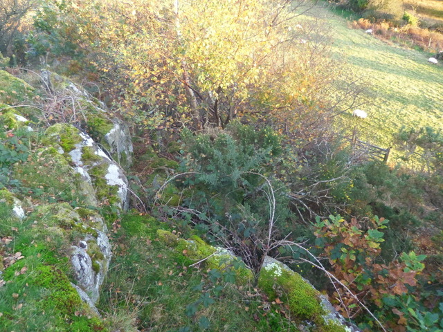
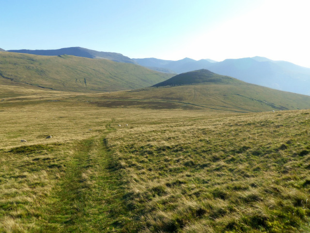
What a beautiful October afternoon. Standing in my back garden I could see Moel Wnion sitting there tempting me. So, determined to find this supposed Cup marked stone with in the cairn, off I trot. To make it a little easier for my self I drive to the Bryn Hafod quarry which is beautiful filled with water but treacherous.
I walk up past Bryn Hall, the old youth Hostel, then up the track. There is a clear right hand turn with the track in a deep ditch leading up around the side of the hill. It's quite a steady climb and I was grateful for the stunning views down the valley. When I reached the flat, the ground was quite boggy and the dogs were quite happy to find proper boggy puddles to lie in and roll around in, because they were so hot.
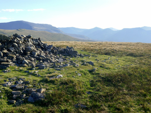
Following the track East (left) you soon begin to ascend as the track turns north. Follow this up hill until you are rewarded with fine views from the flat top of the hill.
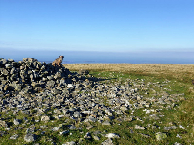
The track turns right Eastish again and leads straight to the cairn which is much ruined, but would have been huge.
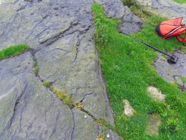
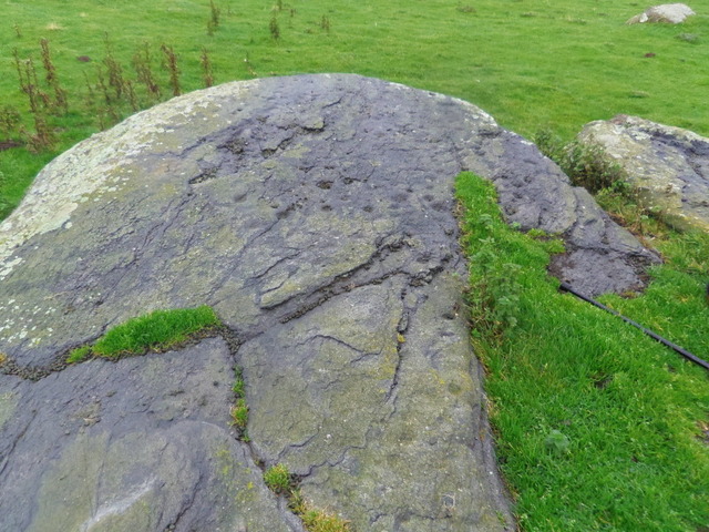
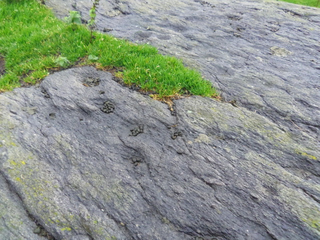
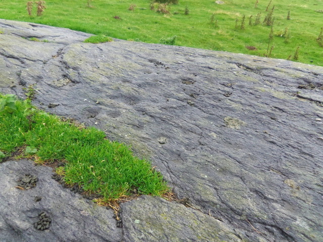
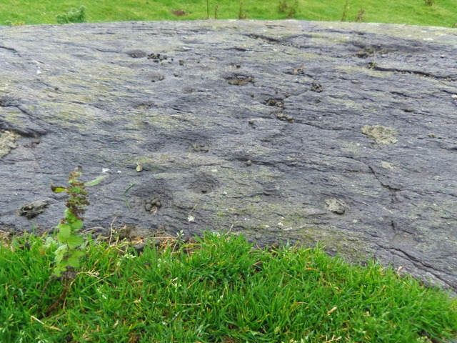
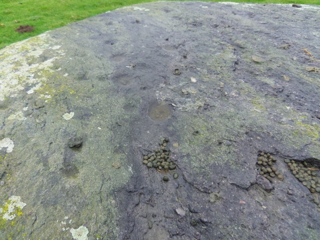
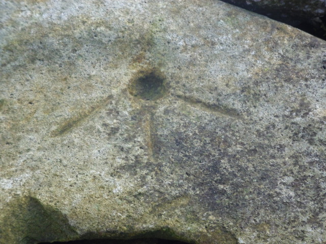
The only cup marked stone I could find with in the cairn also has 3 lines on it. GAT says the stone has only one cup mark. There are lots of stones up there that are pitted but thanks to Tiompan I now know these are natural. I am not sure about this one, but it was the only possibility.
It was such a beautiful day that there were butterflies fluttering around. The sun made taking some pics difficult because it was late afternoon and the sun was low in the west.
On the walk down the hill I decided to take some pics of a stone "structure" maybe a wall. The outside of a compound perhaps? It is clearly man made and in an area peppered with hut circles.
|

|
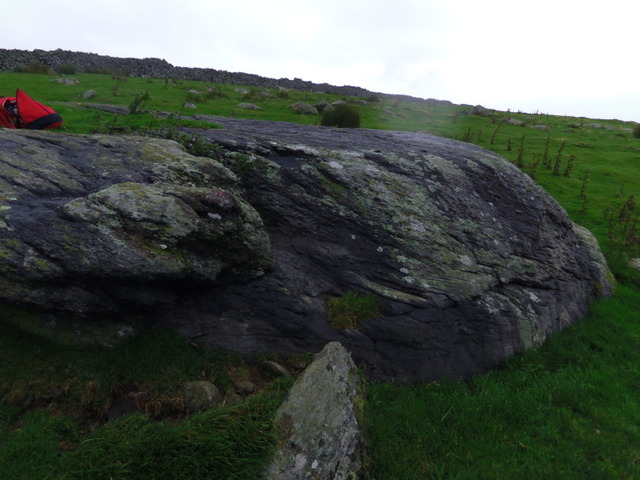
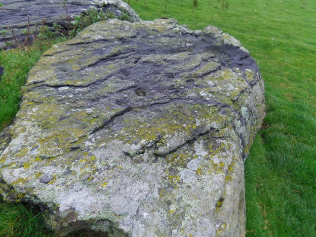
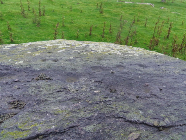
I had tried to find this cup marked stone 3 other times after Tiompan had told me about it. I was so happy to finally find it.
The weekend before, the weather had been awful and I had been stuck in. So this Monday even though the weather wasn't great I decided to go anyway. I had my new snazzy waterproof wind proof coat, my newish boots and my new little camera. So off I went.
I parked at the car park in Aber at the bottom of Foel Dduarth and walked along the old Roman road. It was very windy indeed but not raining, yet. Passing the Yr Orsedd stone which looks very much like a standing stone, not sure why it has disputed antiquity.
There is a very handy sign post pointing you towards Llanfairfechan. There are lots of arrow stones around here but I didn't look at those today. The wind was really picking up and actually blew me over.
Following along this track until there is a fork, taking the right hand track I dipped down a bit and was out of the wind a little. But it had started to drizzle now and I was losing light.
I walked along this track for a while until there was an obvious right hand track leading down hill to a corregated shed and sheep pen.
As you walk down towards the shed you can clearly see the cup marked stone in the next field. I was quite excited at this point and not fazed by the fact that I was going off the access land and onto a private farm.
I had to climb a gate with some barbed wire on it and then negotiate a number of gates around the sheds and sheep pens and then I was in. The cup-marked rocky out crop is the biggest in the field and I went straight to it, but by now it was raining proper and I didn't want to fiddle around with the settings on new camera so it was just point and shoot and hope for the best. I knew there were two other cup marked stones in the area and went on a hunt. I had seen their postion on Google Earth but try as I might I just couldn't find them. I spent about an hour looking but to no avail.
It was getting darker and more miserable so I sat next to a wall ate my sandwiches and headed for home. I'll try to find the others on a brighter day.
|
|