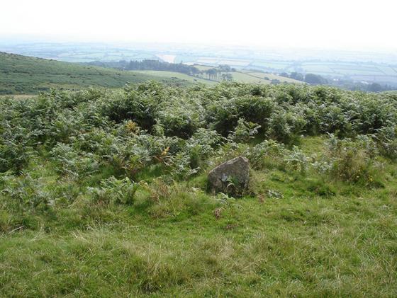
Stalldown Stone Row viewed from NW across Stalldown Stone Row Cairn NW. The hollow in the top of the cairn is evident. Stalldown Stone Row Cairn NE is visible centre frame just below the horizon.
Image credit: Mark Johnstone
Stalldown Stone Row viewed from NW across Stalldown Stone Row Cairn NW. The hollow in the top of the cairn is evident. Stalldown Stone Row Cairn NE is visible centre frame just below the horizon.

Stalldown Stone Row Cairn NW viewed from E.

The kerb of Stalldown Stone Row Cairn NW is delineated by c. 1.5 feet high stones.

Stalldown Stone Row Cairn NE in its moorland setting.

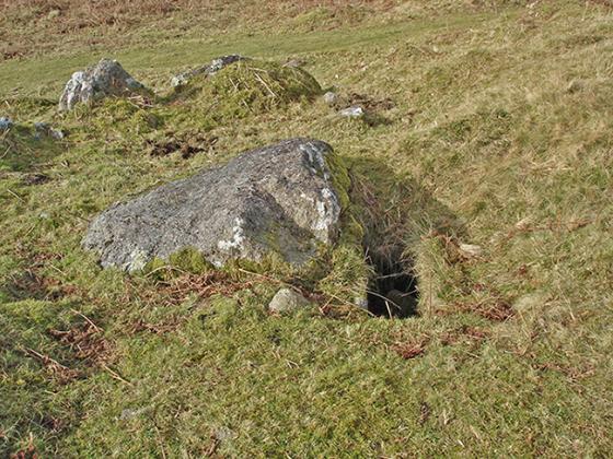
The excavated interior of Stalldown Stone Row Cairn NE.

The central hollow in Stalldown Stone Row Cairn NE. It may be the site of a removed cist.

Stalldown Stone Row Cairn S in situ.

The grassy low lying remains of Stalldown Stone Row Cairn S.

The cairn to the northwest of Stalldown stone row on the right.

A stone at the eastern side of Hillson’s House cairn.
02/05/2009

Hillsons House...built from the stones of the main cairn on Stalldown, the wall nearest the camera is a modern addition as Crossing only mentions three walls when he visited in the late 1800s.

Cairn just west of summit of stone row, not easily spotted in dead grass. SX633625
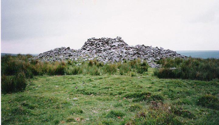
This is one of the much modified cairns in this area, this one being more modified than others in that it once had a house on it , the cairn being 20 metres in diameter. Legend has it that the house was lived in by a clock maker although some say he was more likely to have been a peat cutter.

Barrow on Stall Moor – March 2004

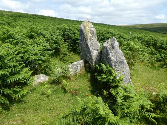
Stalldown Cist – 9th March 2004

Hillson’s House viewed from the east.

The cairn at SX632632.

This kist is in the cairn at SX632632 and is to the north of the stone row.

The kist in the cairn at SX628623.This cairn/kist is to the west of the stone row.

Directions: Take the B213 Ivybridge turn off the A38. If you exit from the E, turn R, cross over the A38 and take the first L on the roundabout signposted for Cornwood. If you exit from the W, take the first L on the roundabout signposted for Cornwood. Follow the Cornwood Road for c. I mile until you reach a mini roundabout. Take the L turn onto a narrow lane for Cornwood. Stay on this road for c. 2.5 miles until you reach the Cornwood Inn at a crossroads in Cornwood. Take the R turn for Torr/Harford onto a lane. After 0.25 miles stay straight on the lane. After another c. 0.5 miles stay straight. After another 0.25 miles turn L up an un-signposted lane and bear R after a sharp corner. Follow this narrow leafy lane for c. 0.25 mile then take the L fork. The road will end c. 0.4 mile later just after Watercombe Farm. Park as close as possible and follow the track for c. 0.5 mile past the water treatment buildings reaching the open moorland of Stalldown Moor. When you are 100 yards clear of the buildings strike N uphill towards Stalldown Stone Row relying on GPS or Map Reading to reach the Southern Terminal 0.5 mile N at SX 63218 62074.
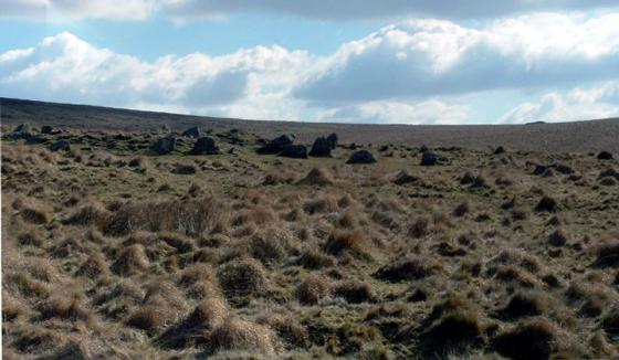
There is a cluster of cairns in or near the Northern third of Stalldown Stone Row. Stalldown cairn circle (listed in TMA) is constructed a few yards to the E of the Stalldown Stone Row axis, a hiatus in the row of standing stones. Around 100 yards NNW in open moorland there is a small grass cairn measuring c. 30 feet across with a 4 feet earth bank. An intermittent perimeter of kerb stones c. 1.5 feet high define the edge of the cairn. There is a shallow hollow in the centre of the cairn suggestive of an excavation. It lies c. 30 yards E of Stalldown Stone Row.
A third cairn, Stalldown Stone Row Cairn NE lies c. 100 yards SE from here, on the E side of the stone row.
The concentration of several sites in a small radius suggests that it was the centre of ritual activities at Stalldown. The inclusion of Stalldown cairn circle into the stone row perhaps indicates that it was the focal point.
Historic England 1015806 (go to Links) has a full description of Stalldown Stone Row and its associated cairns.
The ruined cairn lies c. 250 yards S of the Southern terminus in Stalldown Stone Row. It has been reduced to a circle of rough uneven grassy lumps, measuring c. 10 yards across by 1 yard high. The dark green of the cairn contrasts with the light brown of the moorland.
Historic England 1012748 states that the centre of the cairn has a central hollow probably related to a past disturbance in search of a cist. It also speculates that the cairn may have been the original terminus of the stone row. The Stalldown area has been used for peat cutting in the past so some of the stones may have been removed or buried. In any case, the close proximity of the cairn to Stalldown Stone Row extends the area of the Stalldown Complex.
As can be seen from the images posted there are several cairns in the vicinity of the Stalldown Row...the trouble is, the row is so mighty that the cairns are insignificant in the scope of things!
Usually i would take my time to search them all out but i was just so enthralled with the light playing on the stone row that I only photographed one....sorry!
Crossing writes in his Guide to Dartmoor that Hillson’s House cairn got its name after a baby was found on Stall Moor and adopted by local people. He was given the name Hillson and after a while moved up onto the hill and built himself a house amongst the stones of the cairn. Here he made a living making clocks...out of what it doesn’t say, but it does say that a Mr Hillson who lived in Cornwood in the mid 1800s had one of these clocks.
Stalldown Stone Row Cairn NW is incorporated within the area of the Stone alignment and cairns on Stalldown scheduled by Historic England.