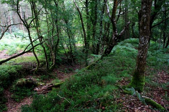
The outlier beyond.
Image credit: Chris Bickerton
The outlier beyond.


Ninety minutes after the summer solstice sunrise.


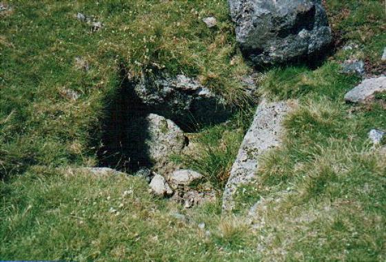
The outlier with the circle beyond.

October 2017

October 2017

October 2017

October 2017

27th February 2010

27th February 2010

27th February 2010

G/F provides scale for the White Moor Stone outlier, seen from the circle.

Stones in the southwestern arc of the circle.

Looking west, wide angle towards the High Willhays/Yes Tor ridge, Dartmoor’s two mountains.

Looking east(ish) under a clear sky.

White Moor Stone.

The outlier, with boundary mark.

Looking towards the White Moor Stone outlier.

Looking south, with Hound Tor visible on the right.


A bit of a ‘grainy’ scanned image, but what a ‘circle this is!

5th May 2007

Little Hound Tor Circle 31st January 2007

2nd June 2006

Whitmoor Stone – 2nd June 2006

February 2004

Little Hound Tor Circle – 28th February 2004

Little Hound Tor Circle 26th December 2005

another view of the circle.

One of many trips to this off the beaten track stone circle.
Walked here as part of a longer camping trip, but for the day I’d recommend starting around South Zeal.
I can’t speak for the other routes, I headed around the west side of Cosdon Hill and down into the settlement at the south east side of Taw Marsh. It is worth noting that once you have descended off Cosdon Hill that the path is basically non existent. I ended up following a compass baring from the north side of Little Hound Tor- until the ground was easier to trek through, despite going in late June… from what others have said here id probably recommend going up and over Cosdon Hill – unless you’d like to see their settlements.
The circle is well worth the reward though – and an easier hike onwards to Scorhill!
It’s a fair old walk of two and a half kilometers from Cosdon hill stone rows to White Moor stone circle, following the well obvious footpath we stayed clear of Raybarrow pool, indeed why would you even try to go through it, you’d have to be mad to stray from the path, I’m always straying, but when the path goes straight to where your going?
After much wet feet based japery, the stones finally come into view, my heart missed a beat, and I got that giddy Brodgar feeling, it’s been so long coming, has this stone circle, and such a long walk, even my goosebumps had goosebumps. Eric, as ever took it in his coolest of strides, he asked which way were going next, sat, and waited for me to drink my fill of White moor, he knows the score.
I’ve been on lots of moors, hillsides and commons, fields and heaths, and, do you know, none of them have been white, not a one, and this place is also decidedly not white, it’s most definitely green, bright, shiny, wet and very green, almost, you might say, as green as grass, why isn’t this place called Green Moor? That’s what I’d have called it, is there even a green moor anywhere? Bet not.
Even my feet are wet now, and I’m beginning to join Eric in his fantasies about Thanos clicking his fingers and getting rid of wet feet the universe over, but wet feet are still another small price to pay to be here, now.
I walk around the stones, there’s no need to touch them, they’re hard and wet, I know. There’s two things I do at an ancient site, photography and sitting, it’s still quite wet, so sitting is out. Walking round and round, clicking the little back box at it all, and yes a slight caress of the tallest stone, a pretty and thin slab, and telling Eric yes I’ll be done shortly, he’s over by the outlier now and I can tell how tall it is, it’s maybe twice as tall as any of the circle stones, I walk over to it, little knowing that I was walking away from the circle of my dreams.
The outlier has been graffitised, by someone with the initials DC and TP and just T, later that morning I see that DC also went to the long stone on Shovel down, a repeat offender. The outlier is almost pointing us in the direction of Buttern hill stone circle. I tell Eric that we’re now on our way back to the car, just one stone circle and chambered cairn on the way. He leads me away, with only time for a quick wistful look over my shoulder, I whisper bye stones to the stones of White moor, still a stupid name though.
Whilst not criticising the directions given by previous contributors, as someone who nearly always manages to misread even the simplest of OS maps and doesn’t go in for GPS-type devices, I thought that I could share my experience of visiting this wonderful circle last Saturday in the hope that future searchers might be aided in locating it. Even though I’ve driven all the way from London to visit the sites on Lewis and Orkney, somehow arriving at this site after trekking across what seemed like three or four miles of moorland struck me as a much greater endeavour. Ok, the weather was blissful and the ground underfoot mostly dry, but there were still some tricky sections requiring careful navigation around boggy patches where the path seemed to disappear.
The main thing for me was locating a suitable starting-point for the walk. A local recommended parking in a layby near the entrance to Olditch Farm halfway between two bridle-paths both of which lead up to the moor. A note about the layby; it’s on the left as you drive up from the south to Sticklepath but you could go by without seeing it; you have to reverse into it (’you turn in on yourself’ the local had helpfully observed).
The southerly bridlepath (ie the one behind you as you park which we came back on) leads up to a point not far from Cosdon Hill stone rows from which the path then goes all the way to the circle, with necessary diversions round the boggiest bits. Even though it had been dry recently, sections of the initial path up to the moor were still very wet whereas the northerly bridlepath was much drier and it brings you out on to a path which leads up to the top of Cosdon Hill from which you can go straight down to the circle (in theory; we missed the top, following some other walkers, and ended up going down the side of the hill to the stone rows and thence to the circle). Both bridlepaths involve steady uphill climbs, not too strenuous but
with stops and diversions it was about two/two and a half hours each way, echoing what others have said.
The first sighting, coming over the shoulder of Little Hound Tor ( after another unplanned diversion off the path to avoid some bogs) and seeing the outlier first, was a genuinely exhilarating moment and if like me you’re a bit misanthropic about sharing your visits to sites like this with others (apart from your own companions) then you’re unlikely to be too worried about intruders at this place.
Magical, everything I wanted and more.
My favourite stone circle of all time. I lived around the area for 25 years, visiting it in all seasons. I loved it’s remoteness and the fact that you had to make an effort to get there. The fact that a lot of people just walked by without giving it a second glance prompted me to write a poem about it back in 2008
Circles of Stone
My heart is in the lonely places, the forgotten places
that people walk by without seeing
that people walk by without thinking
Where echoes of the past float on the wind
For those that want to hear
For those who want to care
For those who want to be somewhere,
else
The Raven always watching over
Guardian of life and bearer of death
of those who have gone before
Their memories lost, waiting to be found
In the swirling mist and the circles of stone
I am a stranger in this time
Wandering and searching for a truth
that is always out of reach
and I sit
in the circle of life and death set in stone
and live with the pain of having no hope
while listening, for the voices of the past
February 2008
After leaving Cosdon stone row (23.4.2011) under a brilliant blue sky and blazing heat, we head off the bridleway and slightly up on to the slopes of Cosdon Hill itself. This provides a welcome breeze, but also allows us a better view of the route ahead. The bridleway curves westwards then back to the south, plotting a course between the bog of Raybarrow Pool and the slope of Little Hound Tor. We cut directly south, heading for the Tor, but still have to negotiate some squelching as we round the Pool. As others have mentioned, if you’re coming in anything but very dry weather make sure you’ve got waterproof boots!
All such concerns are swept away as we round the shoulder of Little Hound Tor. The outlying White Moor Stone comes into view first, silhouetted against the sky, then the circle itself appears. Wow! What an absolute belter. I practically run down the hill with a big grin on my face.
It’s a fairly big circle if you’re used to the cairn circles of this area, but nowhere near the size of the biggest Dartmoor rings. All but one of the stones are erect (or at least leaning), only one in the southern arc lies fallen. It has a wonderful setting, lying below various tors but still boasting awesome views, particularly to the west where Dartmoor’s two mountains – High Willhays and Yes Tor – fill the skyline.
The outlier is larger than anything in the circle, standing at about 6 feet high (I didn’t measure it) but leaning over slightly. It is a chunky slab, the long side doesn’t line up on the circle. The boundaries of three parishes meet here and the stone has incised initials relating to the Duchy of Cornwall (DC), Throwleigh Parish (TP) and Tawton (T).
Back to the circle. I’d agree entirely with Gladman’s assessment. This is a megalithic wonder, a brilliant site (and I may give it the nod over Down Tor). Its remoteness, setting and general condition place this is in the front rank of stone circles I have visited.
We linger for a good while, only seeing one other walker and a pair of cyclists (who seem taken aback as they come upon the circle, then cycle right through the centre) while we are here. Given that this is a scorching hot Saturday in the middle of Easter weekend, even we few visitors are probably more than you might find here on most days.
Eventually we head off, climbing over Little Hound Tor itself, before heading northwest to the White Hill Bronze Age settlement. I really hope to come back here again.
Aubrey Burl, in his usual ‘right-on-the-money’ style rates this as a ‘a little known but fascinating site recommended to the enthusiast’....... I’d go a bit further and reckon it’s one of the classic stone circles of Britain, all things considered. However, perhaps the sheer joy of reaching it after a two and a half(ish) mile uphill slog means I eulogise a bit too much... and Down Tor still remains my favourite Dartmoor site. But not by much, which is perhaps the highest compliment I can give.
The pilgrimage is such that I somehow manage to leave the superb triple stone row on the flanks of Cosdon Hill ‘until the way back’ – shades of Callanish, where the main event is all consuming. Managed to pick my way through the bog en-route without too much difficulty, but then again I am used to the (very wet) Welsh uplands, so I’m guessing the old tales of travellers disappearing into bottomless pits shouldn’t be altogether discarded and sticking to the path is a must. Proper walking boots – and gaiters, if you have them – will help save the poor feet from a soaking.
The circle itself possesses that aura that only truly remote sites have.... absolute silence. In fact I only had one visitor in some 3 hours on site – a 65 year old local who obviously knew his stuff.
Returned to the Cosdon Hill rows via Cosdon Hill itself, the summit crowned by cairns as the icing on the cake. Finally, note that the initial stage of the walk – near Nine Stones – is a bit complicated with drystone walls and whatnot. I therefore asked a passing dog walker if this was the path to White Moor and received a complete blank look. ‘No, this is the path to Whit’ Moor..... ‘
After leaving Cosdon Stone row (28.2.05), we considered the weather report from that morning’s news, mentioning overnight temperatures of -9 C. After walking in very cold conditions the previous day, (making several boggy areas much easier to cross) we had high hopes that taking the path that skirts around Ray Barrow Pool might be possible. It was, but only because of the low overnight ground temperatures and was still precarious. On reflection, I would prefer after visiting Cosdon rows, to continue up Cosdon Hill crossing over to Little Hound Tor and then onto White moor stone circle. The extra ascent and distance being better than an early bath.
White moor stone circle sits on the southerly slope of Little Hound Tor and with it’s surroundings of many impressive Tors, creates an enigmatic scene. The circle measures 67ft 3” N/S and 66ft 3” E/W with 18 visible stones (tallest 4ft 5” in the south) and one is broken at ground level.
From the circle, standing 521ft away on a bearing of 155 deg is another outlier of conjecture. With Dartmoor boundary/directional markings “T” & “TP” carved into it, but an unerring alignment through the circle, this stone is a puzzle.
It was worth all the effort to reach this lovely circle, a jewel of the moor.
Having researched the scant information available on-line about this circle, I decided to wait until the best possible weather before attempting to find it. Given the difficulty that it presented, this was a smart move.
Looking at the OS map, the footpath leading to the circle appears to skirt the edges of the Raybarrow Pool (not so much a pool as a marsh). This is very, very misleading. While the marsh may technically be at the bottom of the hill, the boggy area extends right up the slope, with the footpath cutting straight through the middle of it. When I visited on a very hot August day, the terrain was impossible to navigate. I was only able to make progress by back-tracking substantially and climbing pretty much to the top of the hill. Every other route eventually ended in marsh. Even getting up the hill was troublesome due to the heavy vegetation. I would imagine that in poor weather, this terrain could be extremely dangerous.
All in all, it took two and a half hours to get from the road to the circle. There is an alternative (but less direct) route, but I can’t comment on this since I didn’t have the time to check it out. On the plus side though, for the return journey, there’s a path leading from the circle up the hill that borders the footpath (doesn’t appear to be marked on the OS map). It’s possible to follow this most of the way uphill, and then cut back down to the main path.
All in all, I’d advise great caution if attempting to visit this site. Poor weather could make this potentially life-threatening for the inexperienced walker. In good weather it’s a challenge, but shouldn’t be a risk if you’re careful. However, it is a strenuous walk (mostly uphill), and I’d allow at least four hours for getting there and back.
For those who are up to the challenge, the reward is very much worth the effort. This is about as remote a site as I’ve ever seen, and the views are breathtaking. Sitting in the middle of this beautiful circle, you really feel as though you’re in the middle of a wilderness – and that’s no common achievment in this crowded modern-day Britain.
Various huntsmen ignored the holy day. One hunted on Dartmoor all Saturday till night fell. On and on he went round and round the hillside till it was midnight – and Sunday. Instantly he and his hounds were turned to stone, and on rough nights at Hound Tor they can be heard moaning and baying.
From ‘Some examples of post-reformation folklore in Devon’ by Theo Brown
Folklore, Vol. 72, No. 2. (Jun., 1961), pp. 388-399.
Details of stone circle on Pastscape
(SX 63278961) Stone Circle (NR). (1)
A stone circle, 65 feet in diameter and originally consisting of 19 stones is on Whitemoorstone Down, about a mile south of Cosdon. One stone is now missing and four have been broken off. There is a distinct gap in the continuation; the stone on the east side of the gap and the largest stone in the circle are in due line north and south and point south to the White Moorstone (SX 68 NW 6) some quarter of a mile distant. (2-3)
According to Paul Pettit in “Prehistoric Dartmoor” IBSN 0-9515274-6-0
Seventeen stones stand today, the two tallest about 4 and a half feet above the ground, one pillar and one slab. the stones are predominantly broad, but there are three distinct pillars and facing each of them on the opposite side of the circle is a broad slab. This appears to be comparable to the pairing of stones in many double rows. A cairn lies close to the circle , and about 170 yd to the south-east is the standing stone known as White Moor stone. No site on Dartmoor is moor mysterious and evocative.