Image credit: Graeme Field


The most northwesterly in the group of enclosures near Small Brook.

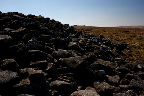
Looking along a reave at the northwest of the settlement.

Spacious hut circle at the northwestern end of the settlement. Two large stones (one leaning, one fallen) to the left were presumably door jambs.

One of the more northwesterly enclosures. This one seems to lack any obvious hut circles, perhaps it was a paddock? A hut circle lies beyond, with a large upright door jamb.

These rocks inside one of the enclosures appear to mark a natural spring.

Another well-preserved hut circle.

One of the better-preserved hut circles. With Metheral Hill behind.

The central enclosures near Small Brook. Yes Tor can be seen on the skyline to the left of centre.

Low hut circle remains in one of the central enclosures.

Approaching another of the enclosures. Looking northwest towards Belstone Tor.

Outer wall of one of the central enclosures in the group.

Scanty remains of a hut circle towards the southeastern end of the settlement. Looking south towards Hound Tor and Steeperton Tor.
We leave White Moor stone circle and head north over Little Hound Tor (23.4.2011). The original, typically over-ambitious, plan had been to visit the Nine Stones cairn circle on Belstone common, but we had enjoyed a long leisurely visit to the White Moor circle and the heat was more than enough to put paid to any ideas of climbing the steep slopes of Belstone Tor now. So instead we decide to walk up the Taw valley, to finish the walk at Sticklepath.
This gives us the opportunity of an unplanned detour to the cluster of settlements shown on the OS map at White Hill, so we head northwest from Little Hound Tor, slowly descending as we go.
We come upon the first evidence of settlement somewhat unexpectedly. At the southeastern end of the group, uphill from the rest, are a scatter of unenclosed hut circles. We find a couple, neither more than a circular scatter of stones. There are good views here, across the Taw valley to Belstone Tor and the Dartmoor mountains beyond, as well as back southwards to Hound Tor and Steeperton Tor. Cosdon Hill blocks the view eastwards.
The hillside drops steeply down from these first circles, and before long we come across an enclosed group. The enclosure wall is the most obvious feature here. Running further northwest, we see various enclosed groups, with some better preserved hut circles and eventually a reave. It’s difficult to get a full sense of what we are looking at, or even which settlement on the OS is the one we are in at any given time. A proper exploration would need a larger scale plan (see Jeremy Butler’s “Dartmoor Atlas of Antiquities” for one) and could easily take several leisurely hours.
Which alas we don’t have. So we head along the valley, northwards. Down by the water itself there is a carnival atmosphere, with the first people we have seen for quite some time enjoying the long weekend, the sunny weather and the pleasant walk along on a path on the western bank of the river. Our route, along the eastern bank, proves to be a rather more arduous sheep-track amongst ankle-twisting rocks. We’re glad to reach the shelter of the trees along the river as it turns eastwards below Belstone, and even more glad to reach the garden of the Taw River pub at Sticklepath!