The nascent Afon Glaslyn makes its carefree way down to the valley floor – from the foot of Yr Wyddfa itself – with all the alacrity of youth.
Image credit: Robert Gladstone
The nascent Afon Glaslyn makes its carefree way down to the valley floor – from the foot of Yr Wyddfa itself – with all the alacrity of youth.

The valley setting of the settlement, seen from a cloudy Glyder Fach. The position of the Dyffryn Mymbyr stone circle is also indicated.

Looking down on the site from the track on the hillside to the east.

Aerial view of two of the roundhouses in the northern cluster, from the track on the hillside to the east.

General view of the setting, from the SE.

Another circle in the northern cluster.

Massive roundhouse in the northern cluster.

Some impressively massive stonework in the settlement.

In the southern cluster.

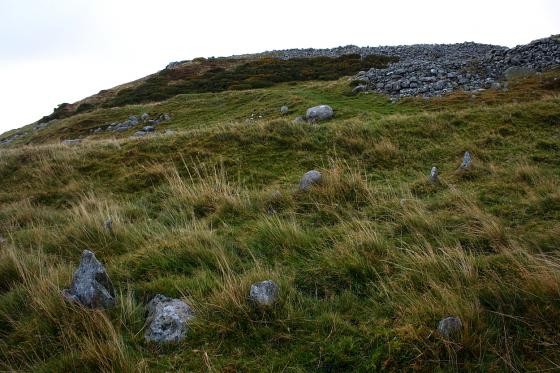
Fainter, less well-preserved hut circle within the settlement. Looking south.

Another of the southern cluster, looking west to the Afon Glaslyn tumbling down the hillside opposite.

One of the southern cluster of hut circles, nearest the modern buildings. Looking NE.

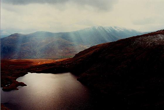
Looking down the Glaslyn valley. The settlement lies near the house on the valley floor, the rocky mountain above is Gallt y Wenallt (“Hill of the White Hillside”).

Not as sharp as I’d have liked, but according to the radio the wind was gusting at 80mph plus! Perhaps........ the settlement is lower centre right, Crib Goch up in the stratosphere. Relatively speaking.

Some further landscape perspective ... looking from Craig Penlan, en-route to Cwm Dyli. Note the power station to right, fed by the waters of Llyn Llydaw within Cwm Dyli.

A view of the settlement in its valley setting from near Llyn Teyrn, to the approx north-west.

The men amongst the TMA-ers will know that sometimes beauty is accentuated by a discreet veneer of mystery. Such is the case here, I think, with temperature inversion masking the settlement. The awesome Snowdon ‘horseshoe’ rises above, Yr Wyddfa centre of image. Note the pipeline feeding the power station.

the southern line of three hut circles, not as well preserved as the northern three, or not as young?


The little one of the northern three.

Three hut circles, big, medium and little.

Three hut circles way down at the bottom, I like the way the hillside seems to go impossibly steep.
I started the morning way up on high with the best view in Wales, it all went downhill from there really, literally. At 110m above sea level this might be the lowest point in the Snowdonia national park. Surrounded by the highest mountains on three sides and an open valley on t’other is where this collection of six hut circles can be found, surrounded as they are by such jaw dropping beauty it’s hard to see why the national monument record gives them such a naff name, they were obviously getting so bored naming things that they just stopped bothering altogether, why bother mentioning the power station at all thats Snowdon up there for gods sake the highest mountain in Wales and you name the place after a power station ?
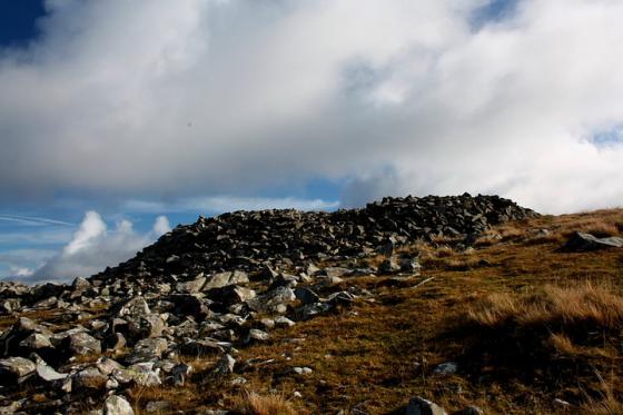
I struggle to apply an iron age date to the settlement, with so many hillforts in North Wales it seems with no defences the inhabitants were either on a death wish or they were so cut off from outside the mountains that they didnt know to defend themselves, perhaps they were a lost mountain tribe, hidden from the minds of men, but not the sands of time. The cairn on the hilltop to the east with such good views of the snowdon horeshoe, might, I feel be connected with the Cwm Dyli settlement, from way down on the valley floor you cant see the mountain tops to the west, but a short half hour scramble up the hillside and there is the “best view in Wales”, if I lived here thats where I’d like to spend my for ever.
Out of the six hut circles ( three to the north, 30m south three more)one is much bigger than the others and was easily spotted from on high as I came down the mountain side, maybe the cheif of the hidden people lived here and later got interred way up the hillside. Besides the round houses there are two other structures that are unidentifiable to me but Phil Harding would probably know, it’s shame he wasn’t with me.
Its easy to get here, you can practically drive right up to the circles, in such splendid surroundings I wonder why hasn’t any else been here, but then I already know why, I only learned they were here myself a few months ago, and Ive been round and about here virtually all my life, you just dont know theyre there.
Only time seperates me from a visit to these hut circles, look at that name though, I ask you ?
A couple of good aerial photos are found on Coflein here
coflein.gov.uk/en/site/301041/details/HUT+CIRCLE+SETTLEMENT+NORTH+OF+CWM+DYLI+POWER+STATION/