Skip to content
Julian Cope
presents
The Modern
Antiquarian
Latest
Posts
Sites
Map
Blog
Forum
search
Search
⚠️
Sign in
more_horiz
United Kingdom
Wales
Gwynedd
Fortified hut settlement above Rachub
Ancient Village / Settlement / Misc. Earthwork
SH62826790
expand_more
Nearest town:
Bethesda (1km SSE)
OS reference:
SH62826790
OS sheet:
115
Latitude:
53° 11' 24.37 N
Longitude:
4° 3' 12.41 W
Added to TMA by
postman
Images (3)
Add
content
Images
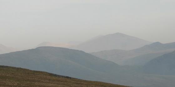
Image credit: Chris Bickerton
postman
Dec 11, 2010
Image credit: Chris Bickerton
postman
Dec 11, 2010
Quarried away on two sides.
Image credit: Chris Bickerton
postman
Dec 11, 2010
Sites within 20km of
Fortified hut settlement above Rachub
Cairn cemetry, W. shoulder of Moel Faban
Cairn(s)
•
0.33km E
photo
4
description
1
Pen-y-Gaer (Bethesda)
Hillfort
•
0.65km SSE
photo
6
description
1
Moel Faban Arrow Stone
Carving
•
0.68km E
photo
8
forum
1
description
2
link
2
Moel Faban, Carneddau
Megalithic Cemetery
•
0.69km ENE
photo
30
ondemand_video
1
forum
1
description
4
Moel Faban Settlement
Ancient Village / Settlement / Misc. Earthwork
•
0.85km ENE
photo
13
ondemand_video
1
description
4
Bwlch ym Mhwll-le (Llefn)
Cairn(s)
•
1.02km ENE
photo
25
ondemand_video
1
forum
1
description
3
link
2
Cwm Ffrydlas, Carneddau
Ancient Village / Settlement / Misc. Earthwork
•
1.56km ENE
photo
13
description
3
link
1
Twll Pant-hiriol
Ancient Village / Settlement / Misc. Earthwork
•
1.64km NE
photo
12
description
1
link
1
Rhiw Goch Stone
Natural Rock Feature
•
1.75km WNW
photo
1
description
1
Pen Dinas camp
Hillfort
•
1.82km W
photo
4
description
1
Sling
Burial Chamber
•
2.52km WSW
photo
33
ondemand_video
1
forum
1
description
5
link
1
Parc Gelli
Ancient Village / Settlement / Misc. Earthwork
•
2.76km W
description
1
Moel Wnion
Cairn(s)
•
2.8km NE
photo
29
description
2
link
1
Ffridd Fedw
Standing Stone / Menhir
•
2.97km N
photo
1
description
2
Cwm Caseg, Carneddau
Ancient Village / Settlement / Misc. Earthwork
•
3.12km E
photo
7
description
1
Drosgl (Northern slopes)
Cairn(s)
•
3.46km ENE
photo
3
description
1
Drosgl Cairns
Cairn(s)
•
3.47km ENE
photo
38
description
5
link
1
Caer Pencraig (Ty’n y Caeau)
Hillfort
•
3.56km WSW
photo
5
description
1
link
1
Cairn N of Moel Wnion
Cairn(s)
•
3.67km NE
photo
2
description
1
Carnedd Howell
Cairn(s)
•
3.67km W
description
1
Mynydd Du Settlement, Carnedd Dafydd
Ancient Village / Settlement / Misc. Earthwork
•
3.7km ESE
photo
8
description
1
Cras
Cairn(s)
•
3.93km NE
photo
18
description
1
Cairn above Ffridd Ddu
Round Cairn
•
4.19km NE
photo
2
description
1
Carnedd Moel y Ci
Cairn(s)
•
4.19km WSW
photo
17
ondemand_video
1
description
1
link
1
Llandegai Cursus
Cursus
•
4.6km WNW
photo
3
description
2
Coed Aber round house
Ancient Village / Settlement / Misc. Earthwork
•
4.69km ENE
photo
16
description
2
Coety Bach
Ancient Village / Settlement / Misc. Earthwork
•
4.8km SSE
Meuryn Isaf
Kerbed Cairn
•
5.21km NE
photo
20
description
2
link
2
Maes y Gaer
Hillfort
•
5.78km NE
photo
20
description
1
Anafon Valley cairns
Cairn(s)
•
5.9km NE
photo
17
description
1
Carnedd Dafydd
Cairn(s)
•
5.93km ESE
photo
30
description
2
Garnedd Uchaf
Round Cairn
•
5.94km E
photo
7
description
2
Cairn SW of Carnedd Dafydd
Cairn(s)
•
5.95km ESE
photo
9
Garnedd Fach, Y Carneddau
Round Cairn
•
6.07km SE
photo
13
description
2
Foel Dduarth (west)
Ancient Village / Settlement / Misc. Earthwork
•
6.12km NE
photo
9
description
1
link
1
Carnedd y Saeson
Cairn(s)
•
6.25km NE
photo
36
description
2
Ty’n-llywyn Pentir
Standing Stones
•
6.28km WSW
photo
9
description
1
Hafod Gelyn (north)
Cairn(s)
•
6.34km NE
photo
3
description
1
Foel Grach
Round Cairn
•
6.36km E
photo
28
description
4
link
1
Foel Dduarth
Enclosure
•
6.43km NE
photo
20
description
1
Carnedd Llewelyn
Cairn(s)
•
6.48km E
photo
47
description
6
Camp Hill (Bangor)
Hillfort
•
6.85km WNW
photo
1
Afon Anafon Arrow Stone
Carving
•
7.03km ENE
photo
2
description
3
link
1
Tristan’s Cairn
Cairn(s)
•
7.11km E
photo
15
description
2
Cairn, NNW of Foel Ganol
Cairn(s)
•
7.18km NE
photo
9
description
1
Foel Dduarth Arrow Stone
Carving
•
7.29km NE
photo
4
description
3
Cwm Gafr
Ancient Village / Settlement / Misc. Earthwork
•
7.52km S
photo
2
description
1
Cairn NNE of Foel Ganol
Cairn(s)
•
7.53km NE
photo
5
description
1
Yr Orsedd standing stone
Standing Stone / Menhir
•
7.67km NE
photo
10
description
2
Arrow Stone I near Ffridd Newydd
Carving
•
7.73km NE
photo
8
description
3
link
1
Yr Orsedd cup marked stone
Cup Marked Stone
•
7.78km NE
photo
3
description
1
Arrow Stone II near Ffridd Newydd
Carving
•
7.86km NE
photo
15
forum
1
description
5
Llyn Ogwen
Ancient Village / Settlement / Misc. Earthwork
•
7.87km SE
photo
15
forum
1
description
2
Garreg Fawr
Round Cairn
•
7.88km NE
photo
4
description
1
Pant-y-Griafolen
Ancient Village / Settlement / Misc. Earthwork
•
7.97km E
photo
17
description
4
Carnedd Pen y Borth Goch
Round Cairn
•
8.17km ENE
photo
41
ondemand_video
1
description
2
link
1
Dinas Dinorwig
Hillfort
•
8.25km WSW
photo
6
description
2
Carnedd y Ddelw
Cairn(s)
•
8.3km ENE
photo
27
description
4
link
1
Garreg Fawr
Cup Marked Stone
•
8.38km NE
photo
20
forum
1
description
2
Arrow Stone SW of Cammarnaint
Carving
•
8.44km NE
photo
2
description
2
Afon Garreg Wen
Standing Stone / Menhir
•
8.48km E
photo
11
description
1
Garth Standing Stone
Standing Stone / Menhir
•
8.5km W
photo
13
description
4
Pen y Maen
Standing Stone / Menhir
•
8.76km WNW
Llanerch Fedw
Cairn(s)
•
8.86km ENE
photo
4
description
1
Clogwyn-yr-Eryr
Ancient Village / Settlement / Misc. Earthwork
•
8.93km E
photo
7
description
2
Adam and Eve
Natural Rock Feature
•
9.21km SE
photo
48
forum
1
description
2
Parc Bach
Burial Chamber
•
9.21km SSW
photo
10
description
1
Dinas (Llanfairfechan)
Ancient Village / Settlement / Misc. Earthwork
•
9.27km NE
photo
36
description
2
Nant-y-Cytiau Arrow Stone
Carving
•
9.37km ENE
photo
2
description
2
Afon Eigiau
Burial Chamber
•
9.47km E
photo
9
description
2
Bwlch-y-Ddeufaen
Standing Stones
•
9.49km ENE
photo
38
description
6
The Giantess’ Apronful
Cairn(s)
•
9.59km ENE
photo
18
description
5
Plas Cadnant
Standing Stone / Menhir
•
9.59km WNW
photo
14
description
4
Caer Carreg-y-fran
Hillfort
•
9.61km WSW
description
1
Pen-y-Bwlch
Enclosure
•
9.64km SW
photo
3
Clogwyn-yr-Eryr stone row
Stone Row / Alignment
•
9.7km E
photo
10
description
4
Foel Lwyd
Cairn(s)
•
9.81km ENE
photo
3
description
1
Gwern Gof Isaf
Ancient Village / Settlement / Misc. Earthwork
•
9.81km ESE
photo
19
description
1
Ty Mawr
Burial Chamber
•
9.83km W
photo
14
forum
2
description
1
Maes-y-Bryn
Round Barrow(s)
•
9.88km NE
photo
5
Cader Ellyll
Ancient Village / Settlement / Misc. Earthwork
•
10.01km SSW
photo
6
description
2
Castell y Gwynt, Y Glyderau
Natural Rock Feature
•
10.02km SE
photo
18
forum
1
description
2
Ffrith-Y-Bont
Stone Row / Alignment
•
10.09km ENE
photo
5
description
1
Hafodygors wen hut circle
Ancient Village / Settlement / Misc. Earthwork
•
10.11km E
photo
4
description
1
Dinas Ty-Du
Hillfort
•
10.12km SW
photo
21
ondemand_video
1
description
3
Parciau Gleison
Standing Stone / Menhir
•
10.13km SW
photo
4
description
2
Cerrig Pryfaid
Stone Circle
•
10.13km ENE
photo
36
forum
2
description
10
Pen Llithrig y Wrach
Round Cairn
•
10.37km E
photo
47
description
4
link
1
Tal-y-Braich Circle
Stone Circle
•
10.43km ESE
photo
6
description
2
Hafodygors Wen Cairn II
Cairn(s)
•
10.47km E
photo
5
description
1
Tal-y-Braich Cairn
Cairn(s)
•
10.5km ESE
photo
3
description
2
Afon Bedal Cist
Cist
•
10.5km ESE
photo
5
description
2
Hafodygors Wen
Cairn circle
•
10.51km E
photo
48
description
6
Yr Aelgerth
Ancient Village / Settlement / Misc. Earthwork
•
10.62km SSW
photo
4
forum
1
description
1
Braich y Dinas
Hillfort
•
10.64km NE
link
1
Hafodlas Cairn Circle
Cairn circle
•
10.67km SW
photo
4
description
1
Bryniau Bugeilydd
Barrow / Cairn Cemetery
•
10.83km NE
photo
5
description
1
Cairn, between Afon Bedal and Bwlch Cowlyd
Cist
•
10.88km ESE
photo
4
description
2
Foel Lwyd (north)
Barrow / Cairn Cemetery
•
10.89km ENE
photo
11
Dinas (Y Felinheli)
Promontory Fort
•
10.91km WSW
photo
5
Bryn-yr-Hen-Bobl
Chambered Cairn
•
10.93km W
photo
23
description
7
Plas Newydd Burial Chamber
Dolmen / Quoit / Cromlech
•
10.93km W
photo
44
forum
3
description
9
Cwm Cowlyd
Ancient Village / Settlement / Misc. Earthwork
•
10.98km E
photo
3
description
1
Maen Morddwyd
Standing Stone / Menhir
•
10.98km WSW
photo
4
description
4
Moelfre (Penmaenmawr)
Cairn(s)
•
11km NE
photo
12
description
3
Cremlyn (North and South)
Standing Stones
•
11.07km WNW
photo
11
link
1
Nant Y Benglog
Cairn(s)
•
11.08km ESE
photo
3
description
1
Cefn Coch (Penmaenmawr)
Cairn(s)
•
11.11km NE
photo
35
description
3
link
1
Bwlch Cowlyd
Cairn(s)
•
11.17km ESE
photo
2
description
1
Cors y Carneddau
Cairn(s)
•
11.18km NE
photo
41
description
3
link
1
Cors y Carneddau
Stone Circle
•
11.24km NE
photo
5
description
3
Cae Coch
Standing Stone / Menhir
•
11.26km ENE
photo
26
forum
1
description
4
Graig Lwyd
Ancient Mine / Quarry
•
11.28km NE
photo
14
forum
1
description
1
link
1
Moel Eilio, Y Carneddau
Ancient Village / Settlement / Misc. Earthwork
•
11.34km E
photo
14
description
1
Circle 278
Ring Cairn
•
11.45km NE
photo
26
forum
2
description
3
Ffon-y-Cawr
Standing Stone / Menhir
•
11.49km ENE
photo
21
forum
1
description
4
Monument 280
Standing Stones
•
11.5km NE
photo
43
description
5
Y Meini Hirion
Stone Circle
•
11.58km NE
photo
101
forum
4
description
15
link
1
Waen Bryn-Gwenith (stone I)
Dolmen / Quoit / Cromlech
•
11.62km E
photo
11
description
1
Cerrig Gwynion
Cairn(s)
•
11.63km ENE
photo
7
description
1
link
1
Dyffryn Mymbyr
Stone Circle
•
11.64km SSE
photo
46
description
3
Maen-y-Bardd
Dolmen / Quoit / Cromlech
•
11.77km ENE
photo
67
description
9
link
1
Circle 275
Stone Circle
•
11.8km NE
photo
28
forum
1
description
5
Waen Bryn-Gwenith (stone II)
Standing Stone / Menhir
•
11.88km E
photo
14
description
1
Fridd Wanc
Barrow / Cairn Cemetery
•
11.94km NE
photo
10
description
1
Caerhun Stones
Standing Stones
•
11.99km ENE
photo
12
forum
1
Bwlch Goleuni
Long Barrow
•
12.01km ESE
photo
15
description
2
Rhiw Burial Chamber
Burial Chamber
•
12.02km ENE
photo
30
forum
1
description
5
Pant Ifan
Standing Stone / Menhir
•
12.06km WSW
photo
4
description
1
Hendrefor
Burial Chamber
•
12.21km WNW
photo
9
description
5
Pen-y-Gaer (Caerhun)
Hillfort
•
12.22km ENE
photo
47
description
4
Ffrith y Ddwyffrwd
Cairn(s)
•
12.28km ENE
photo
7
description
1
Maen du’r Arddu
Natural Rock Feature
•
12.28km S
description
1
Cefn Maen Amor
Stone Circle
•
12.29km ENE
photo
7
description
3
Bryn Celli Ddu
Chambered Cairn
•
12.29km W
photo
130
ondemand_video
1
forum
12
description
29
link
10
Cilgwythwch
Standing Stone / Menhir
•
12.33km WSW
photo
9
description
2
Cairns SSW of Caer Bach
Cairn(s)
•
12.36km ENE
photo
2
description
1
Maen Penddu
Standing Stone / Menhir
•
12.38km ENE
photo
21
forum
1
description
2
Cae Du
Cairn(s)
•
12.46km E
photo
28
description
2
Maen Crwn
Standing Stone / Menhir
•
12.46km NE
photo
21
description
2
Dyffryn Mymbyr cist II
Cist
•
12.48km SE
link
1
Dyffryn Mymbyr
Cairn(s)
•
12.49km SE
photo
14
description
5
Bryn Celli Ddu Gorsedd
Natural Rock Feature
•
12.51km W
photo
14
forum
1
description
4
link
1
Moel Eilio
Cairn(s)
•
12.53km SW
photo
39
description
2
Caer Bach
Hillfort
•
12.57km ENE
photo
42
ondemand_video
1
forum
1
description
6
Red Farm
Stone Circle
•
12.59km NE
photo
20
forum
2
description
3
Caer Bach cairn
Cairn(s)
•
12.63km ENE
photo
4
description
1
Tyddyn Bach Standing Stone
Standing Stone / Menhir
•
12.7km W
photo
19
description
2
Pen-y-Gwryd (Cairn SE of)
Round Cairn
•
12.98km SE
photo
7
description
2
Caer Idris
Hillfort
•
13.33km WSW
description
1
Pen-y-Gelli
Cairn(s)
•
13.34km WSW
photo
1
description
1
Bwlch Farm
Standing Stone / Menhir
•
13.36km NW
photo
5
description
1
Lledwigan Cairn, Cefn Cyfarwydd, Y Carneddau
Round Cairn
•
13.36km E
photo
10
ondemand_video
1
description
1
Waen Gyrach
Cairn(s)
•
13.4km ENE
photo
24
description
2
Yr Wyddfa
Cairn(s)
•
13.64km S
photo
45
description
3
Tyddyn-Grasod
Cist
•
13.65km ENE
photo
11
description
2
Hafodty
Standing Stone / Menhir
•
13.75km ENE
photo
16
description
2
Cerrig-y-Ddinas
Hillfort
•
13.93km ENE
photo
24
description
3
Nant-y-Llys
Long Cairn
•
13.94km SE
photo
9
description
2
Hafodty Circle
Stone Circle
•
13.96km ENE
photo
35
ondemand_video
1
description
1
Settlement north of Cwm Dyli power station
Ancient Village / Settlement / Misc. Earthwork
•
13.99km SSE
photo
23
description
2
Brynsiencyn
Round Barrow(s)
•
13.99km WSW
photo
1
description
1
Bwrdd Arthur (Llanddona)
Hillfort
•
14.16km NW
photo
20
description
2
Porth Llwyd
Burial Chamber
•
14.16km ENE
photo
2
description
1
Llyn y Wrach
Ring Cairn
•
14.17km NE
photo
27
description
2
The Three Leaps
Stone Row / Alignment
•
14.41km WNW
photo
5
forum
1
description
5
Plas Curig
Cairn(s)
•
14.45km ESE
photo
11
description
2
Perthi Duon
Burial Chamber
•
14.81km WSW
photo
18
description
6
Dinas Allt Wen
Hillfort
•
14.96km NE
photo
25
ondemand_video
1
Craig Cwmbychan
Round Cairn
•
15.06km SW
photo
20
description
2
Trefwri Standing Stone (East)
Standing Stone / Menhir
•
15.16km WSW
photo
10
description
1
Carnedd Moel Siabod
Round Cairn
•
15.27km ESE
photo
63
description
2
link
2
Gwern Engan
Ancient Village / Settlement / Misc. Earthwork
•
15.3km NE
photo
1
Trefwri Standing Stone (West)
Standing Stone / Menhir
•
15.36km WSW
photo
14
description
2
Caer Leb
Enclosure
•
15.47km WSW
photo
15
description
3
Pont Sarn-las
Ancient Village / Settlement / Misc. Earthwork
•
15.66km WSW
photo
1
description
1
Hirdrefaig
Standing Stone / Menhir
•
15.76km W
photo
6
description
2
Mynydd Mawr
Round Cairn
•
15.87km SW
photo
34
description
3
link
1
Ty’n Pwll
Round Barrow(s)
•
15.9km WNW
description
1
Bwlch y Rhediad, Moelwyns
Cairn(s)
•
15.94km SE
photo
7
description
1
Cadair Ifan Goch
Natural Rock Feature
•
16.01km E
photo
3
description
1
Castell Bryn-Gwyn
Henge
•
16.18km WSW
photo
19
description
5
Cefn Glas 1
Cairn(s)
•
16.29km ESE
photo
2
Drws-y-Coed
Ancient Village / Settlement / Misc. Earthwork
•
16.39km SSW
photo
3
description
1
Castell Caer Seion
Hillfort
•
16.44km NE
photo
34
description
2
Bodowyr
Dolmen / Quoit / Cromlech
•
16.46km WSW
photo
57
description
14
link
1
Pen-y-Castell, Maenan
Hillfort
•
16.47km E
photo
10
Llanddyfnan
Standing Stone / Menhir
•
16.51km WNW
photo
4
description
4
Bryn Gwyn
Stone Circle
•
16.59km WSW
photo
34
description
12
link
1
Cefn Glas
Cairn(s)
•
16.63km ESE
photo
17
description
3
link
1
Y Garn, Nantlle Ridge
Cairn(s)
•
17.08km SSW
photo
58
description
3
Coed y Brain
Ancient Village / Settlement / Misc. Earthwork
•
17.13km SW
photo
3
description
1
Llangaffo
Standing Stone / Menhir
•
17.56km WSW
photo
2
Gelli Ffrydiau
Hillfort
•
17.58km SW
photo
12
description
1
Bedd Carrog
Round Barrow(s)
•
17.67km ENE
description
1
Trum y Ddysgl
Ancient Village / Settlement / Misc. Earthwork
•
17.67km SSW
photo
3
description
1
Hendre Waelod
Dolmen / Quoit / Cromlech
•
17.77km ENE
photo
30
description
6
link
2
Glyn
Burial Chamber
•
17.95km WNW
photo
27
forum
1
description
4
Llangristiolus
Standing Stone / Menhir
•
18.17km W
photo
4
description
2
Benllech
Burial Chamber
•
18.32km WNW
description
2
link
1
Pant-y-Saer
Burial Chamber
•
18.66km WNW
photo
24
description
7
link
1
Dinas Emrys
Hillfort
•
18.91km S
photo
26
description
10
link
1
Dinas (Beddgelert)
Hillfort
•
19.37km S
photo
12
description
2
Llyn Llagi
Ancient Village / Settlement / Misc. Earthwork
•
19.58km SSE
photo
4
Dinas (Llaneugrad)
Promontory Fort
•
19.88km WNW
photo
2
Llyn yr Adar
Cist
•
19.98km SSE
photo
7
description
1
search
I’m looking for…
location_on
photo
ondemand_video
forum
description
link