Image credit: A. Brookes (21.5.2016)


Chris paces the diameter in megalithic yards.

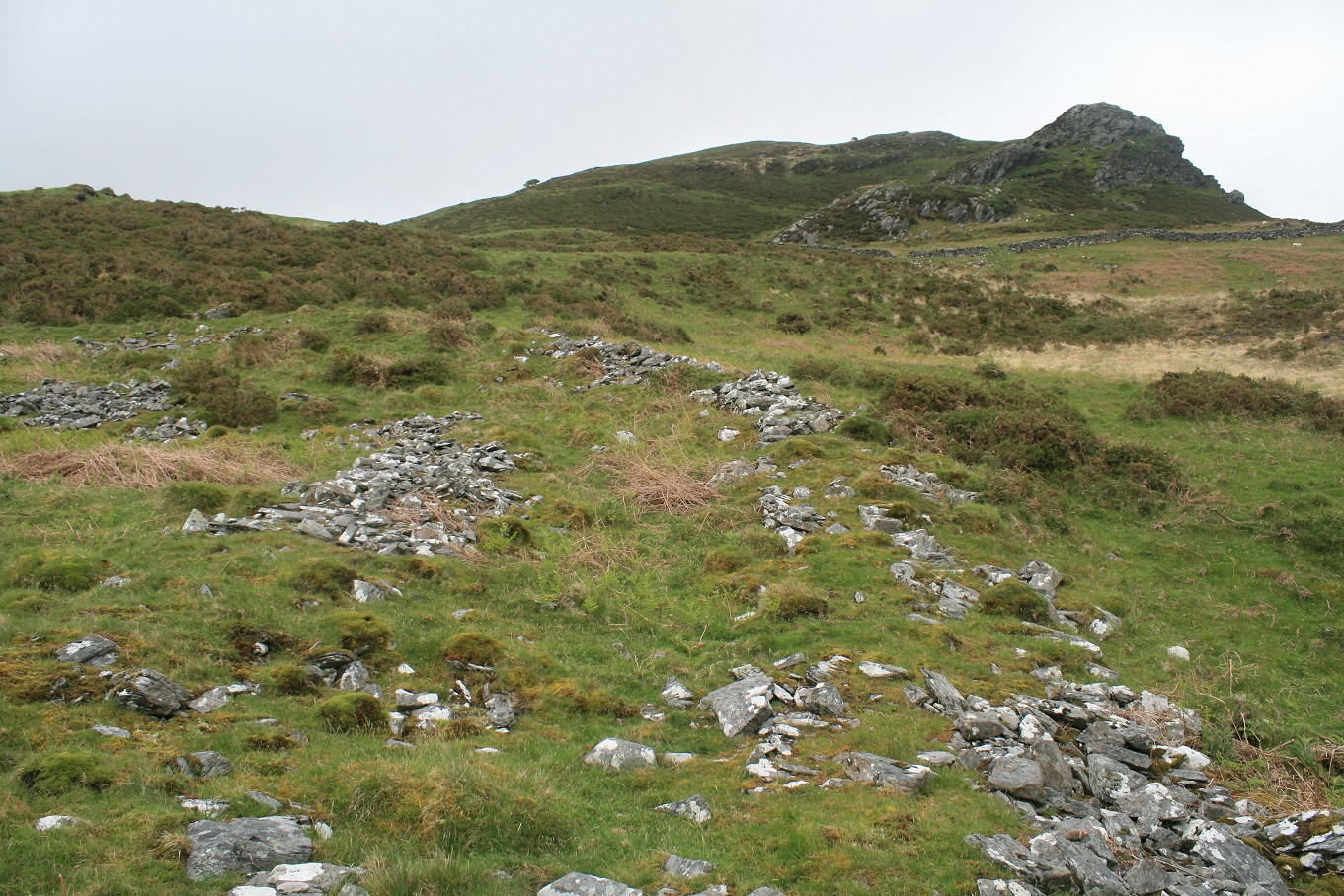
Looking east across the site towards Y Gyrn.

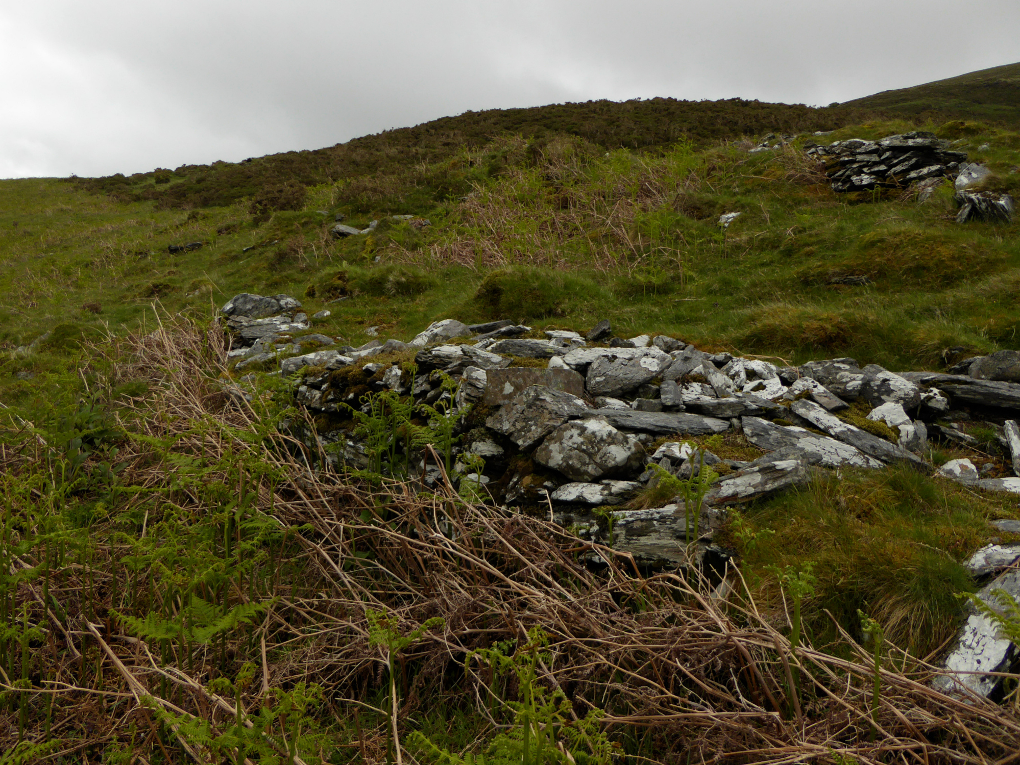
Some substantial masonry in the outermost wall.

Looking down on Maes y Caerau from Y Gyrn, with the Dwyryd estuary beyond. Moel y Gest can be seen through the gloom across the river to the left of centre, above the Italianate uber-folly of Portmeirion.

First view from across the waterfalls of a small stream.

Zooming down over the rocks of Y Gyrn.


The circular walls of Maes y Caerau.
Curving walls under Y Gyrn.

Peeling back the encroaching turf would reveal a truly amazing place, probably.

The big rock is Y Gyrn and on the other side Bryn Cader Faner and much more.


The settlement is on the (fairly) level ground to the west (left) of the drystone wall. The slopes of Y Gyrn are on the right.
We were here a few years ago, but we had to pass it by due to deep snow and the approach of the dark of the night, for those three years it was on my North Walean wish list. On the map, coflein and google earth it looks very good, three stony rings one inside the other, I was very much looking forward to seeing it from above on the rocky prominence named Y Gyrn, and closer up too of course.
We first caught sight of its rubble rings on the way to the Y Gyrn cairns, waterfalls barred the way so we decided to see it on the way back down. So, after many stony treats we found ourselves stood upon the rocky towers of a mini mount, the views, even on this murky kind of day are expansive, many different things can be seen, collectively they are known as North Wales. But closer to and below us is one of the oddest settlements I’ve seen for while, I can make out the three stone banks but its half grassed over and as the ground is falling away from us, and the rings are on the hill, they are kind of pointing away from us, spoiling the birds eye view I had envisaged. The voodoo priestess laughed and gave me a slap across the face, I had to agree, we had uncannily missed any and all rain, staying dry and happy, and not to mention you get what you get, not what you wish for.
Three concentric rings of dry stone walling one and a half to two meters thick, the innermost ring is thought to be a round house. The entrance to the two outer walls is at the south west, in places the walls are still half a dozen courses high. I thought it strange that the Iron age homesteaders hadn’t leveled the ground before building, maybe I’ve seen too many stone circles, either way I quite liked the way the whole place is draped over the contours of the land and apparently early cultivation terraces.
I liked this place, the green valleys, the mountains, the ancient places, but I reckon a bit of de-turfing would really benefit the site, if it is left to itself it will disappear, just like it’s apparent twin 600 yards south west Bryn-Melyn, twin? did I not say.
I got in by a back door to Coflein and found these details and some aerial photos of this cracking looking interesting site. I’ll try to get back up as soon as the weather improves
coflein.gov.uk/en/site/300033/details/MAES-Y-CAERAU+HOMESTEAD/


