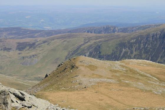
Looking WSW towards Moel Faban, topped with obvious cairns.
Image credit: A. Brookes (18.4.2013)
Looking WSW towards Moel Faban, topped with obvious cairns.

Two adjoining circular structures, looking SE to Drosgl and Gyrn Wigau. The settlement is quite sheltered in the high-sided valley, despite being above 400m OD.

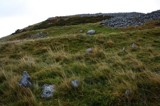
Detail of low remains of settlement walls, looking up to Gyrn.

Postie crossing one of the larger circular enclosures in the settlement. The western Glyderau (and Moel Eilio, right) provide the wonderful backdrop to the setting.

Low rubble remains of settlement walls. Looking SE to Gyrn Wigau.


View down the valley from the settlement. The hill on the right of the pic is Moel Faban with it’s cairns.


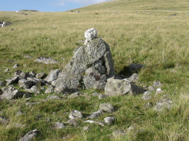
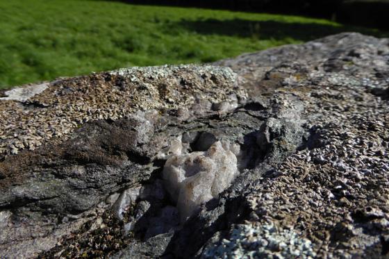
This is the boulder with the quartz on top that marks the path leading to the area of the settlement

the track leading passed Moel lefn on the left towards Y gyrn with the settlement at it’s base

Looking from the great Bronze Age cairn upon Drosgl.......
I have recently found on the Coflein website at the bottom of the entry for Cwm Ffrydlas that an archaeology student wrote their dissertation on Cwm Ffrydlas in 2015.
It’s really interesting and has lots of maps and overlays and is well worth looking at if you plan to visit this site as it gives some clarity to what can look like a jumble of stones.
It’s a PDF document that I can’t share here but if you click on the red pdf link at the bottom of the Coflein entry it will take you there.
Shortly after leaving the cairn and heading to the col, the heavens open and a stinging sideways rain blasts into us. We reluctantly abandon any intention of visiting the cairn on Moel Wnion, instead pressing onwards, around the shapely cone of Gyrn. The rain finally relents as we reach the ancient settlement at Cwm Ffrydlas.
There are a couple of curving external boundaries, but the remains are pretty scanty and quite difficult to make sense of. However, the settlement is beautifully positioned, at least as far as the scenery goes, with an awesome view across the valley to the Glyderau and Moel Eilio. It’s also sheltered down here, out of the winds that have blasted us for most of the day. A remote place now, on a day when we haven’t seen a soul, but people called it home once.
Following the path next to Moel Faban that passes the arrow stone, settlement and burnt mound, pass the huge glacial feature that separates Moel Faban and Moel Lefn on the left. The path skirts around the eastern base of Lefn. Looking to the right there is a narrow path or sheep track leading to a small upright stone with a quartz lump sat on top of it.
Walk towards the sheepfold keeping the mine on the other side of the valley in line with it.
An early bronze age settlement that is really difficult to figure out when you are there amongst the stones. But it is worth coming because the view down the valley is wonderful.
I wandered around trying to work out what was what and found circular features, rectangular features and higglety piggelty features. Then I sat and lost myself in the view.
Lynch says that these are “one of the most characteristic and accessible of Griffith’s Class II settlements’- groups of very small huts set within irregular, non-terraced fields. Such settlements are believed to be early Bronze age in date”
There are 6 small poorly built huts most on the line of the field walls.
The fields are of irregular, rounded shape and variable size.
It maybe that the stones were never structural walls but a stone skin piled up against a wooden wall.