
Moel Wnion (left), Lefn and Moel Faban, seen from Llandegai to the north. The snowy higher slopes of the Carneddau are hiding in the clouds.
Image credit: A. Brookes (31.3.2018)
Moel Wnion (left), Lefn and Moel Faban, seen from Llandegai to the north. The snowy higher slopes of the Carneddau are hiding in the clouds.

Note the moth-eaten (tough moths in North Wales... mothus monstrousus) OS triangulation pillar, centre.

The massive footprint... a random snapshot of public perception of such monuments was accorded me by a passing, middle aged woman.. ‘are you photographing birds?’ says she. ‘No, I’m here for the archaeology, the Bronze Age cairn’, says I. ‘What cairn?’ says she, clearly bemused. Incidentally Carnedd y Filiast – site of the exquisite ‘Atlantic Slab’ – can be seen approx centre skyline beyond Nant Ffrancon.

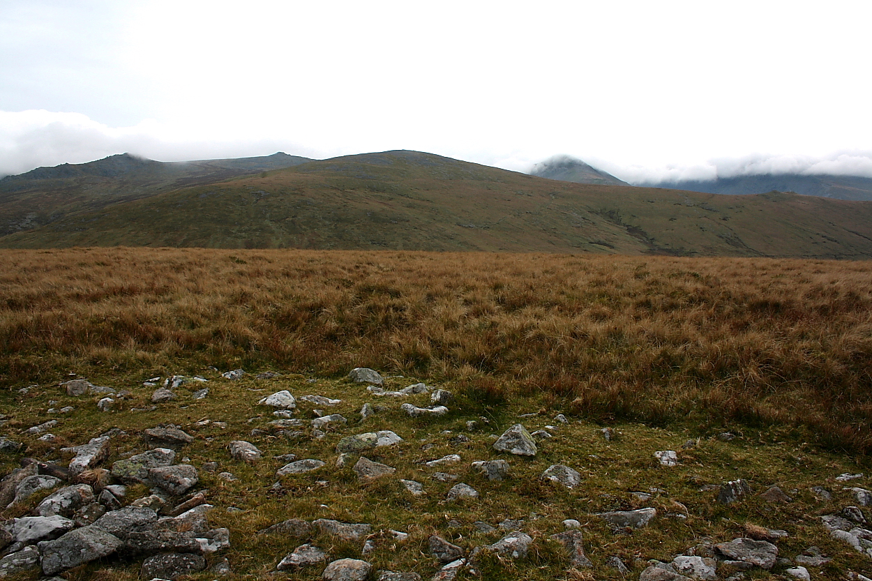
Llwytmor is the peak with its head in the clouds... Bera Mawr the serrated summit to the right.

The prominent slab suggested the displaced remnant of a cist or chamber... however in this instance there was no corroborating evidence.. wishful thinking? Note, however, the truly massive footprint. I could not locate the ‘cup marked stone’ incidentally.

Llwytmor, Bera Mawr, Bera Bach and Drosgl (left to right) form the backdrop beyond the cairn...

Clearly this was a massive cairn in terms of overall footprint... however guess the nature of the original profile will be forever more open to conjecture.

A ‘tsunami’ of cloud pours over Carnedd Dafydd beyond... Yr Elen is centre left, with the splendidly be-cairned Drosgl far left.

As is often the case with upland cairns, the surmounting muppet shelter gives a totally false impression of the original size of this monument.

Moel Wnion from Gyrn Wigau..... Ynys Mon lies beyond The Menai Straits...

Moel Wnion, illuminated, with becairned Cras to the right and Ynys Mon beyond. Seen from the rocky summit of Bera Mawr.

Moel Wnion (with conical Gyrn to the left) seen from Gyrn Wigau to the south.

Looking over the cairn on Moel Wnion to the Menai Straits and Angelsey.

I hope you can just see the cairn on Moel Wnion

From the north slopes of Drosgl.

The much ruined cairn looking towards south east

Walking south from the cairn with Y Gryn to the right and Gryn Wigau to the left with the Carneddaus in the back ground.

Semi circular orthostat wall with bank at the base of Moel wnion.

The reservoir at the base of Moel Wnion with Twll pant Hiriol on the left and the cairns on top of Moel faban on the left

Looking west from the cairn with Y Gyrn on the left and Moel Lefn middle right.

Looking North. Puffin Island can be seen in the sea on this October afternoon.

Looking south. Showing the extent of the cairn

The Natural hollow on the left of the pic is Twll pant Hiriol with it’s hut circle inside, on Moel Lefn. The hill in the middle of the pic is Moel Faban. The little group of houses on the far right of the pic is where I live.

cup marked stone in cairn. I think the lines are modern.

Looking from the shattered rock formations of Gyrn Wigau.....


The destruction wrought by walkers and the Ordnance survey alike are both really saddening. One can only hope the OS are now more conciencious.

Due to low clouds and no compass I know not which direction this is looking.
What a beautiful October afternoon. Standing in my back garden I could see Moel Wnion sitting there tempting me. So, determined to find this supposed Cup marked stone with in the cairn, off I trot. To make it a little easier for my self I drive to the Bryn Hafod quarry which is beautiful filled with water but treacherous.
I walk up past Bryn Hall, the old youth Hostel, then up the track. There is a clear right hand turn with the track in a deep ditch leading up around the side of the hill. It’s quite a steady climb and I was grateful for the stunning views down the valley. When I reached the flat, the ground was quite boggy and the dogs were quite happy to find proper boggy puddles to lie in and roll around in, because they were so hot.
Following the track East (left) you soon begin to ascend as the track turns north. Follow this up hill until you are rewarded with fine views from the flat top of the hill.
The track turns right Eastish again and leads straight to the cairn which is much ruined, but would have been huge.
The only cup marked stone I could find with in the cairn also has 3 lines on it. GAT says the stone has only one cup mark. There are lots of stones up there that are pitted but thanks to Tiompan I now know these are natural. I am not sure about this one, but it was the only possibility.
It was such a beautiful day that there were butterflies fluttering around. The sun made taking some pics difficult because it was late afternoon and the sun was low in the west.
On the walk down the hill I decided to take some pics of a stone “structure” maybe a wall. The outside of a compound perhaps? It is clearly man made and in an area peppered with hut circles.
We walked up from the two ill named cairns to the north, and as we ascended the clouds closed in and our compassless selves guessed the way up, as the cairn occupies the highest point on Moel Wnion you cant really go that wrong.
The views should have been tremendous but visibility was down to twenty yards or so, despite the clouds we found the cairn with ease.
This cairn’s slow destruction was a product of walkers hiding from the elements (why would anyone do that) and belligerent ordnance surveyors who plonked there part time trig point right in the middle of it, who ruined first I don’t know but ruined it is, at least there’s fantastic views all round Anglesey and the mountains mmmmmm ? oh right there’s just clouds.
Snowdonia mountain cairns catalogue. It gives a detailed plan of each of the summit cairns.


