earthwork/s directly below tomb – ?settlement
Image credit: wideford
earthwork/s directly below tomb – ?settlement

curvilinear banks of ?settlement

dyke seen from 1st stone group

dyke looking over 2nd stone group to first

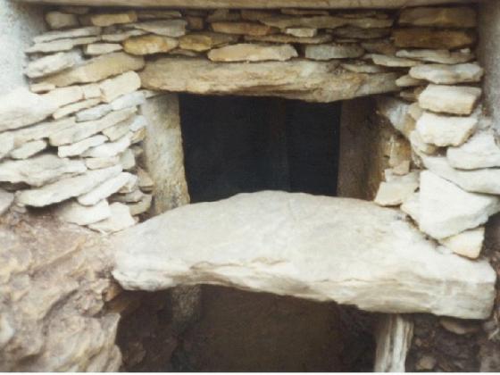
stone group includind pierced square slab

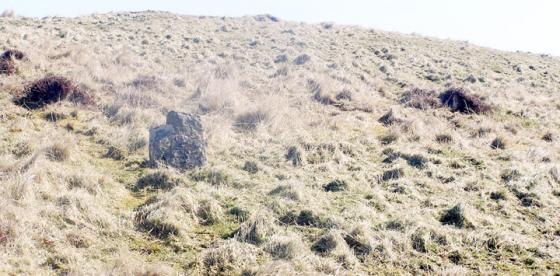
uphill dyke from lowest located stone

view uphill to old track, fallen 2m min. stone embedding

end of Smerquoy track
Looking down from the Wideford Hill Tomb to the straightened watercourse below (the line of the parish boundary) I saw just the other side cropmarks occupying this end of a field and extending slightly into the next. After carefully picking my way down to a fence I saw through my binoculars that the cropmarks were actually curvilinear banks. Not being able to cross that ‘drain’ from this side I went no further. Instead I decided to go along the hill, parallel to the modern boundary, after some large erect stones seen on previous occasions below the old Wideford track. It rapidly became apparent that I was walking precariously along the top of an ancient dyke, which turned out to be mostly earth with a ‘top dressing’ of earthfast and other small slabs revealed here and there. The O.S. shows short lengths of field fence at varying angles where the old map shows nothing, as is true of all this side of the hill then. It is difficult to tell whether these strictly follow the hill-dyke or not as I was unaware of any divergences myself in following it. The modern fence is mostly fading away, and along the top of the dyke are many stumps of old posts. I think there have been two attempts in modern times to use this ancient feature as an aid to modern enclosure, one using the ‘standing stones’ that I was after. The first indication of the dyke’s height was a grind/slap in it, a gap with tall stones either side, some erect and others fallen. The dyke exposed here is a metre or so in height, possibly more in places, generally with a steeper drop on the downhill side. Watch your every step. There are a few more prehistoric ‘gates’ on the way and regions where waters seem to have swept through the earthwork later. Even mediaeval ‘gateposts’ only have pairs of ‘standing stones’, here are clusters of tall stones high and mighty guardians of portals into places long gone. Some have been seduced into bondage with barbed wire. One of the fallen becoming embedded in the earth is 2m or more, against another leans a small rectangular flag with a well-rounded piercing. After a while the dyke ends where a farmtrack starts. But there is another dyke here at right angles to the first. Looking downhill a thin rectangle of gorse extends and another large stone stoops near one end. I can see no stones on the hill below it. From here this, apparently slighter (and scooped out in several places not too long ago, dark dry earth in the hollow scars), dyke strikes up the hill to peter out just before reaching the old track from Haughhead to the cairn. Uphill the line continues as a plain drystane wall.
NOT PREVIOUSLY NOTED, DISPUTE AGE obviously
At least from HY40741218 to HY40481155