stones used to repair a fieldwall
Image credit: wideford
stones used to repair a fieldwall

viewed from Redland road on hillside above

The Ouse, a tidal inlet, in foreground and Bay of Firth behind broch

The Ouse, a tidal inlet, in foreground and Wideford Hill in background. Ingshowe broch lies in between

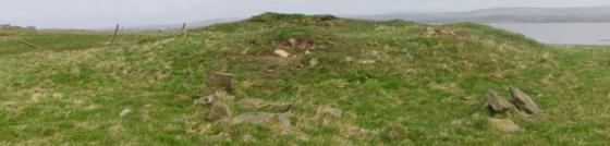
broch is on east side of road going to Evie

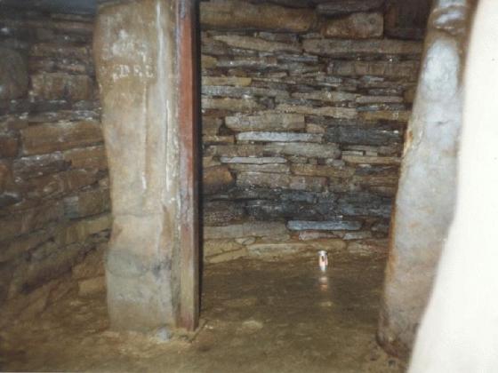
pasage between walls, cliff just off-screen at back

cell from front above i.e. wall outside broch tower

aperture at back of cell detailed

aperture at back of cell detailed

not until you leave the road and move closer to the shore at the Finstown end does the usual profile stand clear

?entrance passage wall

?entrance passage

RH of cell from above

cell from left above

roadside view looking across Finstown
15/06/2013 – Not the most exciting visit to a broch I’ve had but it was near to where we were staying and it was the first evening of our holiday so I was still a little over excited. We were in the Land of the wideford and after reading so many of his fieldnotes it was good to be there. Broch wise it’s OK, very overgrown and a little dangerous underfoot. If you are going to visit I’d said go on a Friday between 4.30pm – 8.30pm at least then you can go to The Peedie Chippie. Quality fish supper at the seafront carpark with good views across the bay to the broch.
Go into Finstown and take the road to Evie. Go out of town and you can’t miss the pillbox. This sits on The Hillock (RCAHMS NMRS Record no.HY31SE 4). At the near end is a space going down to the shore. To the left is a square modern wall and from there looking across its nature was plain as a pikestaff, that familiar broch outline revealed. I went down on the shore to see if there was a nice vertical section but the lumps of tarmac sticking out a foot below the clifftop disabused me of any such notion. Maybe further along, but I was restricted to how far I could go. So I came back and followed a path over the rise of the near end that may have been the double wall. Up to the pillbox for a looksee. To the shoreside of this are the visible wall remnants and the ‘cell’ revealed by a minor dig relatively recently. You can make out some passages and an entrance. There is even a little exposed walling. It was very dangerous getting photos because the grass hides holes, a couple of pieces of wire-frames and abundant nettles. Gingerly letting myself down to the passage floor I was always finding myself reaching out for grass holds that then revealed nettles. The walling you can see from the pillbox is a scant course or two high but when you are down in the passage looking back the cell shows itself several courses high owing to that excavation.
In 1990 Andrew Appleby reported that recently much had been removed by someone cutting across the seaward side.