
only thing beteeen this and manse on aerial view an isolated square object
Image credit: wideford. Photoshopped GoogleEarth

only thing beteeen this and manse on aerial view an isolated square object
20/2 & 17/3/06 This site is at the top of Tankerness beyond the Hall of Yinstay. Entry to the field is through a gate arrangement. In 1906 J.W.Cursiter excavated an earthhouse here that unusually produced burnt wood, as well as the usual shellfish, sherds and animal bones. He observed that the modern cairn had been built from non-local stone as well as broch-like blocks. A standing stone had been removed in living memory. From the contents of a next-door field (black earth, burn stones, animal remains, liberal pottery fragments) he deduced the former presence of a settlement here.
On Friday I took a closer look at Yinstay and can confirm most of what J.W.Cursiter said about the area. The first time I went I saw stones in a recently ploughed field almost diagonally opposite that of the souterrain site.but only paid a cursory glance as I did not know at the time that this was the field referred by him as adjacent. The farmer is ploughing a third of this field at a time. Its southern boundary running roughly E-W not many yards N from the cairn. Today the middle section was being ploughed and is very dark earth. However this does not appear to have any extraneous material. Upon closer viewing of the now dry ploughsoil (HY50881034 to 51021031) from the southern section boundary I could make out some burnt stone and small nuggets of what appears to be pot. The modern cairn also appears to contain at least a couple of burnt stones as part of the infill. This is 2.0m across and 2.0m at its greatest height in an arc facing the road, but only survives to any height for less than a third of the circumference, rapidly tailing off. There isn’t much of the red sandstone remaining but the outer wall is certainly mostly built up with broch-style blocks, some obviously carved (especially one with a well chamfered corner), though that this came from its field rather than another in the area is to my mind doubtful. I looked for signs of the souterrain by a field corner but what looked like a prospect (HY50841032) for where the discoverer broke through is at the fence a few yards to the north of the cairn, where by a tall toppled stone there is a slight depression of a few feet in length. Coming down to the road I noticed a water-filled depression (HY509103) that looked like something, but there isn’t anything I can point out and it is some distance away.
Tapering standing stone of red sandstone a ittle under 6’ht with a packing of small stones. It is 2’6” wide at the base, 12~13” thick and oriented N-S. The pointed top is slightly inclined to the west. Low shows two stumps with directions on a site diagram, now either missing or underground.

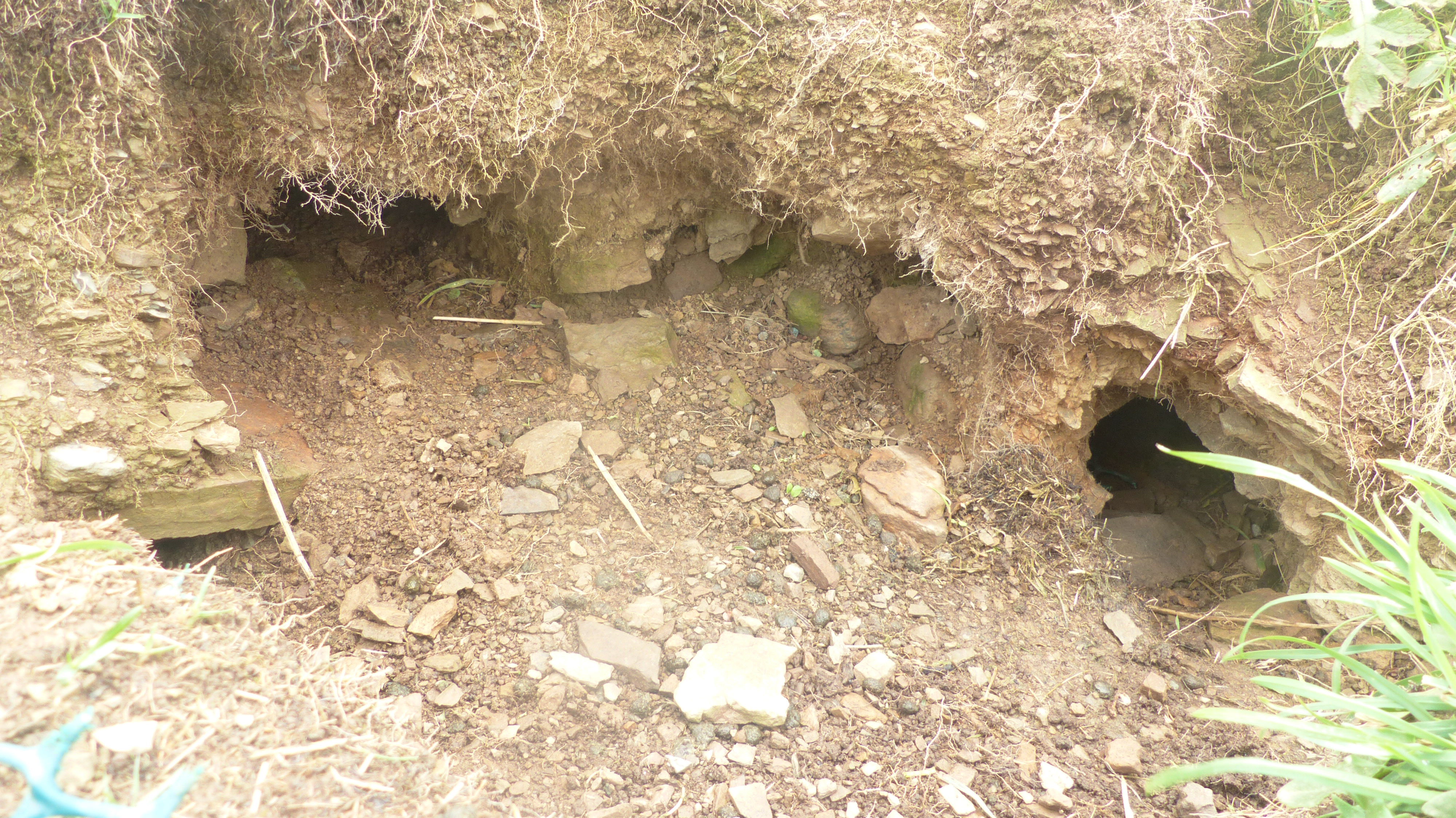
2016 inside one of the burrows a modern artefact looks like someone was digging illegally. August 13th

The Spittal Broch in Watten is to be preserved when the quarry is extended johnogroat-journal.co.uk/news/will-the-spittal-quarry-extension-destroy-an-ancient-broch-366079/?fbclid=IwY2xjawGoSwtleHRuA2FlbQIxMQABHT6gG62i4oxDUPtQPisS0u68QZhigPDOEOFGivPTE874CPqysV3L-AS9zw_aem_wRE0m3xn93AAQz4cQjYApw
Spittal Farm aka Spittal 2 survives to 1.7m but has been damaged by ploughing canmore.org.uk/site/8336/spittal-farm

derived from aerial photo, dig end at top left


The Pict’s House/Fort” on Howe Hill, aka the ‘hillock Of Howe’ – RCAHMS record no. HY51NW 5 on Howe Farm – was an amorphous mound prior to first excavation sometime before 1880. What can be seen of the knoll is roughly 50 by 40 yards and reaches 11’ 6” at the higher end.
Excavation at the top revealed curving drystane walls, After excavation the structure was filled in, but there were still ruins visible in 1923. The Pict’s House structure is thought to be a broch, though a more recent opinion has it as more like an unenclosed settlement, A solstitial alignment to the Mor Stein to my mind indicates an earlier origin or purpose to the whole
I could get to within a field of it all around and only saw a grassy mound. Having a large circular walk to finish I left it in peace.
John Bews says “from the mound at Howe the sun rises on the longest day, I think, directly over this stone. Moor Stone may have been quarried some distance south-east of Castle Bloody...” Howe Hill canmore.org.uk/site/3097/shapinsay-hillock-of-howe as distinct from the Hillock of Howe
Discovered this week in Onziebist tomb during UHI visit archaeologyorkney.com/2023/06/08/onziebist-rock-art/?fbclid=IwAR1ovcs1PTrrFKdwMDu_EUrUgoLcXpr-VU783UjpmCjHLzyF4Mca-q3KDBw
but other avenues to be looked at for the future facebook.com/TomboftheEagles/posts/pfbid0ASDnb2oBjnVJfbgdZsV2kdtd2hyBbJC5TAaPrXUoR5V6MW1DKfYTdFb1Rt2vX4aZl?__cft__[0]=AZVp7M7sXrIc8tmt8Z5WSLRBX908ZbNR7q-wV9nHEF-XtyefAfQBb6nd41oIh1rmJ6o_gcHMJJ9vPZzF1NyXuoIa6z6xsg2M1MV2gdFzpPAUDZM2fnQuXFdG-FRoMdqiMhOwlYxJ_uymIK494-rPnjAdSOJLFNXNkBShO3YHCvgb5A&__tn__=%2CO%2CP-R

Bing Satellite with ? 19th century trenches (when a quern, knocking-stone and mace-head discovered)


mound from main road – there is a short arc of material between the front and back fieldwalls.

view with shore structure

coursed masonry walls with ?chamber

N end of mound, kirk site is behind sea wall right


LH side; flag wall coming out of mound at right-angle, perhaps marking end of site

view from above of flag wall etc

from above looking along cliff-face with Gairsay in the distance (site is opposite Holm of Rendall, nothing apparent there)

another view of cell

looking into cell’s open end

coursed masonry including 2 contiguous walls

edges of two adjacent structures ?

mound and structural remains in the shore

looking down on structural remains in the shore
NMRS record no. HY 42SW 12. The way I went to the site requires low tide. By the Hall of Rendall the millburn enters the sea and you follow the shore from there. Some general features are apparent with a variety of construction techniques. It feels like the cliff isn’t natural but all mound material, and this appears to be born out by the rise to a low promontory at the N end close to the kirk site. Antiquarians deemed it a broch, though nowadays the more generic term of Atlantean roundhouse is preferred (“2 main sections of massive walling” with “coursed masonry and vertical slabs” seen as intra-mural). An alternative conjecture specifically related it to the Knowe of Nesthouse chambered mound, though the similarities strike me as superficial from a distance. From the main road you can make out the short arc feature between the field walls at the south end that shows on Canmap. If this were a roundhouse settlement you would expect more of these even with what is left of the site. If it is all we have of a broch tower perhaps the promontory is the outer bank for the outworks. We needn’t stick with any of the above, seeing it instead as a sequence of various Iron Age settlement types rendered higgledy-piggledy by time and erosion


