
looking down on staircase and interior front
Image credit: wideford
looking down on staircase and interior front

entrance seen from within

RH interior from top of hill looking in

RH interior with entrance seen from top of hill looking in

lower RH quadrant from inside

LH side of interior from top of hill looking in

three of orthostats in LH side

don’t remember the ?niche at left of photo
staircase and projections for upper floor viewed from inside

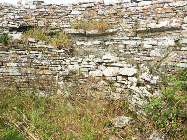
exterior feature

exterior feature wall


I had forgotten about this broch till I just this moment came across the prints. To paraphrase it’s one of the ruins that Petrie buggered about a bit. It stands quite well behind Hoxa but this wall is his reconstruction. Would have been nice to go inside the wall but the interior was completely taken over by very tall nettles, so went further along the road got into a field and proceeded up the long ramp of a mound that approaches the broch from behind. From the ‘hilltop’ there you look directly into the structure. Lovely it is.
Stone avenues between here and the Little Howe settlement at the coast are only the product of field clearances. RCAHMS NMRS number ND49SW 1 also reports that indications of structures about it are rather later. If so why does the mound lead up to the broch instead of more generally about it? I remember that Mine Howe is said to have been reached via one of the other mounds – perhaps it wasn’t simply a case of this being the only dry route at the time.
According to the Orkneyinga Saga Earl Thorfinn Skullsplitter was buried here.
Hoxa believed to derive from Hangs-eil


