looking northwards across mound with structure C lower right
Image credit: wideford
looking northwards across mound with structure C lower right

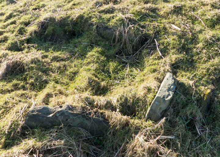
structure C looking from ‘southwards‘
looking above structure C ‘westwards‘

structure C at lower southern side of mound looking from ‘northwards‘

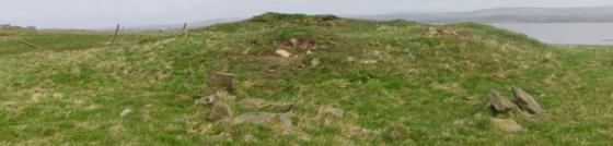
likely structural remains B at top of mound

on top of mound looking southwards with ?structure B at left

Knowe of Grugar/Ryo seen from Burgar Hill above

south view of site from track to beach

possible basal edge material in cliff section

orthostats near coast edge

part of mound rim seen from southwards

structural remains at coast edge top of mound
In February coming down the Evie Road the field containg this was open, so I took the opportunity to see the greater portion close up. Climbing to the top I noticed several metres of what could have outer face of broch tower wall. Couldn’t see if ever so slightly curved or straight but the stones at the edges could be the “stones, several of which, laid on edge, can be seen protruding through the turf” that the record mentions. Actually, going down the southern side, is a definite structure with three built sides visible to perhaps several inches deep by 18 across. I assume this has ‘appeared’ since the 2011 geofizz. Could be a small fish tank or the top of a toilet I guess.
Coming along the shore from the Knowe of Stenso is not easy – even at low tide it as a matter of skirting rocks, clambering up and down geos, crossing over and through burns. Even following the fence line I found some of the boggy bits. Unlike Stenso the fence beside is slack enough to climb over [though no dout they’ll remedy that the morrow], however on coming to the high point without entering the field and then peering over into the slightly depressed top all I saw was grass (in 1928 the P.O.A.S. says neither this nor Stenso had been excavated, but he likely meant professionally as a local had been down inside the latter). To me the site didn’t feel the right orientation for a broch, though as I mistakenly thought I’d a pic from the main road I have no image to check whether it truly is edge on to the coast. Certainly I would have expected to see some signs of a bank outwith the mound. That said, just over the fence at the highest point I did see a few projecting slabs I felt to be an even slighter version of the structure I had seen earlier at the Knowe of Stenso in the exact same relative position.
NMRS record no. HY32NW 10 is thought to be a site like that which covered Gurness broch and settlement. The grass-covered stony mound is over a hundred feet across and sixteen high, with several edge-set stones indicating structures below the turf. Gru(d)gar is two fields away and over the road. Ryo is the original appelation and is likely to be either Orcadian ‘roo’ meaning heap of stones or a variant of Grugar (a spindle whorl found on the farm has the name Grudiar/Grudair attached).