Visited 2008.
I parked by the church and followed the ‘path’ through the trees which runs around the side of the hillfort. I then made my own way through the bushes/trees up to the hillfort. This is private land with a fence around it and when I visited there were several horses in the field. Nothing to see other than small stones around the edge. Whether these are anything to do with the hillfort or just part of field clearing I don’t know.
Articles
Picturesque Llanblethian.
Descending Llanblethian-hill, the path to Cowbridge passes over very rocky ground, some of the rocks curiously marked – one forms a fancied resemblance to the impression that would be made by a foot and knee in kneeling, is set down as having been made by the devil, who, in carrying a load, was obliged to rest there. May not the legend have taken its rise in monkish times?
Entering the field from the hill, the pathway winds at the head of three or four strong springs in the field corner. That nearest the hill used to be considered good for diseases of the eye, and cures were wrought there – nothing is now heard of its restorative powers.
Further on, by the hedge-side is a spring protected by a low square of masonry, with an orifice on one side for the overflow. In this are some fragments of an oaken box (nearly perfect a few years ago), where children and others used to go and wish, dropping a pin into the box at the time. Ill-luck was to attend those who took any of the pins out of the box, nevertheless the pins were often cleared out. Either at this well, or the Bomin (Bowman’s) well in the next field, children used to flock on a certain day in the year, All-Hallow’s-tide, I fancy, taking with them drinking vessels and sugar, mixing the sugar with the waters of the spring, and drinking them.
Some years ago a half-crazed fellow began searching for treasures within the precincts of the old castle. After wasting some time therein he gave it up as a bad job. In a drawing of the place as it stood in 1740 the ruins appear of much greater extent than at present, as well as those of Castell Llychad (or Llychod), which is introduced in the back ground. Much of the old castle was taken down 40 years ago to build St. Quentin’s Cottage [...] between here and the castle, on the top of Llanblethian-hill, Castell Llychod, a subterranean passage is said to exist. As there is nothing to indicate such a means of communication, the tradition must be taken upon its own merits.
‘Cadrawd’ writing in the Cardiff Times, 1st July 1893.
I had a look at the old maps and “The Devil’s Foot and Knee” is marked up until the 1960s, at SS986743, on a footpath, so might well be findable. The eye well is at SS987744 and Bowmen’s well at SS988745.
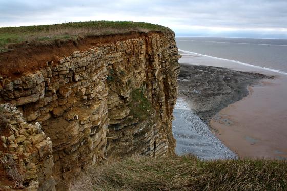
Aerial photograph of the hillfort.
Sites within 20km of Llanblethian Hill
-
Marlborough Grange Barrow
description 1 -
Breach Farm Barrows
description 1 -
Breach Farm
description 2 -
Mynydd Bychan
description 2 -
Stalling Down
description 1 -
Domen Fawr Barrow
description 1 -
The Twmpath
description 2 -

Llanquian Wood Camp
photo 5description 1 -
Cae’r Mead Barrow
description 1 -
Mynydd Y Fforest
description 1 -
Croes Heol-Y-Splott
description 1 -
Monkton East
description 1 -
Llantrithyd Camp
description 1 -
Craig Tan Y Lan
description 1 -
Monkton East (South)
description 1 -
Wick Barrow
description 1 -
Ffynnon Y Capel
description 1 -
Monknash
description 1 -
Rhyle Barrow
description 1 -
Naboth’s Vineyard
description 2link 1 -

Castle Ditches (Llantwit Major)
photo 27description 2 -

Summerhouse Camp
photo 22description 2 -
Bonvilston Gaer
description 1 -
Coed Y Gaer
description 1 -
Castle Ditches (Llancarfan)
description 1 -

Nash Point
photo 36ondemand_video 2description 7 -
Cwm Bach and Whitmore Stairs
photo 23description 2 -
Redland Farm
description 2 -

Coity Chambered Tomb
photo 7description 5 -

Beacons Down
photo 3description 1 -

Bridgend Stone
photo 2forum 1description 3 -

Cottrell Park
photo 5description 4link 1 -

Dunraven
photo 34ondemand_video 2description 4link 1 -

Fleming’s Down
photo 16forum 1description 2 -

Coed-y-Cwm
photo 8description 2 -

Heol-y-Mynydd
photo 2description 3 -

The Beacons (Llantrisant)
photo 7description 3 -

Coedcae Gaer
photo 10description 3 -

Tinkinswood
photo 53ondemand_video 2forum 3description 26link 7 -
Norton Causewayed Enclosure
description 1 -

Maes-y-Felin enclosure
photo 6 -

St. Lythans
photo 63ondemand_video 2forum 1description 22link 4 -

Caerau Hillfort, Rhiwsaeson
photo 8description 5 -

Cae-yr-Arfau
photo 6description 3 -

Vianshill
photo 2description 1 -
Sant-Y-Nyll
description 1 -

The Bulwarks, Porthceri
photo 20description 3 -

Merthyr Mawr Warren
photo 5description 3 -

Cae’r-Hen-Eglwys
photo 20forum 1description 5 -
Craig-Y-Parc
description 1 -

Tythegston
photo 13description 4 -
Marsyd
description 1 -
Cefn Cross
-
Cefn Cross (Mount Pleasant Farm)
description 2 -
Stone II, Cefn Cross
-
Stone I, Cefn Cross
description 1 -
Llywnda-Ddu
description 1 -

Mynydd Herbert
photo 12description 1 -

Cold Knap
photo 6description 1 -
Lle’r Gaer
description 1 -

Tarren Deusant
photo 4forum 2description 4link 1 -
Pengoetre Wood
description 1 -

Caerau
photo 1description 6 -

Friar’s Point
photo 21description 2 -

Garth Hill
photo 25forum 2description 11 -

Mynydd Maes-teg
photo 1description 1 -
Atlantic Trading Estate Barrow
description 1 -

Taff’s Well
photo 1description 2 -

Dinas Powis
photo 10description 1 -

Mynydd Pen-y-Graig
photo 6 -
Leckwith
description 1 -

Pant Blaenhirwr
photo 3description 1 -

Garn Fach (Ogmore Valley)
photo 8description 2 -

Mynydd Brith-weunydd
photo 6 -

Pont-y-Pridd Rocking Stone
photo 18forum 1description 13 -

Coed-Pen-Maen Common
photo 9description 2 -

Garn Fawr (Ogmore Valley)
photo 11description 2 -

Mynydd Llangeinwyr
photo 7description 1 -
Sker House
description 1 -

Cefn Gwyngul
photo 3 -

Mynydd y Gelli
photo 18description 6link 1 -

Pant Waungorrwg
photo 4description 1 -

Bryn Defaid
photo 4 -

Sully Island
photo 23forum 1description 3