Below the fort.
Image credit: A. Brookes (2.4.2023)
Below the fort.

A good place to appreciate sedimentary rocks; western tip of the fort promontory.

Looking across the Hafren towards North Devon from the fort interior.

The inner rampart on the east side of the fort.

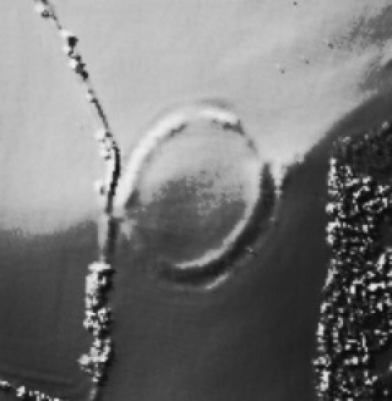
The inside of the outer rampart on the east side of the fort, from the inner ditch. Impressive earthworks!

The muddy Wales Coast Path crossing the outer rampart on the east of the fort.

Looking along the coast towards the fort (left of centre, with St Donat’s Point beyond) from Stout Point to the east.

The Mam C pointed out what she believed were prehistoric footprints preserved in the rock here.... I didn’t think so, but in retrospect I think she was right.

Below and to approx. south-east...

A good retrospective view of the wedge-shaped fort can be had from the cliff-path on the opposite side of Cwm Col-hun.

Thick shrubby vegetation cloaks the northwestern slopes above Cwm Col-hun. Viewed from the western tip of the fort.

Looking westwards along the coast from the crumbling cliffs at the west end of the fort interior.

The single rampart at the top of the steep NW slope above Cwm Col-hun.

The overgrown inner rampart from the fort interior. The Bristol Channel, with Exmoor beyond, can be seen in the background, far right.

The vegetation-choked ditch between the middle rampart (left) and the inner rampart (right). Looking SSE.

The steep northwestern slopes of the fort are on the left. Seen from Cwm Col-huw as the sun sets.

The sun setting off the shore of North Devon, from the beach below the crumbling cliffs of Castle Ditches. Nash Point is over to the right.

The westernmost tip of the promontory fort.

The eastern ramparts viewed from the open interior of the fort.

Looking north along the innermost of the eastern ramparts. This small section is the only part of the defences not heavily overgrown.

This really is a true powerhouse of a defended enclosure... very difficult to see, but well worth checking out.

The bank ends abruptly.... incidentally that’s The Mam C trying not to fall over the sheer edge beyond the fence. Careful now.

The crumbling southern flank of the ‘fort. Seriously, please take care up here....

I received a nice scratch on the forehead for having the temerity to check out the powerful defences of this ‘fort. Worth it, though.

The only section of the ramparts free from vegetation.... the inner bank adjoining the cliff face.

Coflein cites this enclosure as having three banks.... I, however, count four. Probably safer to go with the former, owing to my (lack of) maths prowess and the extreme overgrown nature of the site. Note the powerful defences... incidentally the Mam C assures me that the featured bath is probably part of a scientific experiment relating to snakes and other such wondrous creatures. Castle Ditches is a Nature Reserve, after all. I hope so. The dumping of rubbish is all too frequent in South Wales.

Looking approx eastwards across the innermost bank where it suddenly terminates at the cliff edge. I assume some of the enclosure has been lost to the sea, then? Summerhouse Camp – another fine cliff-edge Iron Age fort – lies beyond.
Visited last summer on a lovely hot day. Drive through Llantwit Major and follow the road down to the car park at the sea shore. There is a shop here where you can buy the normal bucket/spade, chips, tea, ice cream etc. A nice little spot where the river runs into the sea and there are plenty of places to sit and ponder.
With ice cream in hand I headed along the coast, but to be honest I couldn’t make anything out. The vegatation was waist high so I headed back and had a cuppa instead!
The Castle Ditches are part of some Iron Age defensive earthworks on the coast near Llantwit Major – some of the enclosure has probably fallen into the sea.
Marie Trevelyan mentions them in ‘Folk lore and folk stories of Wales’ (1909):
Among the places in South Glamorgan where the latest Beltane fires were kindled [was..] Llantwit Major between 1837 and 1840. The following information with reference to the Beltane fires was given me in these words:
” The fire was done in this way: Nine men would turn their pockets inside out, and see that every piece of money and all metals were off their persons. Then the men went into the nearest woods, and collected sticks of nine different kinds of trees. These were carried to the spot where the fire had to be built. There a circle was cut in the sod, and the sticks were set crosswise. All around the circle the people stood and watched the proceedings. One of the men would then take two bits of oak, and rub them together until a flame was kindled. This was applied to the sticks, and soon a large fire was made. Sometimes two fires were set up side by side. These fires, whether one or two, were called coelcerth, or bonfire. Round cakes of oatmeal and brown meal were split in four, and placed in a small flour-bag, and everybody present had to pick out a portion. The last bit in the bag fell to the lot of the bag-holder. Each person who chanced to pick up a piece of brown-meal cake was compelled to leap three times over the flames, or to run thrice between the two fires, by which means the people thought they were sure of a plentiful harvest. Shouts and screams of those who had to face the ordeal could be heard over so far, and those who chanced to pick the oatmeal portions sang and danced and clapped their hands in approval, as the holders of the brown bits leaped three times over the flames, or ran three times between the two fires. As a rule, no danger attended these curious celebrations, but occasionally somebody’s clothes caught fire, which was quickly put out. The greatest fire of the year was the eve of May, or May 1, 2, or 3. The Midsummer Eve fire was more for the harvest. Very often a fire was built on the eve of November. The high ground near the Castle Ditches at Llantwit Major, in the Vale of Glamorgan, was a familiar spot for the Beltane on May 3 and on Midsummer Eve.