Carl Wark (l) and Higgar Tor (r) seen from Burbage
Carl Wark (l) and Higgar Tor (r) seen from Burbage

The Western rampart, approaching from Higgar Tor

NE side, seen from Burbage valley


The SE corner.. the transition from built to natural defences

The SE corner

The S rampart looking towards Burbage

The N side, Burbage Rocks in background

The northern side’s natural defences, Higgar Tor in background

View along S rampart to entrance

The SW entrance

Interior of Western rampart

The Western rampart

The northern side seen from Higgar Tor

Eastern side at sunset

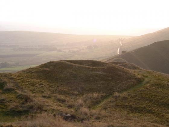
Seen from Burbage Valley

Sunset over Carl Wark, seen from Burbage Moor.

Sunset above Carl Wark, seen from Burbage. They’ve gone, so have a fair few of the stones..but the sky remains. They saw sights like this, and now do we.

Higger Tor under the rainbow. Carl Wark hillfort and Winyard’s Nick are to the right. From Eyam Moor, near the Stanage ring cairn.

From the modern entrance, eroded by walkers, towards Higger Tor.

From the southern end of the wall towards Higger Tor.

Winter sunset from Carl Wark, looking towards Over Owler Tor.

Sunrise on Carl Wark.

Carl Wark (left) & Higgor Tor.

The ‘hillfort’ highlighted by a passing sunburst below Higger Tor

Hillfort or ritual site. Both? Towards Higger Tor from the cross-rampart

The sun finally breaks through cloud on the horizon shortly after the Summer Solstice Sunrise and bathes Carl Wark in golden light.

The sun finally breaks through cloud on the horizon shortly after the Summer Solstice Sunrise and bathes Carl Wark in golden light.

Vie of Higger Tor from the wall at Carl Wark.

The entrance to Carl Wark and view to the south west to Over Owler Tor and Mother Cap.

The view along the wall to the south towards Froggatt Edge, White Edge and Minninglow.

The southern end of Carl Wark’s wall and view south west to Over Owler Tor and Mother Cap.

Carl Wark from Higger Tor at sunrise. Mist clings to Burbage Brook.

Carl Wark from Burbage Brook.

Carl Wark from Burbage Valley.

Carl Wark from Higger Tor on a morning when Hathersage Moor looked more like arctic tundra than the Peaks. Even the sunrise didn’t make an appearance.

Looking towards Carl Wark from the Longshaw estate, June 10th 2008.

This is a carving into a large flat stone. It’s on Hathersage Moor, SK 2532 8173, about 150m NNE of the sheepfold. Where the track forks -- left into a two-wheel track down to the road, right towards Higger Tor -- take the right fork. The stone is a few metres after the path crosses a ditch. The carving is in the middle of the path, and quite clear. It’s about 50cm in diameter. I can’t vouch for its prehistoric quality -- is there a modern explanation?


Fly me to the moon

Higger tor

from amongst the many boulders on Higger tor

looking west across Carl Wark towards the stone built wall


The north cliff wall, with Higger Tor behind

Taken on Burbage bridge to the south

Crappy weather and wicked Sciatica prevented me getting any closer, on me birthday too....sigh

Carl Wark viewed through Higger Tor


Taken from Higger Tor, Easter 2006

Possible carved line in rock, facing approx NE

Natural rock form, of which there are many spread across the hillfort

Southern entrance

South wall

Walling at south entrance (possible building)

Stone Basin (Horse Trough?)

Carl Wark fort from western approach

04/04.
This overhanging rock, with a natural basin on it’s top, is known a Caer’s Chair.
Hayman Rooke visited Carl Wark in the 1780’s and in true Rooke fashion thought the site to be “a holy place or court of justice” connected to the Druids.
He suggests the ‘chair’ as being “a seat of justice, where the principal Druid sat”

Higgar Tor from Carl Wark.

The original, inturned entrance on the western end of the south wall of Carl Wark hillfort


09/03. Carl Wark viewed from Higgar Tor, boulder rampart in right of picture.

05/02 These 2 big stones are on the approach to Carl Wark. Rampart in background.

05/02 top of the rampart

05/02 Carl Warks rampart
Moving Stone through the Ages: Carl Wark Hillfort and the Burbage Quarries.
“A walk taking in quarries, iron smelting a prehistoric cainfield and the enigmatic Carl Wark Hillfort.”
Wednesday, 21 July. 10:30-16:00. Meet at the pay and display car park, west of Upper Burbage Ridge. Up-to-date information on 01626 816200.
What a fantastic place Carl Wark is, didn’t he play for Everton, or did I go school with him either way a strange name for a Hillfort.An even stranger place to live with all the boulders everywhere, it frankly looks more like an enclosure like on gardom’s edge.
parking is available to the North and the south, we parked near the Burbar bridge but then had to cross the river, so youll be better off walking down to the bridge and take the path there .
The stone built wall is quite impressive with the entrance and more walling plus some kind of stone trough but it’s outside the fort weather that means ‘out I don’t know,I told the kids it’s where naughty kids were made to sit till they can behave themselves.A walk up to Higger tor is obligatory as it looks over the fort and a window in the rocks fortuisouly looks straight to it .The Peak district is the most visited natoinal park in the world and on this day you could really tell it was teaming with walkers and climbers .The carpark near Burbar bridge south has what really looks like a standing stone long and tall aligned on the fort please someone go take a look
Near Hathersage. Amazing hill fort on the moors very easy to get to too.
Two sides of the fort have a steep slope for defence the 3rd has a massive drystone wall, made from gritstone boulders. The site is approx 2 acres in size.
The rock outcrop at ‘Higgar Tor’ is definitely worth a scramble round too, this was ‘Wet Withens’ main alignment the Midsummer Sunrise.
” Carl Wark was the site of a British encampment. A Celtic tribe lived here before the Roman legions came toBritain. At the end of the sixth century this area was part of the kingdom of Argoed, governed by Sir Lamoracke, one of the knights of King Arthur’s Round Table, who stood next to Sir Launcelot and Sir Tristram in deeds of valour.
Men knew Sir Lamoracke (or Llywarch, to give him his celtic name) as a fierce warrrior. He had twenty-four sons, and at Carl Wark he and they fought the hordes of Loagrians, who invaded the country when the Roman army of occupation left Britain. After a long and bitter defence the knight and the remnant of his forces were driven from the stronghold.”
Norman Price “The Derbyshire Dales” 1953
In the eighth volume of the Archaeologia, is an account, by Mr. Hayman Rooke, of some ancient remains on Hathersage Moor, particularly of a Rocking-stone, twenty-nine feet in circumference; and near it, a large stone, with a rock-bason, and many tumuli, in which urns, beads, and rings, have been found. At a little distance he mentions observing another remarkable stone, thirteen feet, six inches in length, which appeared to have been placed by art on the brow of a precipice, and supported by two small stones. On the top is a large rock-bason, four feet, three inches in diameter; and close to this, on the south side, a hollow, cut like a chair, with a step to rest the feet upon. This, in the traditions of the country, is called Cair’s Chair [Carl’s Chair?]. Not far from this spot are also some Rocking-stones, “and of such a kind as seems plainly to indicate, that the first idea of forming Rocking-stones at all, was the appearance of certain stupendous masses, left by natural causes in such a singular situation, as to be even prepared, as it were, by the hand of Nature, to exhibit such a curious kind of equipoise.” (Munimental Antiqua, vol 1).
p477-478 of ‘The Beauties of England and Wales’ (1802).
“....as we cruise again down the valley to Grindleford Bridge; first making a detour to visit the grand rocky platform of Hu-Gaer, (“The city of God”), and the old British fort of Caelswork (“which means, the fort or building of the Churl – Anglo-Saxon ‘Carl’” – and not “the work of the Gaels,” as a repitition of writers have it;) and to bask on Millstone Edge......”
Edward Bradbury ‘All About Derbyshire’ 1884
According to Dr Bill Bevan’s report for Moors for the Future, Carl Wark is thought to have been mainly for ceremonial use. The wall built to block the view across Hope Valley to Mam Tor.
Stuart Piggot thought the wall to be similar to those at Dark Ages forts in Scotland.
Dating Carl Wark has proved to be a bit of a problem. The Dark Ages, Roman down to the Neolithic have all been suggested.
It’s boulder strewn interior has been likened to those at Gardom’s Edge and Cratcliffe Hillfort which have also been suggested to date back to the Neolithic.
No major excavation of the site has taken place.
A site research note for Carlwark can be found at https://www.brigantesnation.com. This site investigates the links between sites and the Brigantes tribe.
Carl Wark: Prehistoric Ritual Enclosure or Dark Ages Battlefield?