Kinderlow centre skyline. Seen across the heathery moorland of Brown Knoll, to the SE.
Image credit: A. Brookes (8.9.2021)
Kinderlow centre skyline. Seen across the heathery moorland of Brown Knoll, to the SE.

The Kinderlow ridge is centre skyline. Seen from the top of South Head, to the SSW.

Kinderlow with cairn is the ridge rising over on the right. Kinder Scout to the left. From the windy and exposed summit of Mount Famine, across the River Sett valley to the southwest.

The western edge of the Kinder Scout plateau rises on the left of the cairn.

The visible stones may suggest a kerb.

Looking west-ish. There’s a fairly constant flypast of planes from Manchester Airport.

Even wet weather visits have been made easier by the paved path to the cairn.

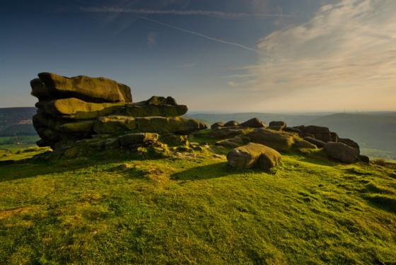
There are some cracking rock formations just above the cairn near the trig point.
The prominent cairn stands out on the shadowed ridge. Seen from Kinderlow edge to the northeast.

26/12/2012 – Kinderlow Cairn

26/12/2012 – Kinderlow Cairn

26/12/2012 – Kinderlow Cairn

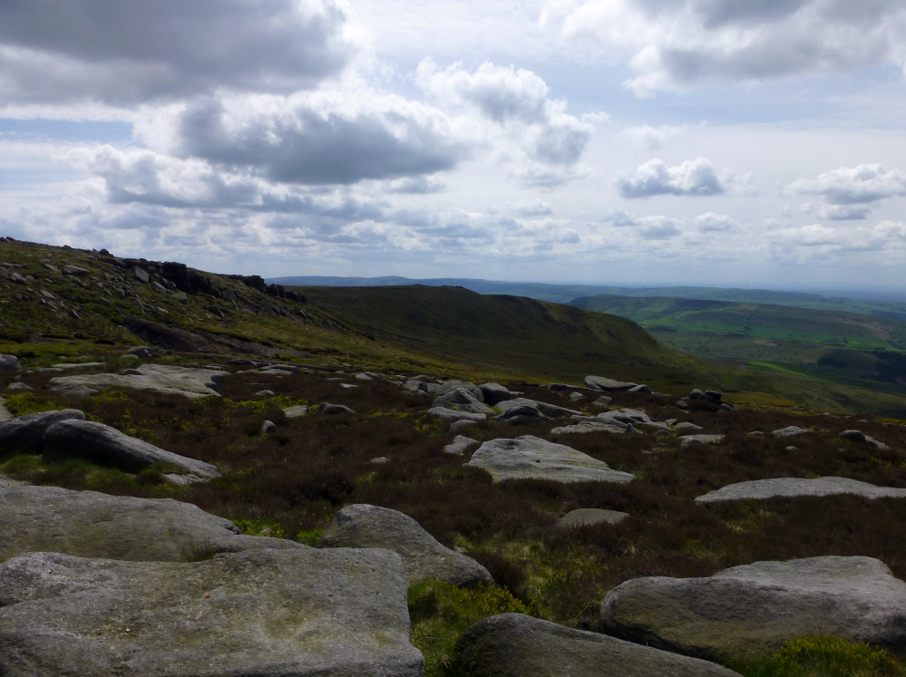
26/12/2012 – View west from cairn

A typical location for a cairn, with extensive views, Kinder reservoir in the distance with a coating of ice.

Night fell quickly so i camped close by the cairn, -9 at one point.
Brrrrrrrr.


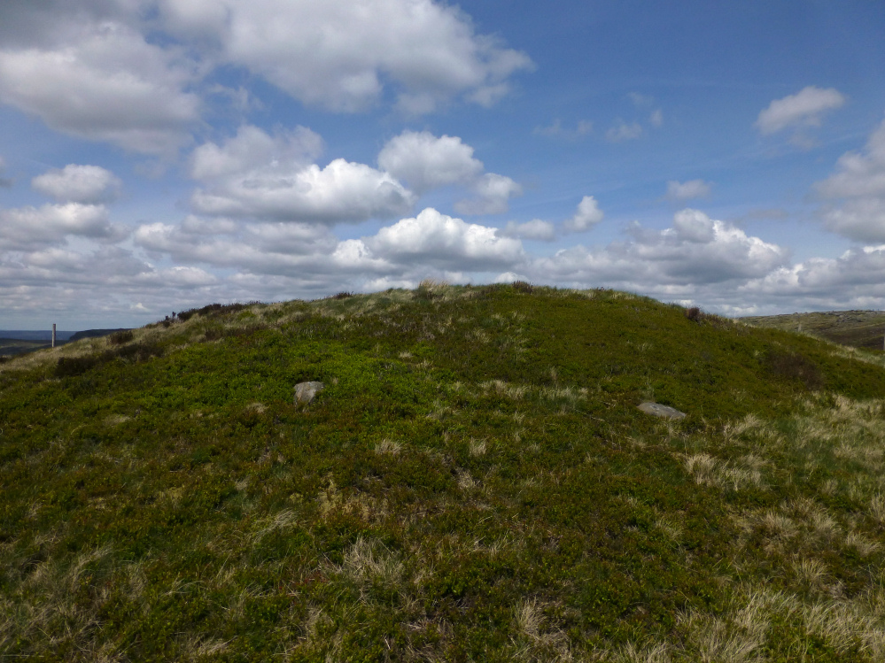
26/12/2012 – It’s been a while since I was here. I remember a pretty miserable trudge over Kinder to camp at Hayfield for the night as a teenager, many moons ago. Today we parked in Hayfield, opposite the campsite and set off walking past Tunstead to climb the west side of Kinderlow to the cairn. From the 427m mark on OS map to the cairn it gets quite steep but it is a nice walk with the view getting ever better as we climbed. The cairn is grassed over but has a few visible kerbstones. At around the 600m mark the view from the cairn is fantastic, looking west to Manchester and beyond. The weather was kind to us today, with the sun coming out as we reached the cairn. Well worth a visit and a pretty good way to burn off the Xmas pud as well.
Fantastic views, particularly in the snow.
From Magic: The monument is a bowl barrow located at the summit of Kinderlow in the western gritstone moorlands of Derbyshire. It includes a steep-sided sub-circular mound measuring 17.5m by 15m and standing c.2m high. A gritstone kerb is visible in the edges of the mound and there is a modern walker’s cairn on the summit. The monument has not been excavated and so cannot be precisely dated, but its form and hilltop location assign it to the Bronze Age.
It is currently being restored by NT/Peak District National Park Authority to repair erosion damage.
... A later generation than the old wife has been known to pour out a libation of good red port to “whatever gods may be,” during the exhilaration which followed reaching the highest point of our county – the cairn on Kinderlow. There was folk lore in this too. The climbers were of a hard, sceptical kind, believing in nothing, not even in themselves, yet they wasted good wine on this ritual. There on the top, against the sky, the present day world had dropped away and there was a feeling of being surrounded by they know not what elemental forces moulding the timeworn world.
Derbyshire Advertiser and Journal, 30th April 1920.
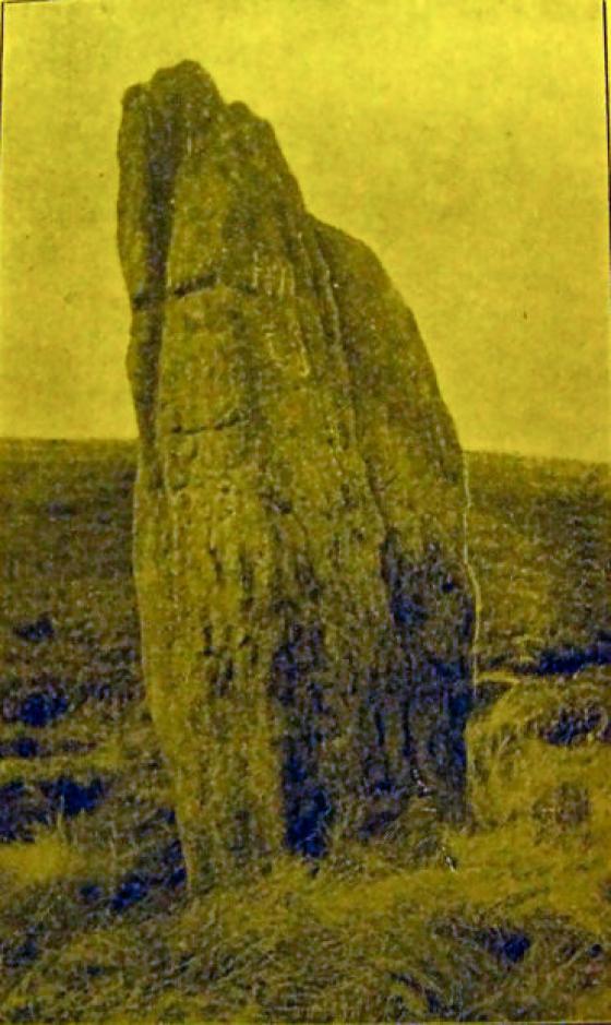
I would imagine the cavern mentioned could be Kinder Low cavern, very near to this cairn.
At a meeting of the Society of Manchester Scientific Students, Sept. 27, 1882, the members visited Hayfield. On leaving Hayfield railway station the party proceeded to the edge of Leygate Moor. From thence they reached the Old Oak wood near the lower house. A short walk from here is the Downfall. Near here is the Mermaid’s Pool, of which the natives have a tradition that a beautiful woman lives in the side of the Scout; that she comes to bathe every day in the Mermaid’s Well, and that the man who has the good luck to behold her bathing will become immortal and never die. The old people of Hayfield, moreover, tell a long story of a man who, sometime in the last century, went from Hayfield over the Scout, and was lucky enough to meet this mountain nymph, by whom he was conducted to a cavern hard by. Tradition adds that she was pleased with this humble mortal, and that he lingered there some time, when she conferred on him the precious gift of immortality.
From the Notes and Queries section of v1/n1 of the Folk-Lore Journal (1883).