spencer

spencer

All posts expand_more 1-50 of 708 posts
Image of St. Cathan’s Church (Standing Stone / Menhir) by spencer

St. Cathan’s Church

Standing Stone / Menhir

A significant spread of rubble surrounds the stone… most is under gorse but this section on the south side is clear. The cairn, if that is what it is, is an elongated ovoid rather than round. I do wonder if this is a Viking boat burial rather than an earlier cairn.

Image credit: Mike Purslow

Clach A’Pheanais

This stone is about 50m uphill from and in full view of the abandoned cemetery and ruined chapel that stand on the high ground between Balnahard and Balnahard Bay. Just follow the fenceline from the graveyard. It has mistakenly been called a stone of penance for the nuns who once lived hereabouts but it is millennia earlier than the date ascribed. I felt that it was on an track to possible sites on the higher ground beyond and on examination of satellite imagery has now revealed a wealth of old rig and furrow that starts about 600ft north of the stone and extends for a wide area on the hidden uplands here and I was therefore right. There is also a dun on the OS East of this area of cultivation. At time of writing I have yet to cross reference with Canmore and give that its correct name and add to this site.

As for the Balnahard area, it is a hard slog along the track from above Kiloran Bay, the nearest place to park: an hour and a half walk each way. If you want to do any more exploration of the archaeology on the hills around then be fit or bring a tent. I hope to return next year – there is so much to see….

Image of Carn na Faire (Cairn(s)) by spencer

Carn na Faire

Cairn(s)

The pointed top of modern cairn that sits on Carn na Faire can be seen on the skyline. The Gaelic name for this bay is Port na Righ… ‘Port of the King’. As far as I can establish there are only two other places in Scotland that bear this name, the modern Portree on Skye and a bay at Carradale, East Kintyre. Not an everyday name.

Image credit: Mike Purslow
Image of Carn na Faire (Cairn(s)) by spencer

Carn na Faire

Cairn(s)

I found this immediately to the west, alongside the cairn – which is of an unusually large size. I believe this to be the true lookout point which affords shelter, unlike the exposed to the elements top of that cairn, whose Gaelic translation is ‘pile of stones watch point’. A watch point for where? Reckon I have found the answer to that downslope when fieldwalking. As of date of publication of this image fieldnotes and images are yet to be uploaded but local official bodies have already been informed. Perhaps I’ve found hidden in the vegetation the most important prehistoric site on the island… we’ll see…

Image credit: Mike Purslow
Image of Port Sgibinis Raised Beach (Natural Rock Feature) by spencer

Port Sgibinis Raised Beach

Natural Rock Feature

The highest, tenth, level of the raised beaches here, 130’ above present sea level. Kiloran Bay beyond, and beyond that Uragaig raised beach. Dun Tealtaigh sits to its right.. and, further to the right, the undercut cliff and raised hillock which give Dun Uragaig its shelter from the north winds.. I found it calm there, even on a blowy day.

Image credit: Mike Purslow
Image of Dun Tealtaig (Promontory Fort) by spencer

Dun Tealtaig

Promontory Fort

The embarkation point is on the east side.. the Ross of Mull and Isles, an easy sail, on the horizon.
The calls of two corncrakes will have to be visualised. As will the midgies.

Image credit: Mike Purslow

Achaleven

A glorious day, filling in time waiting for the Colonsay ferry departure from Oban, with the great Dun Chathach already under our belts. I was only using an old OS49 map and hadn’t referred to Canmore so it wasn’t initially easy to spot.. but once you do you can’t miss it. Just look for the only tree in the field to your left when you take the Achaleven road. It is atop it. In May this wild apple(?) was a delight. A fine sight. And a damn sight more easy to find than all those cairns and sites around North Connel which defeated me, being behind housing. A better map needed for those…

Image of Achaleven (Cairn(s)) by spencer

Achaleven

Cairn(s)

The first view of the cairn that you will see, in the distance to your left after taking the Achaleven road from the A82 and driving under the railway bridge. W side.

Image credit: Mike Purslow
Image of Ballymeanoch Henge by spencer

Ballymeanoch Henge

Henge

The central cist, part of the northern arc of stones beyond, and, in the distance (not that diminutive – phone cameras, eh?) the four and two stone rows.

Image credit: Mike Purslow
Image of Torbhlaren (Cup and Ring Marks / Rock Art) by spencer

Torbhlaren

Cup and Ring Marks / Rock Art

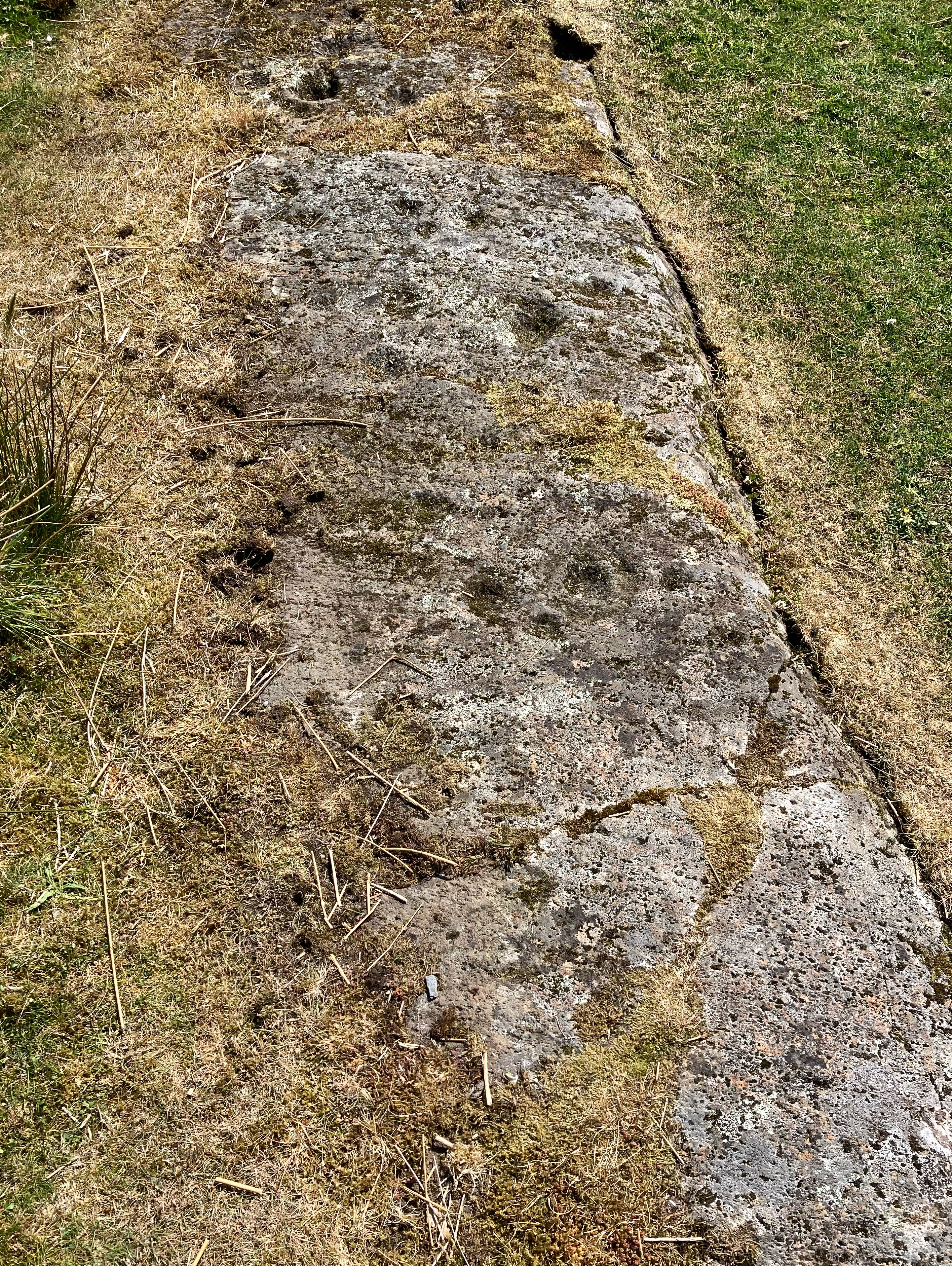
Perhaps this should be called Torbhlaren 2… I saw this distant shape from the gate which gives access to the standing stone, went over and saw packing now exposed by livestock erosion at the prominent end. I’m sure it’s a ‘faller’. At 16’ it’s dwarf the other stone even if securely earthfast when upright. Wish it was…

Image credit: Mike Purslow
Image of East Tarbert (Cairn(s)) by spencer

East Tarbert

Cairn(s)

This, which I think is another probable cairn, overlooks the two cairns on a bluff a hundred yards north, to the east of the road. It would be a skyline feature discernable from the mainland.

Image credit: Mike Purslow
Image of Cnoc na h’Atha (Cairn(s)) by spencer

Cnoc na h’Atha

Cairn(s)

Another view of the site’s drop off, looking N, defined by the old fence posts. Beyond, in the mid distance, the island’s highest point, and, on the horizon, the Paps of Jura.

Image credit: Mike Purslow

Cnoc na h’Atha

This site is unrecorded… it is the Achamore Gardens Viewpoint, the gardens highest point, looking out from a conifer shelter belt to the western side of the island, several other sites in view. I noticed a 60’+ wide domed boulder spread which is enmeshed by tree roots and worn down by visitors. There is a distinct, shaped ‘drop off’ on the northern side. I met the island’s Ranger at the gardens – oh, what a sleeping giant of a place is waking here, they’ll be stunning when fully restored after years of neglect – and when I mentioned what I’d found and my conclusion as to what it was she said I was by no means the first to think so. On that basis I’m adding it here as a site. See accompanying photos.

East Tarbert

Drive north a short distance from Carragh an Tarbert stone and you will come to a sharp left bend in the road. If you can force yourself to look left towards the Paps of Jura you will see these in the foreground. As with so many of the sites on Gigha if you visit the island later than the start of May you will find them already covered with the annual vegetation.

Image of East Tarbert (Cairn(s)) by spencer

East Tarbert

Cairn(s)

The two cairns with East Tarbert Bay beyond, and beyond that the Sound of Gigha and the Kintyre mainland. A twenty minute ferry trip from Tayinloan to another world: Colonsay in miniature.

Image credit: Mike Purslow

North Druimachro

Not hard to spot, this… on the other side of the road from near the entrance drive to the delightful Achamore Gardens, a ‘must see’ if you visit the island. That description can hardly be applied to the dun though. According to Canmore very little remains… a low stretch of what was the north wall and a little bit on the west side. I didn’t wander over and my life doesn’t feel the poorer. Interesting stones at a mound north of it though… perhaps I’ll look next time, touch wood. Yes, this is an island to return to. The sides of the knoll on which the dun sits are thought by the most recent surveyor to have been shaped… I thought so too.

Image of Torbhlaran (Stone Fort / Dun) by spencer

Torbhlaran

Stone Fort / Dun

The N side of this badly degraded dun, top centre, seen from the minor road near Torblaren standing stone. Note the three equally spaced stones lying below and to the left which I think require investigation.

Image credit: Mike Purslow