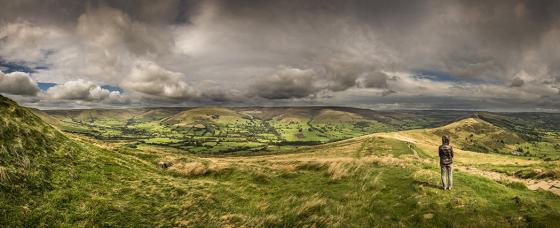
Sites within Bar Dyke
Images
Looking north at the line of the southeasten bank.
07/02 dry stone wall runs down the top
07/02 best section although overgrown
Articles
English Heritage seem particularly undecided on the date of this one, saying probably post-Roman through to possibly as late as 7th century but on the other hand maybe Iron Age or even Bronze Age. So could be anything really.
I wonder if there is a clue in where the northeastern end of the earthwork leads to. As I was driving north away from the site I noticed some strange bumps and small hills to the east just after the two roads join and assumed they were quarry spoil heaps. Checking the maps and internet later I found out these are a natural feature known as Canyards Hills and that Natural England calls them “the most impressive example of ‘tumbled ground’ in England and Wales” Is it significant that Bar Dyke leads to, or from these hills?
I can’t work out any use for this site. What could it possibly be for. The right hand side (from the north) is used as a car-port by Netherlanders (no offence intended but it was today). It would have been a formidable defence against attackers from the south
An earthwork of an unknown date.
The section of the dyke sandwiched between the roads is the most impressive part.
There is an area called Smallfield 200m or so Southeast; a Bronze age/Romano-British Field system.
The whole has been badly disturbed by roads and walls, there is a rubble ring of a possible robbed cairn (Bar Dyke Ring )but it’s hard to pick out amongst the heather and a fence and track cut through it.
Worth a look if your between Ash Cabin and the circle at Ewden Beck.
“Bar-dike, which is now the boundary between Broomhead-moor and Smallfield-common, Mr. [Reverand John] Watson conceived to be a British work. It is an immense trench. He further conceived that here the Britons may have made a stand against a body of forces coming from the side of Bradfield, and that their chief being slain in the encounter was buried under that vast carnedde on that part of Broomhead-moor which is known by the name of Roman Slack, and which is by the common people called the ‘The apron full of stones.’ The name of Roman Slack in Mr. Watson’s opinion points out who were the party against whom the Britons were contending, though in what particular expedition he pretends not to say.”
from ‘Hallamshire’, Hunter, J., 1819 (’Hunter’s Hallamshire’)
Sites within 20km of Bar Dyke
-
Apronful of Stones (Bradfield)
photo 1 description 1 -
Bar Dyke Ring
photo 1 description 4 -
Cowell Flat
photo 6 description 1 -
Broomhead Dyke
photo 2 -
Ewden Beck
photo 1 link 1 -
Ewden Beck
photo 16 description 6 -
Side Head
photo 9 -
Ewden Beck
photo 8 -
Bolster Stones
photo 3 description 1 -
Walder’s Low
photo 6 description 2 link 2 -
Pike Lowe
photo 1 description 1 -
More Hall
photo 10 description 1 -
Margery Hill
photo 5 forum 1 description 1 -
Whitley Church
photo 1 forum 1 description 2 link 1 -
Burnt Hill Plantation
photo 6 forum 1 description 1 -
Head Stone
photo 10 forum 1 description 2 -
New Hagg
photo 3 description 1 -
Pike Low
photo 1 -
Seven Stones of Hordron Edge
photo 49 forum 4 description 15 link 4 -
Ash Cabin Flat
photo 4 description 3 -
Ring Cairn/
Hut Circle photo 1 -
Ash Cabin Flat
photo 4 forum 1 description 2 -
Long Cist
photo 5 description 1 -
Cist II
photo 1 -
Ash Cabin Flat
photo 16 forum 3 description 3 -
Ash Cabin Rock Fall cave /
shelter photo 4 description 1 -
Ladybower Tor
photo 10 forum 2 description 2 -
Moscar Moor
photo 6 description 2 -
Crow Chin
photo 1 description 1 -
Crow Chin North
photo 3 description 2 -
Crow Chin South
photo 3 description 2 -
Crook Hill
photo 12 description 2 -
Bamford Moor North
photo 1 description 2 -
The Old Woman’s Stone
photo 6 description 1 -
Bamford Moor Central
photo 2 description 2 -
Bamford Moor South
photo 21 description 8 -
Dennis Knoll & Sheepwash Bank
photo 8 description 1 -
Ox Stones
photo 14 -
Castle Hill (Ingbirchworth)
description 1 -
Lose Hill
photo 9 -
Carl Wark & Hathersage Moor
photo 65 forum 2 description 9 link 1 -
Whirlow Hall Farm Henge
link 1 -
Winyard’s Nick
photo 6 -
Wincobank
photo 7 forum 3 description 7 link 1 -
Toads Mouth Cairn /
Barrow photo 1 description 1 -
Hathersage Moor Ring Cairn
photo 2 description 3 -
Burbage Rocks
photo 1 forum 1 description 1 -
Toad’s Mouth
photo 2 description 1 -
Fingerem Stone
photo 7 forum 1 description 4 -
Ecclesall Woods
photo 17 forum 1 description 4 link 3 -
Southwest of Burbage Bridge
-
Mother Cap Stone
photo 11 description 2 -
Ciceley Low
photo 5 description 2 -
Stan Low (site)
description 1 -
Offerton Moor East
photo 3 description 1 -
Offerton Moor West
photo 6 description 2 -
Ecclesall Woods 3
photo 1 description 1 -
Highlow Bank Stone
photo 4 forum 1 description 2 -
Highlow Bank Cairn
photo 1 description 1 -
Burton Bole
photo 3 -
Smelting Hill & Abney Moor
photo 12 description 2 -
Scholes Coppice
photo 12 forum 2 description 2 link 4 -
Lawrence Field
photo 8 forum 1 description 3 -
Highlow Bank
photo 1 description 1 -
Castle Hill (Castleton)
photo 5 description 3 -
Strawberry Lea
photo 11 description 3 -
Pin Dale
photo 1 description 1 -
Stainborough Castle
photo 2 description 1 link 2 -
Bole Hill Hillfort
description 2 -
Cup stone
photo 2 description 1 -
Longshaw Estate
photo 4 description 2 -
Eyam Moor II
photo 4 description 4 -
Wet Withens
photo 32 forum 1 description 15 link 1 -
Eyam Moor Barrow
photo 24 description 7 -
Odin Mine
photo 8 description 2 -
Eyam Moor III
photo 8 description 4 -
Mam Tor
photo 64 forum 2 description 8 link 1 -
Brown Edge
photo 15 forum 4 description 5 -
Mam Tor barrows
photo 12 description 2 -
Roman Ridge
-
Stanage II
photo 4 description 2 -
Stanage
photo 20 description 6 -
Graves Park Round Barrow
photo 1 description 1 -
Windy Knoll
photo 6 description 1 -
Royd Edge and Oldfield Hill Earthworks, Meltham
photo 1 forum 1 description 2 -
White Edge Cairn
photo 1 description 1 -
Lord’s Seat
photo 26 description 4 -
Cop Low
description 1 -
Barbrook III
photo 21 description 9 -
Burr Tor
photo 3 forum 1 description 3 -
Stoke Flat
photo 60 forum 1 description 12 link 1 -
Froggatt Edge cairn
-
Ox Low
-
Hagg Wood Cairnfield
-
The Old Bull Ring
photo 1 -
The Holmes
photo 1 description 1 -
Eldon Hill Enclosure
photo 2 description 2 -
Tup Low
description 1 -
Eldon Hill
photo 4 description 3 -
Big Moor
photo 1 description 1 -
Canklow Woods settlement
photo 1 description 1 -
Canklow Woods Rock shelter /
Cave photo 2 description 1 -
Kinderlow
photo 19 description 4 -
Barbrook II
photo 42 forum 1 description 12 -
Barbrook cairns
photo 32 description 2 -
Perryfoot
photo 2 description 2 -
Barbrook I
photo 64 forum 4 description 15 link 1 -
Barbrook Stone Row
photo 2 forum 1 -
Tideslow
photo 12 description 4 -
Curbar Edge
photo 8 description 1 -
Brood Low
photo 1 -
Big Moor (south) cairns
photo 9 -
Barbrook IV
photo 5 description 5 -
Barbrook V
photo 15 description 3 -
Moisty Knowl (Site of)
description 1 -
Swine Sty
photo 22 description 3 -
Green Low
photo 25 description 4