
11/13
11/13

A view of The Bradstone in January 2011. A mighty menhir !! Enjoy. Blingo

04/09


11/04. Sunset and the Bradstone.

11/04. Moon rising over the Bradstone.

11/03.

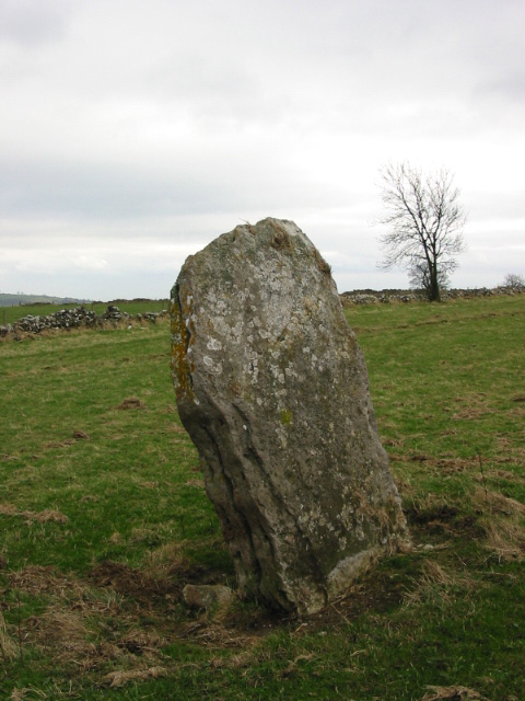
The Wirksworth Standing Stone with two young attendants

Standing Stone near Wirksworth. Possibly a marker on the prehistoric track known in Anglo-Saxon times as The Portway, but certainly pre-Roman,
03/02
Local rumour has it that after 7 years of slumber the Middle Peak Quarry is about to be reworked and even better..... extended. Unfortuantely the stone and, to a much lesser extent, the narrow road that passes it by are likely to be amongst the casualities. An alternative road/route already exists and well the stone.....is just a stone to a lot of folk living in Wirksworth, that is if they know it’s there at all.
So along with the extensions to the quarries around Stanton and the recently approved plans to rework and extend the rakes on Longstone Edge it would appear that the Peak is all out to invert itself....
I came across this enigmatic stone whilst following the prehistoric trackway known later as ‘The Portway’ on the section from Wirksworth up to Gallows Knoll, along ‘Chariot Way’ (sic), to Grangeway, then through Winster to Harthill Moor (with its Castle Ring Iron Age fort, Nine Stones Close, Robin Hood’s Stride, and the Hermits Cave.
Surely it was used as a marker for travellers on that ancient route, as they ascended the steep hill to within sight of the ancient settlement at Harborough Rocks?
Such I felt, as I saw it standing in the field, a permanence in time that extends millions of years more back when you examine it’s limestone heart and see its composition of coral reef shells.
Big slab of limestone, clearly visible from road. O.S marked.


